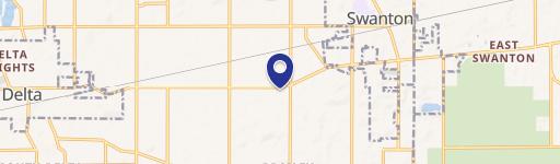
0 Us-20A Swanton, OH 43558
This exceptional 29.61-acre parcel of land is ideally situated at 0 US-20A in Swanton, Ohio, within Fulton County (zip code 43558). Currently zoned for agricultural use (AGR), this property presents a unique opportunity for various ventures. The asking price is $444,150, translating to an attractive price per acre of $15,000. Given its size and zoning, this land offers significant potential for farming, agricultural development, or other compatible uses. The property's location in Swanton provides convenient access to local amenities and transportation routes. Detailed property information, including precise coordinates (latitude 41.5805519, longitude -83.8901677), is available upon request. Serious inquiries are encouraged to explore the possibilities this expansive land tract offers. This is a rare opportunity to acquire a substantial land holding in a desirable Ohio location. The property's agricultural zoning provides a solid foundation for a variety of potential uses, making it an attractive investment for both experienced landowners and those seeking a new venture. Further details are available upon request.
Cap rate
Implied · in-place · derived from last sale + estimated NOIValue
AI, CAP & Alternative Use estimations · Realmo proprietary blendComparables
6 recent transactions · within 1.5 miComparable in this City


Similar Nearby for Sale


Property description
Physical attributes from public recordsZoning & alternative use
No recorded transactions found for this property.
Costs & Benchmarks
Operating expenses, capex projections, utility benchmarks, and submarket comparables — all in one view.
Risks
Flood, climate, environmental, title, and tenant-concentration risk — surfaced with mitigations and source citations.


