Property summary
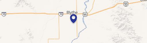
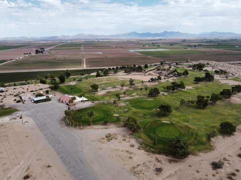
This exceptional 1,100-acre property in Riverside County, California, presents a lucrative investment opportunity in the mining industry. Located conveniently off Interstate 10, approximately 10 miles north of Blythe, this site boasts extensive high-grade calcium carbonate deposits. Prior appraisals valued the mineral deposits at $55.6 million (2008) and $32.2 million (1994). Comprehensive geological reports, including results from core drilling and testing on 60 acres (extending to the remaining acreage), confirm the presence of 30 to 60 million tons of high-grade calcium carbonate (97-100% purity), with dry brightness ranging from 87% to 93.8%. Eleven bore holes, ranging from 100 to 300 feet deep, provide detailed data. Additional resources include marble and decorative surface rock. The property is zoned BLM, with prior mining plans of operation approved in 1996 and 2008. Access is excellent, via a paved county-maintained road from Blythe, extending to paved roads at the quarry and good gravel roads throughout the site. Water resources are available, with the Colorado River situated just 4 miles away. The strategic location offers proximity to major highways and metropolitan markets, approximately 225 miles east of Los Angeles and 150 miles west of Phoenix. Mining claims include Rocky Canyon #1-#11 (eleven 80-acre placers) and Vikings #1-#6 (six 40-acre placers). Detailed core reports and geological mapping are available for review. The asking price is $7,900,000, translating to $7,182 per acre. This represents a unique chance to acquire a well-documented, high-yield mining operation with significant potential for future growth.
Property profile
VerifiedCap rate & NOI
Location
Value estimations
Owner & transaction history
Comparables
6 recent transactions · within 1.5 miComparable in this City


Similar Nearby for Sale



Similar Nearby for Lease


Value estimation
Instant AI valuation built from comps, income signals, and proprietary benchmarks. A defensible range, not a single guess.
from $99/month
Cap rate
Cap rate calculated from real income and expense signals, benchmarked against sales of similar assets nearby.
from $99/month
Property description
Physical attributes from public recordsZoning & alternative use
Zoning
The recorded zoning designation, what the district officially allows, and the municipal source it comes from.
No zoning code is on file for this parcel. Zoning coverage grows with every catalog release — check back, or open Location Intelligence for use analysis of this corner.
Find the owner behind the property.
Unlock the evidence behind ownership: portfolio, transactions, debt and signals that help you decide who to contact next.
Registration is required before any owner information is shown.
- Full Property Data
- Historical Records
- Value Estimation
- NOI Potential
- Cap Rate Calculation
- Ownership
- Location Insight
- Alternative use
- Local Zoning Insight
Cancel anytime.
- 30 reports a month
- Location Analytics
- Market Trends
- Full Property Data
- Historical Records
- Value Estimation
- NOI Potential
- Cap Rate Calculation
- Ownership
- Location Insight
- Alternative use
- Local Zoning Insight
Cancel anytime.
- 300 reports a month
- Location Analytics
- Market Trends
- Full Property Data
- Historical Records
- Value Estimation
- NOI Potential
- Cap Rate Calculation
- Ownership
- Location Insight
- Alternative use
- Local Zoning Insight
and get 1 Light Report
- Property Information
- Historical Records
- Value Estimation
- NOI Potential
- Cap Rate Potential
- Location Insight
- Alternative use
- Local Zoning Insight


