42289 Us-26 Dayville, OR 97825
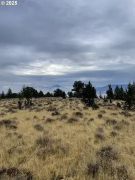
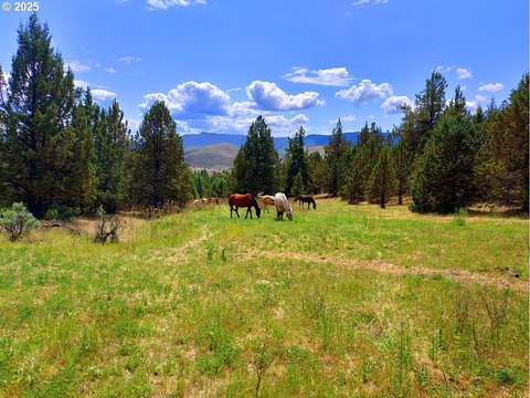
This exceptional Eastern Oregon ranch, spanning over 6,242 deeded acres (per county records), presents a unique investment opportunity. Established in 1864, this fifth-generation family-owned property boasts breathtaking views and diverse terrain, encompassing irrigated meadows, pastureland, extensive timber, and expansive rangeland. The ranch features significant water resources, including 1.75 miles of John Day River frontage, Cottonwood Creek, Dry Creek, and Rattlesnake Creek, along with 354.7 acres of water rights sourced from the John Day River and Cottonwood Creek. A network of diversion ditches and a pump system ensure efficient irrigation. The property's diverse ecosystem supports a variety of wildlife, including elk, deer, antelope, cougar, and black bear, offering exceptional hunting opportunities. Fishing is available in Cottonwood Creek and the John Day River. The ranch currently supports 250-300 head of cattle. Approximately 200 acres are irrigated meadows, 90.5 acres are irrigated pasture, and over 2,000 acres are timber. The remaining acreage is primarily rangeland. The property includes approximately 5.9 acres of improvements. Note: Approximately 650 deeded acres are currently in probate and subject to court approval. All offers are contingent upon court approval. Buyers are responsible for conducting their own due diligence. The property is bordered by the John Day Fossil Beds National Monument, BLM land (with a 204 AUM permit), state land (with a lease), and the Ochoco National Forest, and is within four miles of the Black Canyon Wilderness Area.
Cap rate
Implied · in-place · derived from last sale + estimated NOIValue
AI, CAP & Alternative Use estimations · Realmo proprietary blendComparables
6 recent transactions · within 1.5 miComparable in this City


Similar Nearby for Sale
Property description
Physical attributes from public recordsZoning & alternative use
No recorded transactions found for this property.
Costs & Benchmarks
Operating expenses, capex projections, utility benchmarks, and submarket comparables — all in one view.
Risks
Flood, climate, environmental, title, and tenant-concentration risk — surfaced with mitigations and source citations.


