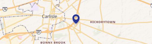
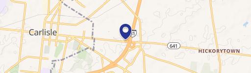
0 Claremont Rd Carlisle, PA 17013
This exceptional 49.465-acre commercial land parcel, located on Claremont Road in Carlisle, Pennsylvania (Cumberland County, zip code 17013), presents a unique investment opportunity. Zoned for light industrial use, this property offers significant potential for development. The land is conveniently situated near the intersection of Claremont and Harmony Halls Roads, providing excellent accessibility. A key advantage is the Norfolk Southern Railroad line running directly through the property, with approvals already in place for a rail connection. This makes the site ideal for businesses requiring rail access for shipping and receiving. The property slopes gently downward from the road towards the railroad. Public water and sewer services are readily available across Claremont Road, simplifying infrastructure needs for new construction. The location boasts high visibility from Interstate 81 and close proximity to the Pennsylvania Turnpike, ensuring excellent transportation links. Furthermore, its strategic location near the US Army War College adds to its appeal. No PennDOT permit is required for access via Claremont Road. The property's APN is 21-08-0575 parcel 003. This prime location, combined with its advantageous zoning and infrastructure access, makes this a highly desirable site for various industrial and commercial ventures. The asking price for this significant land holding is $7,500,000.
Cap rate
Implied · in-place · derived from last sale + estimated NOIValue
AI, CAP & Alternative Use estimations · Realmo proprietary blendComparables
6 recent transactions · within 1.5 miComparable in this City


Similar Nearby for Sale


Similar Nearby for Lease


Property description
Physical attributes from public recordsZoning & alternative use
No recorded transactions found for this property.
Costs & Benchmarks
Operating expenses, capex projections, utility benchmarks, and submarket comparables — all in one view.
Risks
Flood, climate, environmental, title, and tenant-concentration risk — surfaced with mitigations and source citations.


