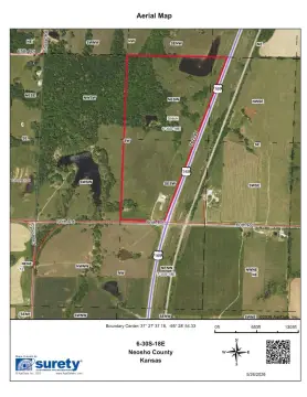
000 Lost Lake Rd Thayer, KS 66776
This exceptional 1.5-acre land parcel is located in Thayer, Kansas, within Neosho County, and boasts a desirable location at 000 Lost Lake N/A, zip code 66776. The property's coordinates are 37.4725447 latitude and -95.501461 longitude. This expansive lot presents a unique opportunity for various development projects or simply as a strategic land acquisition. The asking price for this remarkable property is $9,500. Given its size and location, this land offers significant potential for future growth and appreciation. The property is classified as vacant land, providing a blank canvas for your vision. Further details regarding the property's zoning and potential uses are available upon request. This is an exceptional opportunity to secure a substantial piece of land in a promising Kansas location. Don't miss out on this chance to own a piece of Thayer, Kansas. Contact us today to learn more and schedule a viewing. The property is conveniently located in Thayer, KS, offering easy access to local amenities and transportation routes.
Cap rate
Implied · in-place · derived from last sale + estimated NOIValue
AI, CAP & Alternative Use estimations · Realmo proprietary blendComparables
6 recent transactions · within 1.5 miComparable in this City


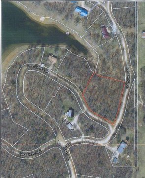
Similar Nearby for Sale
Property description
Physical attributes from public recordsZoning & alternative use
No recorded transactions found for this property.
Costs & Benchmarks
Operating expenses, capex projections, utility benchmarks, and submarket comparables — all in one view.
Risks
Flood, climate, environmental, title, and tenant-concentration risk — surfaced with mitigations and source citations.


