0 Nhn Ambrose Crk Rd Stevensville, MT 59870
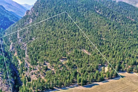
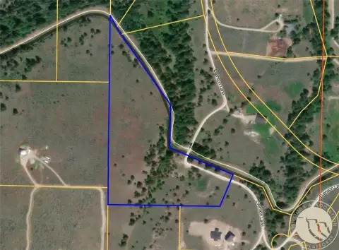
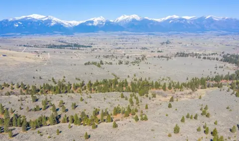
This expansive 224.45-acre property in Stevensville, Montana, presents a unique opportunity. Located on Nhn Ambrose Creek Road, near Florence and a 30-minute drive from Missoula, this land boasts stunning mountain views. Currently used for agricultural purposes, including pasture and hay production, the property includes 22 separate lots, offering significant development potential. Utilities are readily available, with electricity and natural gas access. Water resources include seasonal water from Iron Cap Creek and BRID gravity flow irrigation water rights. Four-wheel drive trails are included in the sale. The land features a mix of pasture, trees, and sagebrush, supporting abundant wildlife. Sub-irrigation is present in portions along the creek. While most of the property is free of covenants, a small portion of Lot 1 is subject to a single covenant. This location is ideal for establishing a family homestead, developing individual lots, or a combination of both. The property's versatility makes it suitable for various uses, from residential development to continued agricultural use. The seller is related to the listing agent. Zip code: 59870.
Cap rate
Implied · in-place · derived from last sale + estimated NOIValue
AI, CAP & Alternative Use estimations · Realmo proprietary blendComparables
6 recent transactions · within 1.5 miComparable in this City


Similar Nearby for Sale


Similar Nearby for Lease


Property description
Physical attributes from public recordsZoning & alternative use
No recorded transactions found for this property.
Costs & Benchmarks
Operating expenses, capex projections, utility benchmarks, and submarket comparables — all in one view.
Risks
Flood, climate, environmental, title, and tenant-concentration risk — surfaced with mitigations and source citations.


