0 Decatur Ms Conehatta, MS 39057
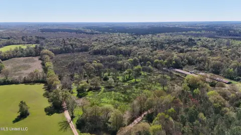
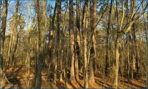
This exceptional property, encompassing approximately 195 acres of versatile land in Decatur, Mississippi, presents a unique investment opportunity. Located conveniently between Pine Bluff, Decatur, and Conehatta, with easy access to Highways 20 and 15, this expansive site offers significant potential for a variety of uses. The total acreage is comprised of several parcels ranging in size from approximately 3.5 to 89.4 acres, providing flexibility for various development scenarios. The individual parcels can be combined to accommodate larger-scale projects, depending on the intended use. The property's zoning allows for a wide range of possibilities, including agribusiness, agricultural operations, live/work units, landfill, open space preservation, cell tower installations, solar farms, data centers, and fish farming, among others. Specific land use approvals are subject to confirmation with the local municipality. The property features a total of 8,000,000 square feet of vacant land. The Assessor's Parcel Numbers (APNs) are: 041R-19-00-002.10, 041R-19-00-002.70, 029R-24-00-007.10, 041R-19-00-002.90, 041R-19-00-009.50, 042R-30-00-004.00, 029R-24-00-007-50, 041R-19-00-014.00, and 041R-19-00-002.50. Additional acreage may be available upon request. This is an exceptional opportunity to acquire a significant land holding in a strategically advantageous location.
Cap rate
Implied · in-place · derived from last sale + estimated NOIValue
AI, CAP & Alternative Use estimations · Realmo proprietary blendComparables
3 recent transactions · within 1.5 miComparable in this City


Similar Nearby for Sale
Property description
Physical attributes from public recordsZoning & alternative use
No recorded transactions found for this property.
Costs & Benchmarks
Operating expenses, capex projections, utility benchmarks, and submarket comparables — all in one view.
Risks
Flood, climate, environmental, title, and tenant-concentration risk — surfaced with mitigations and source citations.


