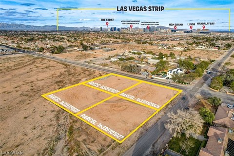
7000 Block 1·215Sw Las Vegas, NV 89113
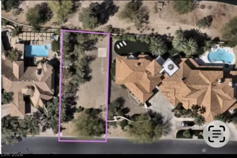
This exceptional 3.72-acre commercial land parcel in Las Vegas, Nevada, presents a unique investment opportunity. Located in the 7000 Block of 1·215SW, this property boasts prime freeway frontage along a major thoroughfare with over 100,000 vehicles passing daily. The land features level topography, simplifying development, and benefits from planned feeder road modifications to enhance accessibility. Its strategic southwest location offers quick access to the airport, resort properties, and I-15. The property consists of two parcels (APN: 176-03-502-006 & 176-03-502-002) and is situated near "The Curve," the intersection of I-215 SW and I-215 W. Retail development is planned on neighboring parcels to the north and east, while an auto dealership is in the planning stages on adjacent western parcels. The Clark County Aviation Department owns the land to the north and east. Signage and cell tower rights remain with the seller. This property offers multiple development opportunities in a high-traffic, high-visibility location, making it an ideal investment for discerning buyers. The asking price is $8,500,000. The zip code is 89113.
Cap rate
Implied · in-place · derived from last sale + estimated NOIValue
AI, CAP & Alternative Use estimations · Realmo proprietary blendComparables
6 recent transactions · within 1.5 miComparable in this City


Similar Nearby for Sale


Similar Nearby for Lease


Property description
Physical attributes from public recordsZoning & alternative use
No recorded transactions found for this property.
Costs & Benchmarks
Operating expenses, capex projections, utility benchmarks, and submarket comparables — all in one view.
Risks
Flood, climate, environmental, title, and tenant-concentration risk — surfaced with mitigations and source citations.


