C-2 Corner Commercial Development
For Sale
$225,000
WHEATLEYS POND Road, Clayton, DE 19938
LAND - CLAYTON, DE
Lot Size3.10 Acres
Days on Market191
Property Features for WHEATLEYS POND Road
General Information
Property type
Land
Property subtype
Other
Subdivision
CLAYTON
Elementary school district
SMYRNA
Middle school district
SMYRNA
High school district
SMYRNA
Standard status
Active
Lot size
3.10 Acres
Taxes and HOA fees
Tax Annual Amount
1024
Listing Agency:
RE/MAX Horizons · RE/MAX International
(302) 678-4300
Listed By:
Steven B. Schmidt · License #RB-0031118
(302) 678-4326
Added: Jan 20
Changed: Jul 1
Last Checked: Jul 30 at 11:06PM
MLS# DEKT2043848
Copyright © 2026 Bright MLS. All rights reserved. All information provided by the listing agent/broker is deemed reliable but is not guaranteed and should be independently verified.
Investment Insights
Based on property information with market context.
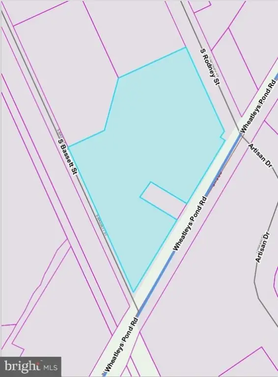
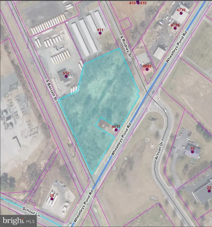
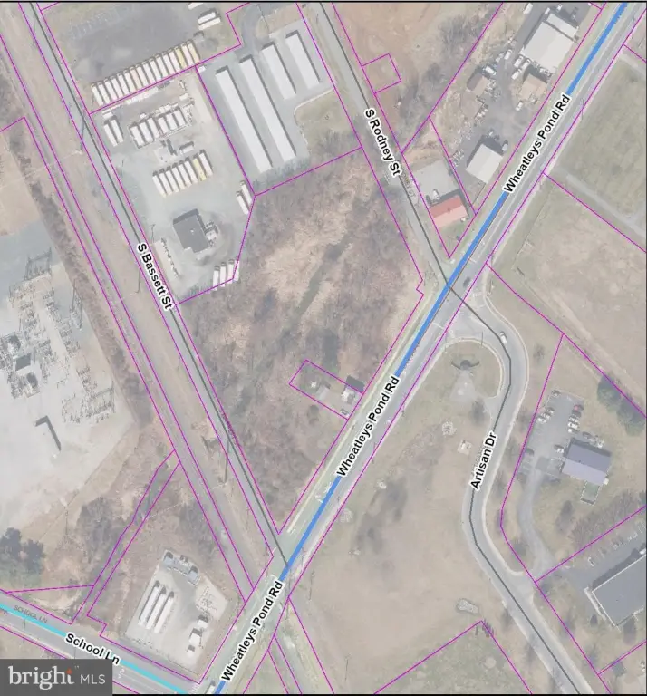
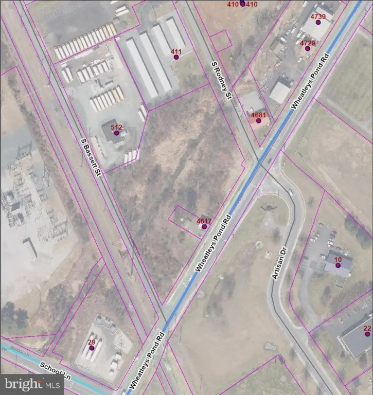
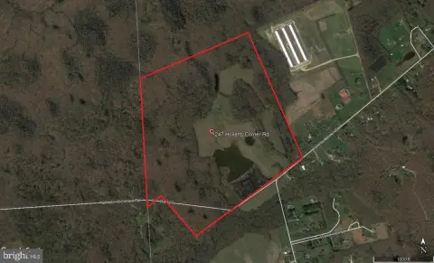
This 3.1+/- acre commercial land parcel is zoned C-2 Commercial and positioned as a high-visibility corner site. The property has frontage on three streets, providing multiple access points and flexible site configuration for a variety of development and operating needs. C-2 zoning supports retail sales and services, restaurants (including drive-through), offices and banks, medical and veterinary clinics, hospitality, daycare, breweries/wineries, indoor recreation, and other specialty commercial uses subject to approvals, with automotive services available on a conditional basis.
The parcel fronts Wheatleys Pond Rd, S. Bassett St, and S. Rodney St, with 10,000 vehicles per day cited on Wheatleys Pond Rd and additional secondary traffic from adjacent roads. The site is located across from the Walmart Distribution Center and is minutes from Route 13, which can support strong day-to-day exposure for many commercial concepts.
For owner-users and developers, the combination of C-2 zoning and three-street frontage can help accommodate a wide mix of tenant types, from retail and office to medical, hospitality, and drive-through restaurants (where approved). Given the conditional nature of certain uses such as automotive services, prospective users should confirm specific development requirements and approvals with the appropriate authorities.
Key Highlights
- High‑visibility corner location with frontage on three streets (Wheatleys Pond Rd, S. Bassett St, and S. Rodney St).
- C‑2 commercial zoning allows for a wide range of uses (retail, restaurant, office, medical, automotive, hospitality, daycare, etc.).
- Excellent exposure with 10,000 vehicles per day on Wheatleys Pond Rd.
Property Analytics
Property Profile
Current Use
Lease Details
10,000 VPD
Traffic count
Location Intelligence
Trade Area within ½ mile
37
Businesses Nearby
Explore this area
Business Placement
Demographics for 19938, DE
10,131
Population
3,246
Households
3.1
Avg Household Size
39
Median Age
23%
College-Educated
91%
High-School Grad
48.2 sq mi
ZIP Area
210
Density / Sq Mi
$96,338
Median Household Income
$47,487
Median Earnings
$1,624
Median Rent
$335,800
Median Home Value

Questions? Ask Rey
Realmo’s AI knows this listing — price, zoning, demand, history. Ask anything.


Frequently Asked Questions
What type of property is this?
Commercial land - 3.1+/- acre C-2 site with three-street frontage and high-visibility traffic for a range of commercial uses.
Where is this commercial land located?
The property is located at WHEATLEYS POND Road Clayton, DE.
What is the asking price?
The asking price for this property is $225,000.
What are key features of this property?
This property features: High‑visibility corner location with frontage on three streets (Wheatleys Pond Rd, S. Bassett St, and S. Rodney St).; C‑2 commercial zoning allows for a wide range of uses (retail, restaurant, office, medical, automotive, hospitality, daycare, etc.).; Excellent exposure with 10,000 vehicles per day on Wheatleys Pond Rd.


