Commercial Land
Parcel B W Washington Street, Kearney, MO 64060
For Sale


$800,000
Land, Kearney, MO
Property SizeContact for details
Lot Size2.05 Acres
Days on Market250
Property Features for Parcel B W Washington Street
General Information
Property type
Property subtype
Zoning
Elementary school district
Middle school district
High school district
Directions
Subdivision
Standard status
APN
Lot size
Taxes and HOA fees
Tax Description
Tax Annual Amount
Legal Description
Listing Agency:
RE/MAX Innovations · RE/MAX International
(816) 454-6540
Listed By:
The REKC Team
(913) 593-3225
Added: Mar 16
Changed: Oct 16
Last Checked: Nov 20 at 2:06AM
MLS# 2607624
Copyright © 2026 Heartland Multiple Listing Service. All rights reserved. All information provided by the listing agent/broker is deemed reliable but is not guaranteed and should be independently verified.

Ask AI about this property
Review the available facts, identify missing information and prepare questions for the agent.
Investment Insights
Based on property information with market context.
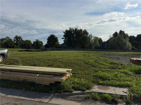
Parcel B is a commercial land offering designated for commercial and industrial use under M zoning. The property is offered as one parcel rather than as a multi-parcel assemblage.
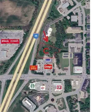
The site is located on W Washington Street in Kearney, Missouri, within Clay County and ZIP code 64060.
The site is located on W Washington Street in Kearney, Missouri, within Clay County and ZIP code 64060.
Key Highlights
- M zoning supports commercial and industrial land use
- Parcel B offered as a single parcel
- Located on W Washington Street in Kearney, MO 64060
Property Analytics
Who owns this building?
See the owner, sales and loan history
Open Analytics
Location Intelligence
Trade Area within ½ mile
618
Businesses Nearby
Improve property use
Find place for business
Demographics for 64060, MO
15,340
Population
6,641
Households
2.3
Avg Household Size
41
Median Age
39%
College-Educated
97%
High-School Grad
58.6 sq mi
ZIP Area
262
Density / Sq Mi
$107,626
Median Household Income
$58,227
Median Earnings
$1,096
Median Rent
$322,100
Median Home Value
Check the figures for this property
Cap Rate, Value Estimation, Potential NOI and more
View Realmo Analytics
Market
Properties on Market for Commercial land in Clay County
Vacancy Rate% for Industrial in Midwest region



Frequently Asked Questions
What type of property is this?
Commercial land - Parcel B offers a single commercial-industrial tract with M zoning in Kearney.
Where is this commercial land located?
The property is located at Parcel B W Washington Street Kearney, MO.
What is the asking price?
The asking price for this property is $800,000.
What are key features of this property?
This property features: M zoning supports commercial and industrial land use; Parcel B offered as a single parcel; Located on W Washington Street in Kearney, MO 64060