Highway Frontage
Hwy US 60, Vernon, AZ 85940
For Sale

$1,400,000
Land, Vernon, AZ
Property SizeContact for details
Lot Size165.80 Acres
Days on Market439
Property Features for Hwy US 60
General Information
Property type
Property subtype
Exterior features
Subdivision
Lot features
Elementary school district
Middle school district
High school district
Directions
Standard status
APN
Lot size
Taxes and HOA fees
Tax Description
Tax Annual Amount
Legal Description
Utilities
Utilities
Listing Agency:
White Mountain Realty
(480) 250-6753
Listed By:
Joseph E Holland · License AZ BR642476000
(928) 243-8701
Added: Sep 9, 2025
Changed: Sep 7
Last Checked: Nov 21 at 11:06PM
MLS# 257904
Copyright © 2026 White Mountain Association of Realtors. All rights reserved. All information provided by the listing agent/broker is deemed reliable but is not guaranteed and should be independently verified.

Ask AI about this property
Review the available facts, identify missing information and prepare questions for the agent.
Investment Insights
Based on property information with market context.
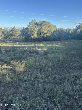
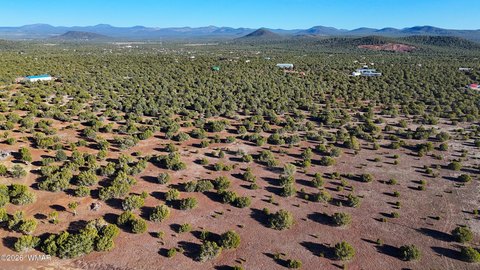
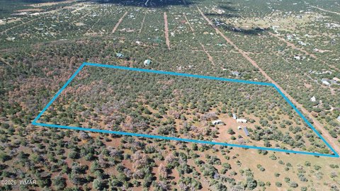
This 165.8-acre land offering combines four adjoining parcels with both hillside and level terrain. The property has vegetation coverage and electricity available, providing basic utility access across a sizable tract. County mapping identifies the area as Winchester Trails Unit 3, although the parcels have never been subdivided.
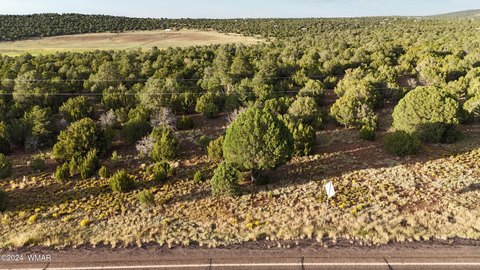
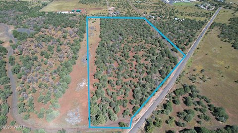
The property extends along nearly 1.5 miles of frontage on Hwy US 60 between Show Low and Springerville. Its location in Vernon, Apache County, places the tract along a major east-west route through the region. Parcel numbers 106-60-039, 040, 041, and 042 are included in the offering.
The property extends along nearly 1.5 miles of frontage on Hwy US 60 between Show Low and Springerville. Its location in Vernon, Apache County, places the tract along a major east-west route through the region. Parcel numbers 106-60-039, 040, 041, and 042 are included in the offering.
Key Highlights
- 165.8 acres across four adjacent parcels
- Nearly 1.5 miles of frontage on Hwy US 60
- Located between Show Low and Springerville
Property Analytics
Who owns this building?
See the owner, sales and loan history
Open Analytics
Location Intelligence
Trade Area within ½ mile
2
Businesses Nearby
Improve property use
Find place for business
Demographics for 85940, AZ
1,580
Population
759
Households
2.1
Avg Household Size
59
Median Age
29%
College-Educated
90%
High-School Grad
98.2 sq mi
ZIP Area
16
Density / Sq Mi
Median Household Income
Median Earnings
Median Home Value
Check the figures for this property
Cap Rate, Value Estimation, Potential NOI and more
View Realmo Analytics
Market
Properties on Market for Land in Apache County






Frequently Asked Questions
What type of property is this?
Land - Undeveloped acreage with varied terrain, vegetation coverage, and electricity available.
Where is this land located?
The property is located at Hwy US 60 Vernon, AZ.
What is the asking price?
The asking price for this property is $1,400,000.
What are key features of this property?
This property features: 165.8 acres across four adjacent parcels; Nearly 1.5 miles of frontage on Hwy US 60; Located between Show Low and Springerville