Single-Tract Tillable
Utopia Avenue Yale, IA 50277
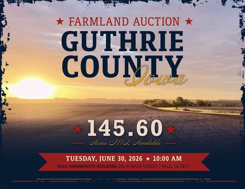
For Sale
Contact for pricing
LAND - Yale, IA
Lot Size145.60 Acres
Days on Market71
Property Features for Utopia Avenue
General Information
Property type
Land
Property subtype
Other
Zoning
Ag
Standard status
Active
APN
0000204200
Lot size
145.60 Acres
Taxes and HOA fees
Tax Description
Exact legal description to be taken from Abstract.
Tax Annual Amount
5338
Listing Agency:
Peoples Company
(515) 222-1347
Listed By:
Matt Adams · License #S59699000
(515) 423-9235
Added: May 20
Changed: Jun 4
Last Checked: Jul 29 at 1:06AM
MLS# 741209
Copyright © 2026 Des Moines Area Association of REALTORS®, Inc. All rights reserved. All information provided by the listing agent/broker is deemed reliable but is not guaranteed and should be independently verified.
Investment Insights
Based on property information with market context.
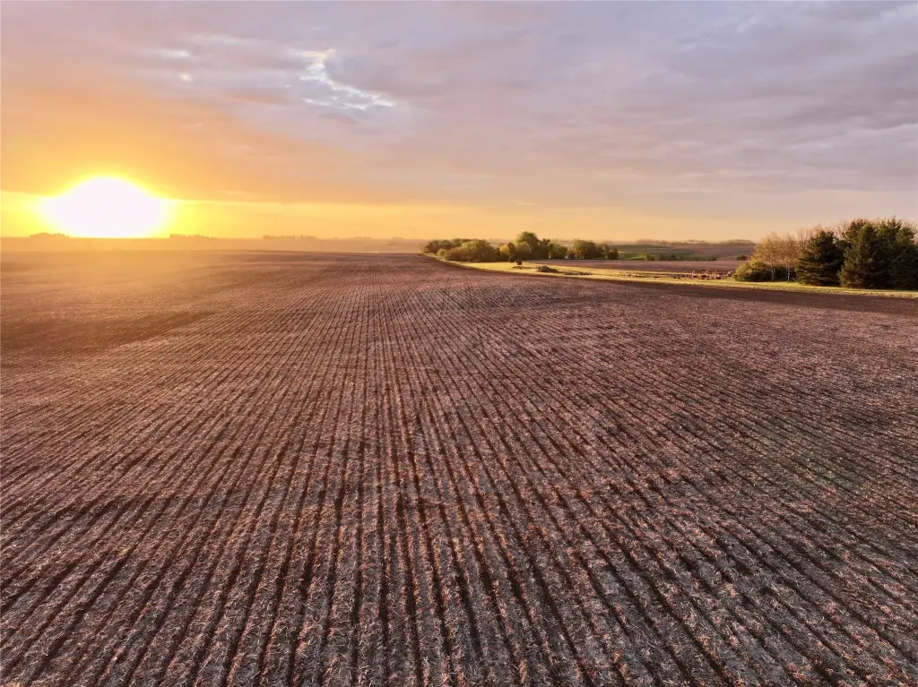
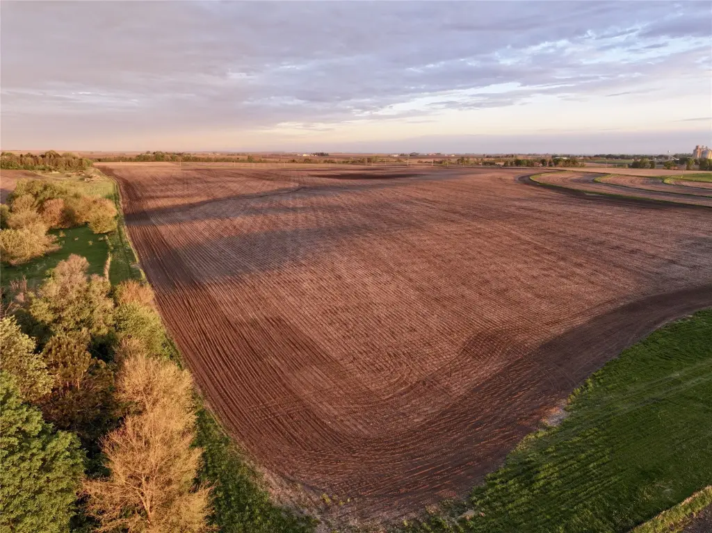
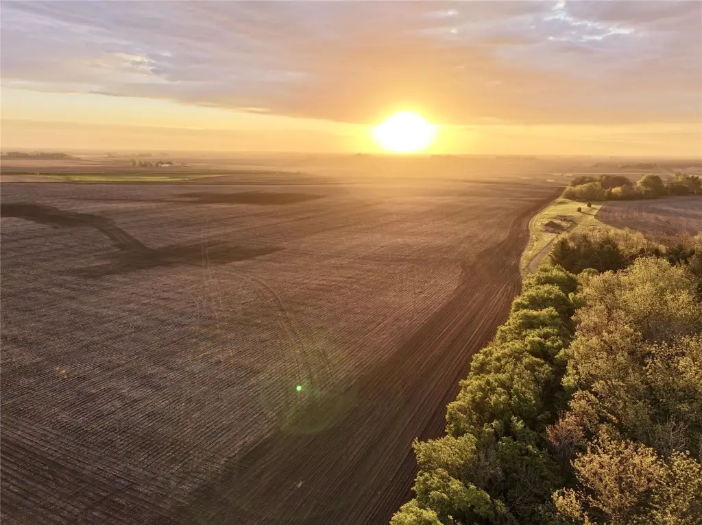
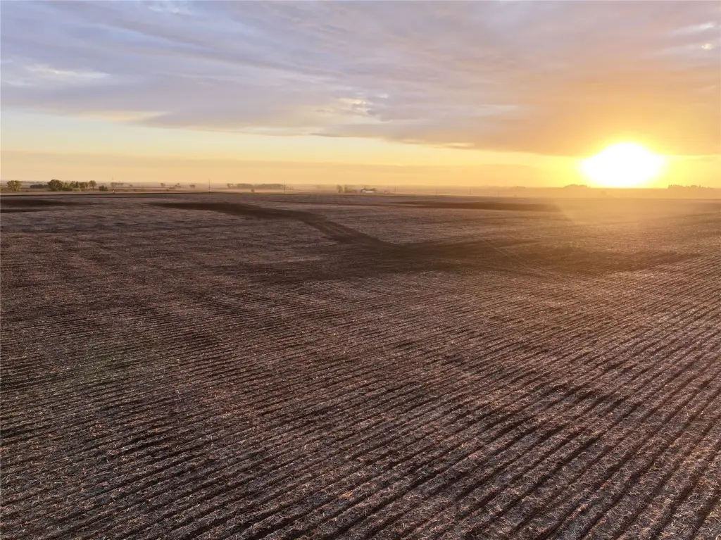
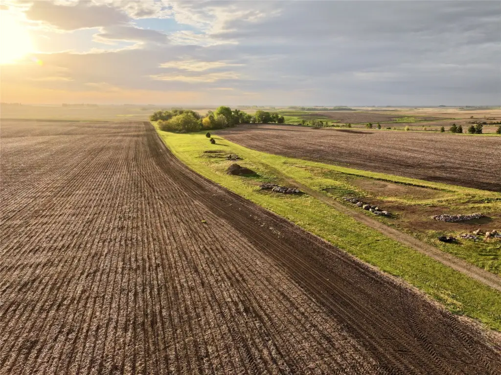
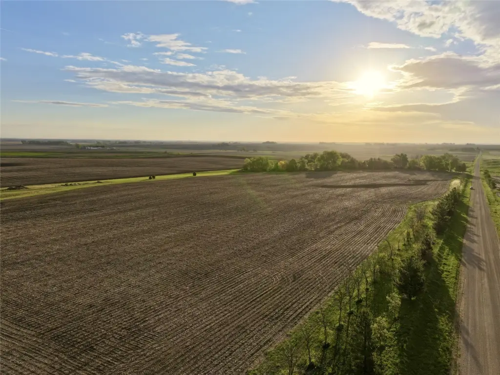
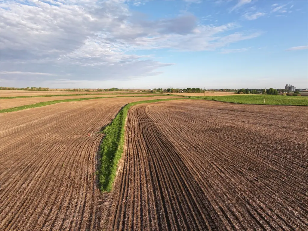
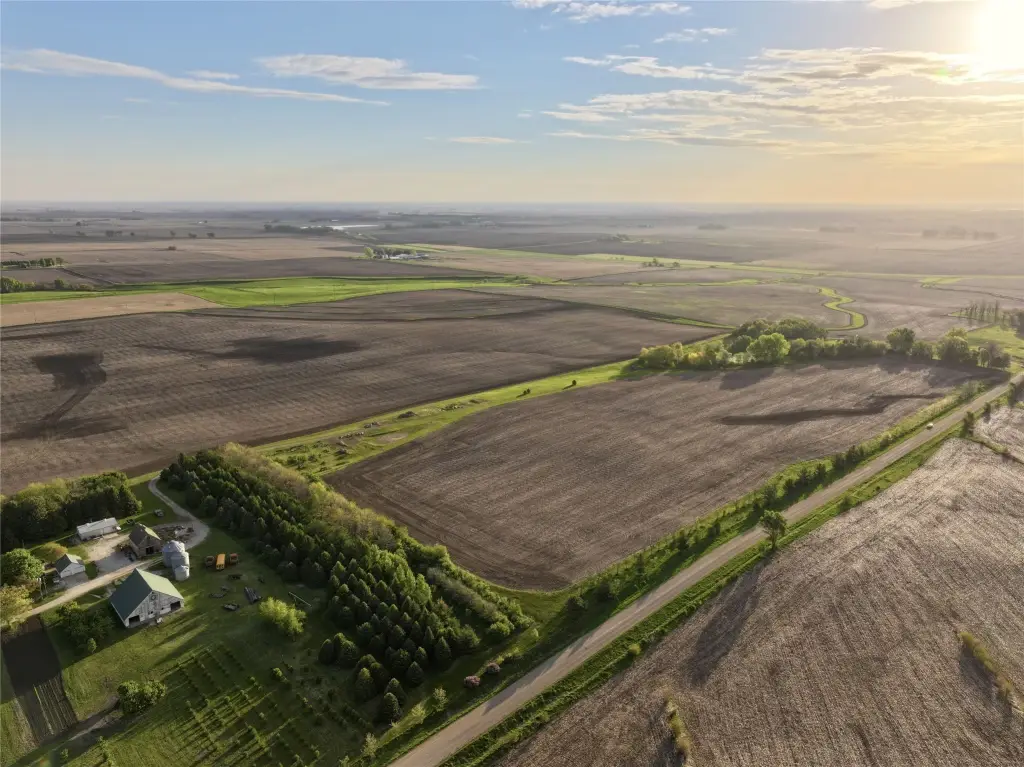
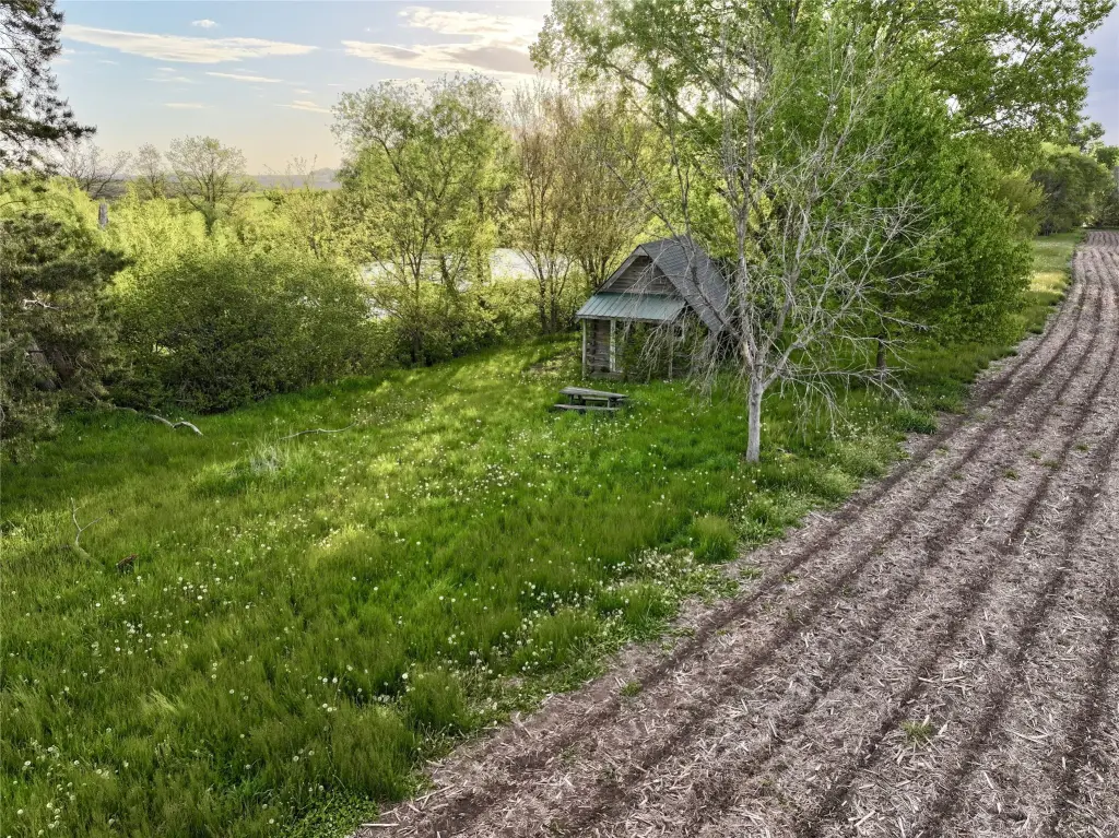
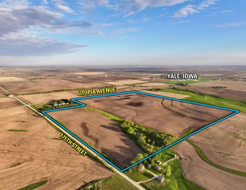
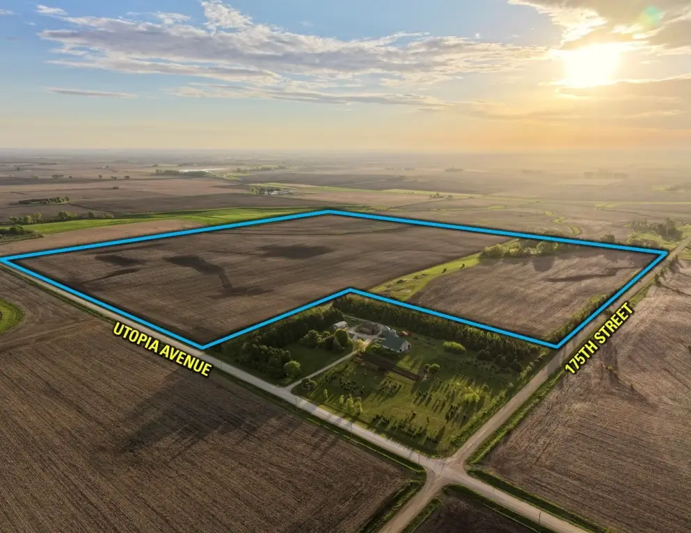
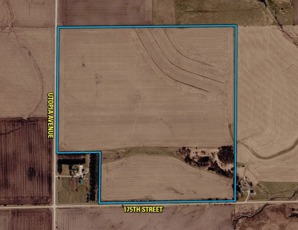
This agricultural property is offered as one tract in Guthrie County, Iowa, totaling 145.60 gross acres. Of that acreage, 133.94 FSA cropland acres are classified as NHEL (Non-Highly Erodible Land). The listing notes a CSR2 soil rating of 87.5 for primary cropland soils, including Clarion loam, Canisteo clay loam, and Nicollet loam. The remaining portion of the tract includes a grass waterway running west to east across the southern one-third of the farm. A small rustic cabin built in 2007 is located within a secluded timbered patch overlooking a catch pond.
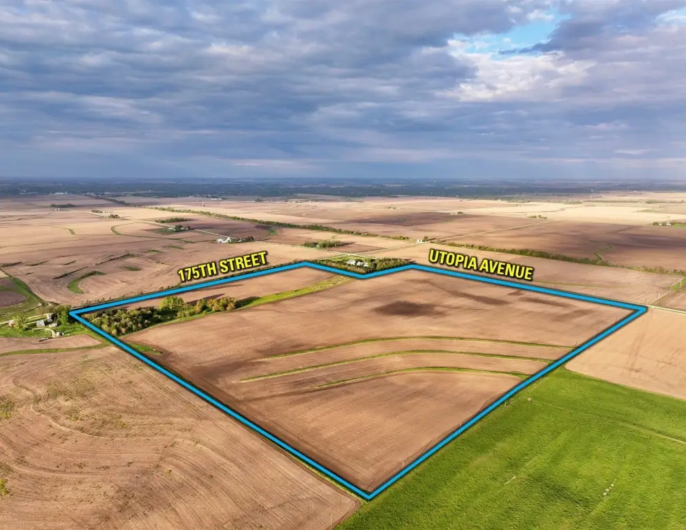
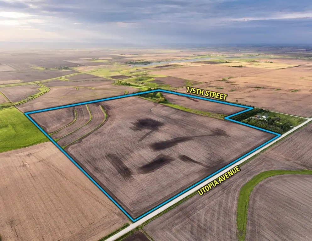
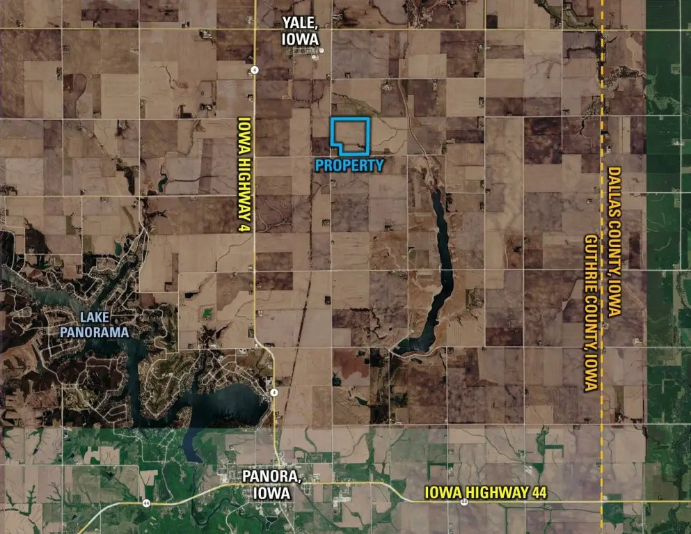
The farm is located just south of Yale and is accessed from Utopia Avenue from the west. The property sits approximately one mile off Iowa Highway 4, providing relatively direct access to the Iowa highway system. The listing also describes established grass terraces in the northeast corner of the tract, including six tile intakes, with approximate locations shown on an included “Tile Intake Map.” In addition, approximately 3.12 acres of waterway separate the current north and south tillable portions of the farm.
For buyers seeking a consolidated agricultural land tract, this property combines NHEL FSA cropland with drainage features indicated by the terrace tile intakes and waterway areas. The separate north and south tillable portions are divided by waterway acreage, which the listing states could be converted to add to more tillable acres. Zoning is listed as Ag.
Key Highlights
- High‑quality farmland with a strong CSR2 soil rating of 87.5 on 133.94 FSA cropland acres.
- Non‑Highly Erodible Land (NHEL) classification ensures sustainable farming practices.
- Excellent access via Utopia Avenue and proximity to Iowa Highway 4.
Property Analytics
Location Intelligence
Current Use
Frequently Asked Questions
What type of property is this?
Agricultural land / Farmland - One tract of Iowa farmland with FSA cropland and an on-site grass waterway, accessed off Utopia Avenue.
Where is this agricultural land / farmland located?
The property is located at Utopia Avenue Yale, IA.
What are key features of this property?
This property features: High‑quality farmland with a strong CSR2 soil rating of 87.5 on 133.94 FSA cropland acres.; Non‑Highly Erodible Land (NHEL) classification ensures sustainable farming practices.; Excellent access via Utopia Avenue and proximity to Iowa Highway 4.