SW Hat Rock Loop, Powell Butte, OR 97753
- Added:
- Mar 6, 2026
- Days on Market:
- 114
- Last Refresh:
- Jun 28 at 3:06 am
Property Features for SW Hat Rock Loop
General Information
- Property type
- Land
- Property subtype
- Other
- Standard status
- Active
- APN
- 19468
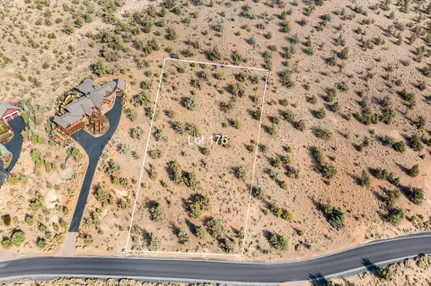
- Lot size
- 1.00 Acre
Taxes and HOA fees
- Tax Year
- 2025
- Tax Annual Amount
- 2522
Utilities
- Utilities
- Cable Available
- Sewer type
- Public Sewer
- Water source
- Public
Listing agent Gregory Broderick (541) 280-2363
Listing office Stellar Realty Northwest 109 NW Greenwood Ave, Ste 105, Bend, OR (541) 508-3148
Listing date Mar 6, 2026
Copyright © 2026 Oregon Data Share. All rights reserved. All information provided by the listing agent/broker is deemed reliable but is not guaranteed and should be independently verified.
HighLights
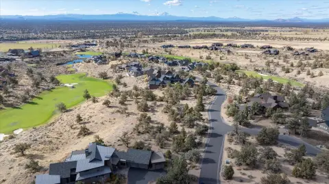
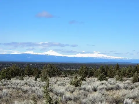
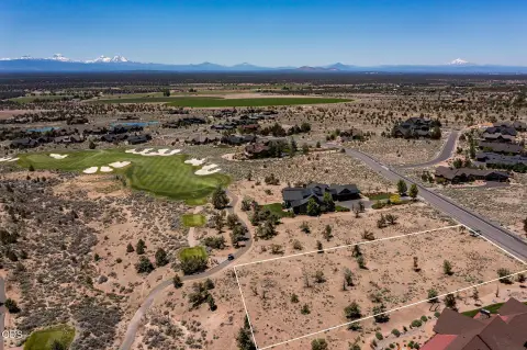
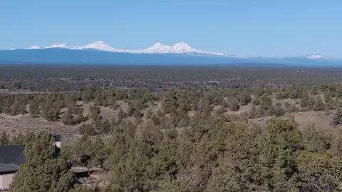
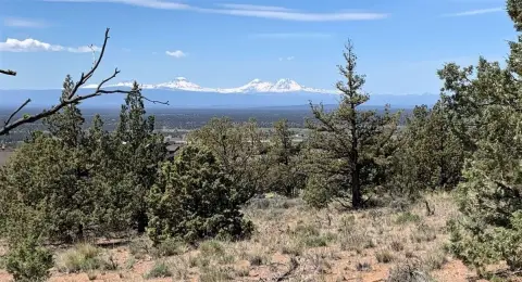
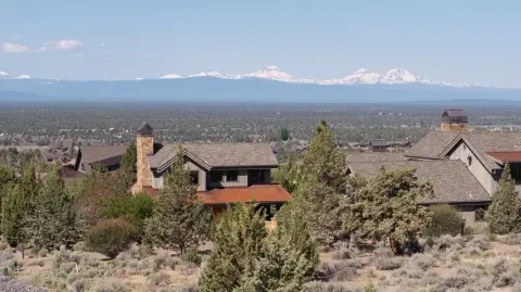
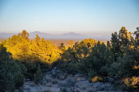
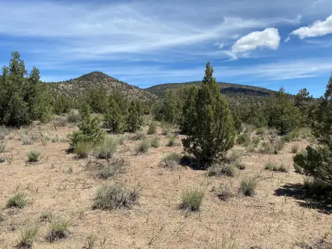
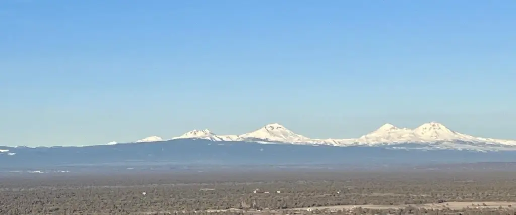
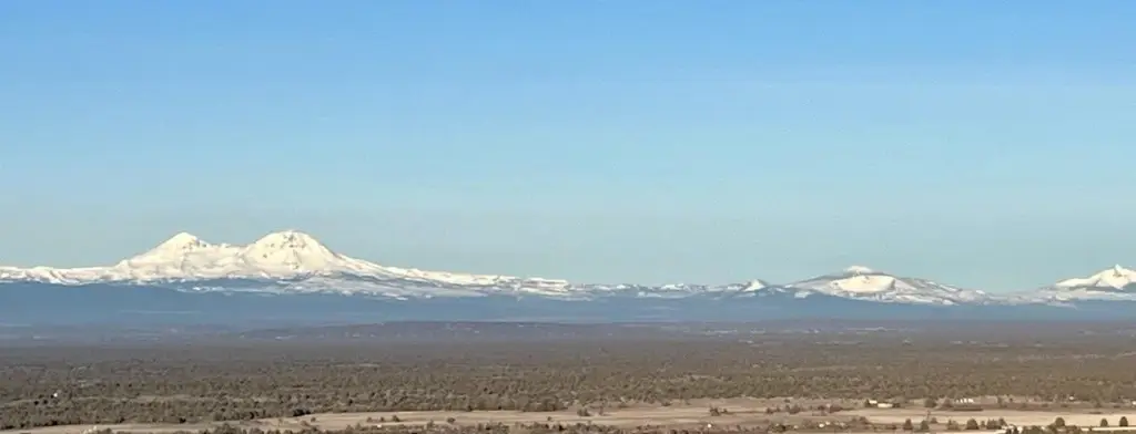
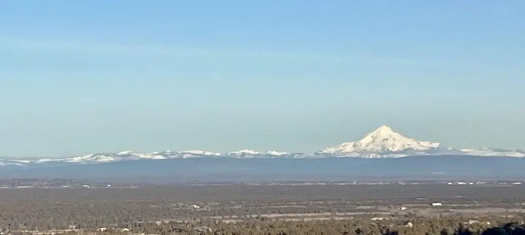
- Premier 1‑acre homesite with panoramic, unobstructed mountain views.
- Highest elevation parcel in the community.
- Backs to protected public land, ensuring lasting privacy.
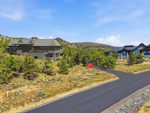
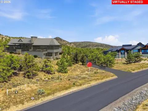
- Includes plans for a 4,000 SF luxury custom home, modifiable to preference.
- Located in Brasada Ranch, a sought‑after Central Oregon community.
- Utilities include cable, public water, and public sewer.
Overview
Located on SW Hat Rock Loop in Powell Butte, Oregon (Crook County), the lot’s elevated position is described in the listing as among the highest elevation parcels in the community. The back-to-protected-public-land configuration is intended to preserve privacy and keep the surrounding area open.
For buyers looking to build from an existing concept, the included custom home plans provide a starting point for designing a residence tailored to the site. The property’s land-only offering gives flexibility in how the buyer positions outdoor amenities and landscaping around the home. If you’re planning a new construction in the Brasada Ranch community and want a homesite with views and an open rear setting, this parcel is positioned as a strong fit based on the details provided.
Current Use by Public Records
Map
- City
- Powell Butte
- County
- Crook
- State
- Oregon
- Longitude
- -121.028868
- Latitude
- 44.165861