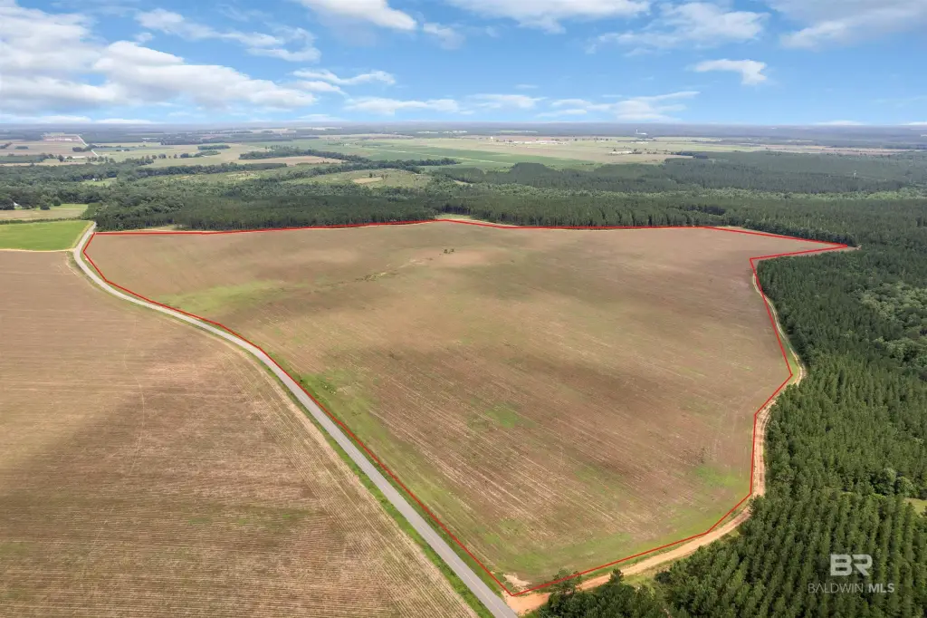
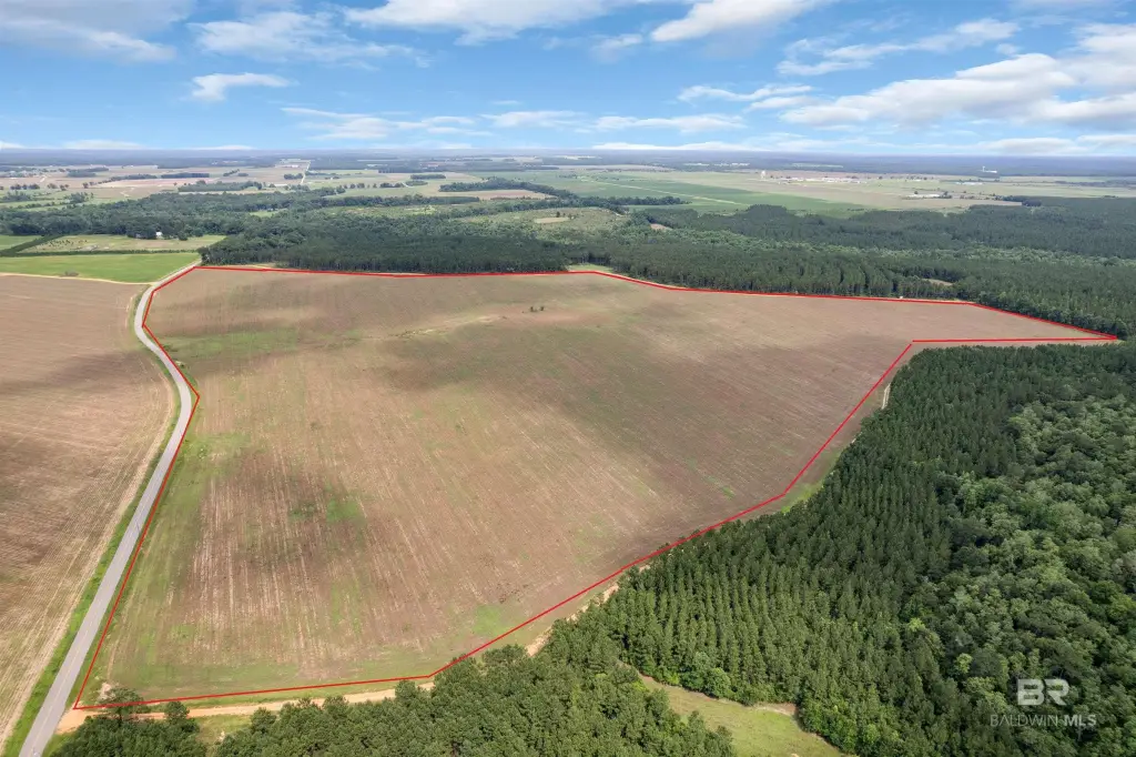
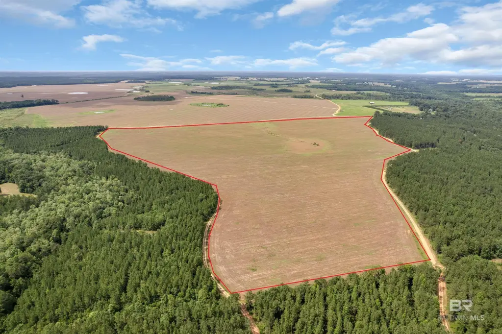
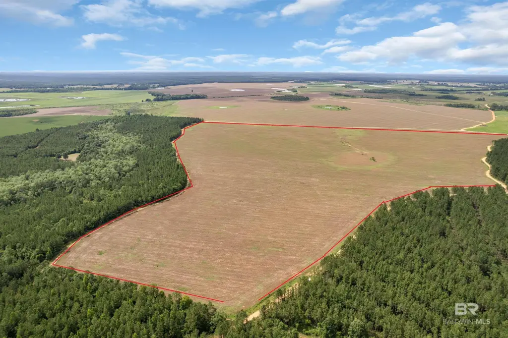
Cleared Agricultural Land
Smithfield Road Atmore, AL 36502

For Sale
$774,965
LAND - Atmore, AL
Lot Size114.98 Acres
Days on Market48
Property Features for Smithfield Road
General Information
Property type
Land
Property subtype
Other
Zoning
Not Zoned,Outside Corp Li
Standard status
Active
APN
30 08 09 32 0 000 001.003
Lot size
114.98 Acres
Taxes and HOA fees
Tax Description
In file
Listing Agency:
PHD Realty, LLC
(251) 368-1063
Listed By:
Taylor Lee · License #0001008901
(251) 294-2060
Added: Jun 12
Changed: Jul 18
Last Checked: Jul 29 at 8:06PM
MLS# 397942
Copyright © 2026 Baldwin REALTORS®. All rights reserved. All information provided by the listing agent/broker is deemed reliable but is not guaranteed and should be independently verified.
Investment Insights
Based on property information with market context.
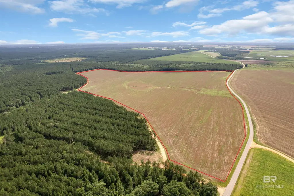
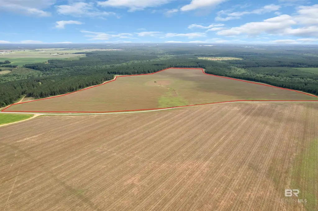
This sale includes a cleared agricultural land tract totaling 114.98+/- acres. The property is described as having high, dry, level ground that has been farmed, with room for a range of agricultural uses. Water infrastructure is in place, including two wells referenced in the remarks: a 400–450+/- ft well producing approximately 450 gallons per minute (needs a pump), plus additional 4" and 8" submersible wells. The property is noted as outside city limits and not zoned (outside corporate limits), with remarks indicating flexibility for uses such as keeping horses.
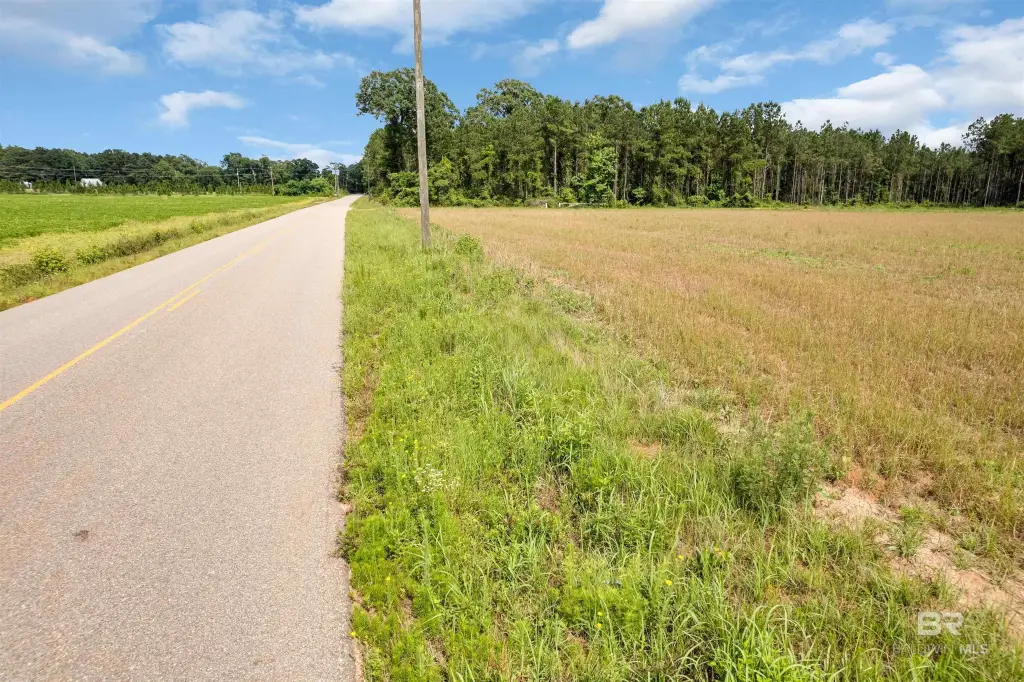
The tract is presented with over 3,000 feet of paved road frontage along Smithfield Road, with multiple access points identified in the remarks. Additional location context provided is that the property sits in the Huxford community just outside Atmore, with quick access to I-65 mentioned in the public remarks. Buyers are instructed to verify all information during due diligence.
For tenants, buyers, or operators looking for acreage with existing site water and long paved frontage, this property may fit agricultural operations that can use cleared, level ground. The extended frontage and multiple access points can also support planning for future development, subdivision, or other land-use scenarios, subject to verification of feasibility and requirements during due diligence.
Key Highlights
- 114.98+/- acres in the Huxford community (outside city limits) with over 3,000 ft of frontage on paved Smithfield Road
- Entirely cleared, high, dry, level ground that has been farmed and is ready for row crops, hay, cattle, or a homestead
- Water infrastructure on site with two wells: a 400–450+/- ft well producing about 450 GPM (needs a pump), plus (2) 4" and 8" submersible wells
Property Analytics
Location Intelligence
Current Use


Frequently Asked Questions
What type of property is this?
Agricultural land / Farmland - 114.98+/- acres of cleared land with extensive paved road frontage and on-site water via multiple wells.
Where is this agricultural land / farmland located?
The property is located at Smithfield Road Atmore, AL.
What is the asking price?
The asking price for this property is $774,965.
What are key features of this property?
This property features: 114.98+/- acres in the Huxford community (outside city limits) with over 3,000 ft of frontage on paved Smithfield Road; Entirely cleared, high, dry, level ground that has been farmed and is ready for row crops, hay, cattle, or a homestead; Water infrastructure on site with two wells: a 400–450+/- ft well producing about 450 GPM (needs a pump), plus (2) 4" and 8" submersible wells