Waterfront Land
For Sale
$224,000
Secluded Lane lot 8, Gordon, WI 54838
LAND - Gordon, WI
Lot Size4.41 Acres
Days on Market49
Property Features for Secluded Lane lot 8
General Information
Property type
Land
Property subtype
Other
Zoning description
Residential
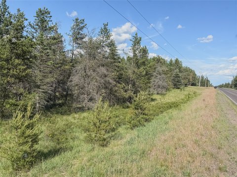
Vegetation
Wooded
Lot features
Sand Soil, Wooded
Elementary school district
Northwood
Middle school district
Northwood
High school district
Northwood
Directions
From Minong: North on Hwy 53 approx. 6 miles. Left on Hwy T. Right on Apple Lake Rd. Left on Gram Rd. Straight onto Bear Hollow Rd. Right on Secluded Ln. Property at end of road on left.
Standard status
Active
APN
WA0320254400
Lot size
4.41 Acres
Taxes and HOA fees
Tax Year
2025
Tax Description
LOT 8 DOUGLAS COUNTY PLAT OF CRANBERRY COVE FR'L NW-NW & FR'L SW-NW, 30-43-12 ALSO 1/18TH INT IN OL1 & OL2 AND 1/15TH INT OL3
Tax Annual Amount
1059
Legal Description
LOT 8 DOUGLAS COUNTY PLAT OF CRANBERRY COVE FR'L NW-NW & FR'L SW-NW, 30-43-12 ALSO 1/18TH INT IN OL1 & OL2 AND 1/15TH INT OL3
Utilities
Water front
1
Listing Agency:
Coldwell Banker Realty~Spooner · GMAC Real Estate
(715) 635-2000
Listed By:
Sara Maas · License #83960-94
(218) 348-8307
Added: Jun 15
Changed: Jul 29
Last Checked: Aug 2 at 11:06AM
MLS# 1602293
Copyright © 2026 REALTORS® Association of Northwestern Wisconsin. All rights reserved. All information provided by the listing agent/broker is deemed reliable but is not guaranteed and should be independently verified.
Investment Insights
Based on property information with market context.
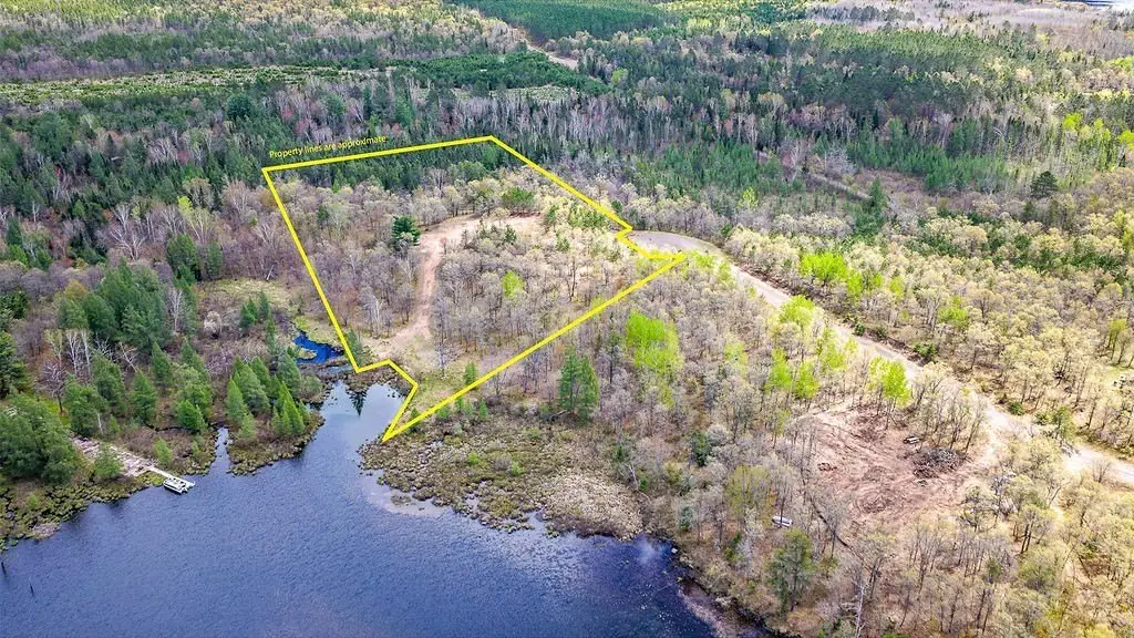
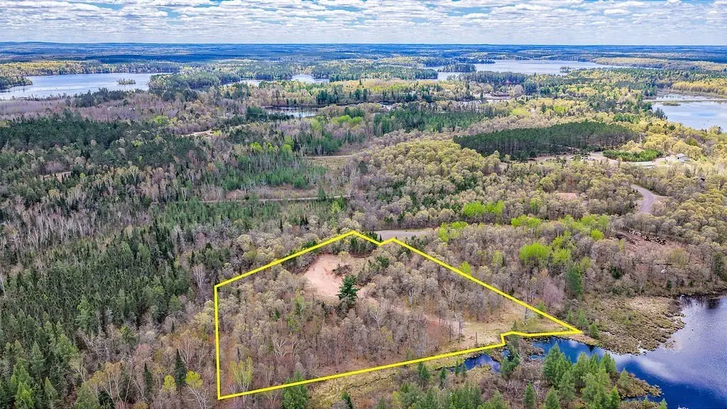
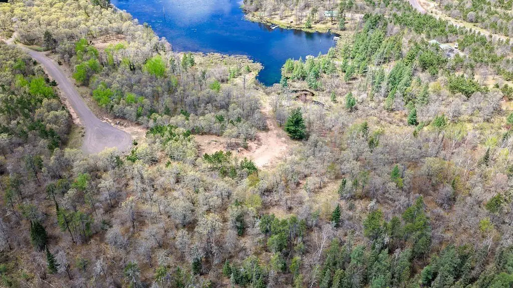
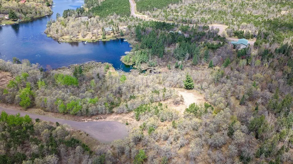
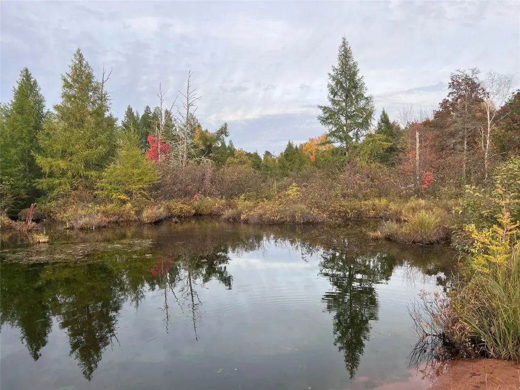
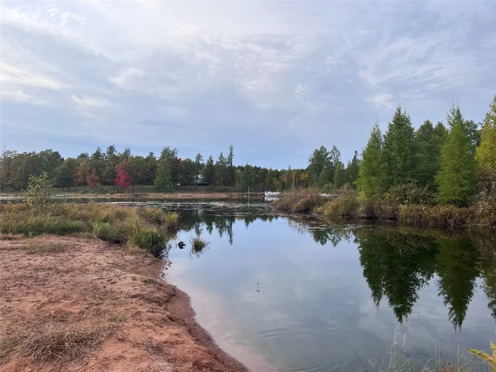
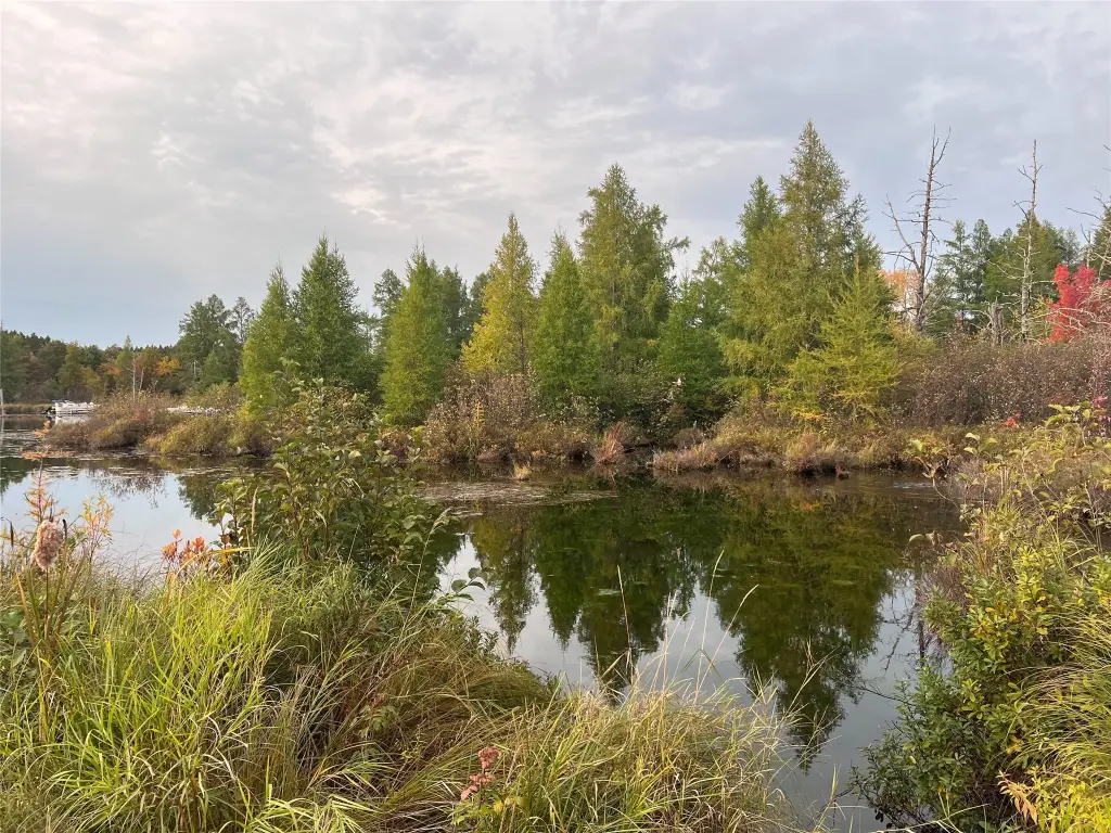
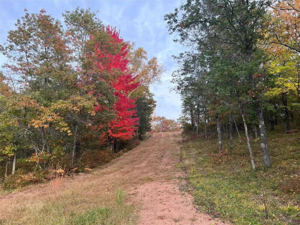
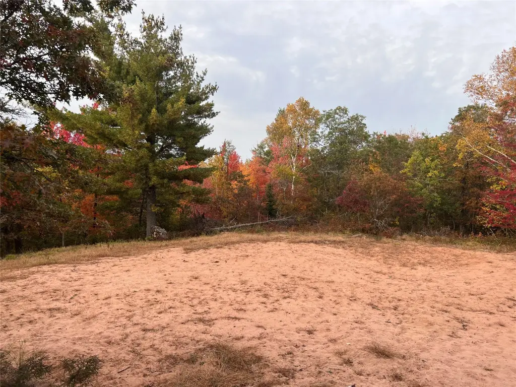
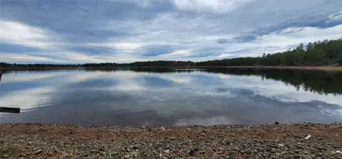
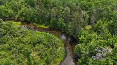
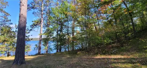
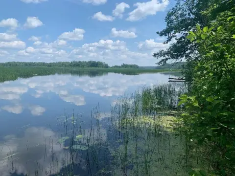
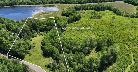
This 4.41-acre waterfront land parcel is located on the Cranberry Narrows and provides direct access to both Cranberry Lake and the Minong Flowage. The site is described as having a cleared, buildable area, along with a private road and driveway approach to the property.
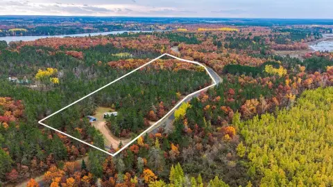
The parcel sits at the end of a quiet cul-de-sac. It is bordered by hundreds of acres of papermill land, supporting a secluded setting.
Overall, the property is configured for a straightforward starting point with site clearing already completed and direct water access identified for recreational use.
Key Highlights
- 4.41‑acre waterfront lot on Cranberry Narrows with direct access to Cranberry Lake and the Minong Flowage
- Located at the end of a quiet cul‑de‑sac
- Cleared buildable site already in place
Property Analytics
Property Profile
Current Use
Lease Details
Yes
Paved road access
Location Intelligence
Trade Area within ½ mile
1
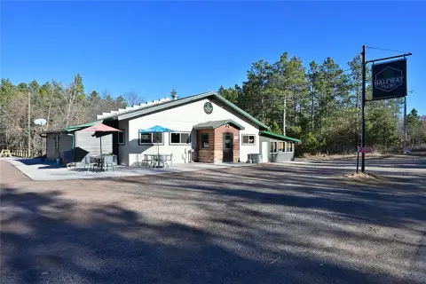
Businesses Nearby
Explore this area
Business Placement
Demographics for 54838, WI
1,481
Population
1,685
Households
0.9
Avg Household Size
59
Median Age
29%
College-Educated
95%
High-School Grad
241.0 sq mi
ZIP Area
6
Density / Sq Mi
$75,000
Median Household Income
$39,554
Median Earnings
$917
Median Rent
$235,700
Median Home Value

Questions? Ask Rey
Realmo’s AI knows this listing — price, zoning, demand, history. Ask anything.


Frequently Asked Questions
What type of property is this?
Waterfront Land - Waterfront lot with direct access to Cranberry Lake and the Minong Flowage, featuring a cleared buildable site.
Where is this waterfront land located?
The property is located at Secluded Lane lot 8 Gordon, WI.
What is the asking price?
The asking price for this property is $224,000.
What are key features of this property?
This property features: 4.41‑acre waterfront lot on Cranberry Narrows with direct access to Cranberry Lake and the Minong Flowage; Located at the end of a quiet cul‑de‑sac; Cleared buildable site already in place


