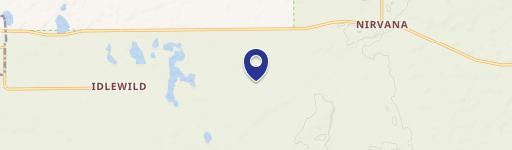
S Queens Highway, Chase, MI 49623
- Added:
- Jun 14, 2026
- Days on Market:
- 9
- Last Refresh:
- Jun 22 at 7:06 am
Property Features for S Queens Highway
General Information
- Property type
- Land
- Property subtype
- Other
- Standard status
- Active
- APN
- 15-013-046-75
- Lot size
- 40.00 Acres
Taxes and HOA fees
- Tax Year
- 2024
- Tax Description
- PT SW 1/4 SW 1/4 BEG SW COR TH N 330' ELY 1322' TO W 1/16 LN, S 329', W 1322' TO POB SEC 13 T17N R12W. 10 A. AND Y 13-11 SW 1/4 SW 1/4 EXC BEG SW COR TH N 330' E 1322' TO W 1/16 LN, S 329', W 1323' TO POB SEC 13 T17N R12W. 30 A.
- Tax Annual Amount
- 831
Utilities
- Utilities
- Electricity Available

Listing agent Sean McDonald License #6â00B5â00B0â00B1â00B3â00B0â00B2â00B0â00B9â00B7 (231) 510-2072
Listing office Homewaters, LLC 1248 Hastings, Traverse City, MI (877) 820-1194
Listing date Jun 14, 2026
Copyright © 2026 Michigan Regional Information Center, LLC. All rights reserved. All information provided by the listing agent/broker is deemed reliable but is not guaranteed and should be independently verified.
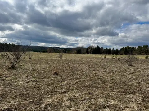
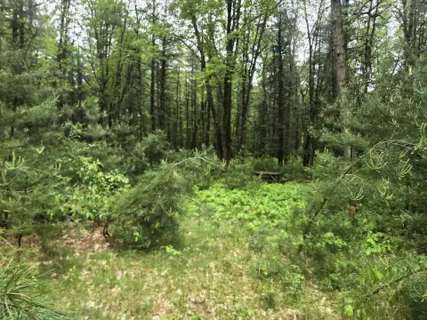
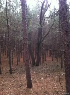
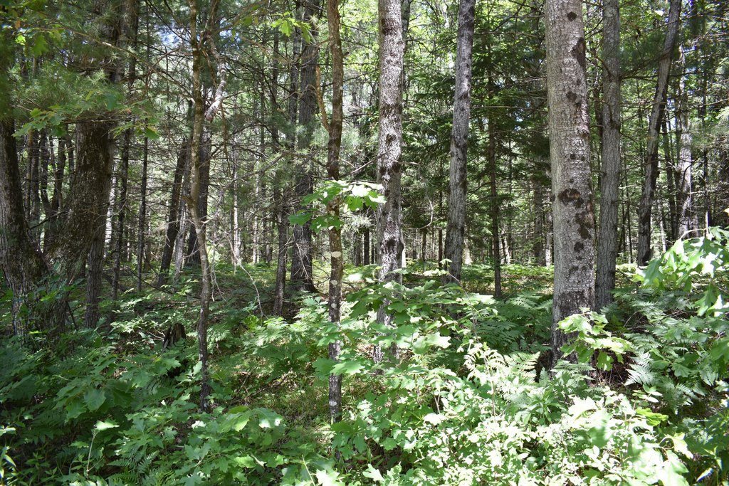
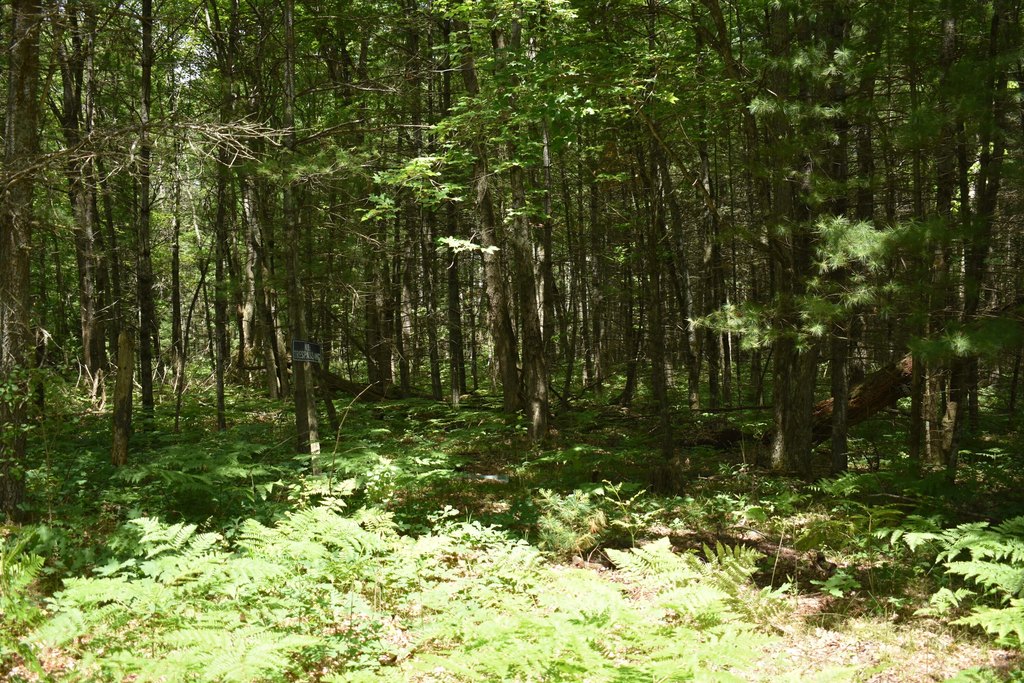
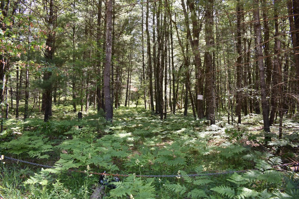
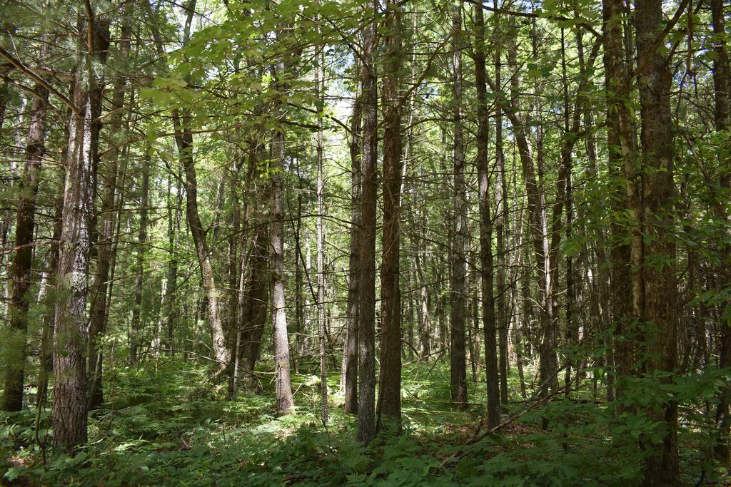
HighLights
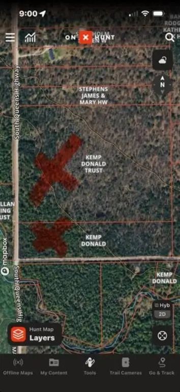
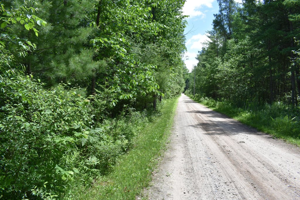
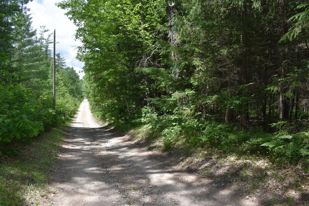
- Two adjoining parcels total 40 acres on a county‑maintained road
- Utilities: electricity available
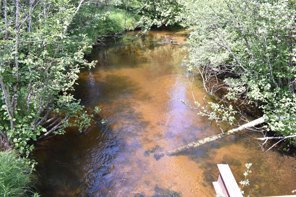
- Mixed tree cover with one small pond
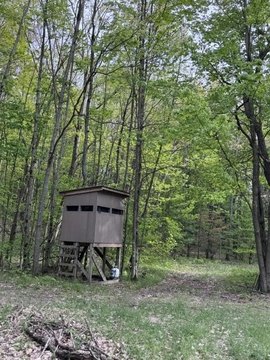
- Deer blinds in place and some walking‑cleared trails
- Close to rails for trails and a grouse management area
- Federal land across the bridge to the southwest of the Middle Branch of the Pere Marquette River
Overview
The parcels are located on a county maintained road. Federal land lies across the bridge to the southwest of the Middle Branch of the Pere Marquette River, and the surrounding area includes access to nearby rails for trails and a grouse management area.
For hunters and outdoor enthusiasts, the combination of wooded cover, a water feature, and in-place blinds supports day-to-day use without requiring immediate clearing or setup. The existing trail network can also help with movement across the property for seasonal access and recreation. For buyers looking for a spot to build an up-north getaway, the land’s natural mix of cover and pond provides a straightforward base for future improvements, subject to applicable zoning and permitting.
Current Use by Public Records
Map
- City
- Chase
- County
- Lake
- State
- Michigan
- Longitude
- -85.700433
- Latitude
- 43.859806