Corner Commercial

For Sale
$725,000
S Airport Drive, Weslaco, TX 78596
Land, Weslaco, TX
Property SizeContact for details
Lot Size9.55 Acres
Days on Market140
Property Features for S Airport Drive
General Information
Property type
Land
Property subtype
Other
Subdivision
West Tract
Lot features
Corner Lot, Irregular Lot
Elementary school
Margo
Middle school
Central
High school
Weslaco East H.S.
Elementary school district
Weslaco ISD
Middle school district
Weslaco ISD
High school district
Weslaco ISD
Directions
From Expressway 83 / I 2, Exit 159/Airport Dr., head South until you get to the property on the Corner of 18th and Airport Dr. Alternatively you can also exit Texas Blvd. or Border Av., head south, East on 18th St. until you are at the corner of 18th and Airport As per FEMA, property's new flood zone is: B. Not yet reflected on map. Documentation available upon request.
Standard status
Active
APN
W380000697000010
Lot size
9.55 Acres
Taxes and HOA fees
Tax Year
2024
Tax Annual Amount
332
Utilities
Water source
Public
Listing Agency:
Davis Real Estate - Weslaco
(956) 968-4571
Listed By:
Marisol Nunez
(956) 463-2959
Added: Apr 27
Changed: Aug 19
Last Checked: Sep 13 at 3:06PM
MLS# 459912
Copyright © 2026 Greater McAllen Association of Realtors. All rights reserved. All information provided by the listing agent/broker is deemed reliable but is not guaranteed and should be independently verified.
Investment Insights
Based on property information with market context.
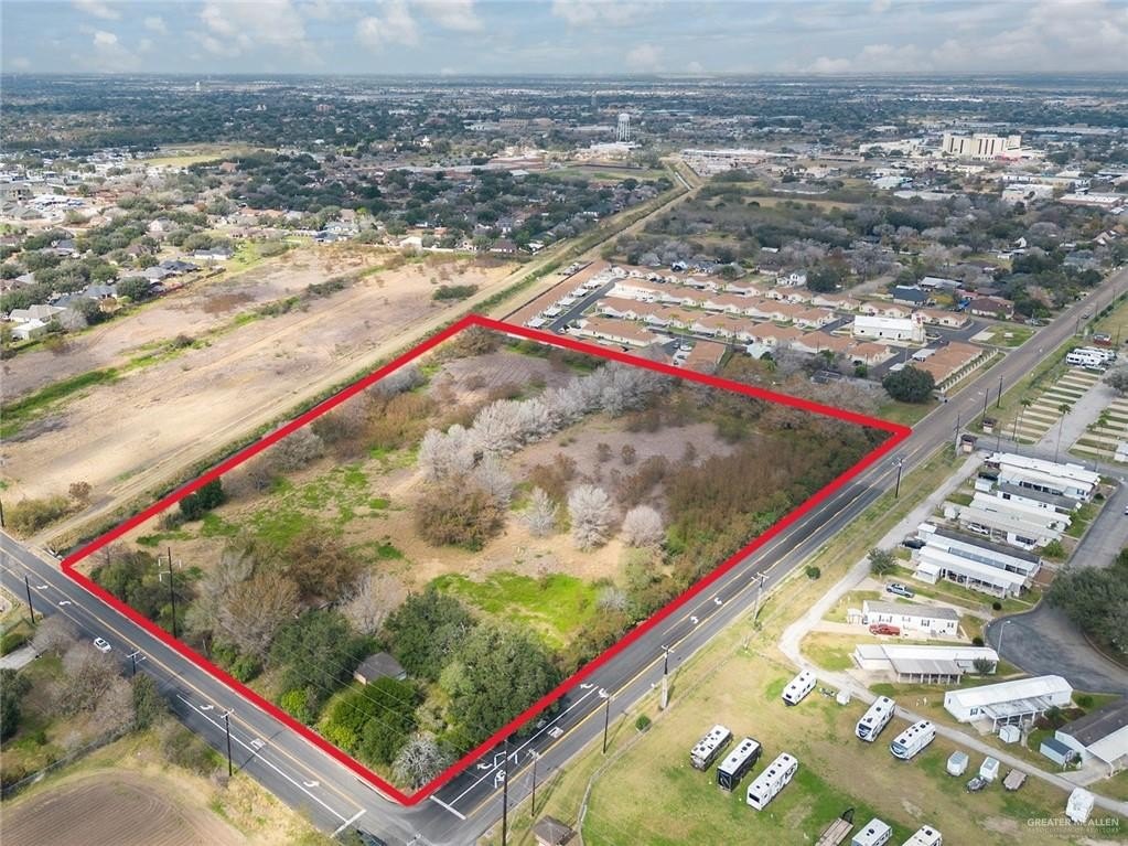
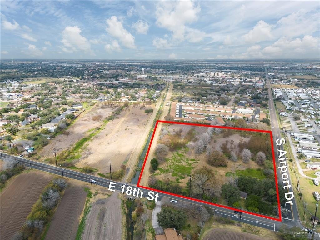
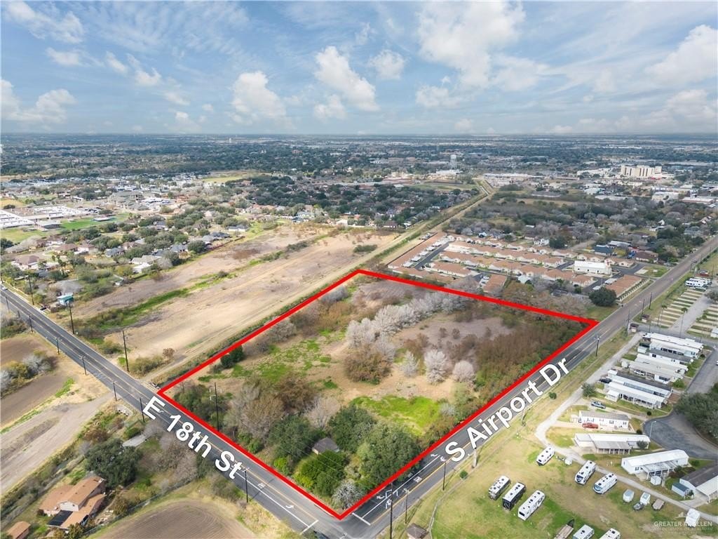
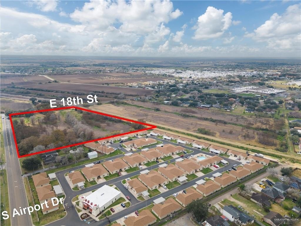
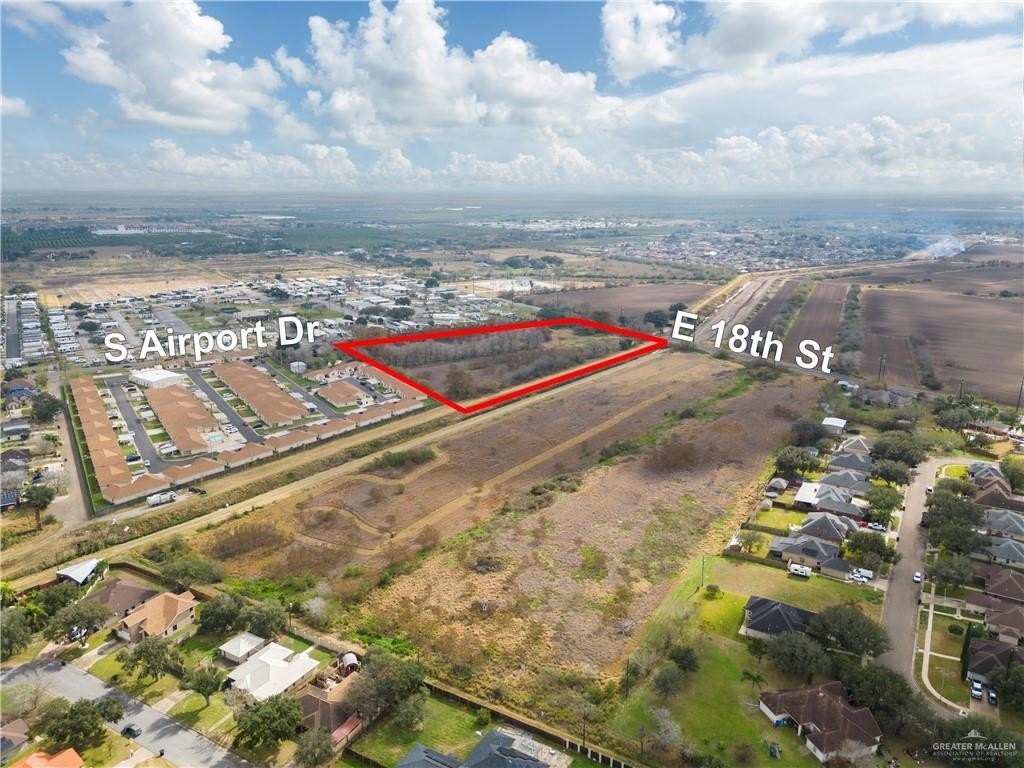
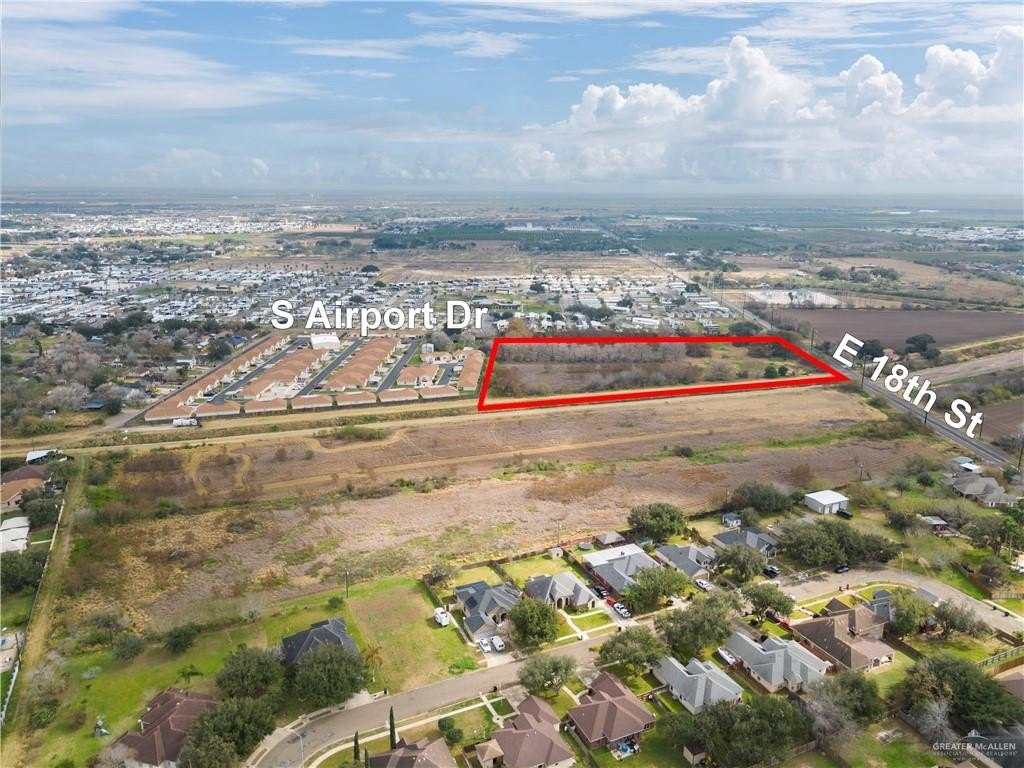
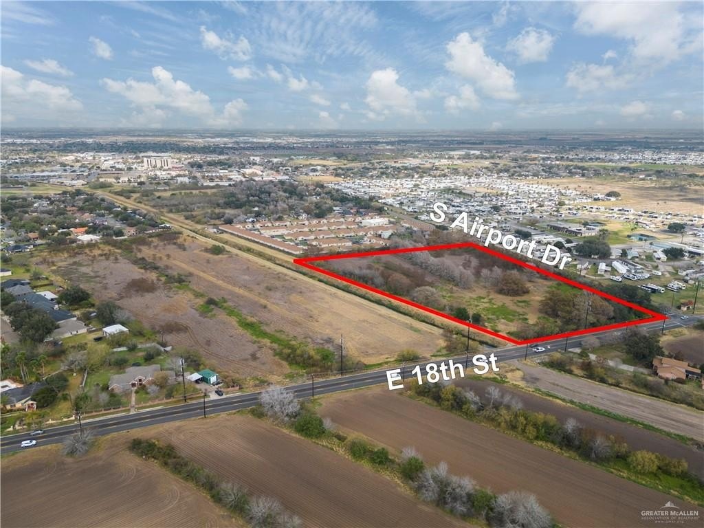
This 9.55-acre commercial land parcel occupies the northwest corner of Airport Drive and 18th Street in Weslaco. The property is identified for potential commercial, agricultural, grazing, equestrian, orchard, residential, mobile home park, and subdivision applications, subject to applicable approvals. Public water is listed for the location.
The site is positioned less than 1 mile from Knapp Medical Center, shops, and restaurants, and approximately 1.5 miles from International Boulevard/FM 1015. Encore Leisure World Mobile Home Park lies across the street to the east, with Margo Terrace Subdivision to the west and Sangria Sunset Apartment Complex to the south. FEMA identifies the property’s new flood zone as B, although that designation has not yet been reflected on the map. Verification of available services and land-use approvals rests with the buyer and the relevant city and county authorities.
The site is positioned less than 1 mile from Knapp Medical Center, shops, and restaurants, and approximately 1.5 miles from International Boulevard/FM 1015. Encore Leisure World Mobile Home Park lies across the street to the east, with Margo Terrace Subdivision to the west and Sangria Sunset Apartment Complex to the south. FEMA identifies the property’s new flood zone as B, although that designation has not yet been reflected on the map. Verification of available services and land-use approvals rests with the buyer and the relevant city and county authorities.
Key Highlights
- 9.55‑acre commercial land parcel
- Northwest corner of Airport Drive and 18th Street in Weslaco
- Less than 1 mile from Knapp Medical Center, shops, and restaurants
Property Analytics
Unlock full access to Insights
Subscribe to Realmo Intelligence
Open Analytics
Current Use
Location Intelligence
Trade Area within ½ mile
89
Businesses Nearby
Explore this area
Business Placement
Demographics for 78596, TX
37,329
Population
15,824
Households
2.4
Avg Household Size
36
Median Age
21%
College-Educated
75%
High-School Grad
40.1 sq mi
ZIP Area
931
Density / Sq Mi
$53,797
Median Household Income
$31,618
Median Earnings
$917
Median Rent
$92,800
Median Home Value
Check the figures for this property
Cap Rate, Value Estimation, Potential NOI and more
View Realmo Analytics

Questions? Ask Rey
Realmo’s AI knows this listing — price, zoning, demand, history. Ask anything.





Frequently Asked Questions
What type of property is this?
Commercial land - A prominent intersection setting with public water listed and nearby medical, retail, restaurant, and residential uses.
Where is this commercial land located?
The property is located at S Airport Drive Weslaco, TX.
What is the asking price?
The asking price for this property is $725,000.
What are key features of this property?
This property features: 9.55‑acre commercial land parcel; Northwest corner of Airport Drive and 18th Street in Weslaco; Less than 1 mile from Knapp Medical Center, shops, and restaurants


