Agricultural Land with Road
Rs County Road 1520 Point, TX 75472
Rs County Road 1520, Point, TX, 75472
$184,140
For Sale
$184,140
LAND - Other - Point, TX
Lot Size10.23 Acres
Days on Market8
Property Features for Rs County Road 1520
General Information
- Property type
- Land
- Property subtype
- Other
- Vegetation
- Grassed, Wooded, Cleared
- Standard status
- Active
- APN
- R501
- Lot size
- 10.23 Acres
Taxes and HOA fees
- Tax Description
- A0013 BREWER JOHN ACRES 12.5
- Tax Annual Amount
- 23
Utilities
- Utilities
- Propane
Building Details
- Architectural style
- Other
Listing Agency
Anatole Realty Group, LLC
(817) 319-8183
N. Richland Hills, TX
Listed by
Cynthia Hennig · License #0512253
(214) 415-9919
Added: Jul 11 Checked: Jul 18 at 11:06 am
MLS# 21156719
Listing URL
Copyright © 2026 North Texas Real Estate Information Systems, Inc. All rights reserved. All information provided by the listing agent/broker is deemed reliable but is not guaranteed and should be independently verified.
Investment Insights
Based on property information with market context.
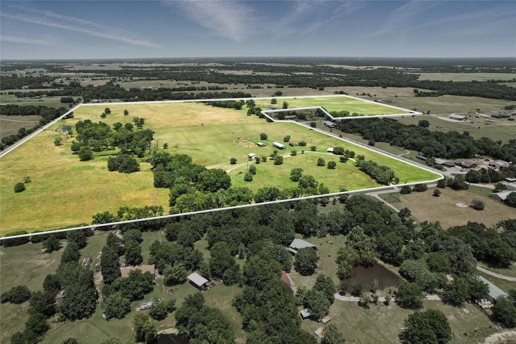
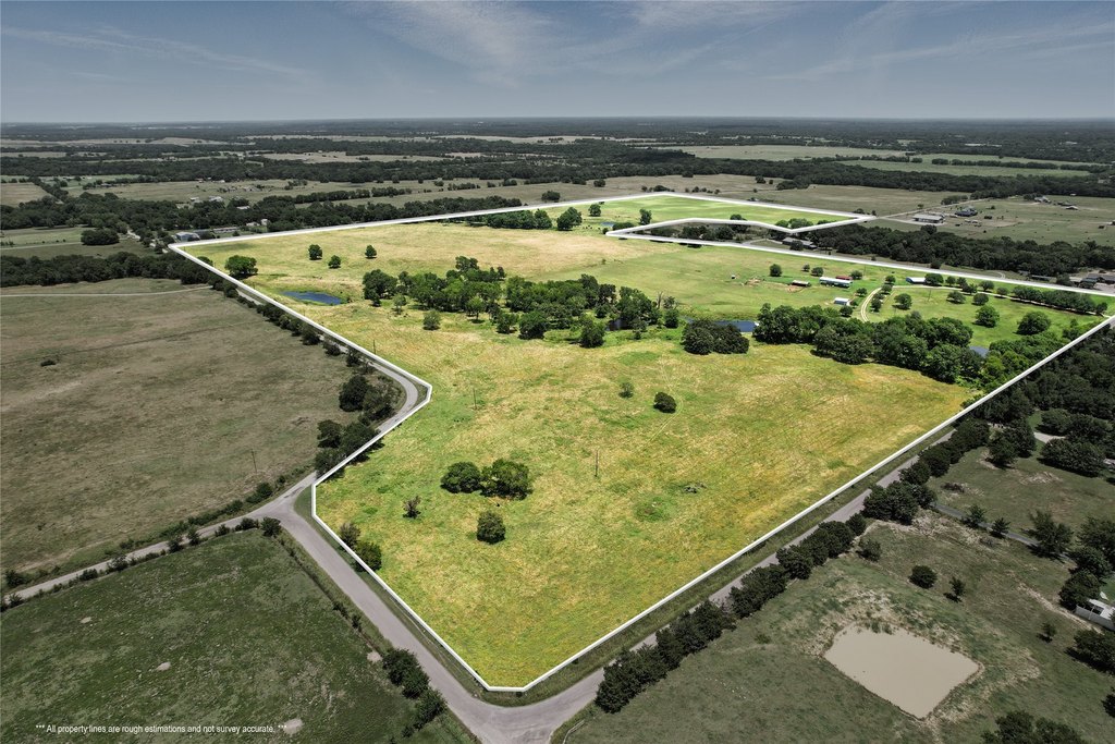
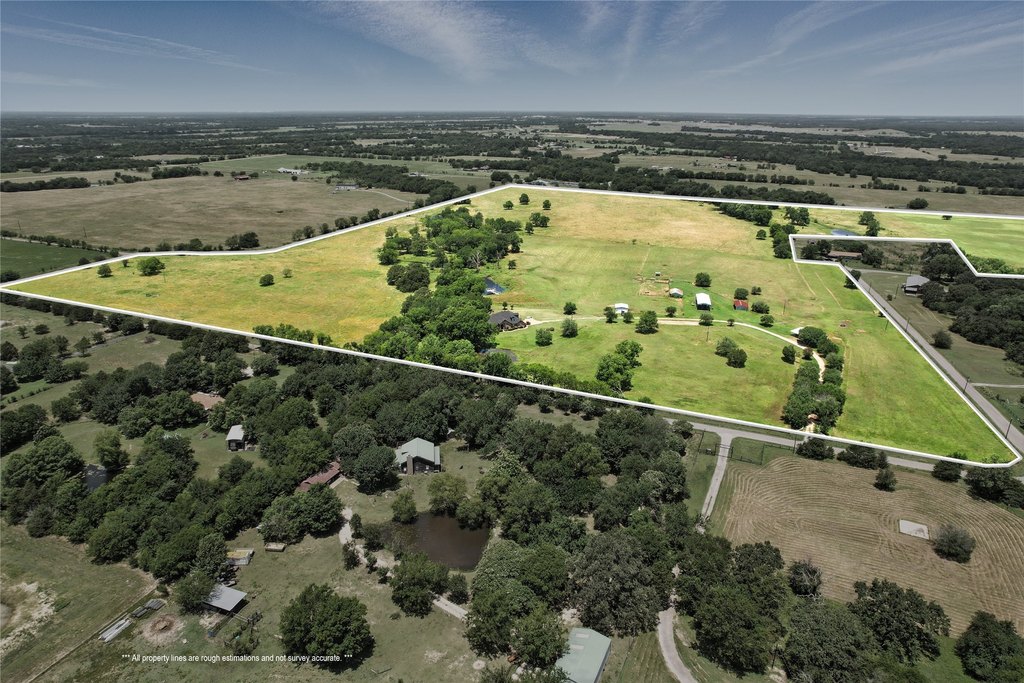
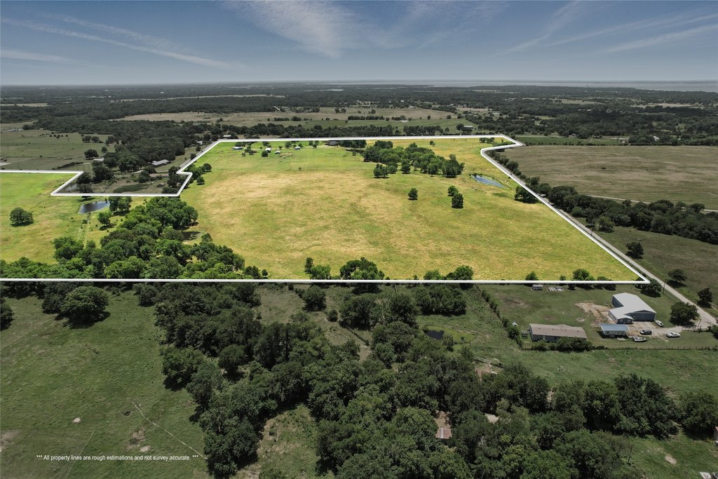
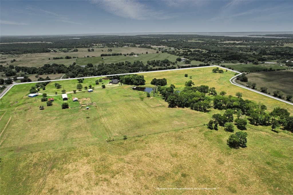
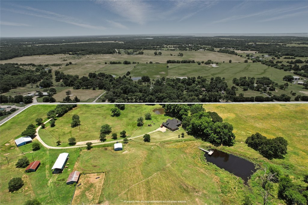
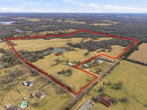
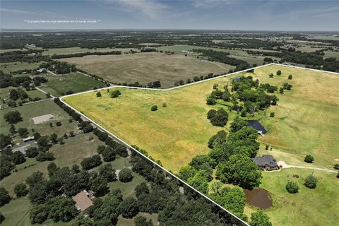
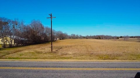
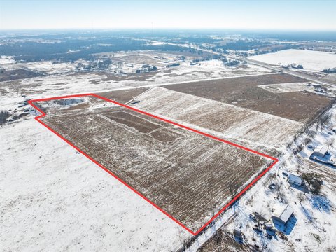
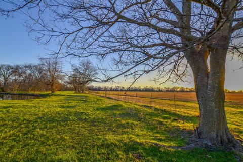
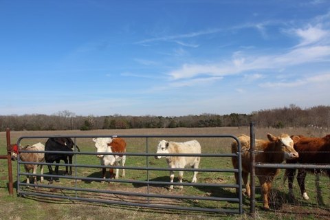
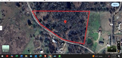
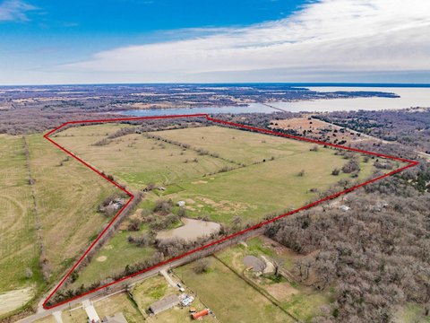
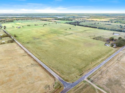
This 10.23-acre agricultural-exempt tract in Rains County is set up for flexible use, with open pastures, wooded areas, and scenic ponds. The property includes coastal fields for grazing and multiple gated entrances already in place.
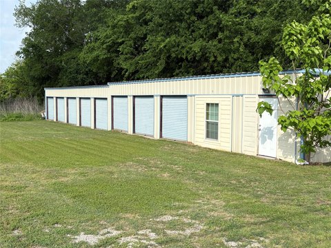
The land provides road frontage on both CR 1515 and CR 1520, and it includes two water meters on each road. Parcels of land are available on 500, 501, and 515, along with an adjoining homestead that has prior use as a cattle ranching operation, including working pens, barns, and storage.
With existing ranch improvements and a configuration that can accommodate farming and livestock-focused operations, this property offers a rural setting for agricultural development or an equestrian/hobby-farm use where water access and road frontage are priorities.
Key Highlights
- 10.23‑acre agricultural‑exempt tract in Rains County, Point, TX
- Road frontage on both CR 1515 and CR 1520, with two water meters (one on each road)
- Open pastures plus wooded areas with scenic ponds and coastal fields for grazing
Property Analytics
Location Intelligence
Current Use by Public Records
Ranches
Similar For Sale Nearby

FAQs
What type of property is this?
Agricultural land / Farmland - 10.23-acre agricultural-exempt tract with open pastures and wooded areas, fronting CR 1515 and CR 1520 with water meters on both roads.
Where is this agricultural land / farmland located?
The property is located at Rs County Road 1520 Point, TX.
What is the asking price?
The asking price for this property is $184,140.
What are key features of this property?
This property features: 10.23‑acre agricultural‑exempt tract in Rains County, Point, TX; Road frontage on both CR 1515 and CR 1520, with two water meters (one on each road); Open pastures plus wooded areas with scenic ponds and coastal fields for grazing


