Rifle, CO 81650, Rifle, CO 81650
- Added:
- Jun 2, 2026
- Days on Market:
- 3
- Last Refresh:
- Jun 4 at 10:06 pm
Property Features
General Information
- Property type
- Land
- Property subtype
- Other
- Zoning
- Rural
- Fencing
- Fenced
- Standard status
- Active
- APN
- 217701200526
- Lot size
- 41.17 Acres
Taxes and HOA fees
- Tax Year
- 2025
- Tax Description
- Section: 1 Township: 6 Range: 93 LOT 1 OF SEC 2 AND LOT 4 OF SEC 1 AS DESC IN BK 681 PG 959. EXCEPT PT OF PROPERTY LOCATED WITHIN LOT 1 SEC 2, THE RESIDUE OF WHICH MAY ALSO BE DESCRIBED AS TRS 7,8 & THE N 471.88' OF TR 9 AS SHOWN ON PLAT NO 1 OF ANTLERS O
- Tax Annual Amount
- 288
Utilities
- Water source
- Well
Listing agent Steve M Carter License #FA40018629 (970) 948-6145
Listing office RE/MAX Country GWS 1605 Grand Ave Unit C, New Castle, CO (970) 945-1215
Listing date Jun 2, 2026
Copyright © 2026 Aspen Glenwood MLS. All rights reserved. All information provided by the listing agent/broker is deemed reliable but is not guaranteed and should be independently verified.
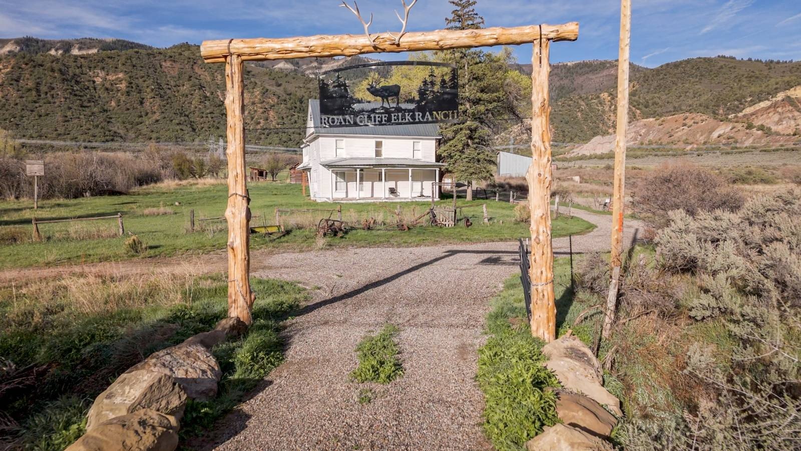
HighLights
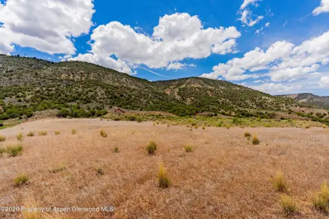
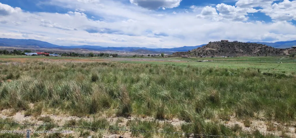
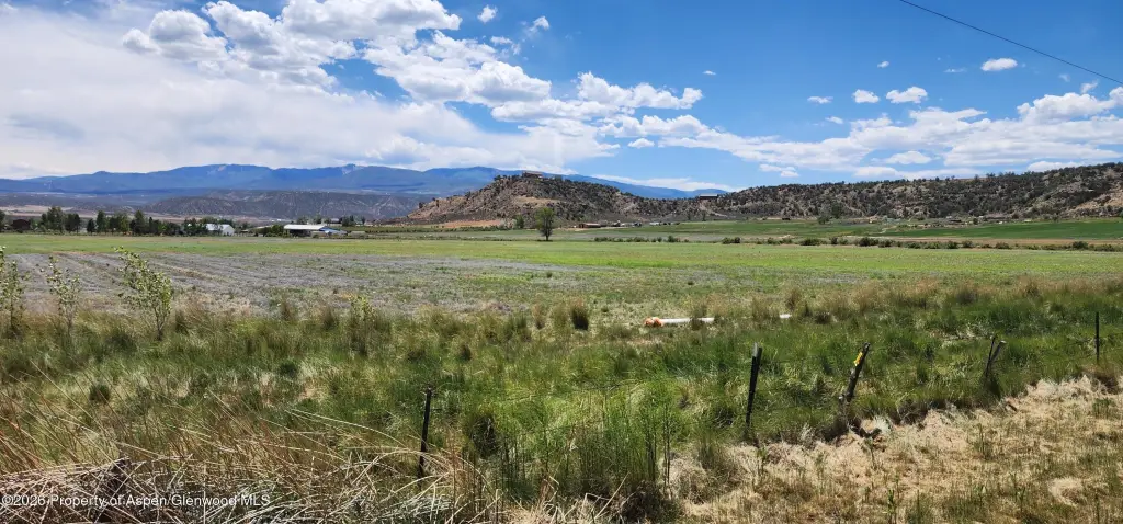
- 41.171 acres of irrigated agricultural land
- Includes 75 shares of Silt Project irrigation water
- Water source: well
- Fenced property
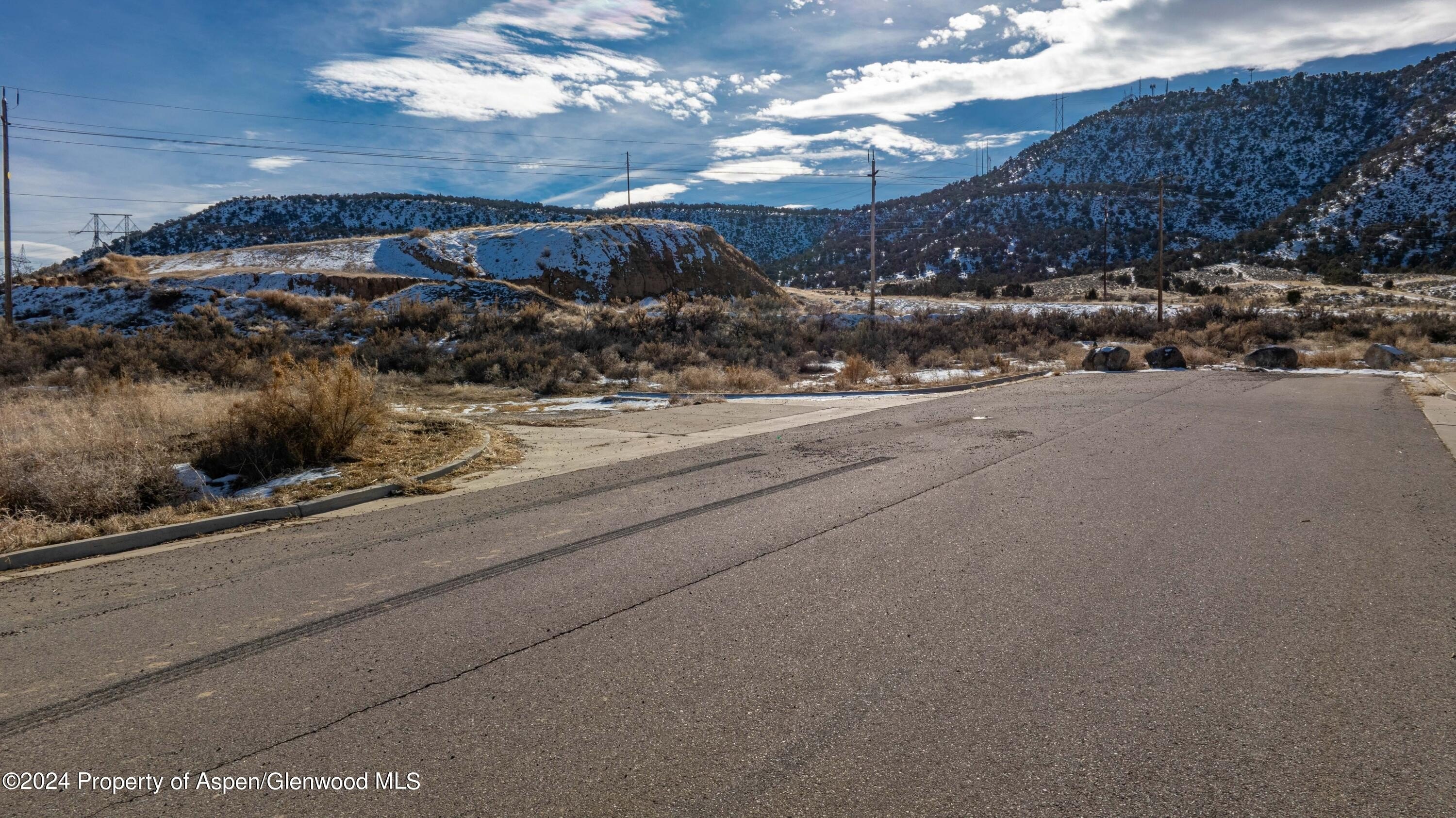
- Level to gently rolling terrain with usable agricultural ground
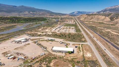
- Convenient access to Interstate 70 and just minutes from the City of Rifle
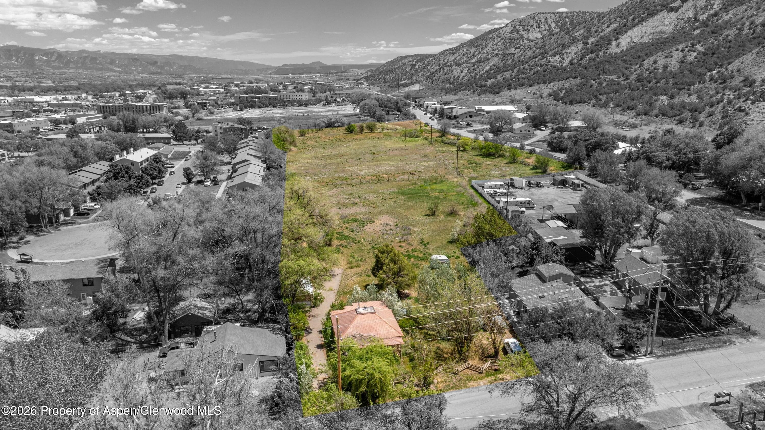
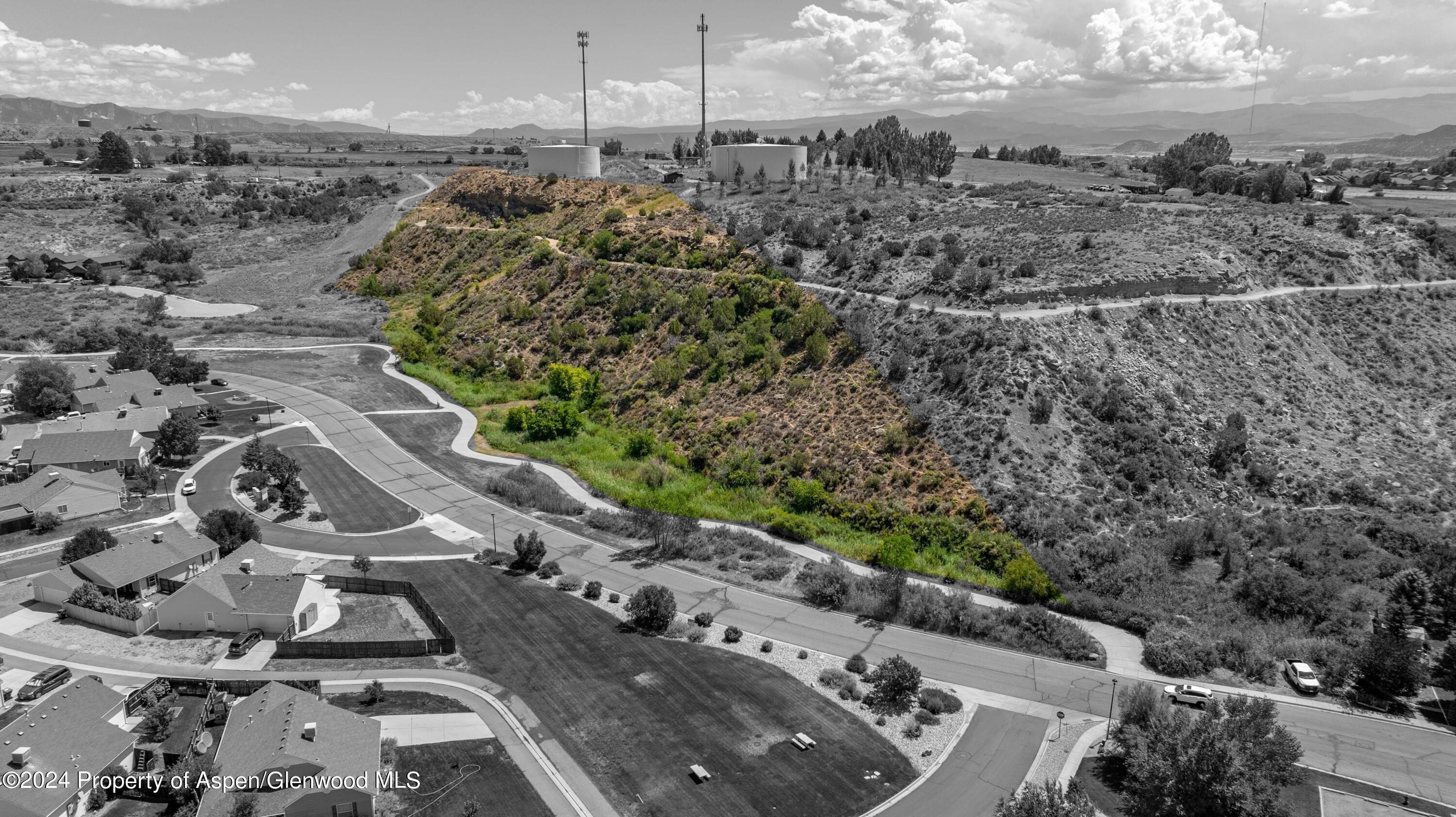
Overview
Located just minutes from the City of Rifle with convenient access to Interstate 70, the acreage offers a practical balance of rural setting and connectivity. The parcel’s open outlook includes 360-degree views of the surrounding mountains, mesas, and valley floor, providing a distinctive backdrop for an agricultural use or rural property development.
With the combination of irrigated capability and versatile land utility, this acreage may appeal to investors looking to put water-supported farmland to work, as well as owner-operators interested in maintaining or expanding a hay, grazing, or horse operation. The water asset from the Silt Project is a key consideration for continued agricultural productivity in the Rifle and surrounding areas, making this property a strong candidate for buyers focused on long-term use of irrigated ground.
Current Use by Public Records
Map
- City
- Rifle
- County
- Garfield
- State
- Colorado
- Longitude
- -107.733894
- Latitude
- 39.560069