Waterfront Agricultural Recreation


For Sale
Under Contract
$118,000
Northside Road, Stark, NH 03582
LAND - Stark, NH
Lot Size12.40 Acres
Days on Market57
Property Features for Northside Road
General Information
Property type
Land
Property subtype
Other
Zoning
Town
Lot features
Abuts Conservation, Rural, Agricultural, Country Setting, Field/ Pasture, Mountain View, Open, Recreational, River Frontage, Waterfront, Near A T V Trail
Directions
Off Route 110 take the covered bridge, take left onto Northside Road, look for sign on property.
Standard status
Active Under Contract
Lot size
12.40 Acres
Taxes and HOA fees
Tax Year
2025
Tax Annual Amount
32
Utilities
Utilities
Phone Available
Sewer type
Septic Needed
Water source
Well Needed
Water front
1
Listing Agency:
Lisa Hampton Real Estate
(603) 788-5106
Listed By:
Jennifer Allen
(603) 788-5106
Added: Jun 5
Changed: Jul 5
Last Checked: Jul 31 at 6:06AM
MLS# 5093381
Copyright © 2026 PrimeMLS. All rights reserved. All information provided by the listing agent/broker is deemed reliable but is not guaranteed and should be independently verified.
Investment Insights
Based on property information with market context.
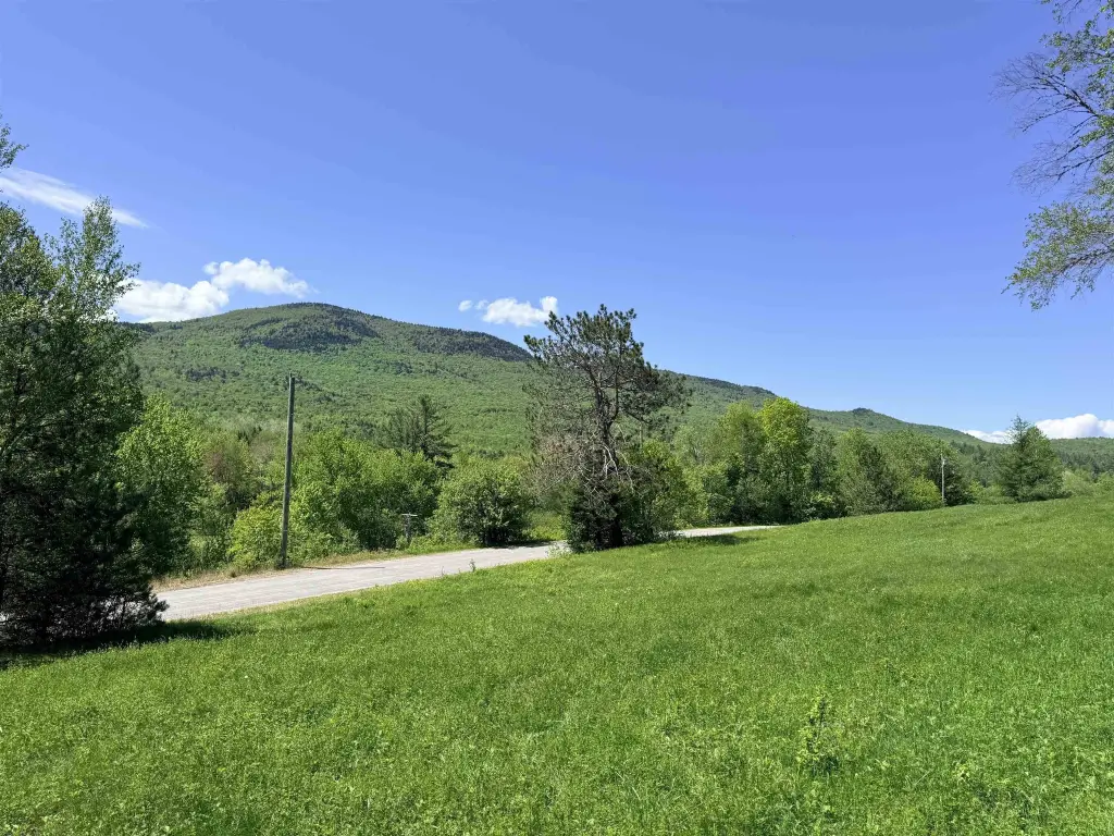
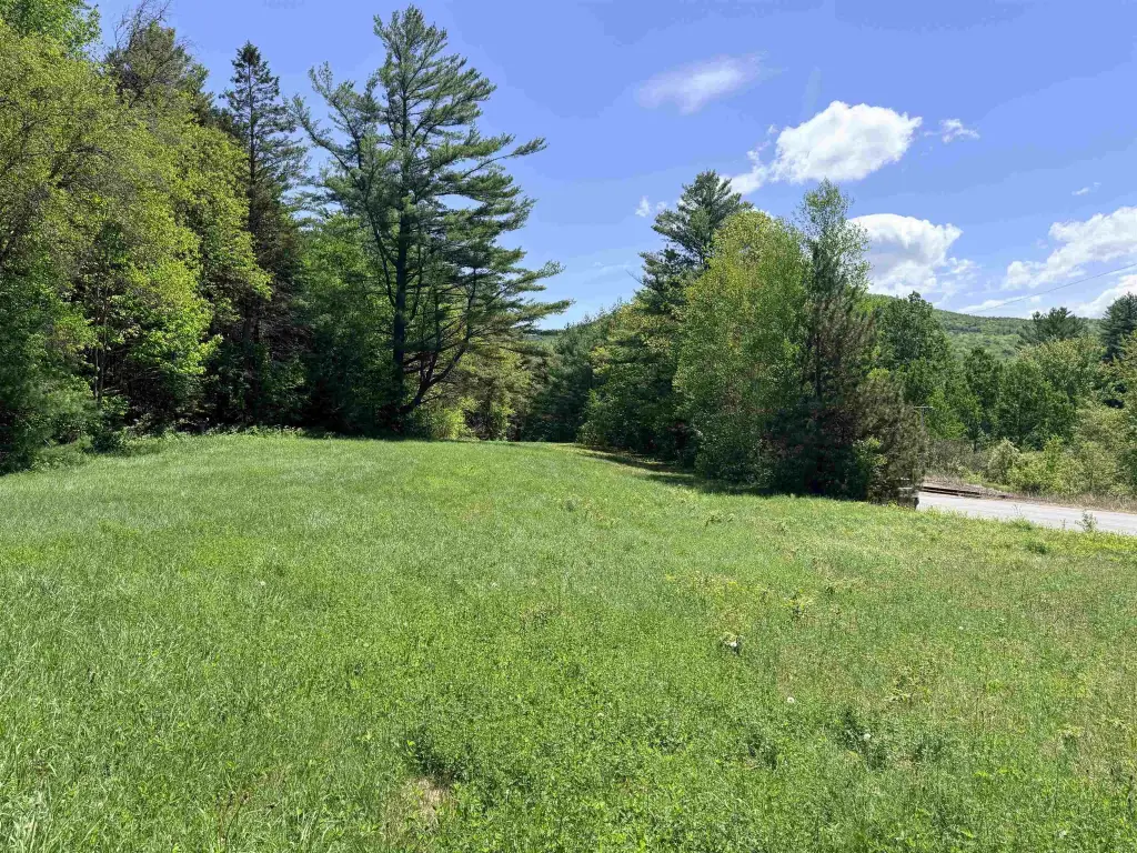
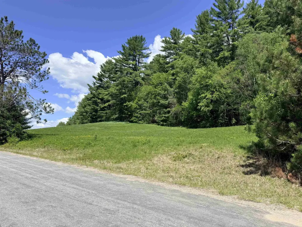
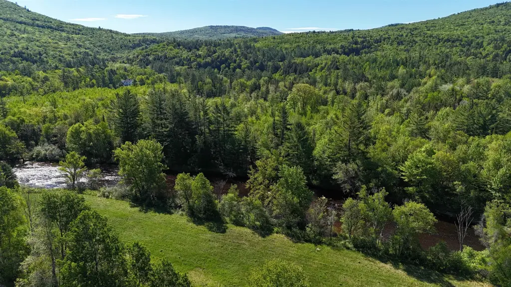
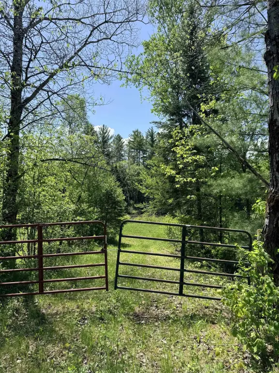
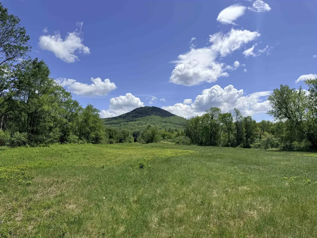
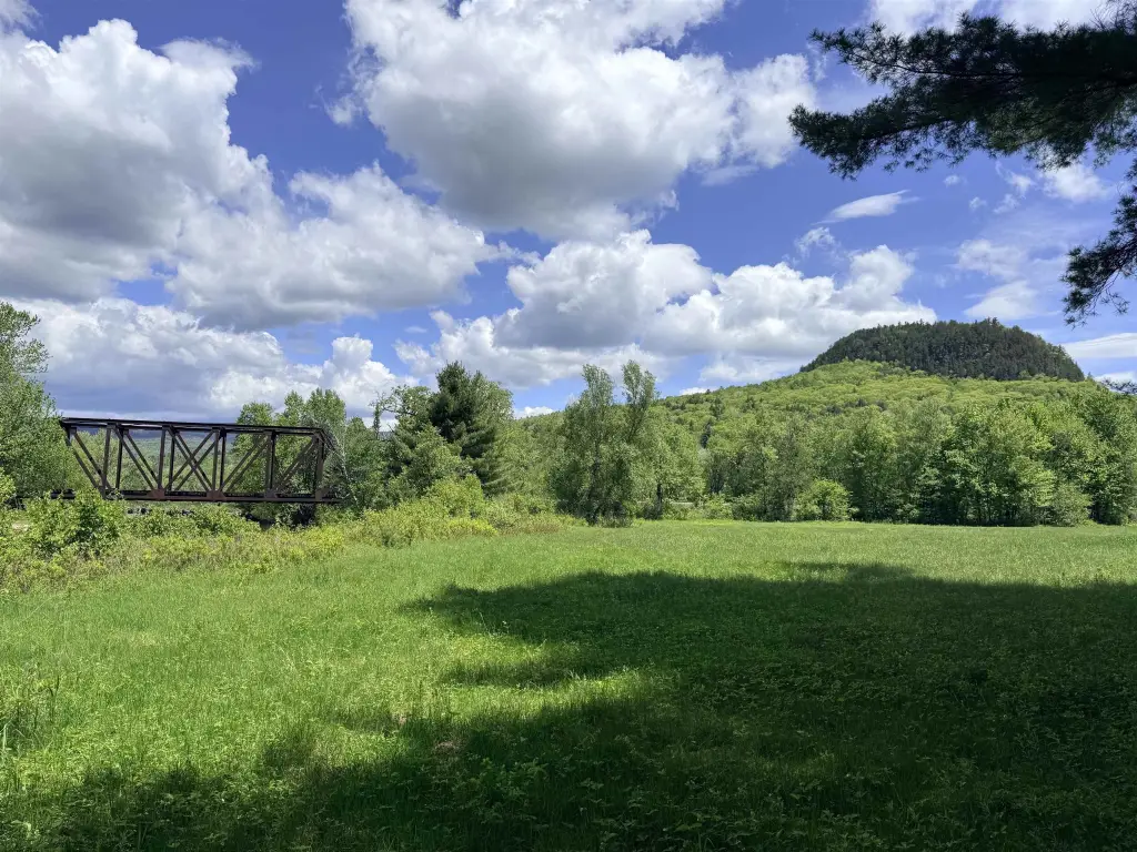
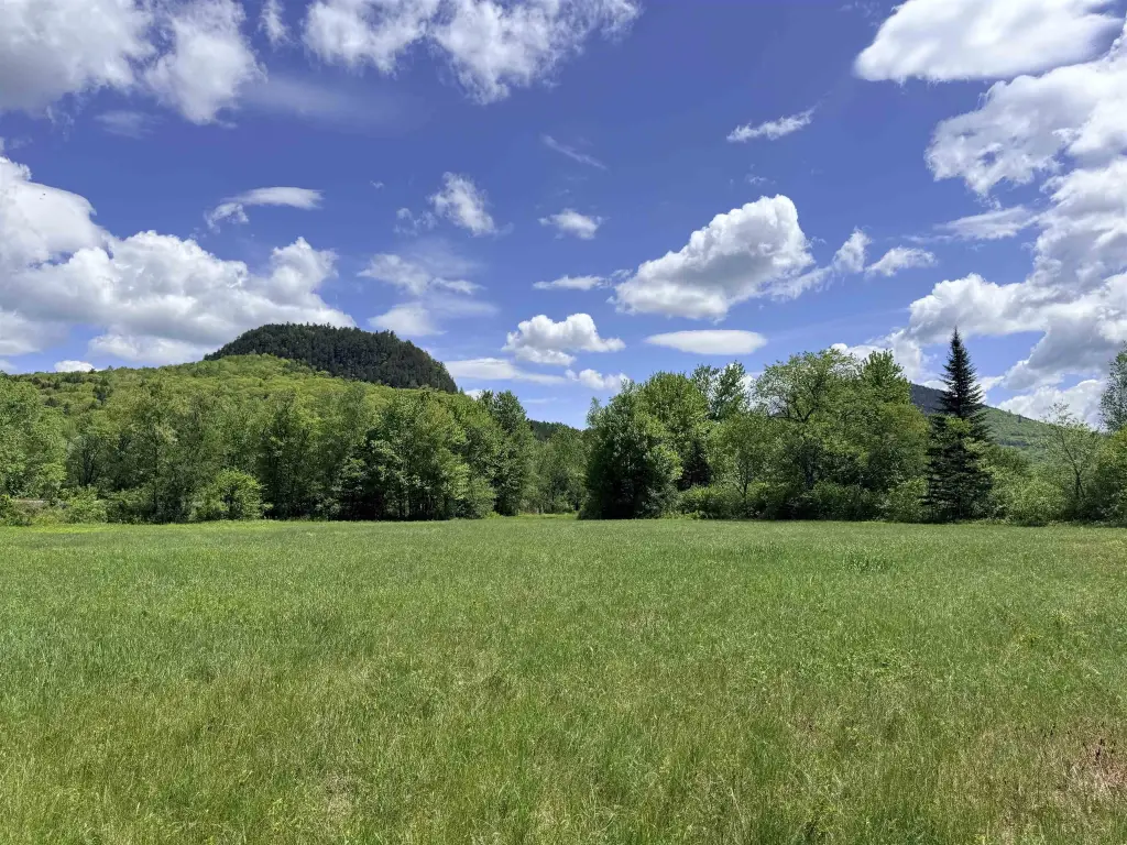
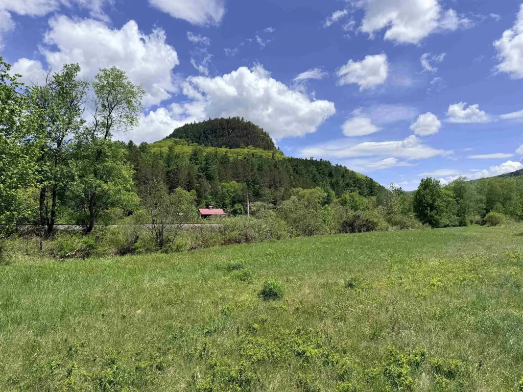
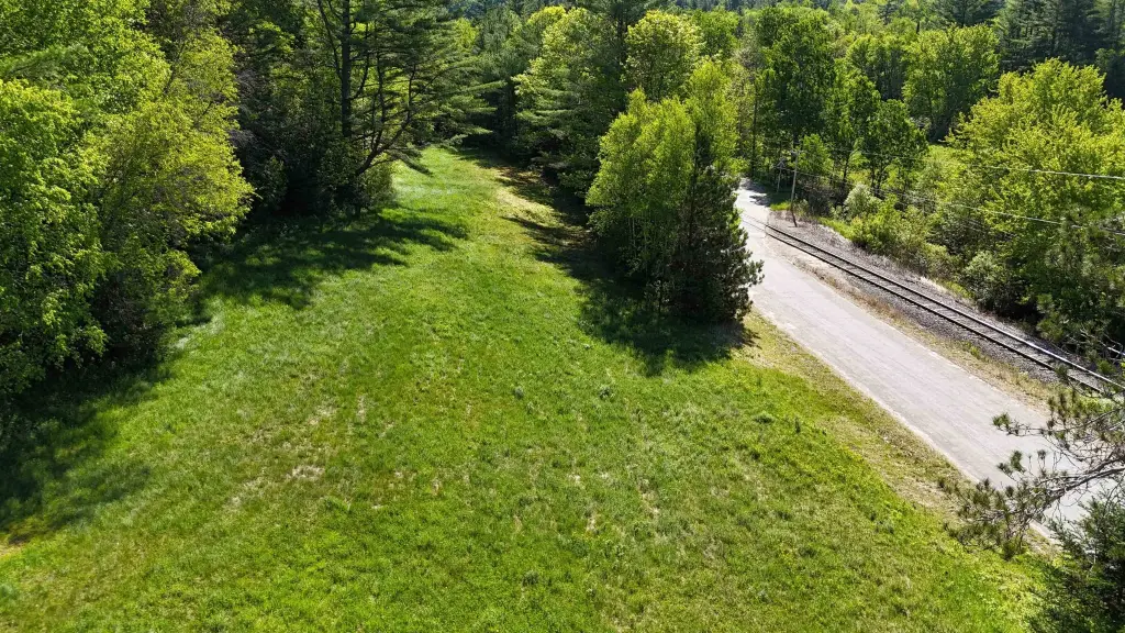
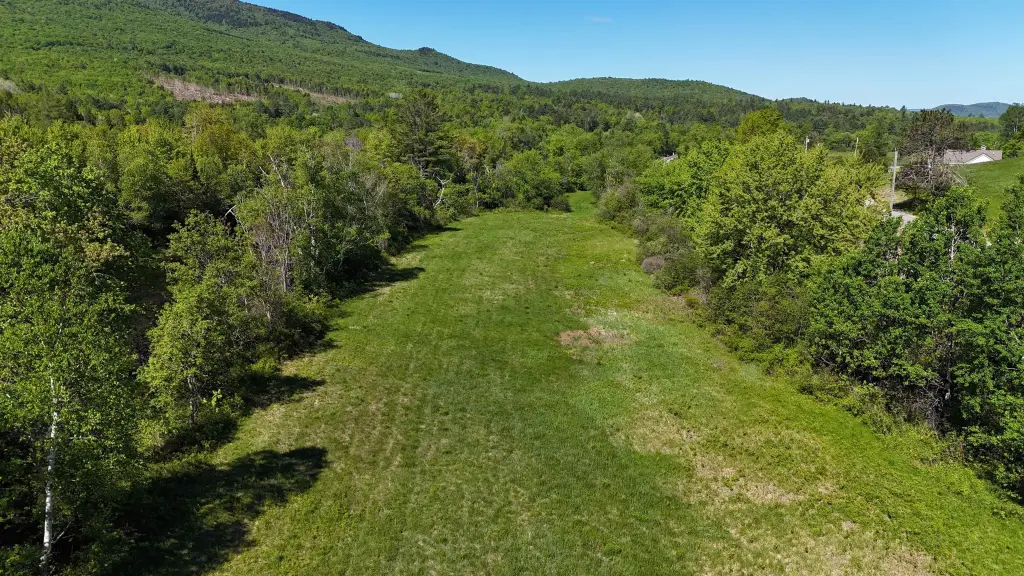
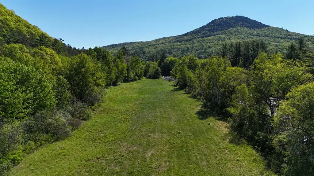
This offering includes two separate parcels totaling 12.4 acres in Stark, New Hampshire, at the base of Devil’s Slide State Forest. One parcel is 2.4 acres along the upper side of Northside Road and features approximately one acre of open field with mountain views. The remaining wooded acreage is under conservation restrictions and cannot be developed.
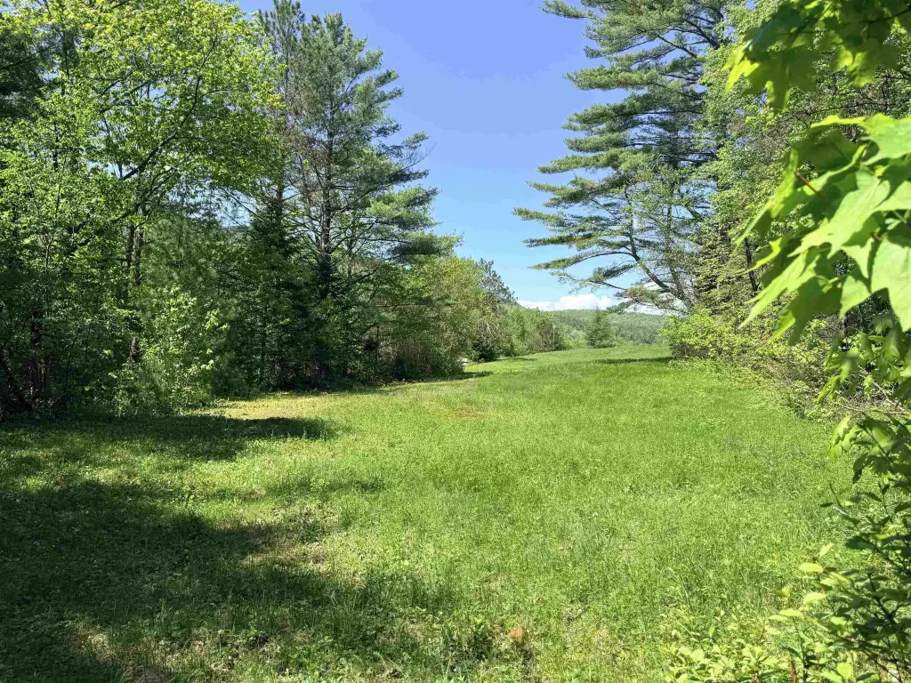
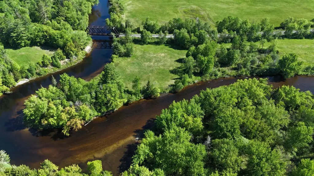
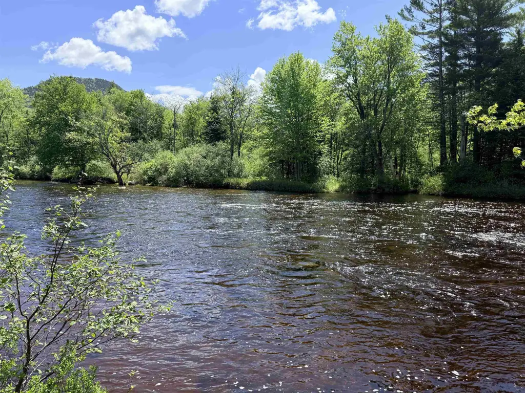
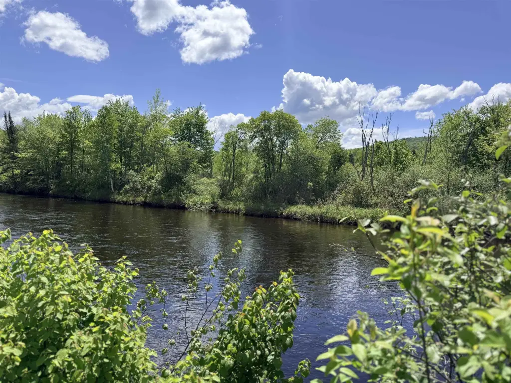
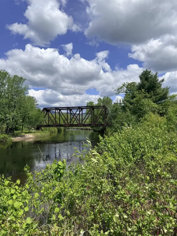
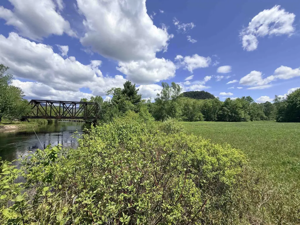
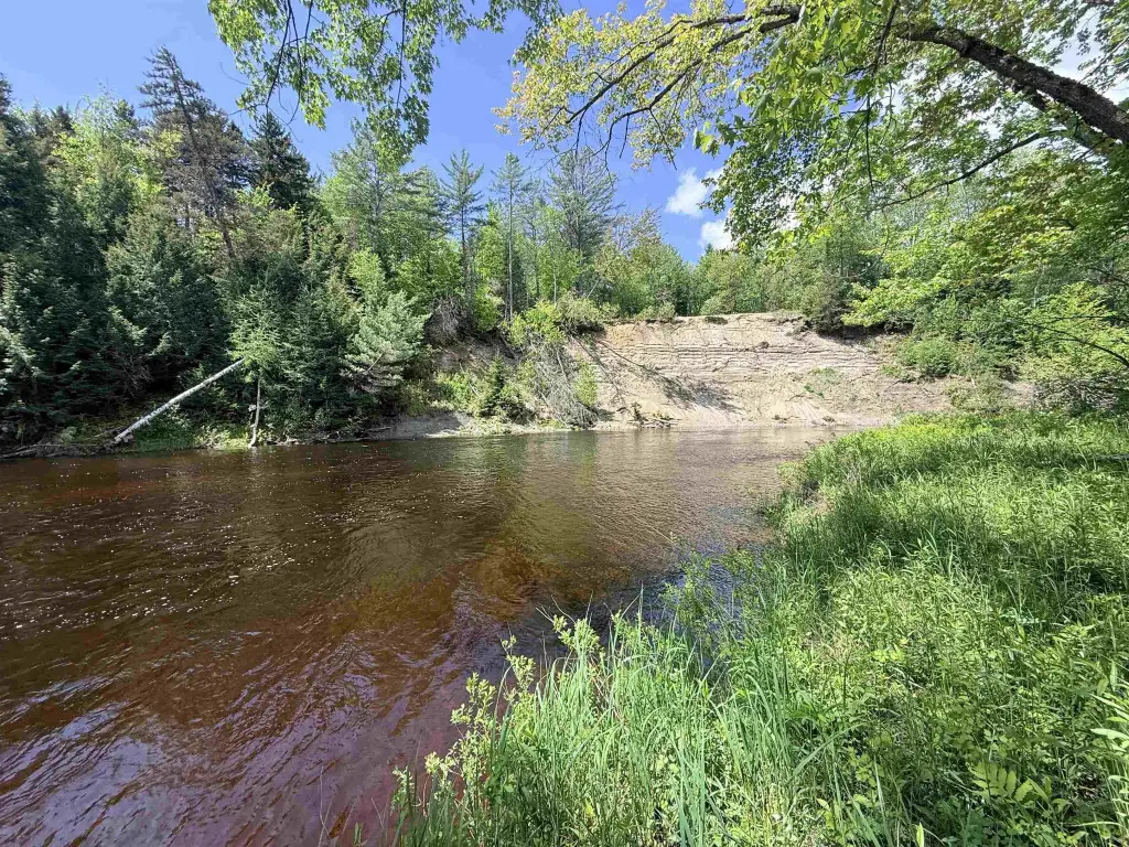
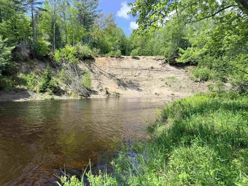
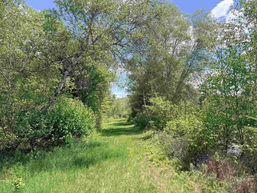
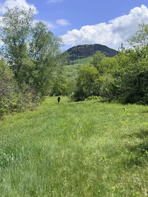
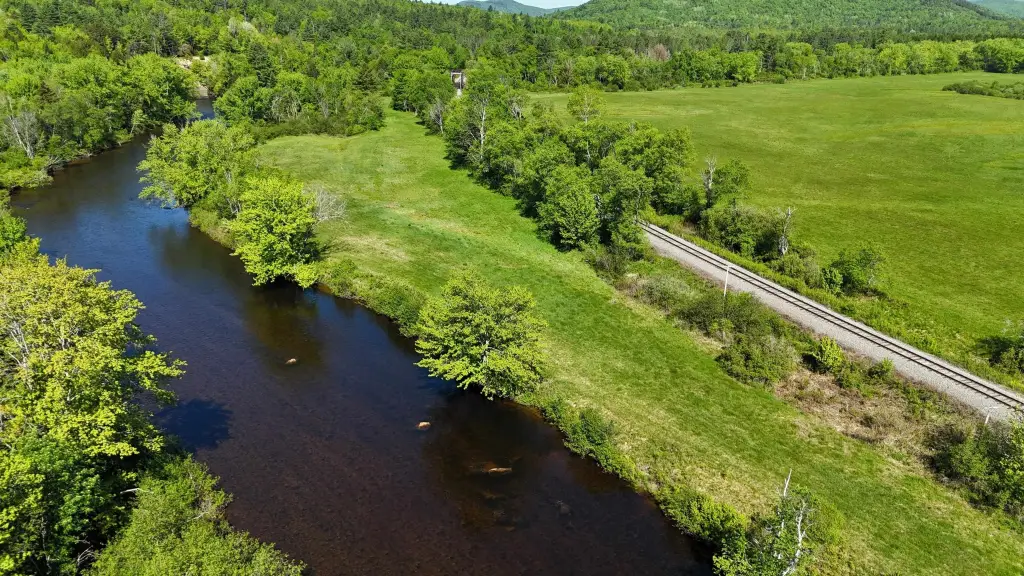
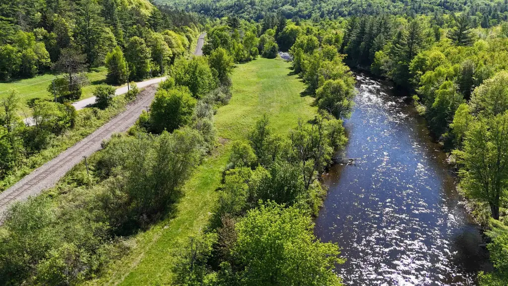
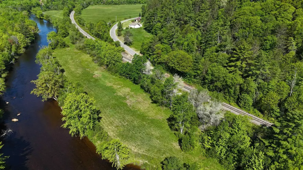
Across Northside Road, the 10-acre parcel is comprised of open meadows with more than 3,000 feet of frontage along the Upper Ammonoosuc River. This parcel is permanently protected by conservation covenants and cannot be built upon or developed. The land is described as protected open space with use permitted for agricultural and recreational purposes.
For buyers seeking outdoor-oriented acreage, the property supports activities such as gardening, farming, fishing, wildlife watching, and hiking. The location also provides proximity to the Devil’s Slide Trailhead and direct access to year-round recreation. The open field portion is the only portion described as potentially permitting future development, subject to local and state approvals, while the conservation-protected areas remain off limits for development.
Key Highlights
- 12.4 acres in Stark, NH, consisting of two separate parcels along Northside Road
- 2.4‑acre parcel on upper Northside Road includes about 1 acre of open field with mountain views; future development may be permitted with approvals
- 10‑acre parcel across Northside Road has open meadows with 3,000+ ft of frontage along the Upper Ammonoosuc River
Property Analytics
Property Profile
Current Use
Location Intelligence
Trade Area within ½ mile
5
Businesses Nearby
Explore this area
Business Placement
Demographics for 03582, NH
2,337
Population
1,271
Households
1.8
Avg Household Size
49
Median Age
10%
College-Educated
92%
High-School Grad
82.4 sq mi
ZIP Area
28
Density / Sq Mi
$53,059
Median Household Income
$36,538
Median Earnings
$918
Median Rent
$117,000
Median Home Value

Questions? Ask Rey
Realmo’s AI knows this listing — price, zoning, demand, history. Ask anything.


Frequently Asked Questions
What type of property is this?
Waterfront Land - 12.4 acres with river frontage, protected open space, and a small development-possible field area for recreation and agriculture.
Where is this waterfront land located?
The property is located at Northside Road Stark, NH.
What is the asking price?
The asking price for this property is $118,000.
What are key features of this property?
This property features: 12.4 acres in Stark, NH, consisting of two separate parcels along Northside Road; 2.4‑acre parcel on upper Northside Road includes about 1 acre of open field with mountain views; future development may be permitted with approvals; 10‑acre parcel across Northside Road has open meadows with 3,000+ ft of frontage along the Upper Ammonoosuc River


