Agricultural Land with Road
New Kent Highway Lanexa, VA 23089
For Sale
$157,900
Pending
LAND - Lanexa, VA
Lot Size6.50 Acres
Days on Market52
Property Features for New Kent Highway
General Information
Property type
Land
Property subtype
Other
Standard status
Pending
APN
26 82A
Lot size
6.50 Acres
Taxes and HOA fees
Tax Year
2025
Tax Description
RT 33 ADJ PAMUNKEY CHURCH DB 104/636 Tax Map 26- 82A
Tax Annual Amount
725
Utilities
Sewer type
Septic Tank
Water source
Well Needed
Listing Agency:
Mason Realty, Inc.
(804) 758-5372
Listed By:
R.D. Johnson II · License #0225029643
(804) 815-8320
Added: Jun 9
Changed: Jun 17
Last Checked: Jul 30 at 1:06AM
MLS# 202601012
Copyright © 2026 Chesapeake Bay & Rivers Association of Realtors. All rights reserved. All information provided by the listing agent/broker is deemed reliable but is not guaranteed and should be independently verified.
Investment Insights
Based on property information with market context.
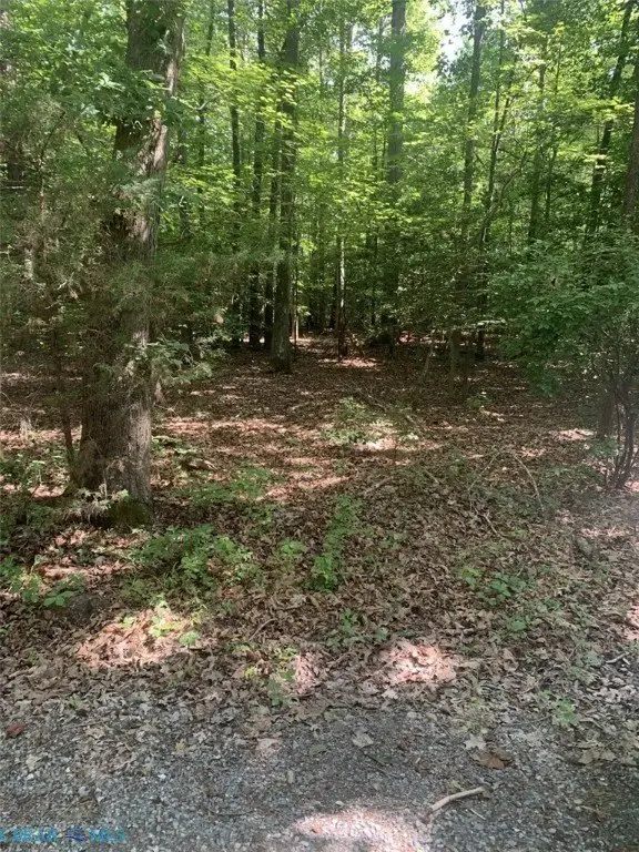
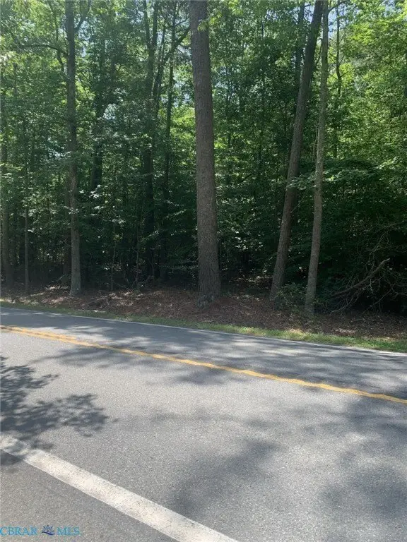
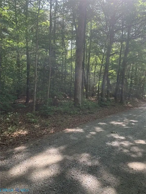
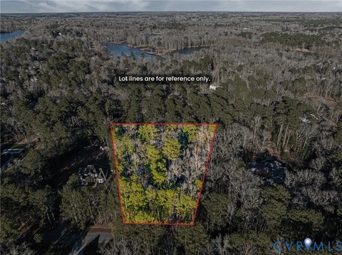
The property consists of 6.5 acres of mature woodland with a level to rolling topography. The soil has been determined suitable for a conventional 4-bedroom septic system by an AOSE dated August 2022. Utilities noted include Cox Cable TV wiring on poles across from Rt. 249 and overhead electric easement crossing the eastern end of the property, along with underground electric service observed along the opposite side of Rt. 623 to the rear of the site.
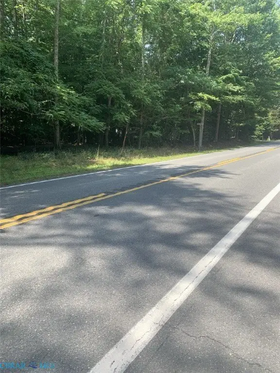
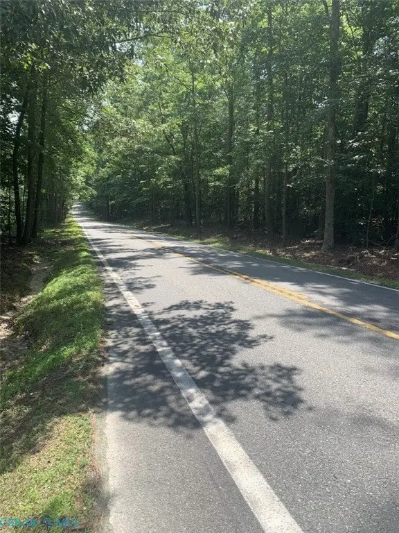
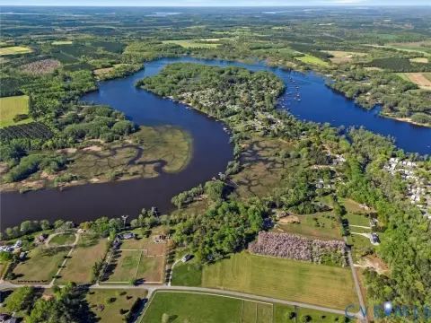
The land fronts approximately 700 feet on Rt. 249 and approximately 600 feet on Rt. 623. Both roads are described as gravel and state maintained. The property is located in New Kent County near Lanexa, VA, and is zoned A-1, Agriculture.
Zoning is A-1, Agriculture, with single-family dwellings identified as a permitted use in New Kent County. The listing also notes no restrictive covenants or HOA, which can simplify long-term ownership and planning for a residential build in this agricultural zoning district.
Key Highlights
- 6.5 acres of mature woodland in New Kent County, fronting approx. 700' on Rt. 249 and approx. 600' on Rt. 623
- Property has level to rolling topography; soil was determined suitable for a conventional 4‑bedroom septic system by an AOSE (Aug 2022)
- Water source: well needed; sewer: septic tank
Property Analytics
Property Profile
Location Intelligence
Current Use


Frequently Asked Questions
What type of property is this?
Agricultural land / Farmland - 6.5 acres of mature woodland with frontage on two state-maintained roads in New Kent County for a single-family build site.
Where is this agricultural land / farmland located?
The property is located at New Kent Highway Lanexa, VA.
What is the asking price?
The asking price for this property is $157,900.
What are key features of this property?
This property features: 6.5 acres of mature woodland in New Kent County, fronting approx. 700' on Rt. 249 and approx. 600' on Rt. 623; Property has level to rolling topography; soil was determined suitable for a conventional 4‑bedroom septic system by an AOSE (Aug 2022); Water source: well needed; sewer: septic tank