Patented Mining Claims with
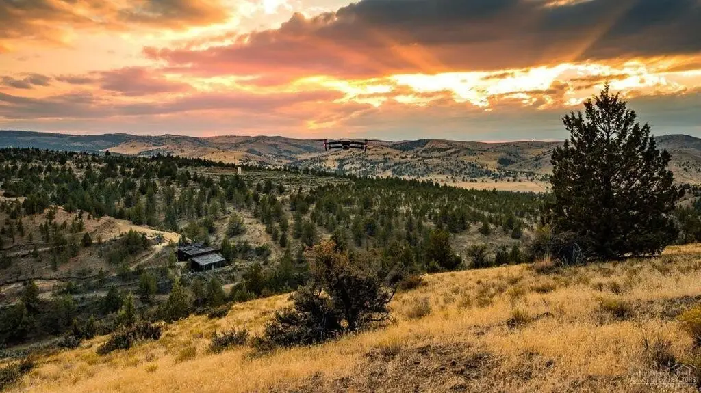
For Sale
$699,900
NE Gosner Road, Ashwood, OR 97711
Land, Ashwood, OR
Property SizeContact for details
Lot Size191.38 Acres
Days on Market421
Property Features for NE Gosner Road
General Information
Property type
Land
Property subtype
Other
Zoning description
Rangeland
Fencing
Barbed Wire
Subdivision
Ashwood
Lot features
Adjoins Public Lands, Native Plants, Rock Outcropping, Sloped
View
Valley, Mountains, Territorial
Elementary school
Ashwood Elem
Middle school
Jefferson County Middle
High school
Culver High
Directions
From Hwy 97 turn East onto NE Pony Butte Rd, follow for 13.1 miles and it will turn into Trout Creek Rd. Follow Trout Creek Rd to the town of Ashwood head east on NE Gosner Road for 1.8 miles.
Standard status
Active
APN
8696 & 8636
Lot size
191.38 Acres
Taxes and HOA fees
Tax Year
2024
Tax Annual Amount
817
Utilities
Utilities
Electricity Available
Water source
Well
Water front features
Stream
Water front
1
Listing Agency:
Keller Williams Realty Central Oregon
(541) 585-3760
Listed By:
Kyle Michael Rogers · License #201240252
(310) 425-6697
Added: Jul 7, 2025
Changed: Aug 28
Last Checked: Aug 31 at 10:06AM
MLS# 220205406
Copyright © 2026 Oregon Data Share. All rights reserved. All information provided by the listing agent/broker is deemed reliable but is not guaranteed and should be independently verified.
Investment Insights
Based on property information with market context.
The Oregon King property comprises 191.38 acres of patented mining claims on private land near Ashwood, Oregon. Historic improvements include an underground mine with a shaft and multiple levels, along with a 50t/day crushing-flotation mill. The property lies at approximately 2,700 ft elevation within the Horse Heaven Mining District and the andesitic Eocene Volcanics geological setting.
Historic production includes 232K oz silver, 2.4K oz gold, 60k lb copper, 110k lb lead, and 37k lb zinc. A final 39-ton shipment reportedly yielded 23 oz gold, 1,886 oz silver, and 700lb copper. The site includes a stream, barbed-wire fencing, electricity available, and a well. Access is identified near NE Gosner Road, approximately 3 miles northeast of Ashwood.
Historic production includes 232K oz silver, 2.4K oz gold, 60k lb copper, 110k lb lead, and 37k lb zinc. A final 39-ton shipment reportedly yielded 23 oz gold, 1,886 oz silver, and 700lb copper. The site includes a stream, barbed-wire fencing, electricity available, and a well. Access is identified near NE Gosner Road, approximately 3 miles northeast of Ashwood.
Key Highlights
- 191.38 acres of patented mining claims on private land
- Historic underground mine with shaft and multiple levels
- 50t/day crushing‑flotation mill
Property Analytics
Current Use
Location Intelligence
Trade Area within ½ mile
1
Businesses Nearby
Explore this area
Business Placement
Demographics for 97711, OR
77
Population
33
Households
2.3
Avg Household Size
56
Median Age
15%
College-Educated
100%
High-School Grad
276.0 sq mi
ZIP Area
$126,250
Median Household Income
$116,875
Median Earnings
Market
Vacancy Rate% for Industrial in West region

Questions? Ask Rey
Realmo’s AI knows this listing — price, zoning, demand, history. Ask anything.



Frequently Asked Questions
What type of property is this?
Mining land & claim - Private patented claims include historic underground workings, processing equipment, electricity availability, and a well.
Where is this mining land & claim located?
The property is located at NE Gosner Road Ashwood, OR.
What is the asking price?
The asking price for this property is $699,900.
What are key features of this property?
This property features: 191.38 acres of patented mining claims on private land; Historic underground mine with shaft and multiple levels; 50t/day crushing‑flotation mill



