Recreational Land with Building
Mississippi Lane lot 62 Bagley, WI 53801
For Sale
$34,900
LAND - Bagley, WI
Lot Size1.13 Acres
Days on Market45
Property Features for Mississippi Lane lot 62
General Information
Property type
Land
Property subtype
Other
Zoning
Res
Standard status
Active
APN
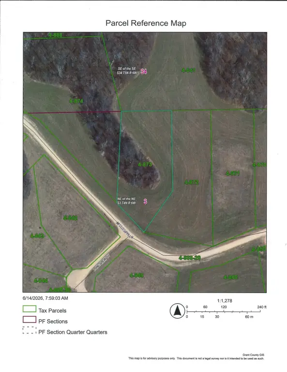
004-00873-0000
Lot size
1.13 Acres
Taxes and HOA fees
Tax Year
2025
Tax Description
Mississippi Mountain unit 62
Tax Annual Amount
81
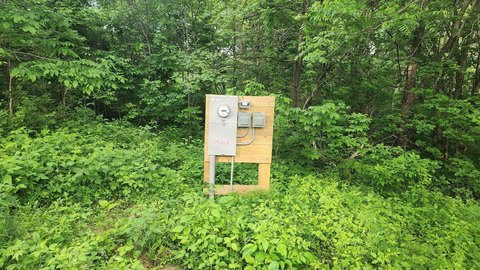
Utilities
Sewer type
None
Water source
None, Well Needed
Listing Agency:
Jon Miles Real Estate
(608) 822-4700
Listed By:
Jonathan Miles · License #5264690
(608) 988-7400
Added: Jun 15
Changed: Jul 28
Last Checked: Jul 29 at 6:06PM
MLS# 2025828
Copyright © 2026 REALTORS® Association of South Central Wisconsin. All rights reserved. All information provided by the listing agent/broker is deemed reliable but is not guaranteed and should be independently verified.
Investment Insights
Based on property information with market context.
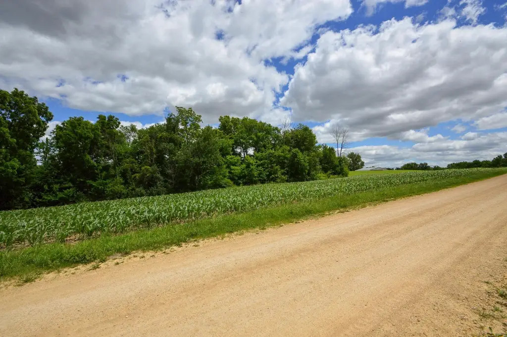
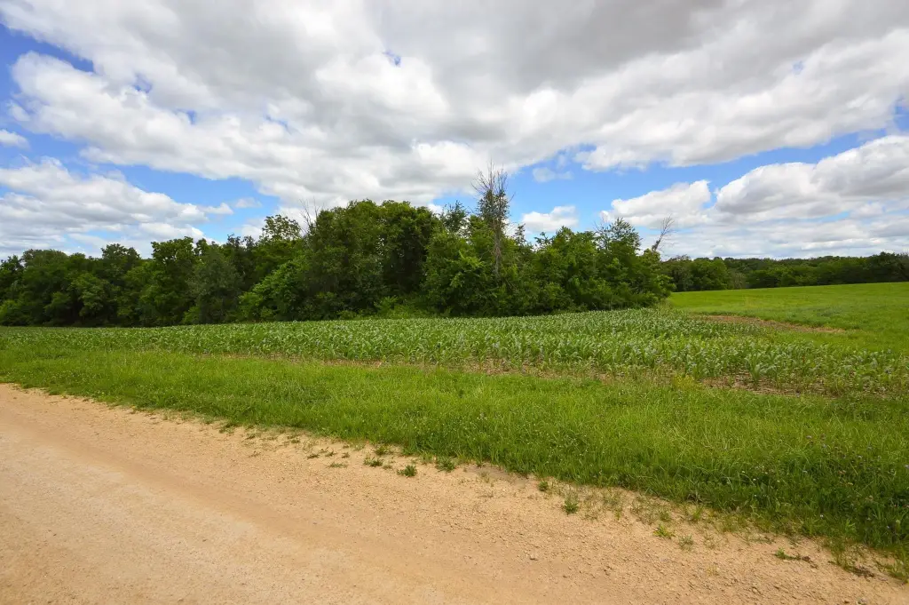
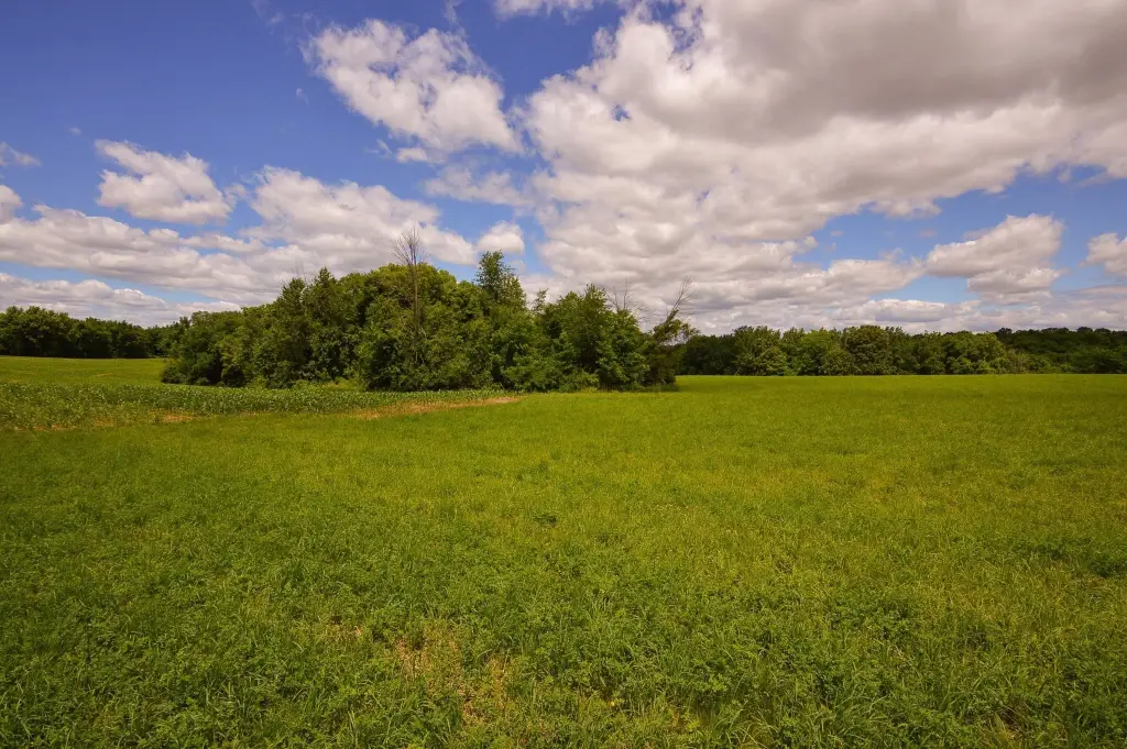
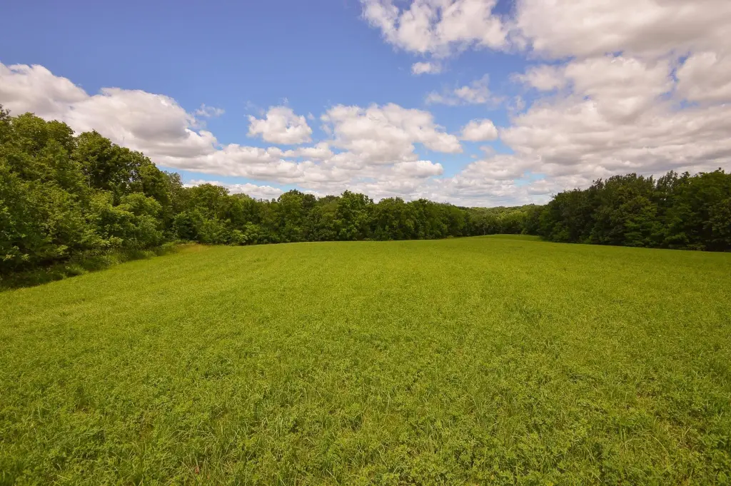
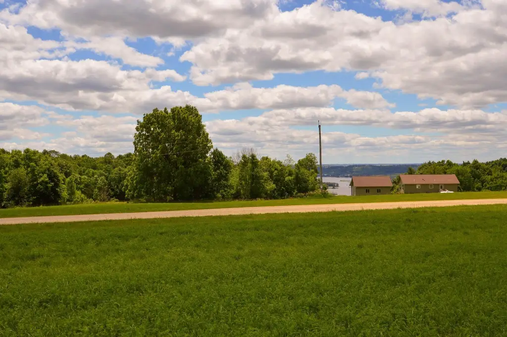
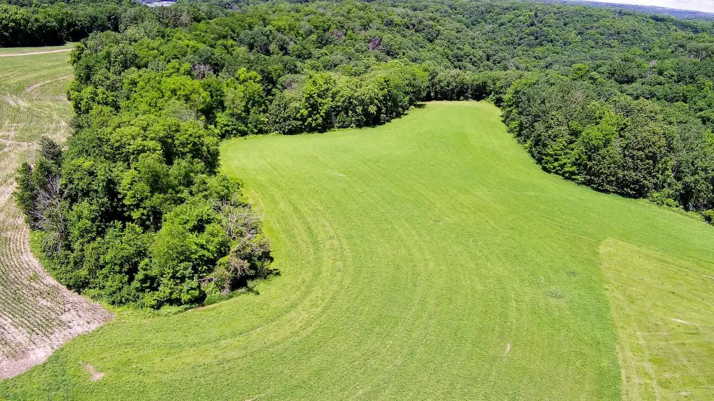
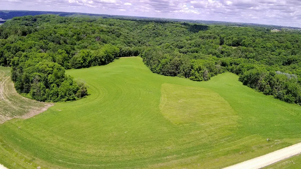
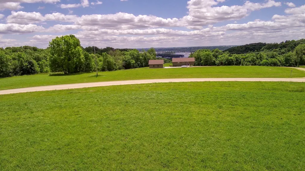
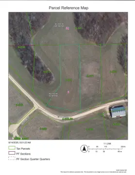
This recreational land parcel is approximately half open ground and half trees, allowing for an easier identification of a building site with limited clearing. Depending on where you choose to build, there may be a distant river view. A residential zoning designation is noted for the property.
The site sits high above the Mississippi River between Bagley and Glen Haven. Beyond the lot itself, the offering includes a large tract of common acreage shared by all owners in the area, supporting outdoor activities such as hiking, hunting, and ATV use. The exploration area continues onto the adjoining Devi’s Backbone State Natural Area, providing additional access to public natural surroundings.
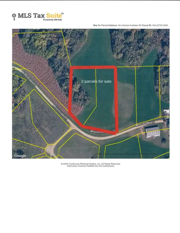
For buyers looking for a private setting that combines a place to build with ongoing recreational access, this parcel offers a mix of terrain and a defined homesite footprint within a broader shared-use landscape. An adjoining lot is also available for purchase separately, which may appeal to buyers considering expanded property control or additional space for their plans.
The site sits high above the Mississippi River between Bagley and Glen Haven. Beyond the lot itself, the offering includes a large tract of common acreage shared by all owners in the area, supporting outdoor activities such as hiking, hunting, and ATV use. The exploration area continues onto the adjoining Devi’s Backbone State Natural Area, providing additional access to public natural surroundings.
For buyers looking for a private setting that combines a place to build with ongoing recreational access, this parcel offers a mix of terrain and a defined homesite footprint within a broader shared-use landscape. An adjoining lot is also available for purchase separately, which may appeal to buyers considering expanded property control or additional space for their plans.
Key Highlights
- Located high above the Mississippi River between Bagley and Glen Haven
- Parcel has about half open ground and half trees for easier identification of a building site
- Distant river view from the lot depending on where you build
Property Analytics
Property Profile
Location Intelligence
Current Use


Frequently Asked Questions
What type of property is this?
Hunting land - Mixed open and wooded parcel offers a secluded homesite with access to shared hunting, hiking, and ATV use.
Where is this hunting land located?
The property is located at Mississippi Lane lot 62 Bagley, WI.
What is the asking price?
The asking price for this property is $34,900.
What are key features of this property?
This property features: Located high above the Mississippi River between Bagley and Glen Haven; Parcel has about half open ground and half trees for easier identification of a building site; Distant river view from the lot depending on where you build