GC-Zoned Commercial
For Sale
$850,000
TBD Weld County Rd, Mead, CO 80542
Land, Mead, CO
Property SizeContact for details
Lot Size4.60 Acres
Days on Market95
Property Features for TBD Weld County Rd
General Information
Property type
Land
Property subtype
Other
Zoning
GC
Subdivision
Recorded Exemption #1207-26-1-
Lot features
Level, No Improvements
View
Hills
Elementary school
Mead
Middle school
Mead
High school
Mead
Elementary school district
ST Vrain Dist RE 1J
Middle school district
ST Vrain Dist RE 1J
High school district
ST Vrain Dist RE 1J
Directions
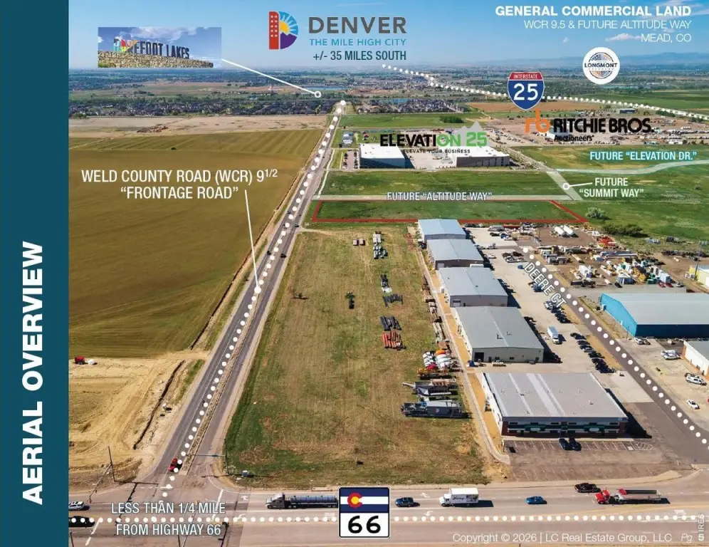
From I-25 S take exit 243 to head East onto CO-66 E. / State Highway 66 E. Turn right onto WCR 9.5 after +/- 0.5 miles and head South. Destination will be on your right after approximately 0.25 mi.
Standard status
Active
APN
R4812107
Lot size
4.60 Acres
Taxes and HOA fees
Tax Year
2026
Tax Annual Amount
10026
Utilities
Sewer type
Public Sewer
Listing Agency:
LC Real Estate Group, LLC
(970) 667-7000
Listed By:
Christopher D Johnston · License #100065188
(970) 420-5652
Added: Jun 10
Changed: Aug 20
Last Checked: Sep 12 at 3:06PM
MLS# 1061525
Copyright © 2026 IRES MLS. All rights reserved. All information provided by the listing agent/broker is deemed reliable but is not guaranteed and should be independently verified.
Investment Insights
Based on property information with market context.
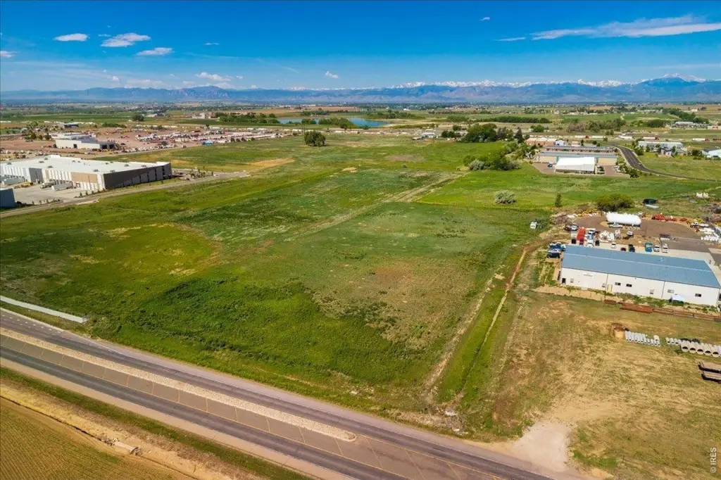
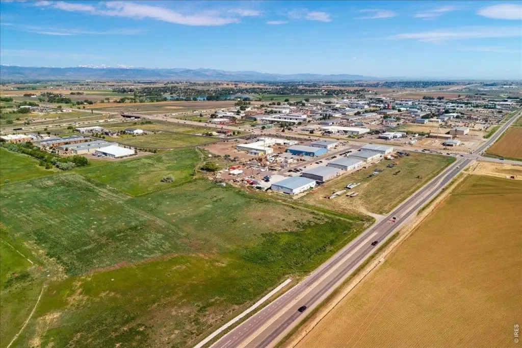
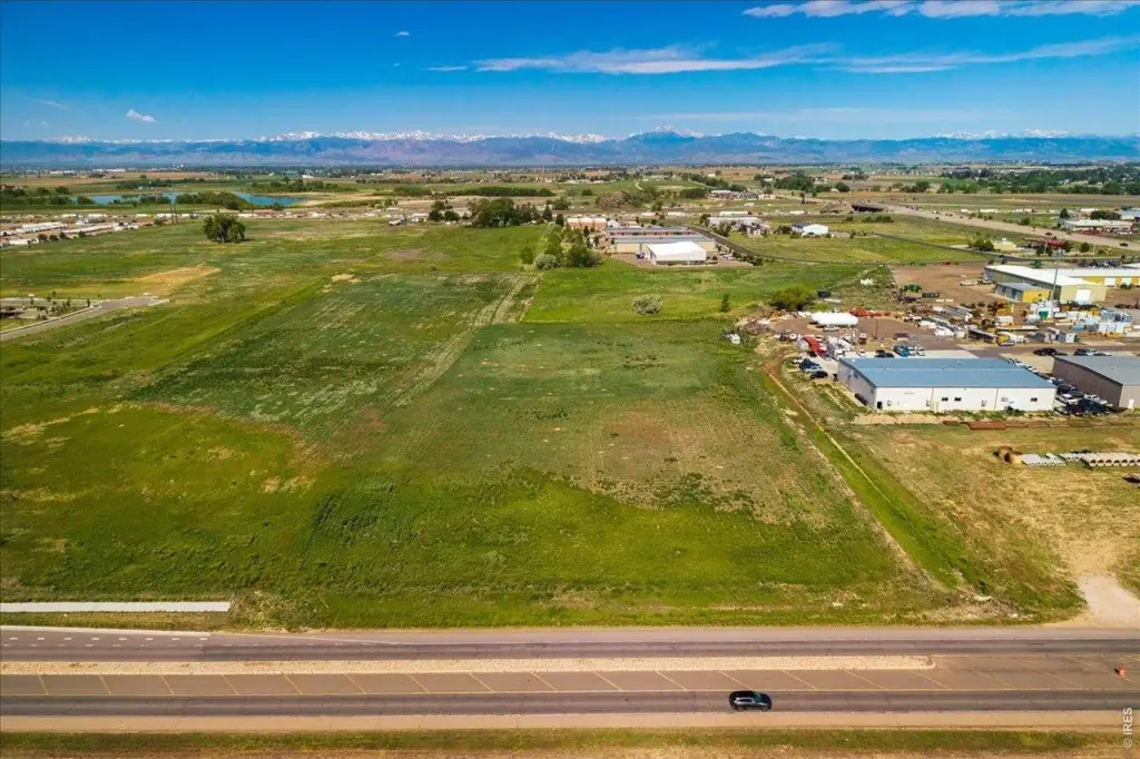
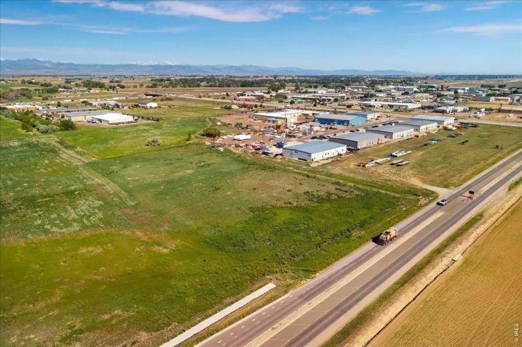
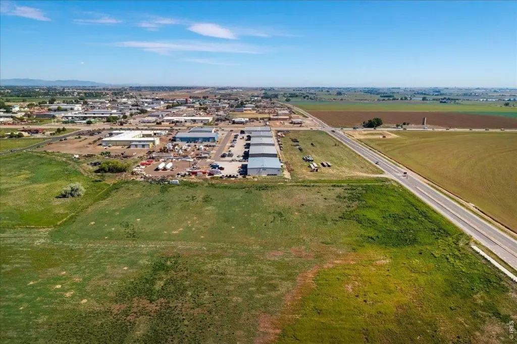
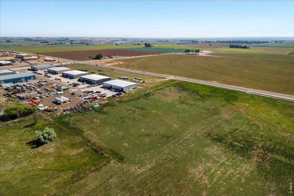
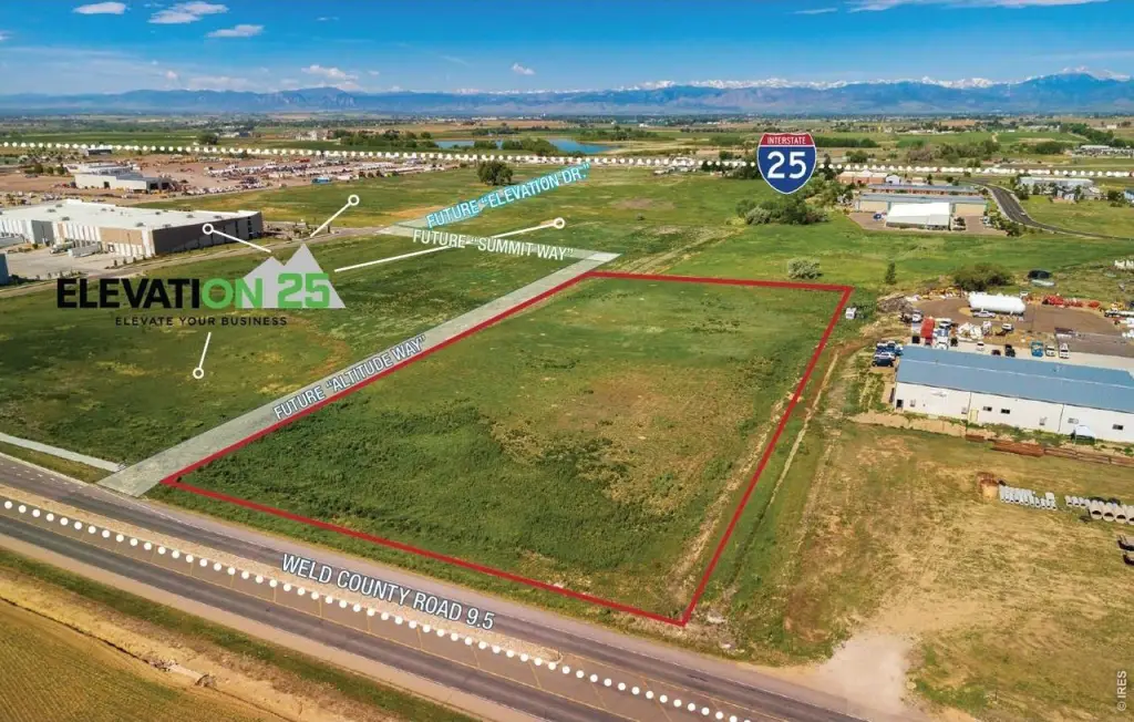
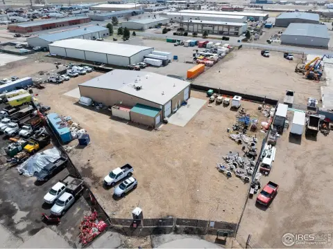
This 4.6-acre commercial land parcel is designated General Commercial (GC) and includes public sewer service. The site has frontage along Weld County Road 9.5 and the future Altitude Way, with plans identifying a future full-turn intersection at the property. Interstate 25 is approximately one-half mile away via Highway 66.
The property is situated between two tracts recently rezoned by the Town of Mead for Light Industrial (LI) use. Planned extensions of Altitude Way, Summit Way, and Elevation Drive are also identified in the surrounding road network. Existing infrastructure is located nearby, and the parcel’s current GC designation provides the stated land-use framework for future development.
The property is situated between two tracts recently rezoned by the Town of Mead for Light Industrial (LI) use. Planned extensions of Altitude Way, Summit Way, and Elevation Drive are also identified in the surrounding road network. Existing infrastructure is located nearby, and the parcel’s current GC designation provides the stated land-use framework for future development.
Key Highlights
- 4.6‑acre commercial land parcel
- General Commercial (GC) zoning
- Frontage on Weld County Road 9.5 and future Altitude Way
Property Analytics
Unlock full access to Insights
Subscribe to Realmo Intelligence
Open Analytics
Current Use
Location Intelligence
Trade Area within ½ mile
232
Businesses Nearby
Explore this area
Business Placement
Demographics for 80542, CO
4,841
Population
1,778
Households
2.7
Avg Household Size
40
Median Age
52%
College-Educated
93%
High-School Grad
9.2 sq mi
ZIP Area
526
Density / Sq Mi
$127,500
Median Household Income
$58,578
Median Earnings
$2,694
Median Rent
$590,500
Median Home Value
Check the figures for this property
Cap Rate, Value Estimation, Potential NOI and more
View Realmo Analytics

Questions? Ask Rey
Realmo’s AI knows this listing — price, zoning, demand, history. Ask anything.




Frequently Asked Questions
What type of property is this?
Commercial land - Commercial parcel with public sewer and access via Highway 66 to Interstate 25.
Where is this commercial land located?
The property is located at TBD Weld County Rd Mead, CO.
What is the asking price?
The asking price for this property is $850,000.
What are key features of this property?
This property features: 4.6‑acre commercial land parcel; General Commercial (GC) zoning; Frontage on Weld County Road 9.5 and future Altitude Way



