M6L137L141 Commercial Street, Rockport, ME 04856


- Added:
- Jun 3, 2026
- Days on Market:
- 13
- Last Refresh:
- Jun 15 at 5:06 am
Property Features for M6L137L141 Commercial Street
General Information
- Property type
- Commercial Sale
- Property subtype
- Other
- Zoning
- 907
- Standard status
- Active
- Lot size
- 34.12 Acres
Utilities
- Sewer type
- Public Sewer
- Water source
- Public
Listing agent Corey Dunn (207) 949-2425
Listing office EXP Realty 41 Hutchins Drive Building 3, Rangeley, ME (888) 439-8743
Listing date Jun 3, 2026
Copyright © 2026 Maine Listings. All rights reserved. All information provided by the listing agent/broker is deemed reliable but is not guaranteed and should be independently verified.
HighLights
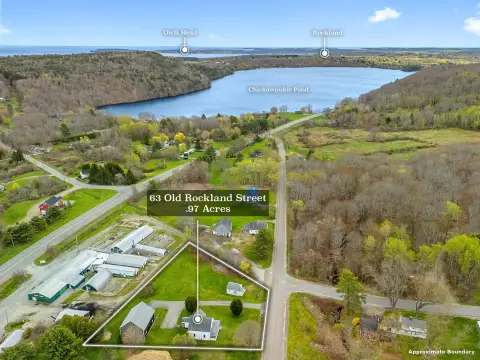
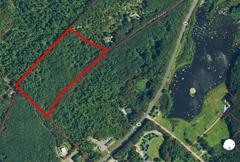
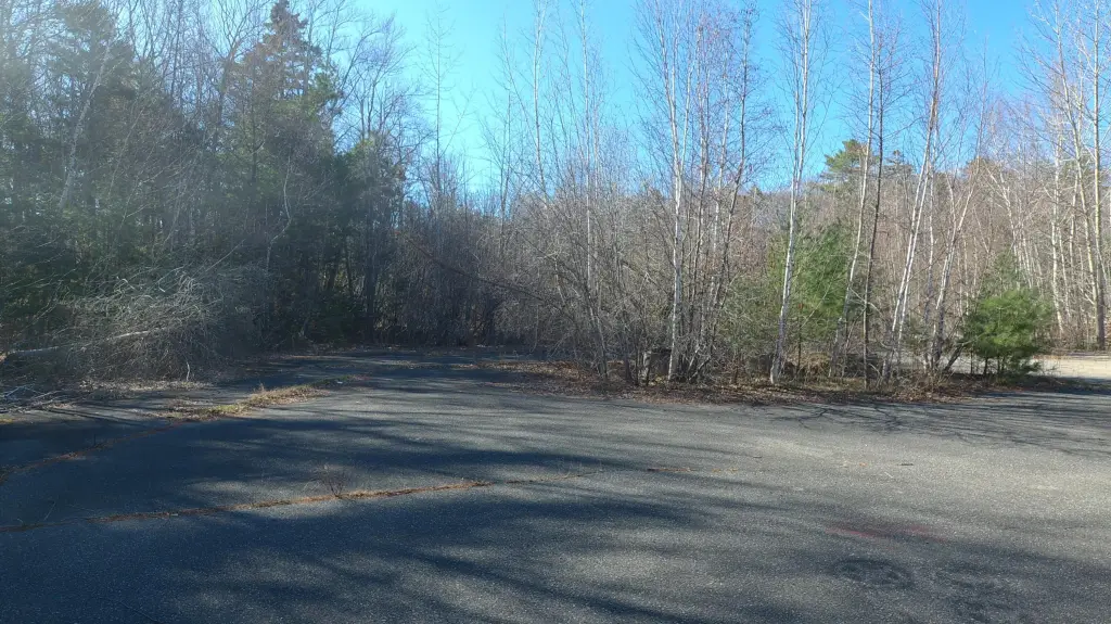
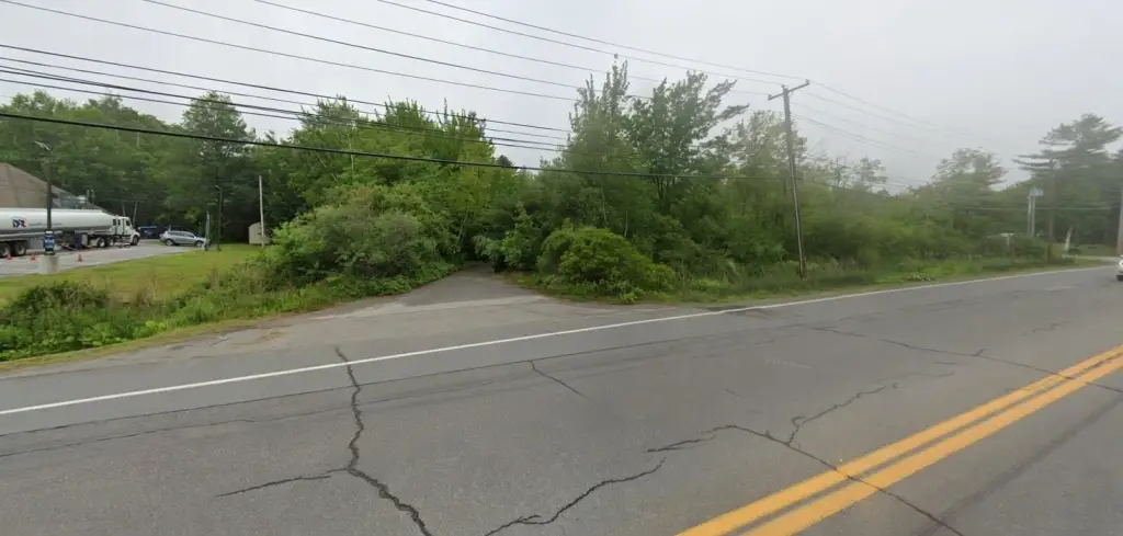
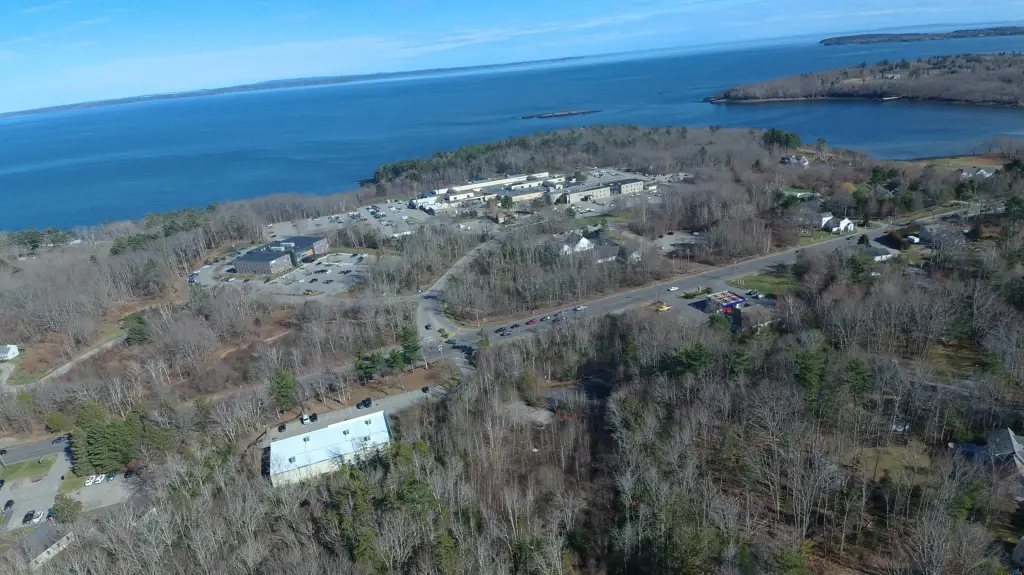
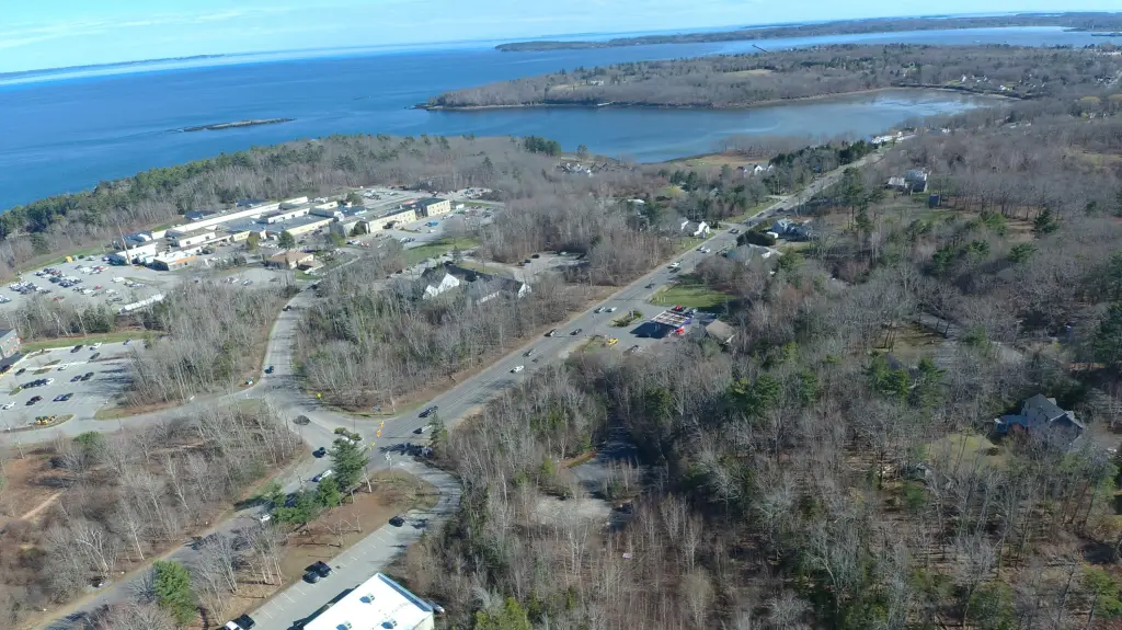
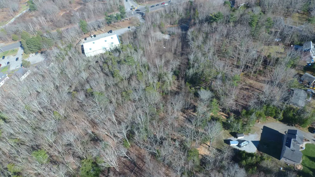
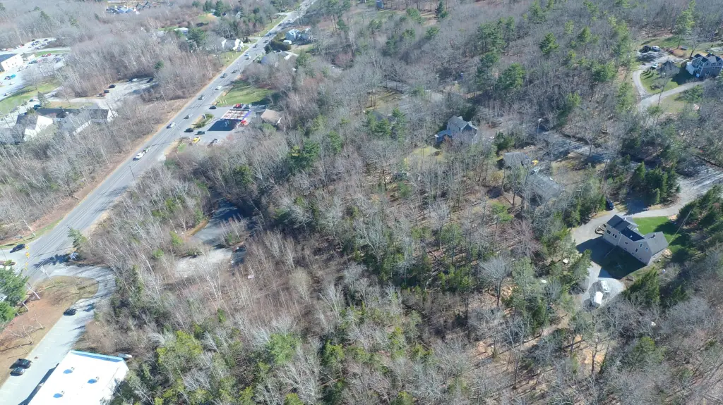
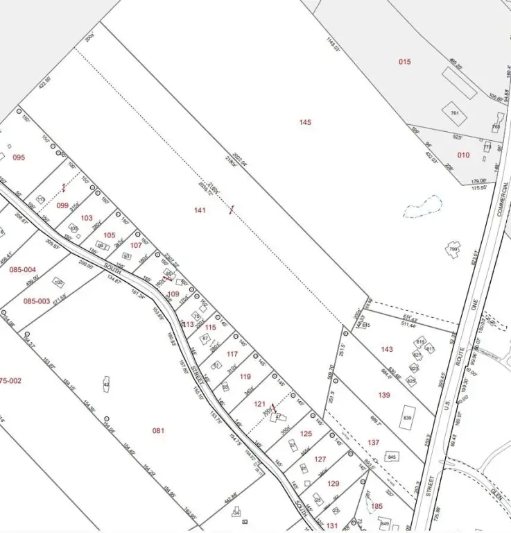
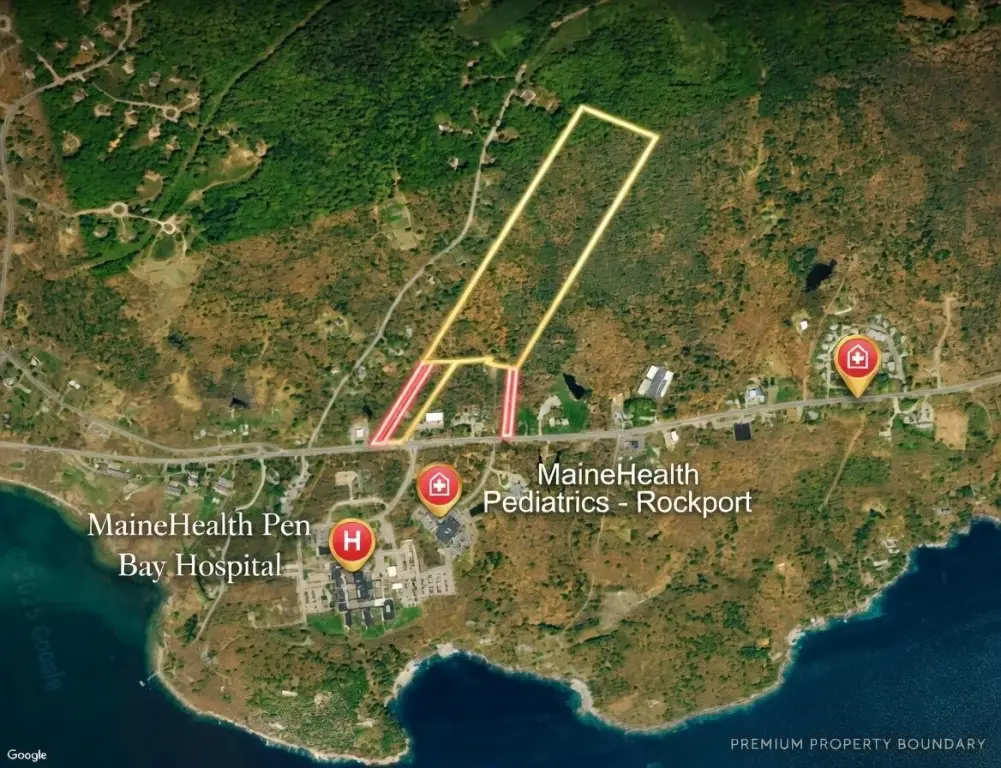
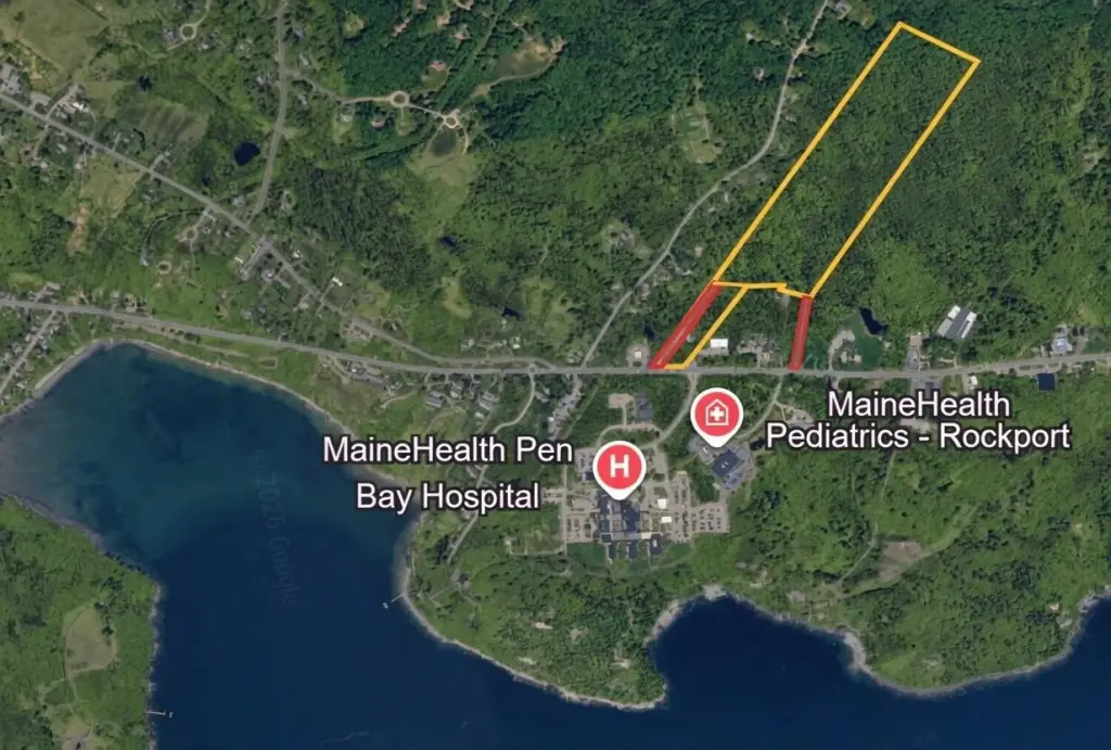
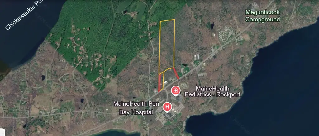
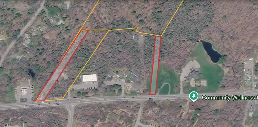
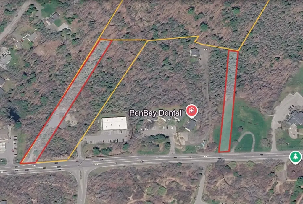
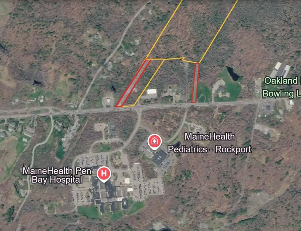
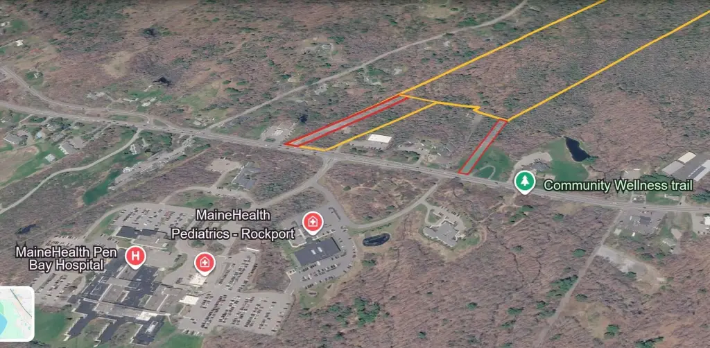
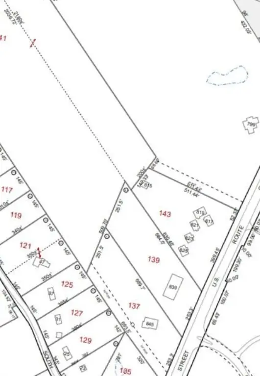
- 34.12‑acre mixed‑use development site along U.S. Route 1 in Rockport, ME with two contiguous parcels
- Approx. 250 ft of direct Route 1 frontage plus an additional 50‑ft right‑of‑way access point to the rear acreage
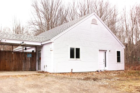
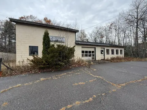
- Front parcel includes an existing commercial pad, paved entrance, and on‑site electric
- Public water and public sewer available at the road for immediate utility connections
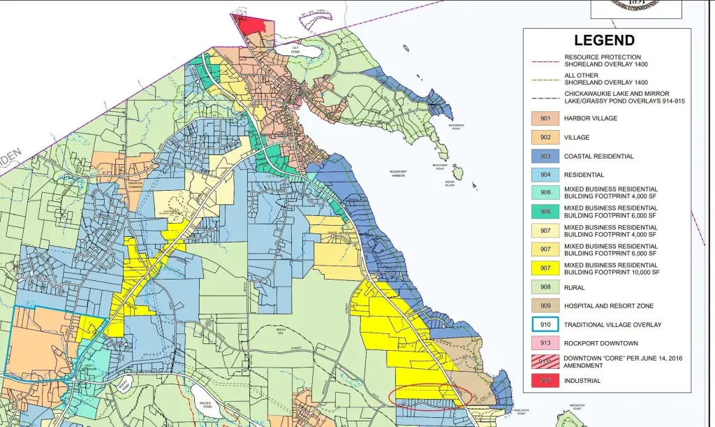
- Zoned Mixed Use (907), with permitted uses including commercial, multi‑family, residential, medical, and professional development
- Rear parcel is 1.12 acres and extends over 2,000 ft in depth for a large contiguous block for scaled development
Overview
The site benefits from approximately 250 feet of direct frontage along U.S. Route 1, plus an additional 50-foot right-of-way access point to the rear acreage. This configuration supports multiple circulation and phasing strategies, including development focused along the frontage, expanded residential or multi-family buildout, or a phased mixed-use concept. The property is zoned Mixed Use (907), which allows a broad range of permitted uses including commercial, multi-family, residential, medical, and professional development.
For buyers and developers seeking flexible options, the combination of frontage, utilities at the road, and zoning breadth can accommodate a variety of project approaches—from commercial pad development to multi-family or residential expansion. The land’s two-parcel layout and extended depth may also support phased planning and coordinated site buildout as requirements evolve.
Current Use by Public Records
Map
- City
- Rockport
- County
- Knox
- State
- Maine
- Longitude
- -69.0943
- Latitude
- 44.1792