LEILANI MAKAI RD, Ocean View, HI 96737


- Added:
- Jun 25, 2026
- Days on Market:
- 1
- Last Refresh:
- Jun 25 at 7:06 pm
Property Features for LEILANI MAKAI RD
General Information
- Property type
- Land
- Property subtype
- Other
- Zoning
- A-3A
- Standard status
- Active
- APN
- 3921510190000
- Lot size
- 21.32 Acres
Taxes and HOA fees
- Tax Year
- 2025
- Tax Annual Amount
- 461
Utilities
- Utilities
- Phone Available
- Sewer type
- Septic Tank
Listing agent Nancy J Stafford License #RS-79020 (808) 937-9225
Listing office ZT Hawaii LLC Wailuku, HI (808) 250-6901
Listing date Jun 25, 2026
Copyright © 2026 Hawaii Information Service. All rights reserved. All information provided by the listing agent/broker is deemed reliable but is not guaranteed and should be independently verified.
HighLights
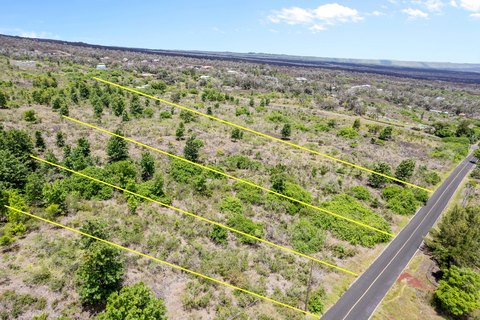
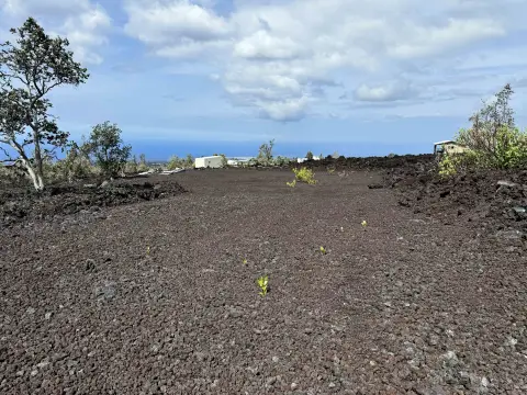
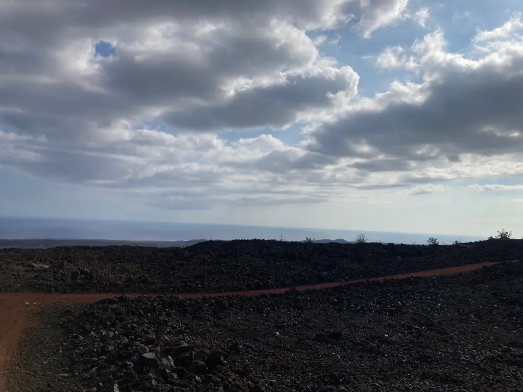
- 21.32‑acre blank‑slate lot in South Kona Estates (Kona South Estates/Ocean View subdivisions on the makai side of Highway 11)
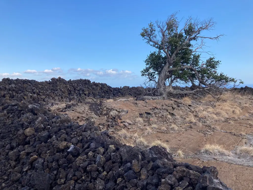
- Marked boundaries: all four corners and some midpoints clearly marked for easier identification of the land area
- Sewer: septic tank; utilities include phone available
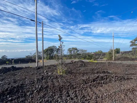
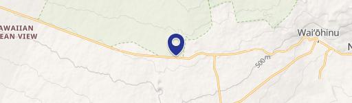
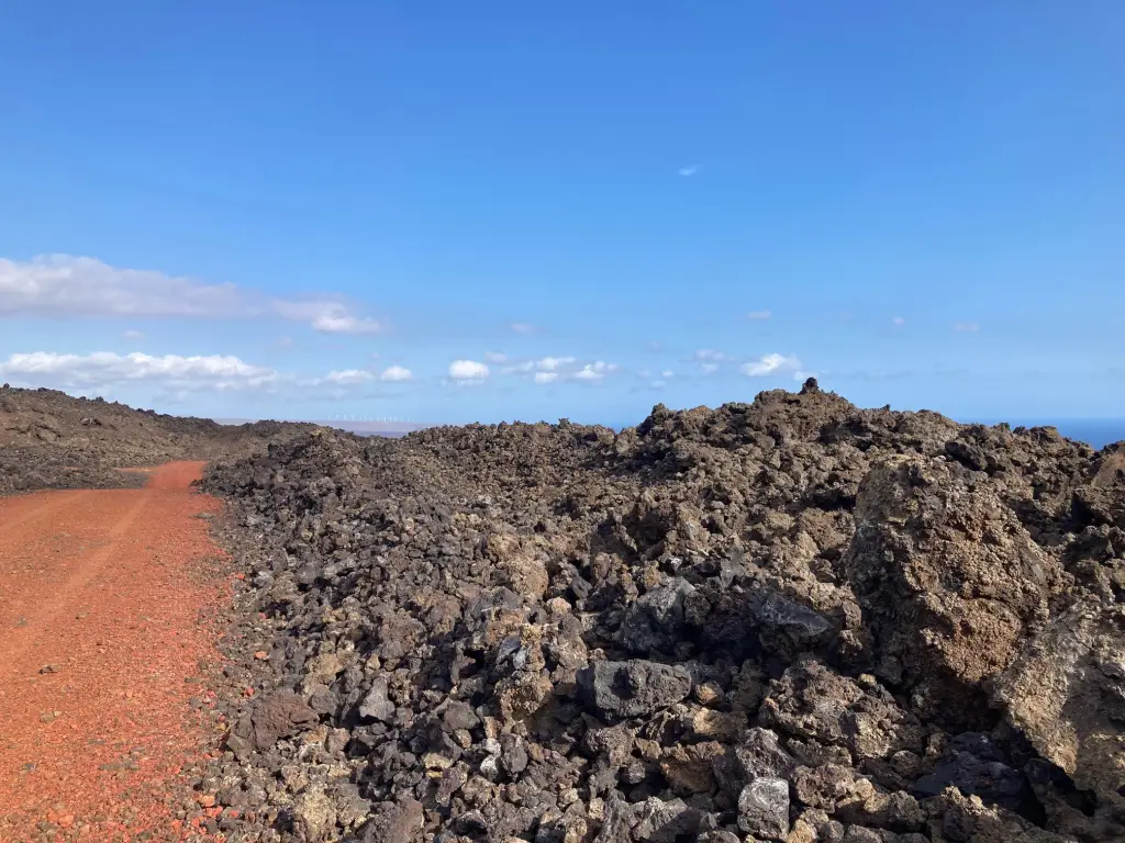
- Access: red cinder road down Leilani Makai leads up to the acreage
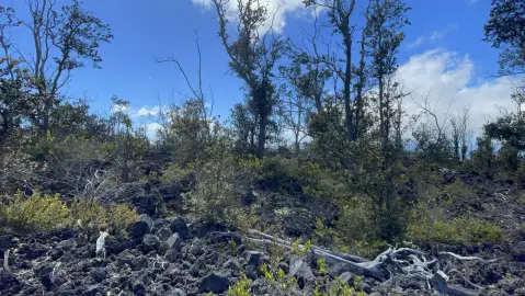
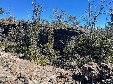
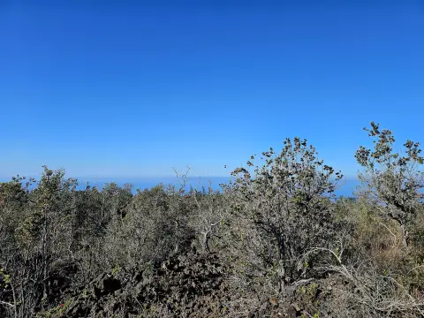
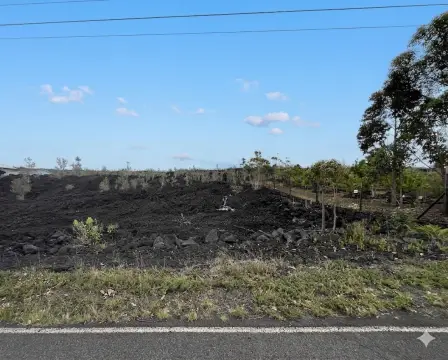
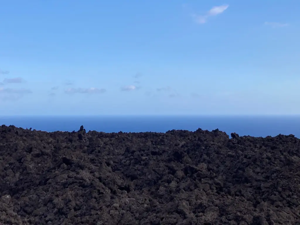
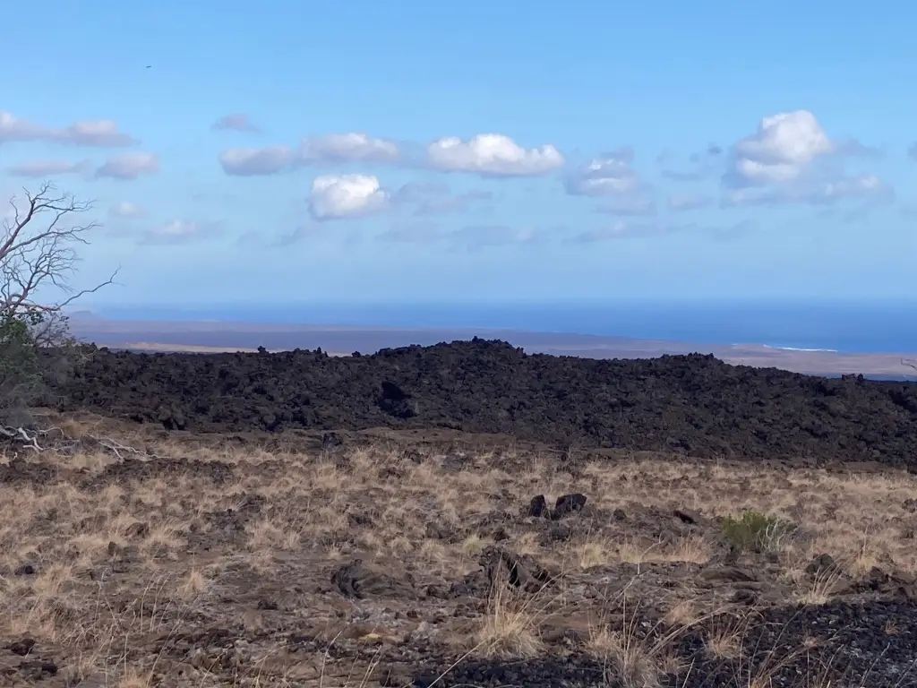
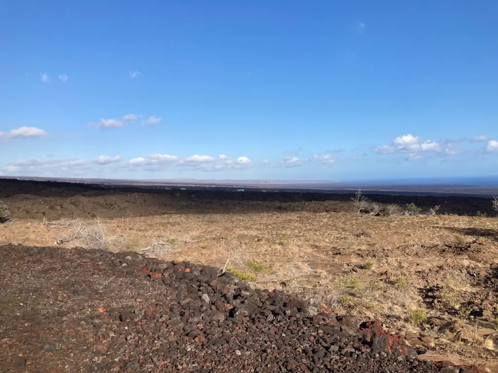
- Terrain includes brown pahoehoe lava flows with some vegetation and areas of crushable a'a lava, plus high and low spots
- Views include uninterrupted sightlines from the windmills at South Point around to Milolii, with Pohue Bay and Queens Bath visible
Overview
Access is described via a red cinder road down Leilani Makai that leads up to the acreage. The Kona South Estates/Ocean View subdivisions are noted as being on the makai side of Highway 11. The town of Ocean View is referenced as having markets, gas stations, restaurants, a post office, and a hardware store, along with a business center. Kailua-Kona is noted as just over an hour north and includes major shopping, a hospital, and other medical services, plus an international airport. Nearby beach areas mentioned include Punalu'u, Papakolea, Pohue Bay, and Ho'okena.
For buyers and operators looking for buildable land with significant natural privacy, this parcel’s mix of lava formations and variable elevations may support multiple siting options across the acreage. It is presented as a straightforward land hold with clearly identified boundaries and direct road access for planning and development decisions.
Current Use by Public Records
Map
- City
- Ocean View
- County
- Hawaii
- State
- Hawaii
- Longitude
- -155.8043329
- Latitude
- 19.04797207