A-2 Agricultural Land
Ave C Vic 245 Ste, Lancaster, CA 93535
For Sale


Contact for pricing
Land, Lancaster, CA
Property SizeContact for details
Lot Size10.43 Acres
Days on Market165
Property Features for Ave C Vic 245 Ste
General Information
Property type
Property subtype
Zoning
Directions
Subdivision
Standard status
APN
Lot size
Utilities
Sewer type
Listing Agency:
Robert Kennerson Real Estate
Listed By:
Robert Kennerson · License CA #01463756
(775) 835-3825
Added: Jun 11
Changed: Nov 4
Last Checked: Nov 22 at 5:06PM
MLS# 26004591
Copyright © 2026 Greater Antelope Valley Association of Realtors. All rights reserved. All information provided by the listing agent/broker is deemed reliable but is not guaranteed and should be independently verified.

Ask AI about this property
Review the available facts, identify missing information and prepare questions for the agent.
Investment Insights
Based on property information with market context.
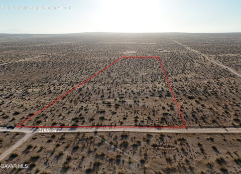
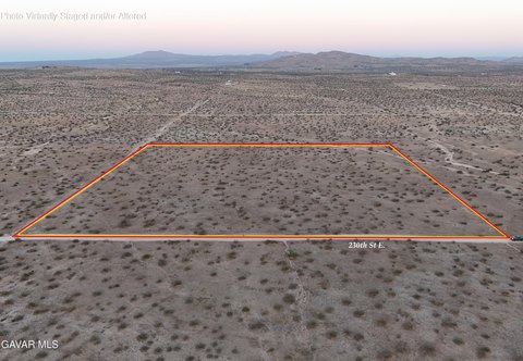
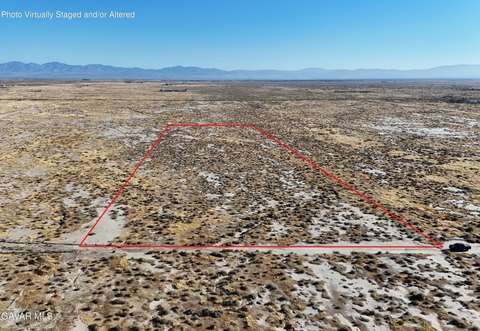
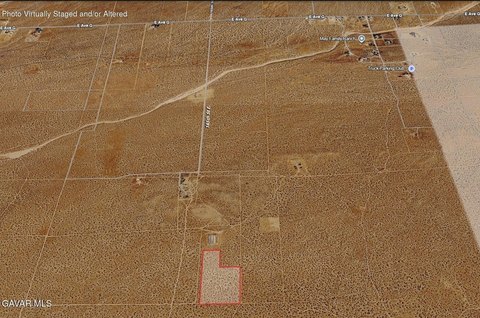
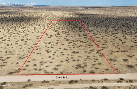
This 10.43-acre agricultural land parcel is mostly flat and classified A-2 for heavy agriculture. The zoning also allows a single-family residence. Roads run along the south and west property boundaries, creating a corner configuration, while the site remains mostly undeveloped and has no sewer service.
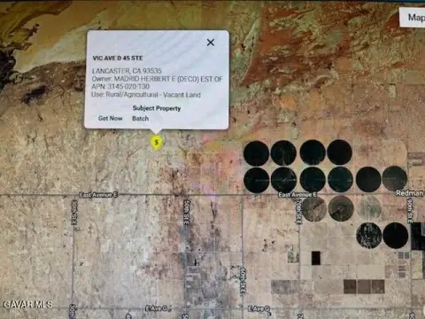
The property is located on Avenue C at 242nd Street East in the Hi Vista area of Lancaster, near the Los Angeles County and San Bernardino County line. The land offers views across the surrounding desert and hills, with Edwards Air Force Base identified in the nearby area. The parcel extends approximately 660 feet north and approximately 660 feet east from its southwest corner.
The property is located on Avenue C at 242nd Street East in the Hi Vista area of Lancaster, near the Los Angeles County and San Bernardino County line. The land offers views across the surrounding desert and hills, with Edwards Air Force Base identified in the nearby area. The parcel extends approximately 660 feet north and approximately 660 feet east from its southwest corner.
Key Highlights
- 10.43 acres of A‑2 agricultural land
- A‑2 zoning allows heavy agriculture and a single‑family residence
- Corner parcel with roads along the south and west edges
Property Analytics
Who owns this building?
See the owner, sales and loan history
Open Analytics
Lease Details
Yes
Paved road access
Location Intelligence
Demographics for 93535, CA
82,149
Population
23,917
Households
3.4
Avg Household Size
31
Median Age
14%
College-Educated
78%
High-School Grad
239.0 sq mi
ZIP Area
344
Density / Sq Mi
Median Household Income
Median Earnings
Median Rent
Median Home Value
Check the figures for this property
Cap Rate, Value Estimation, Potential NOI and more
View Realmo Analytics
Market
Properties on Market for Agricultural land / Farmland in Lancaster






Frequently Asked Questions
What type of property is this?
Agricultural land / Farmland - Flat corner parcel with road access along its south and west boundaries and A-2 agricultural zoning.
Where is this agricultural land / farmland located?
The property is located at Ave C Vic 245 Ste Lancaster, CA.
What are key features of this property?
This property features: 10.43 acres of A‑2 agricultural land; A‑2 zoning allows heavy agriculture and a single‑family residence; Corner parcel with roads along the south and west edges