Mixed-Use Development Land with Route
L137 141 Commercial Street Rockport, ME 04856

For Sale
$4,300,000
LAND - Rockport, ME
Lot Size34.12 Acres
Days on Market57
Property Features for L137 141 Commercial Street
General Information
Property type
Land
Property subtype
Other
Zoning
907 - Mixed Use
Standard status
Active
Lot size
34.12 Acres
Taxes and HOA fees
Tax Year
2025
Tax Annual Amount
3498
Utilities
Sewer type
Public Sewer
Water source
Public
Listing Agency:
EXP Realty
(888) 439-8743
Listed By:
Corey Dunn
(207) 949-2425
Added: Jun 3
Changed: Jun 11
Last Checked: Jul 29 at 4:06PM
MLS# 1659567
Copyright © 2026 Maine Listings. All rights reserved. All information provided by the listing agent/broker is deemed reliable but is not guaranteed and should be independently verified.
Investment Insights
Based on property information with market context.
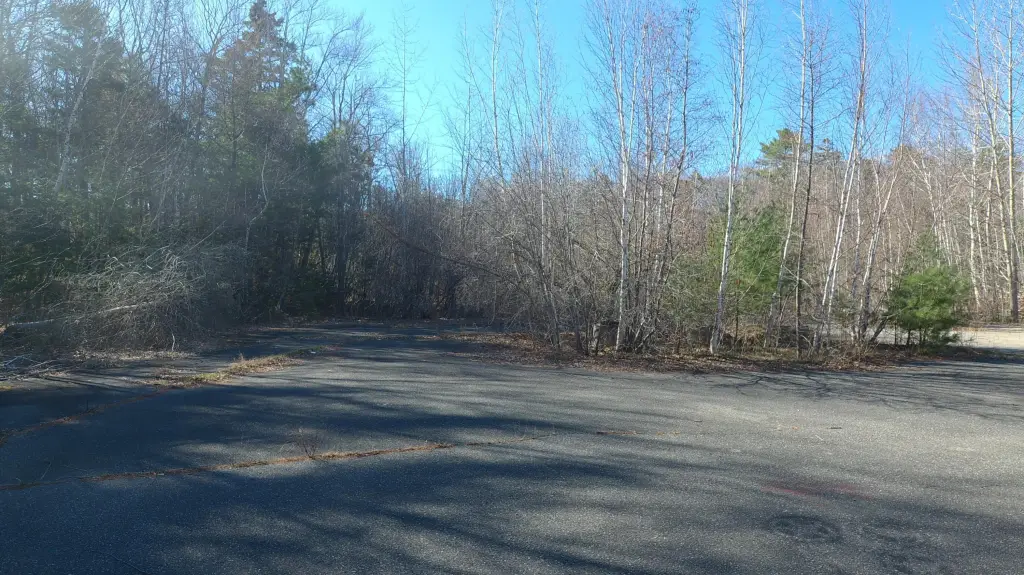
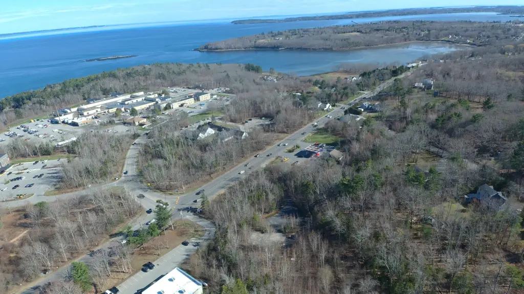
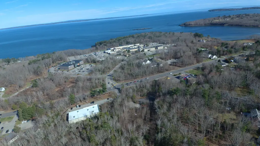
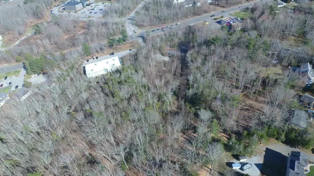
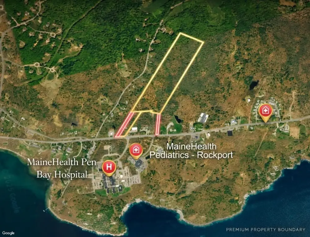
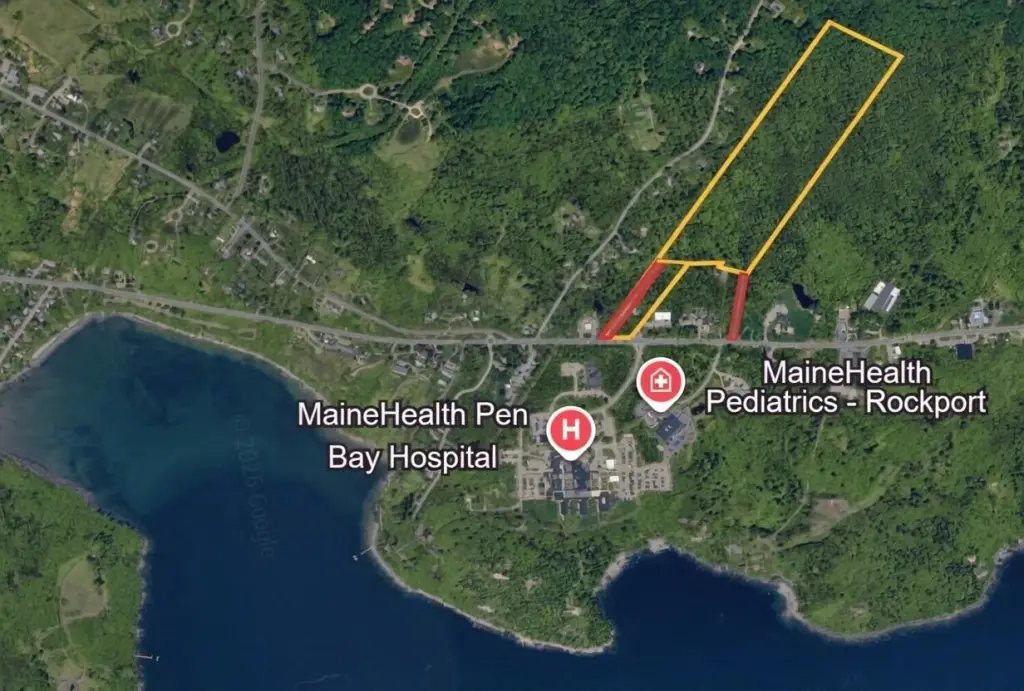
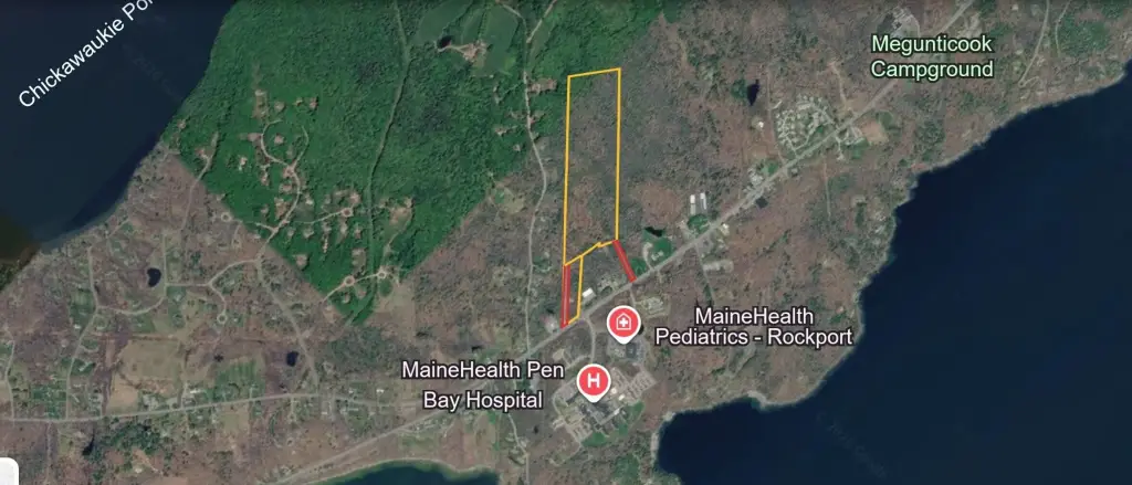
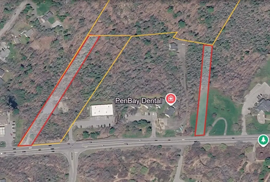
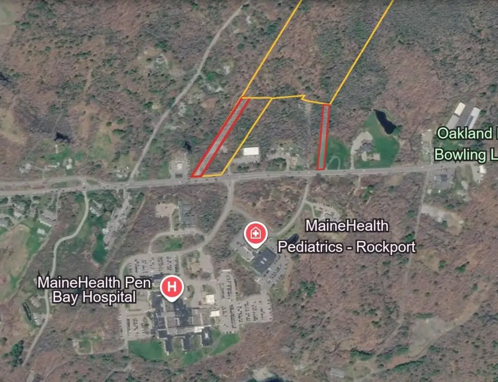
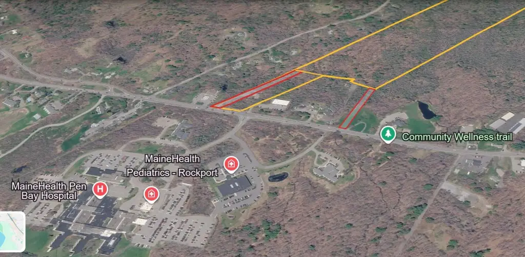
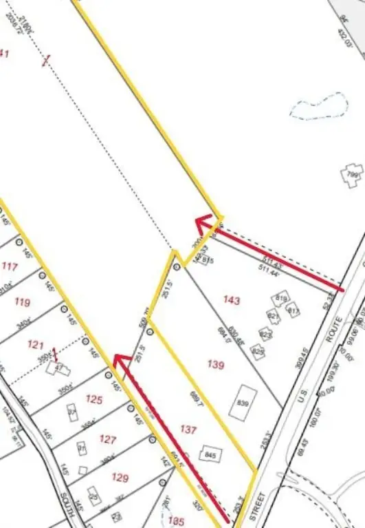
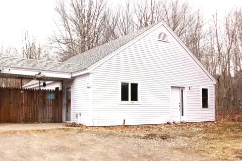
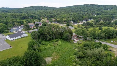
This offering is 34.12 acres of mixed-use development land comprised of two contiguous parcels. The front parcel is approximately 3 acres and includes an existing commercial pad, a paved entrance, on-site electric, and access to public water and sewer at the road. It provides about 250 feet of direct frontage on U.S. Route 1, supporting commercial visibility from the main corridor.
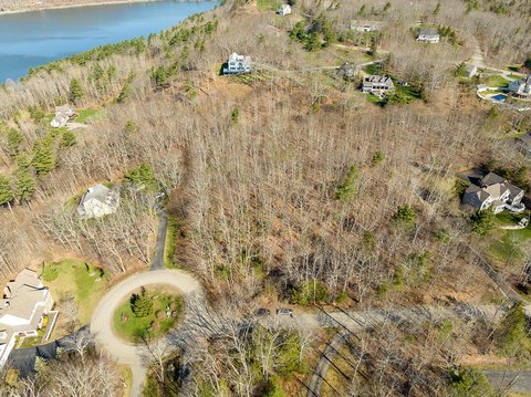
The rear parcel totals about 31.12 acres and extends over 2,000 feet in depth, offering significant scale for a single large project or phased planning. In addition to the front frontage, the site includes a second 50-foot right-of-way access point to the rear acreage to support circulation and flexible site layout.
Zoned 907 - Mixed Use, the property allows a broad range of development options including commercial, multi-family, residential, medical, and professional uses. With direct frontage, existing site improvements on the front portion, and utilities accessible at the road, the site is positioned for planning multiple development strategies such as commercial frontage development, expanded residential or multi-family uses, or a phased mixed-use concept.
Key Highlights
- 34.12‑acre mixed‑use development site along U.S. Route 1 in Rockport, ME (two contiguous parcels).
- Approx. 250 ft of direct frontage on U.S. Route 1 plus an additional 50‑ft right‑of‑way access point to the rear acreage.
- Front parcel includes an existing commercial pad with paved entrance and on‑site electric for immediate build/usage.
Property Analytics
Property Profile
Location Intelligence
Current Use


Frequently Asked Questions
What type of property is this?
Commercial land - Large mixed-use site with direct Route 1 frontage, utilities at the road, and two contiguous parcels for flexible development.
Where is this commercial land located?
The property is located at L137 141 Commercial Street Rockport, ME.
What is the asking price?
The asking price for this property is $4,300,000.
What are key features of this property?
This property features: 34.12‑acre mixed‑use development site along U.S. Route 1 in Rockport, ME (two contiguous parcels).; Approx. 250 ft of direct frontage on U.S. Route 1 plus an additional 50‑ft right‑of‑way access point to the rear acreage.; Front parcel includes an existing commercial pad with paved entrance and on‑site electric for immediate build/usage.


