Recreational Land Tract with
County Road 666 Kosse, TX 76653
County Road 666, Kosse, TX, 76653
$129,999
For Sale
$129,999
LAND - Kosse, TX
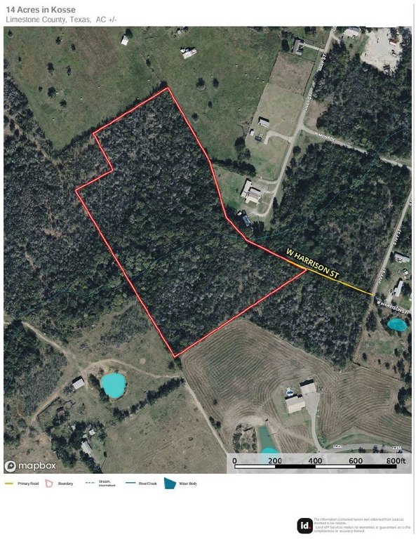
Lot Size14.25 Acres
Days on Market98
Property Features for County Road 666
General Information
- Property type
- Land
- Property subtype
- Other
- Vegetation
- Wooded
- Standard status
- Active
- APN
- R12465
- Lot size
- 14.25 Acres
Taxes and HOA fees
- Tax Description
- A197ICL R FLIPPIN ICL, ACRES 14.25
- Tax Annual Amount
- 3298
Utilities
- Water source
- Public
Listing Agency
Kelly Land and Ranch
(254) 741-1500
Waco, TX
Listed by
Tom Hooker · License #0698374
(254) 741-1500
Added: Apr 15 Updated: Jun 7 at 1:15 am Checked: Jul 21 at 12:06 am
MLS# 21201487
Listing URL
Copyright © 2026 North Texas Real Estate Information Systems, Inc. All rights reserved. All information provided by the listing agent/broker is deemed reliable but is not guaranteed and should be independently verified.
Investment Insights
Based on property information with market context.
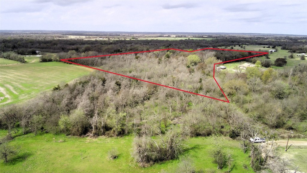
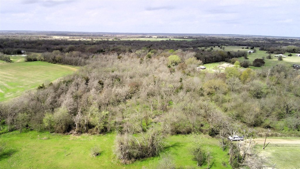
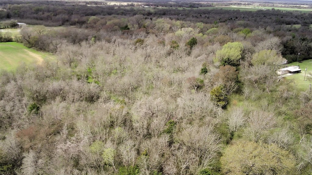
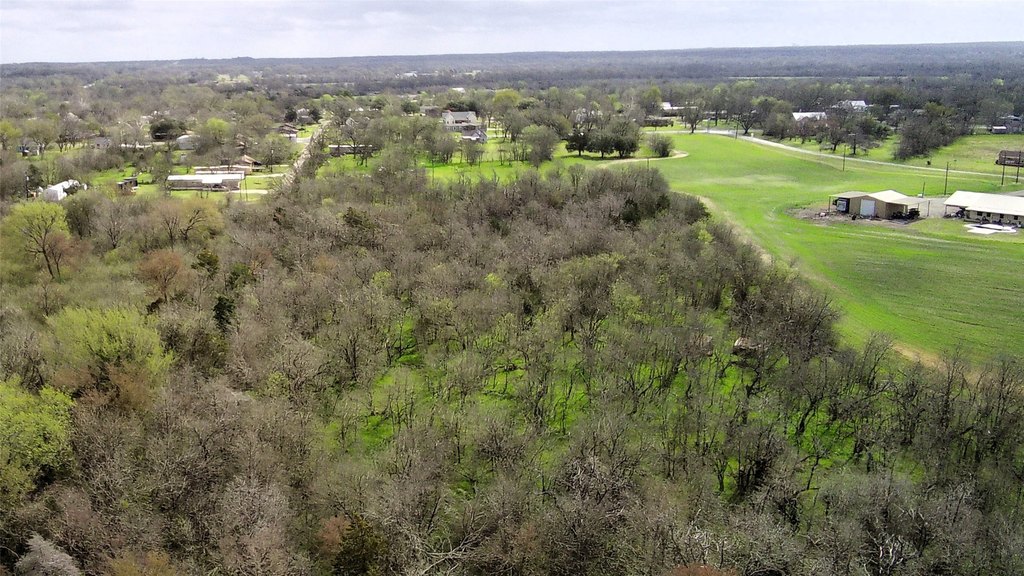
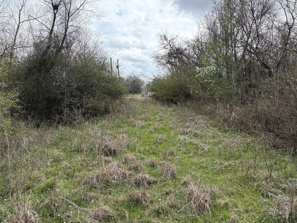
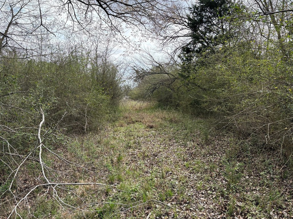
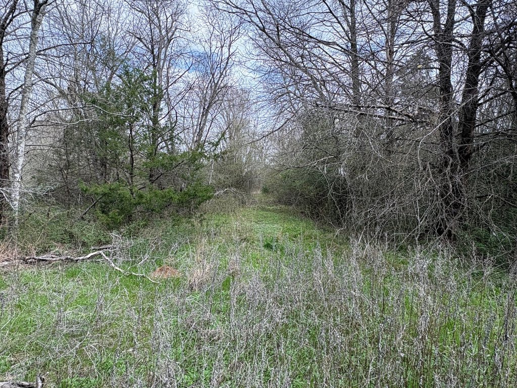
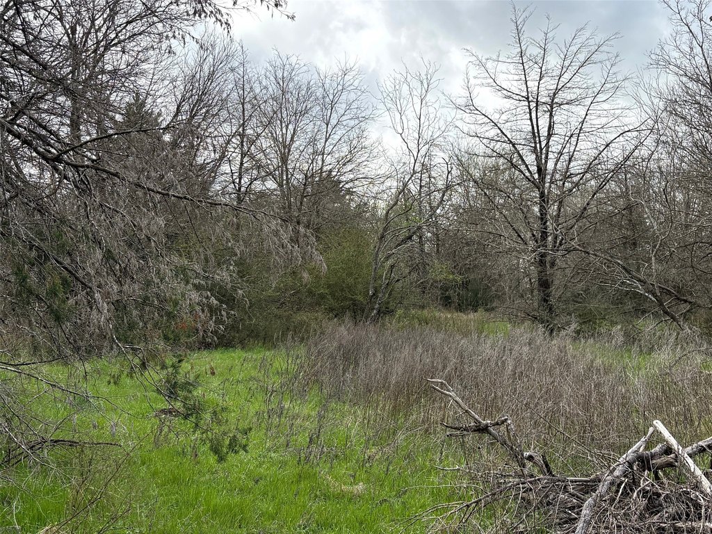
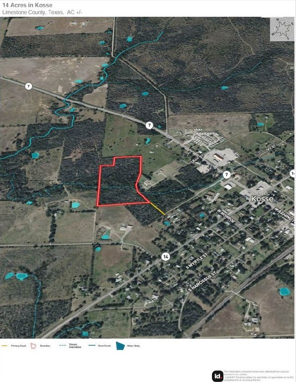
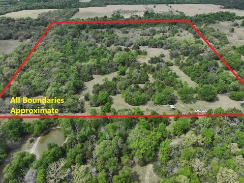
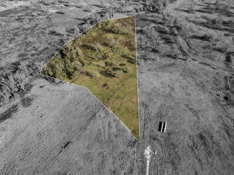
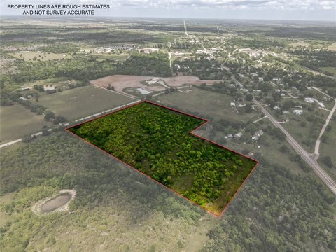
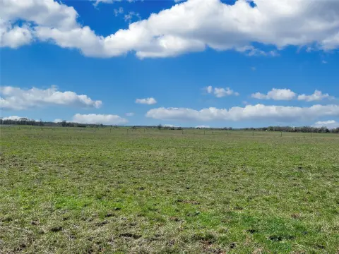
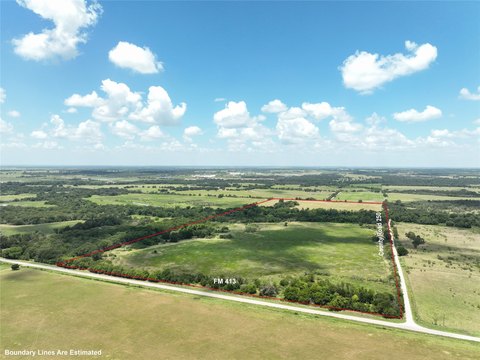
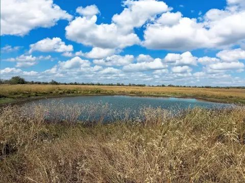
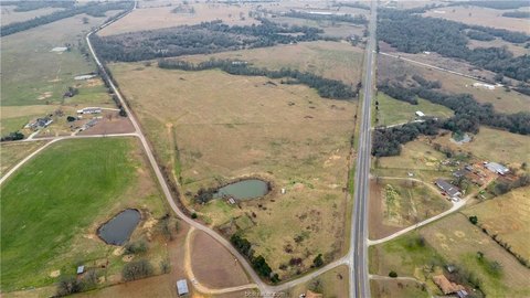
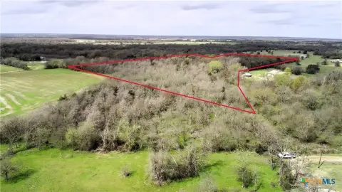
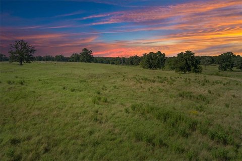
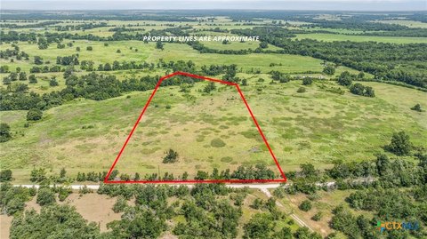
This offering is a rectangular tract of land totaling 14.25 acres, suitable for residential or recreational plans. The property is partially fenced and relatively flat, with heavy woodland cover featuring native hardwoods and pecan trees. A wet-weather creek traverses the site from west to east, creating natural variation across the parcel.
Located on the outskirts of Kosse, the property sits between Waco and Bryan–College Station and is just off the intersection of State Highway 7 and 14. Electricity access is available on-site, and the City of Kosse serves as the water provider. The land is ag-exempt, with light restrictions in place, and the property has no mineral availability.
Given the mix of wooded cover, partial fencing, and creek drainage, this parcel can appeal to buyers seeking a private recreational setting or a low-impact base for future homestead-style use. The combination of ag-exempt status and light restrictions may also support flexible, non-intensive development plans, while the wet-weather creek and existing tree growth are likely to influence how the site is cleared and improved.
Key Highlights
- 14+ acres of residential or recreational land on the outskirts of Kosse between Waco and Bryan‑College Station
- Rectangular, relatively flat, heavily wooded property with native hardwoods and pecans
- Wet‑weather creek traverses the property from west to east
Property Analytics
Property Profile
Location Intelligence
Current Use by Public Records
Agricultural land / Farmland
Similar For Sale Nearby
FAQs
What type of property is this?
Agricultural land / Farmland - Partially fenced, heavily wooded acreage with a wet-weather creek and utilities access for flexible recreation or homestead use.
Where is this agricultural land / farmland located?
The property is located at County Road 666 Kosse, TX.
What is the asking price?
The asking price for this property is $129,999.
What are key features of this property?
This property features: 14+ acres of residential or recreational land on the outskirts of Kosse between Waco and Bryan‑College Station; Rectangular, relatively flat, heavily wooded property with native hardwoods and pecans; Wet‑weather creek traverses the property from west to east