Hwy 64, Hayesville, NC 28904


- Added:
- Jun 10, 2026
- Days on Market:
- 7
- Last Refresh:
- Jun 16 at 2:06 pm
Property Features for Hwy 64
General Information
- Property type
- Land
- Property subtype
- Other
- Standard status
- Active
- APN
- 554000150935
- Lot size
- 2.67 Acres
Building Details
- Architectural style
- Other
Listing agent Curtis Wheeler (828) 371-0462
Listing office Mountain Streams Real Estate 200 HIGHWAY 64 WEST, Hayesville, NC (828) 389-8631
Listing date Jun 10, 2026
Copyright © 2026 Northeast Georgia Board of Realtors. All rights reserved. All information provided by the listing agent/broker is deemed reliable but is not guaranteed and should be independently verified.
HighLights
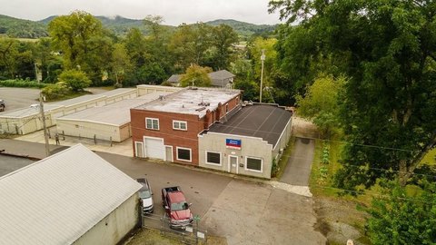
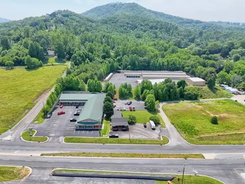
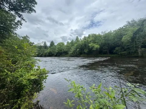
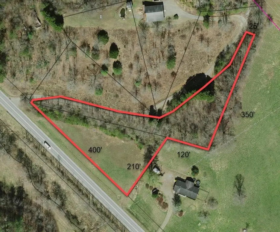
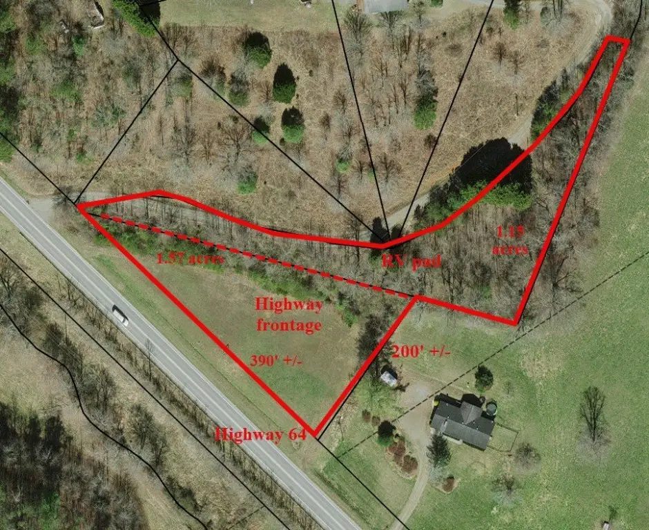
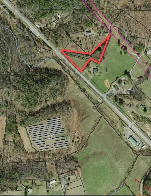
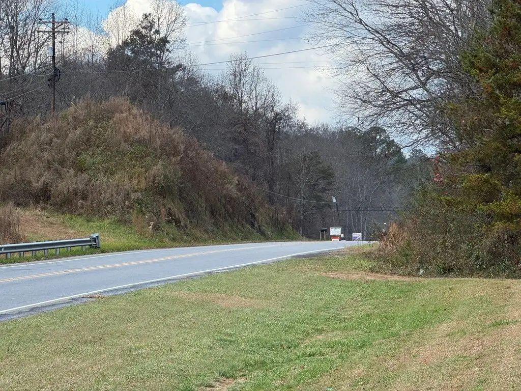
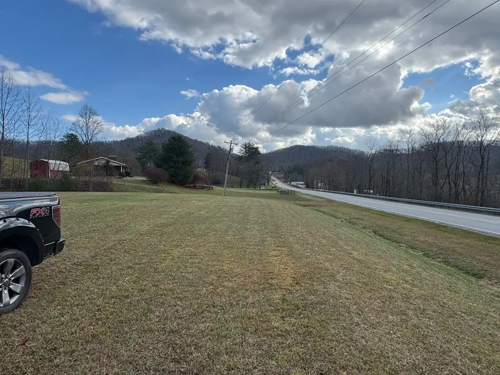
- 1.57‑acre triangular lot on Hwy 64 W west of Hayesville near Qualla Rd/Carter Cove intersection
- 390' +/- frontage and 175' +/- east line depth; flat, cleared, level at‑grade area
- No restrictions and no zoning reported in Clay County
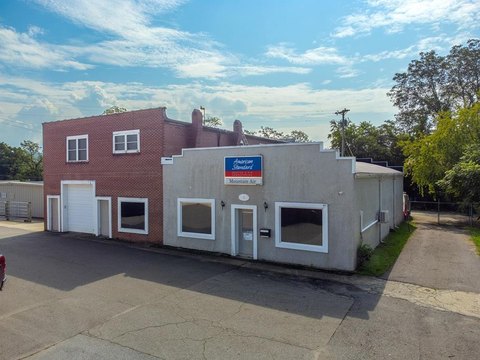
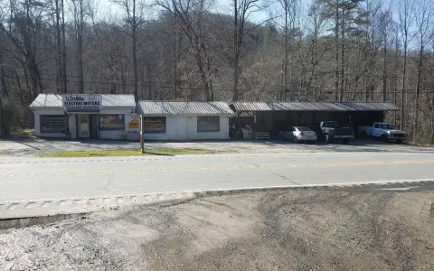
- County‑listed 0.57 acre in cleared area; includes sales lot and farmers/flea market stand rentals plus small office/retail (potential uses)
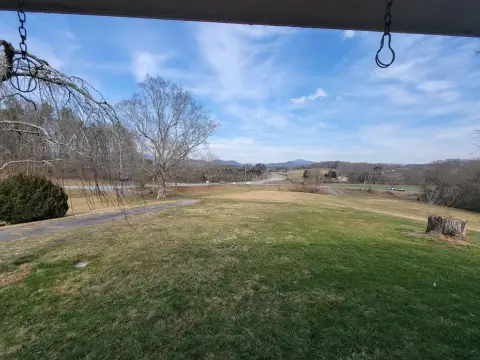
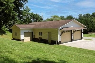
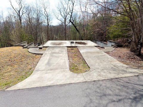
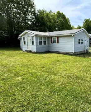
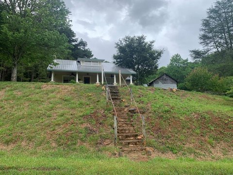
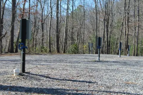
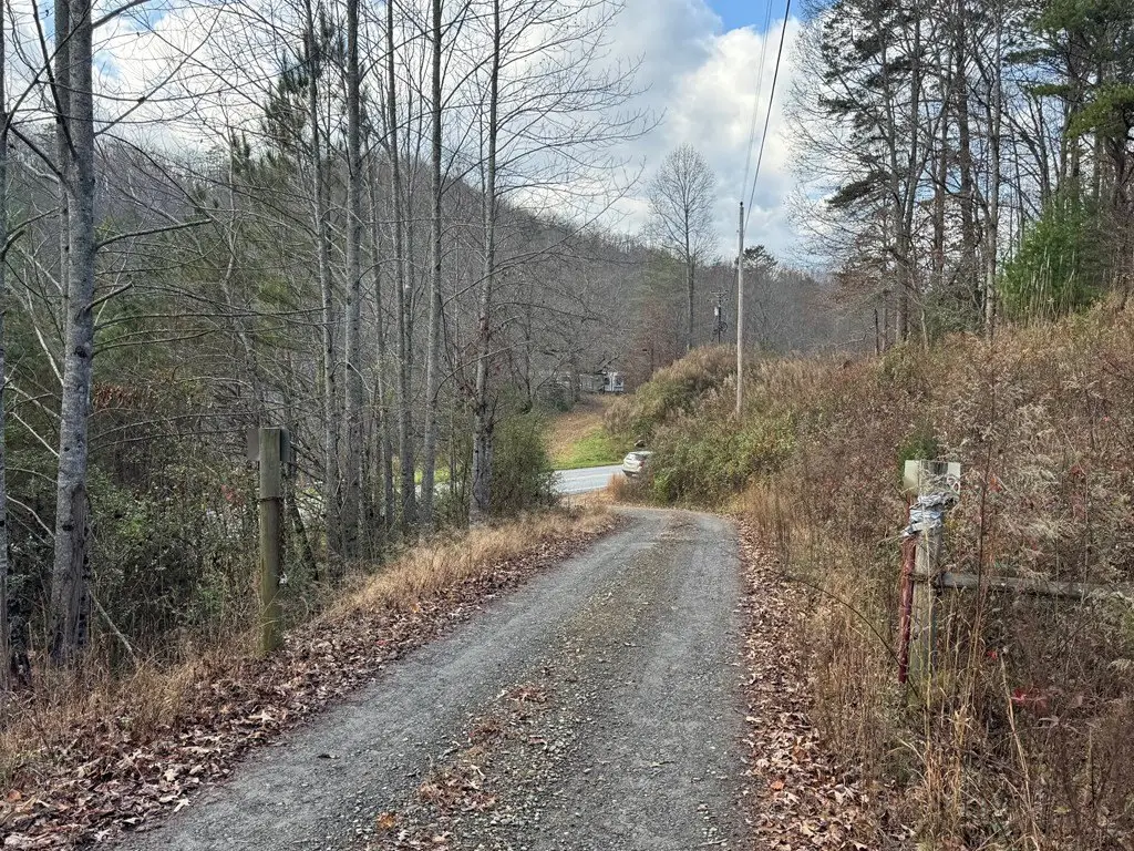
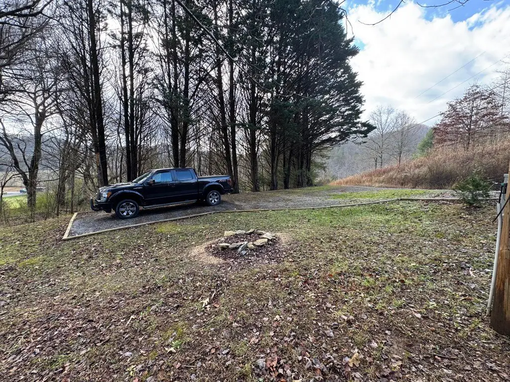
- Adjacent 1.1‑acre parcel above the highway with RV/tiny home/mobile home pad, graveled pad, and small fire pit
- 1.1‑acre pad has electrical, water, and septic stub outs; all‑weather private grade road access; Hwy 64 widening to four lanes planned (R‑5847)
Overview
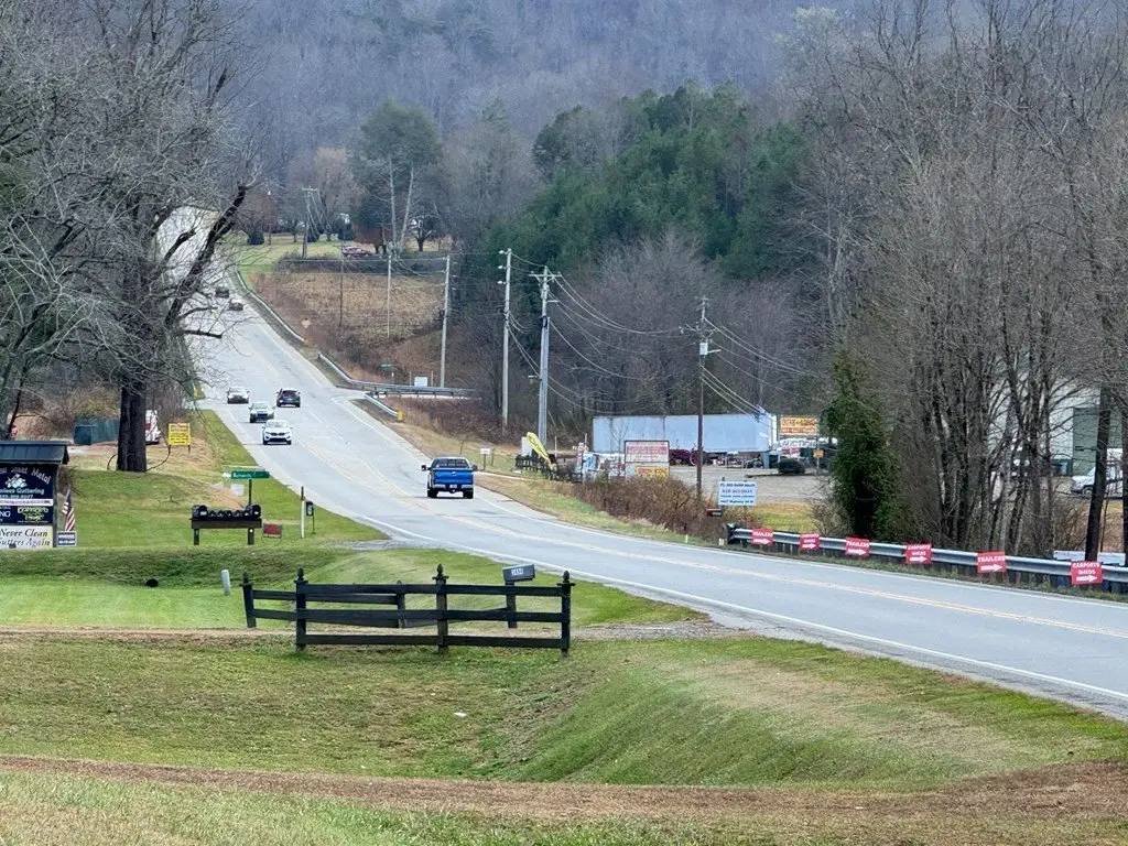
The highway-fronting parcel is located on Hwy 64 W west of Hayesville near the Qualla Road/Carter Cove intersection. The listing notes nearby businesses including Ledford and Parker, Carolina Sheet Metal, Guns and Ammo Pawn, and Truck and Equipment Service. The listing also states Clay County shows no zoning for the property. Additionally, Hwy 64 is scheduled for widening to four lanes with a median in the next few years under project R-5847.
For buyers, this configuration can support a range of light, small-scale uses on the highway lot while the upper parcel may be used for an RV, tiny home, or mobile home pad with existing utility stub outs. The owner will consider splitting the two parcels and may consider owner-financing depending on terms.
Current Use by Public Records
Map
- City
- Hayesville
- County
- Clay
- State
- North Carolina
- Longitude
- -83.819341
- Latitude
- 35.034956