Heavily Wooded Agricultural
Honokaa, HI 96727 Honokaa, HI 96727
Honokaa, HI, 96727
$949,050
For Sale
$949,050
LAND - Honokaa, HI
Lot Size73.85 Acres
Days on Market55
Property Features
General Information
- Property type
- Land
- Property subtype
- Other
- Zoning
- A-40A
- Standard status
- Active
- APN
- 3480050050000
- Lot size
- 73.85 Acres
Taxes and HOA fees
- Tax Year
- 2024
- Tax Annual Amount
- 10669
Listing Agency
eXp Realty
(808) 725-2794
6600 Kalanianaole Highway, Suite 114, Mililani, HI
Listed by
Justice Pang · License #RS-82058
(808) 319-0183
Added: May 25 Checked: Jul 18 at 6:06 pm
MLS# 729631
Listing URL
Copyright © 2026 Hawaii Information Service. All rights reserved. All information provided by the listing agent/broker is deemed reliable but is not guaranteed and should be independently verified.
Investment Insights
Based on property information with market context.
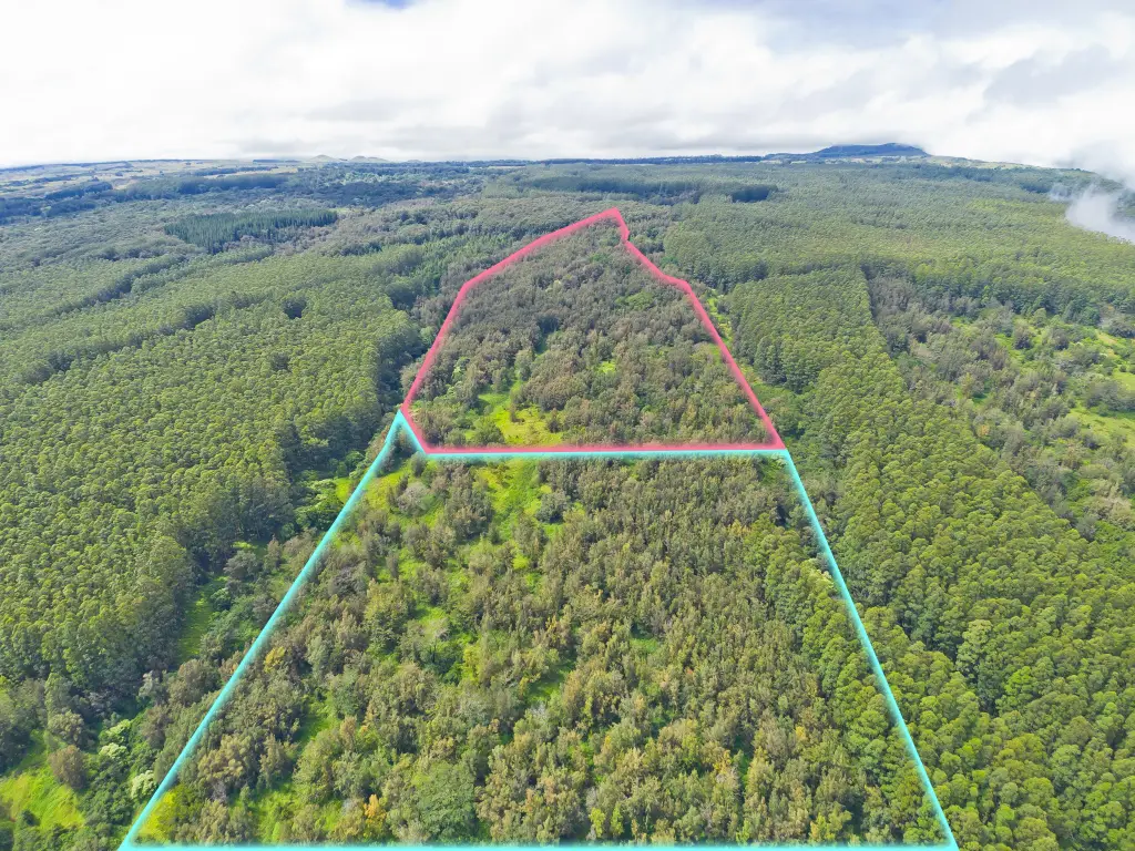
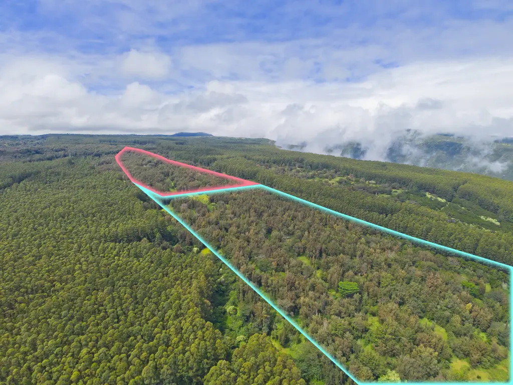
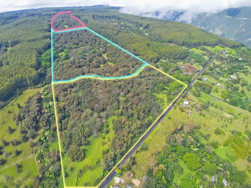
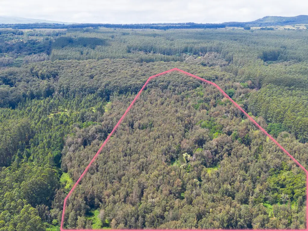
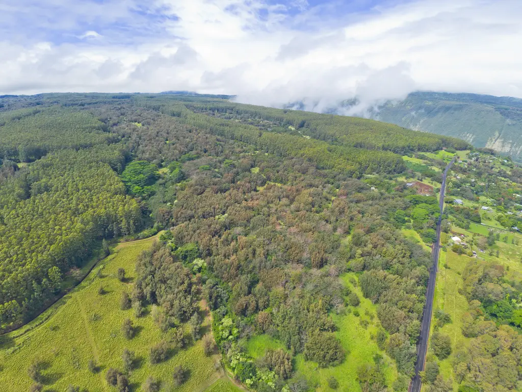
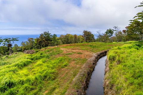
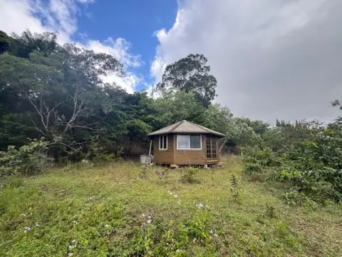
Offered for sale are two adjacent parcels in a heavily wooded setting, with a recently cleared front lot designed to help open sightlines. The property includes mature, impressive koa trees and a portion of the historic Hamakua Heritage Ditch, adding both character and practical value for buyers looking to work with the land. Zoning is A-40A, with Flood Zone X and Lava Zone 8 noted for the property.
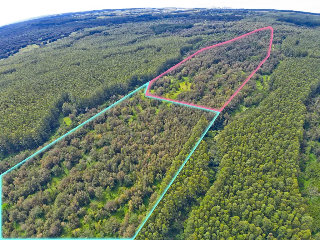
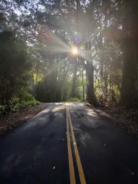
Access is via Mud Lane, described as a scenic route connecting Waimea to Honokaa–Waipio Road. The remarks note that portions of Mud Lane may require a 4x4 vehicle, underscoring the seclusion and “off-the-beaten-path” appeal. The land is positioned near the entrance to Waipio Valley and is presented with the potential for ocean views, depending on future clearing and development approach. The offering includes two parcels: Middle Parcel (MLS 729633, TMK: 3-4-8-5-4) and an End Parcel (MLS 729631, TMK: 3-4-8-5-5). The front parcel has been cleared recently, and the end lot is positioned closer to Waimea.
This is a strong fit for buyers seeking legacy land, a secluded private retreat, or an agricultural venture that takes advantage of the existing native growth and historic water feature. Buyers are encouraged to consult Hawai‘i County Planning regarding subdivision potential and permitted uses.
Key Highlights
- Two adjacent parcels near Waipio Valley: Middle Parcel MLS 729633 (TMK 3‑4‑8‑5‑4) 123.42 acres and End Parcel MLS 729631 (TMK 3‑4‑8‑5‑5) 73.85 acres
- End parcel positioned closest to Waimea; front parcel already sold
- Front lot recently cleared; heavily wooded land with mature koa trees
Property Analytics
Property Profile
Location Intelligence
Current Use by Public Records
Agricultural land / Farmland
Similar For Sale Nearby

FAQs
What type of property is this?
Agricultural land / Farmland - Two adjacent parcels offer privacy, mature koa trees, and access via Mud Lane for a nature-forward estate or agricultural plan.
Where is this agricultural land / farmland located?
The property is located at Honokaa, HI.
What is the asking price?
The asking price for this property is $949,050.
What are key features of this property?
This property features: Two adjacent parcels near Waipio Valley: Middle Parcel MLS 729633 (TMK 3‑4‑8‑5‑4) 123.42 acres and End Parcel MLS 729631 (TMK 3‑4‑8‑5‑5) 73.85 acres; End parcel positioned closest to Waimea; front parcel already sold; Front lot recently cleared; heavily wooded land with mature koa trees