Recreational Hunting Land with Road
For Sale
$738,000
Gentry Mountain, Flag Pond, TN 37657
LAND - Flag Pond, TN
Lot Size147.53 Acres
Days on Market97
Property Features for Gentry Mountain
General Information
Property type
Land
Property subtype
Other
Subdivision
Not In Subdivision
Elementary school
Temple Hill
Middle school
Unicoi Co
High school
Unicoi Co
Directions
From Interstate 26 turn onto Upper Higgins Creek then turn left onto Gentry Mountain Rd to access front of the property or turn right onto Cole rd to access the back along the easement. Property is marked by orange paint/ribbon.
Standard status
Active
APN
065 00701 000
Lot size
147.53 Acres
Taxes and HOA fees
Tax Annual Amount
631
Utilities
Water source
Spring
Listing Agency:
Clinch Mountain Realty & Auction Co.
(865) 993-5263
Listed By:
Skyler Cantrell · License #356129
(828) 380-0327
Added: Apr 27
Changed: Jun 13
Last Checked: Aug 1 at 12:06AM
MLS# 9994573
Copyright © 2026 Tennessee Virginia Regional Multiple Listing Service. All rights reserved. All information provided by the listing agent/broker is deemed reliable but is not guaranteed and should be independently verified.
Investment Insights
Based on property information with market context.
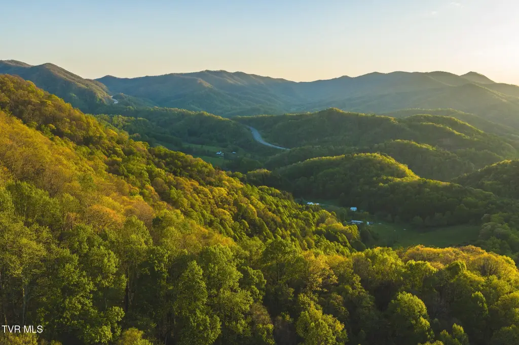
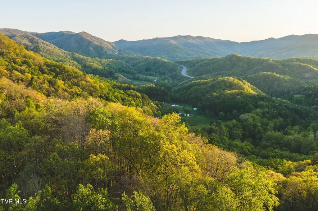
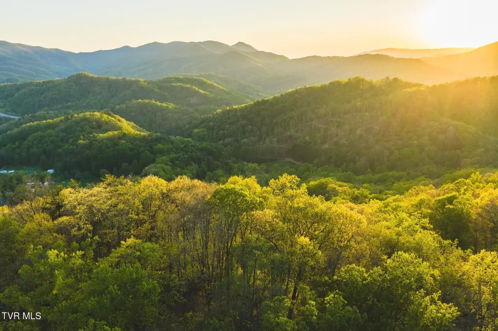
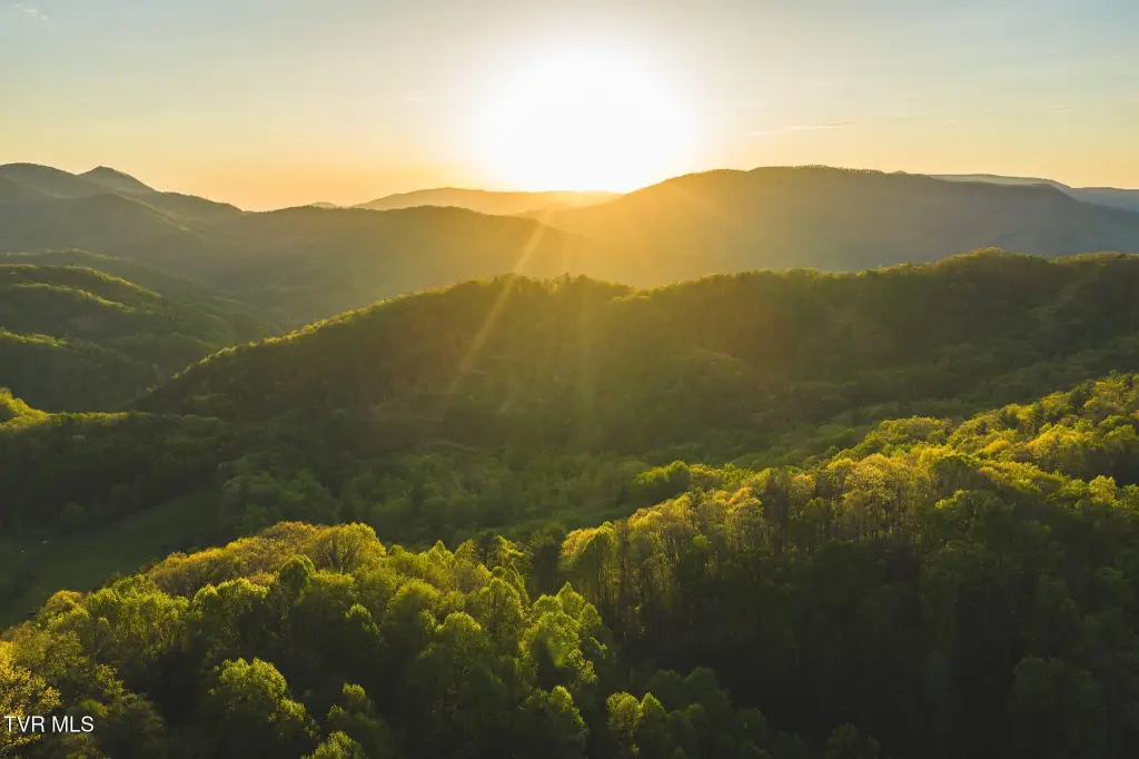
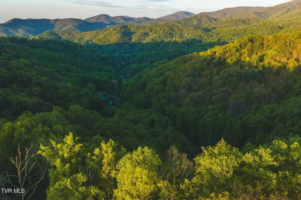
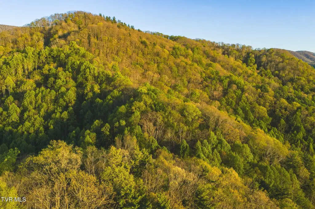
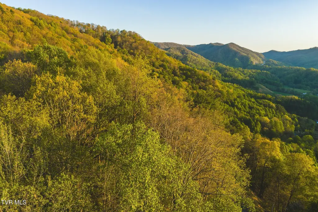
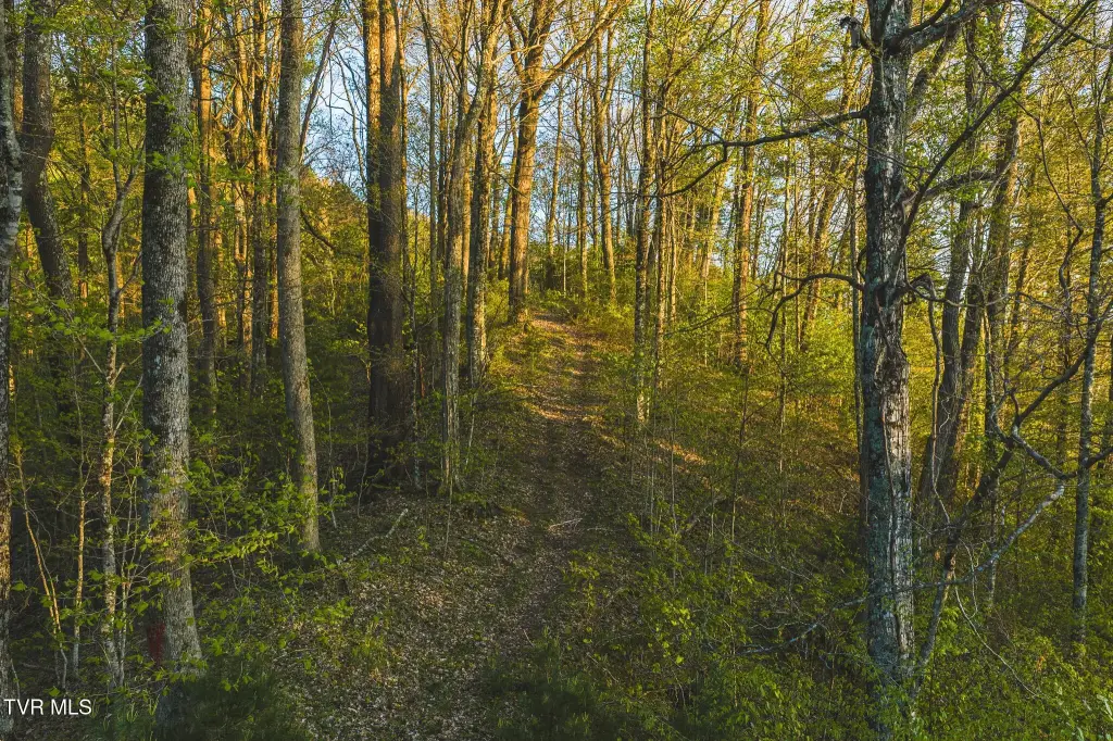
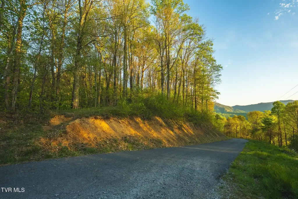
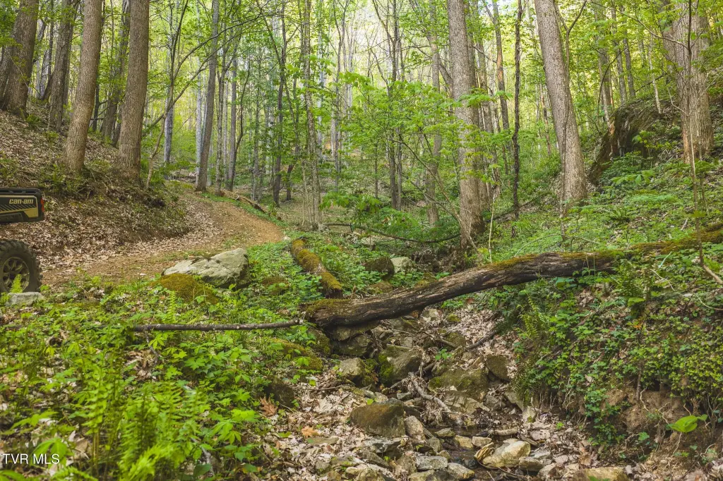
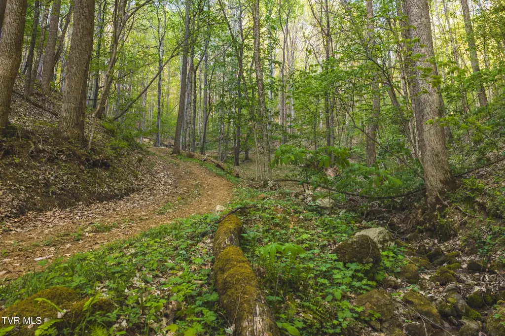
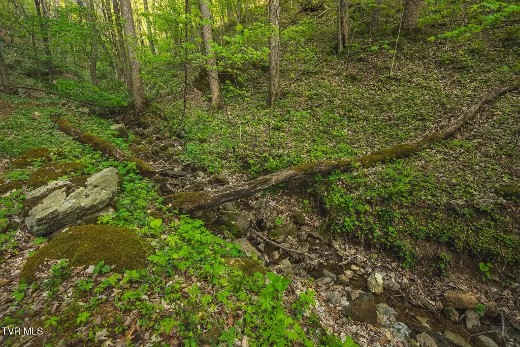
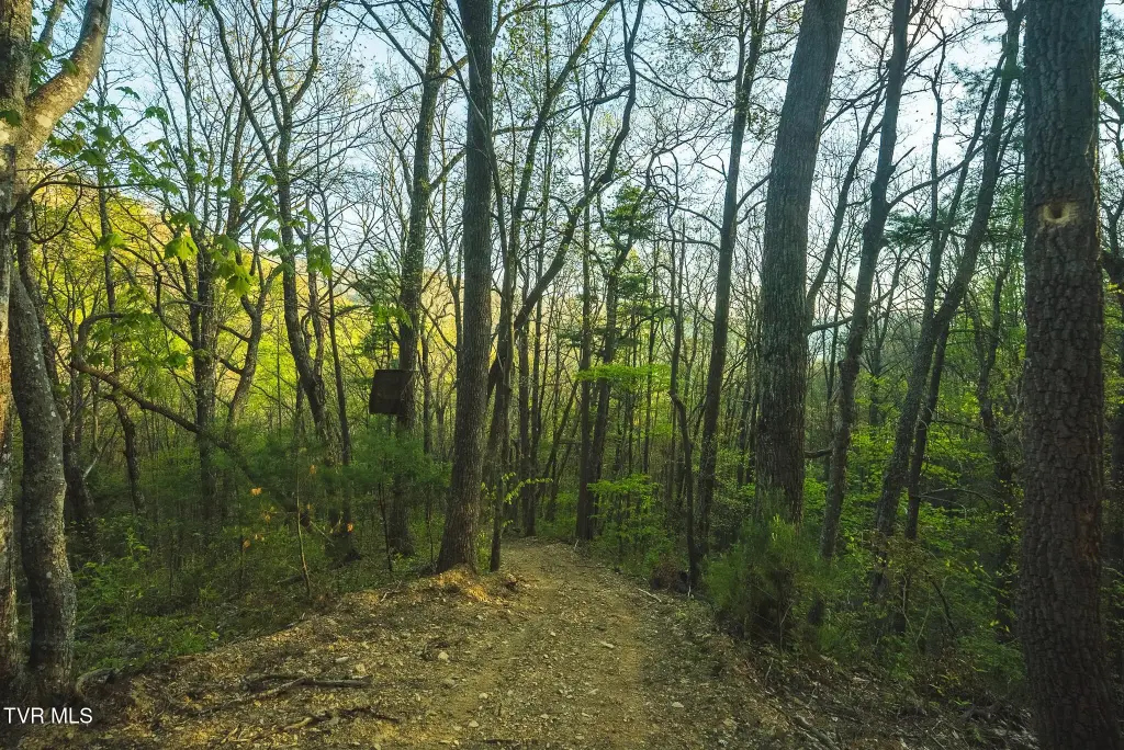
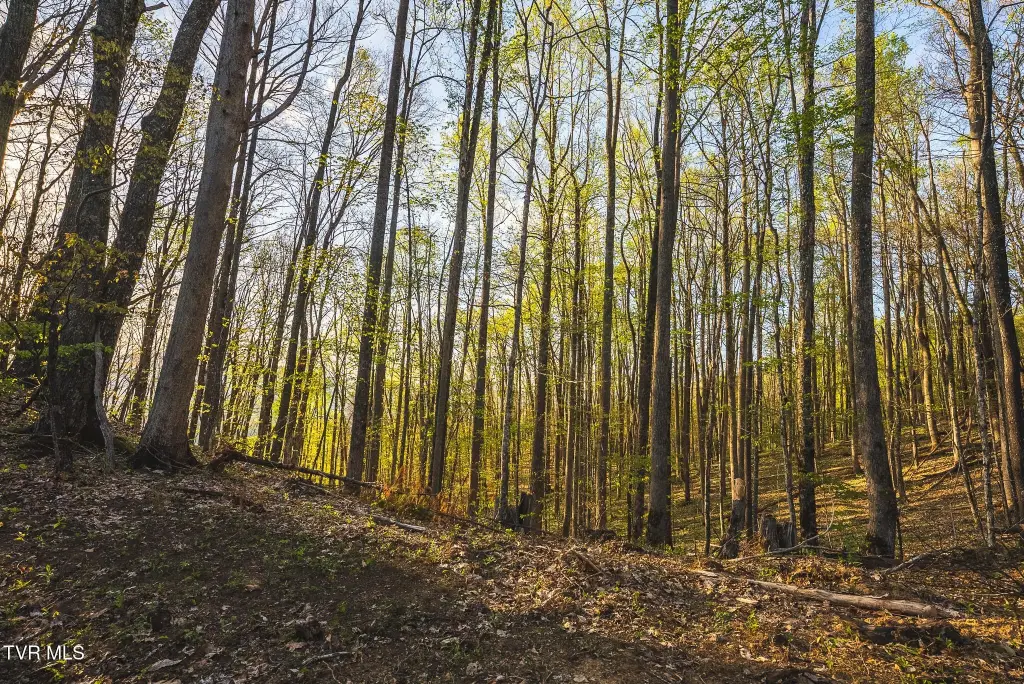
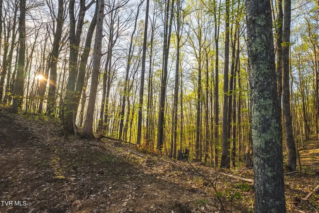
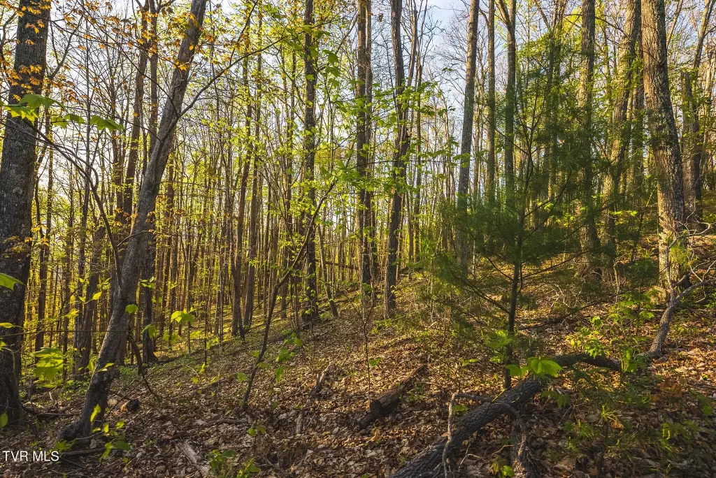
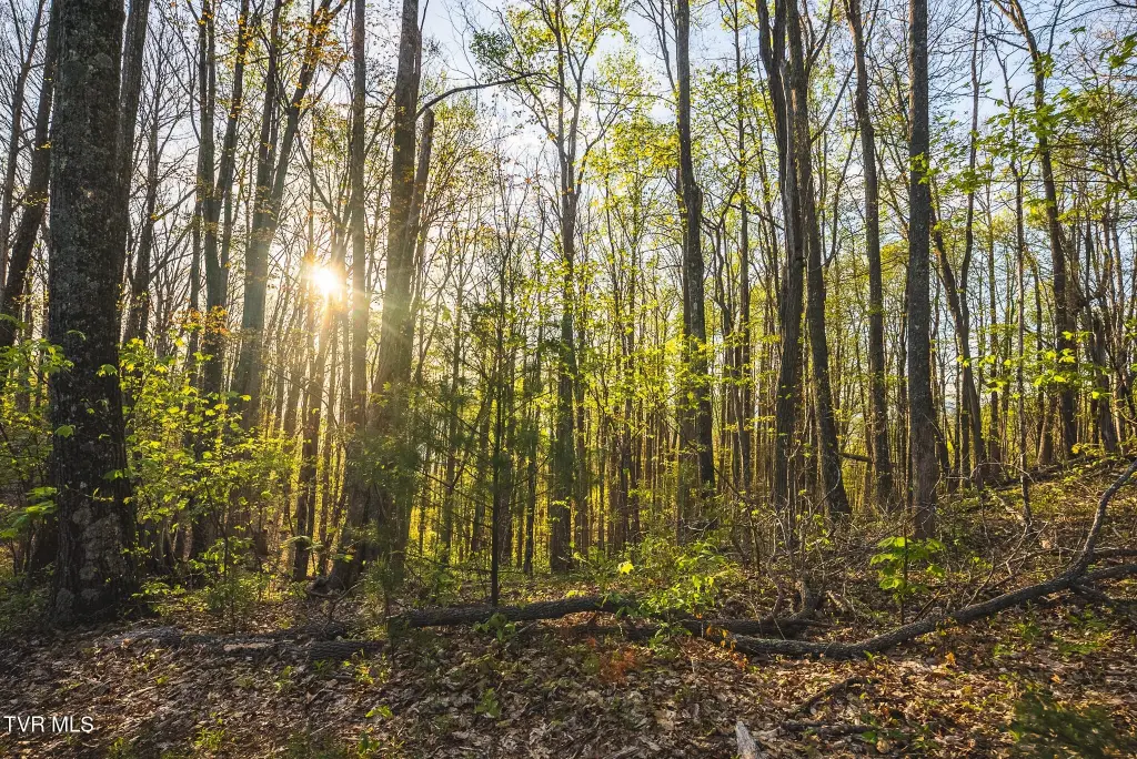
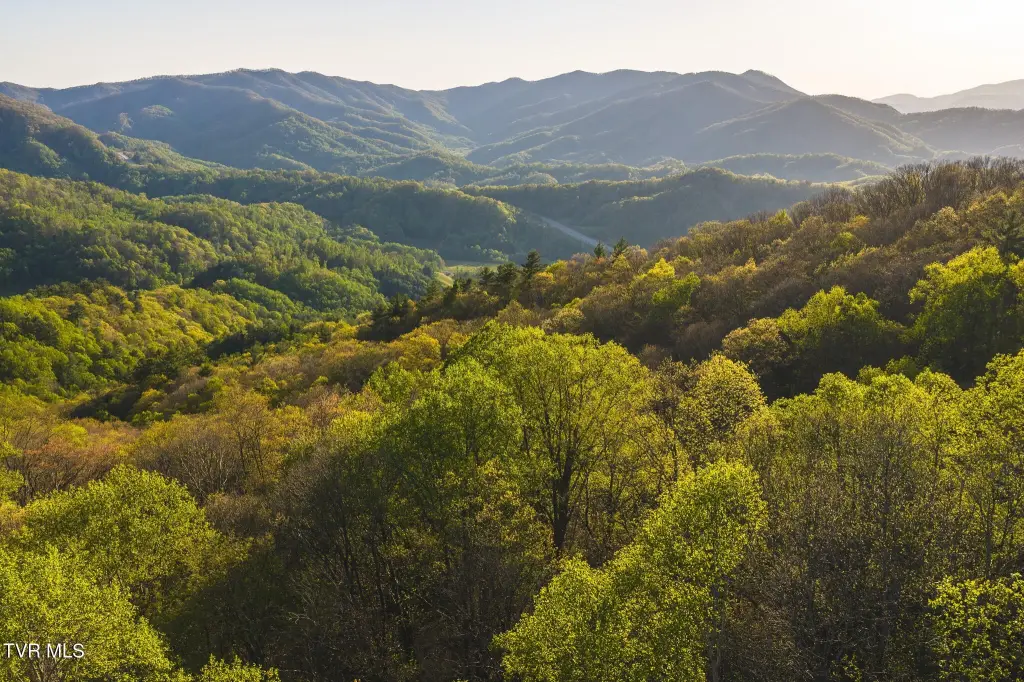
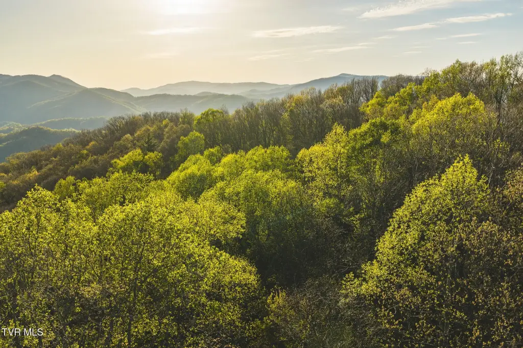
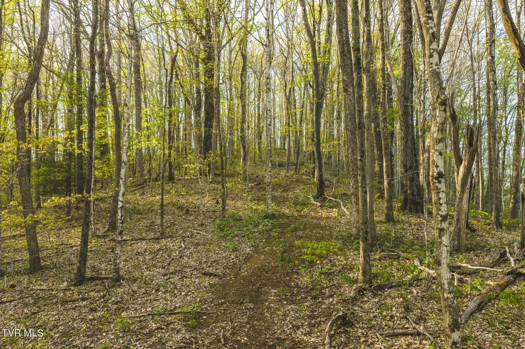
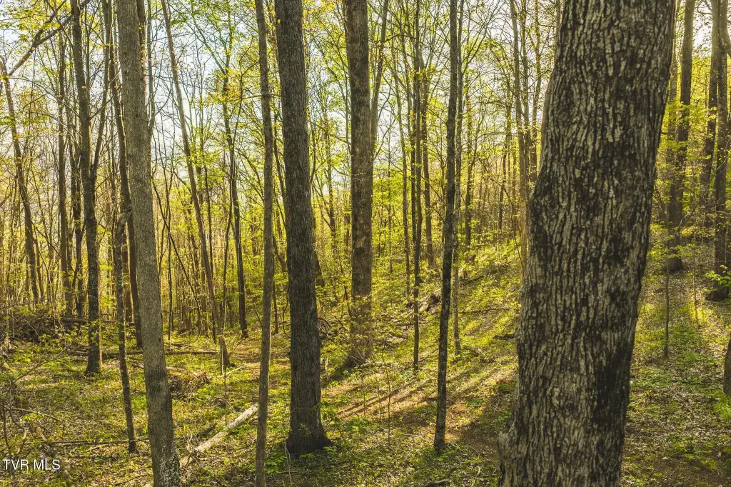
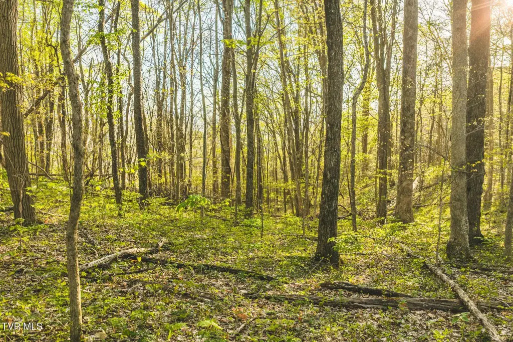
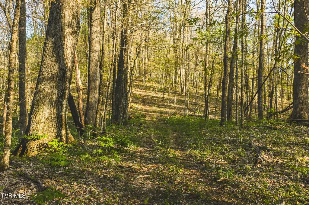
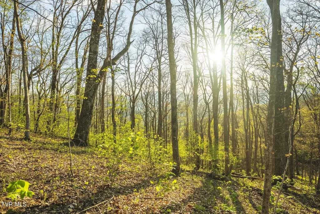
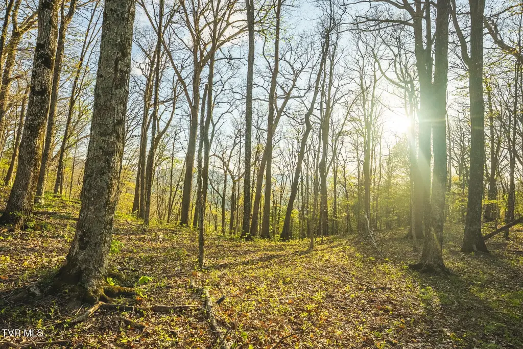
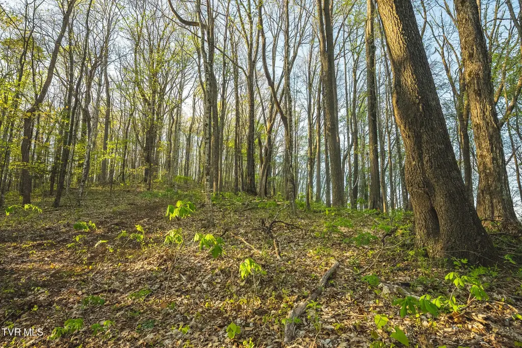
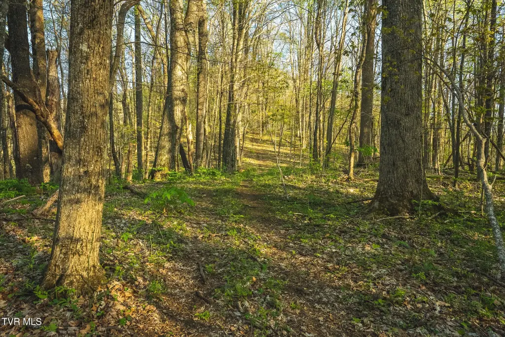
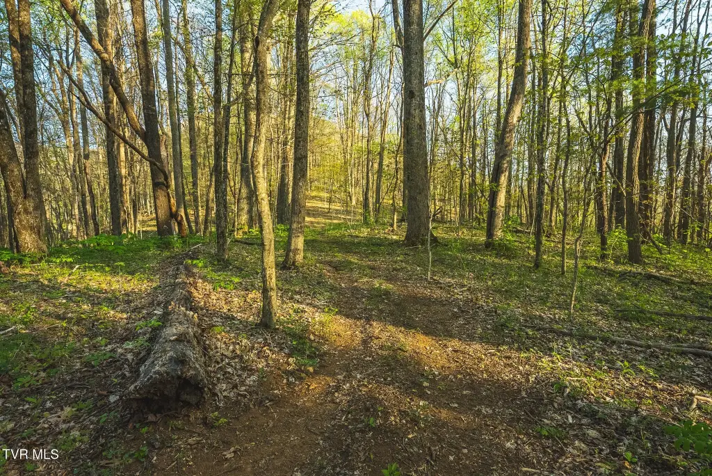
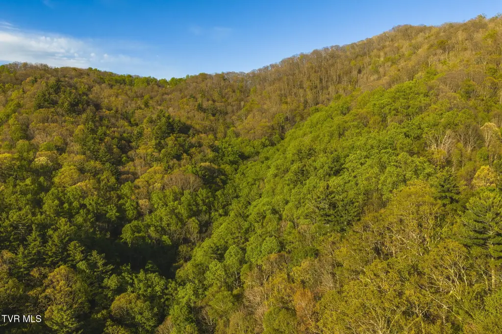
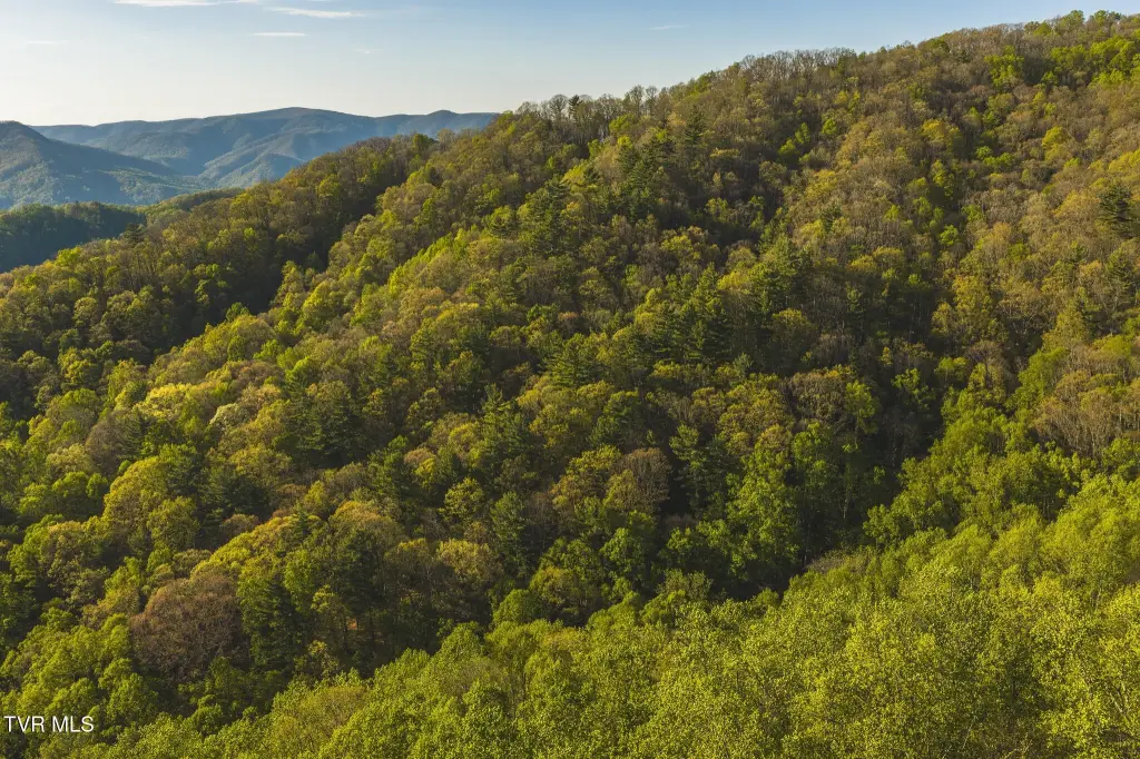
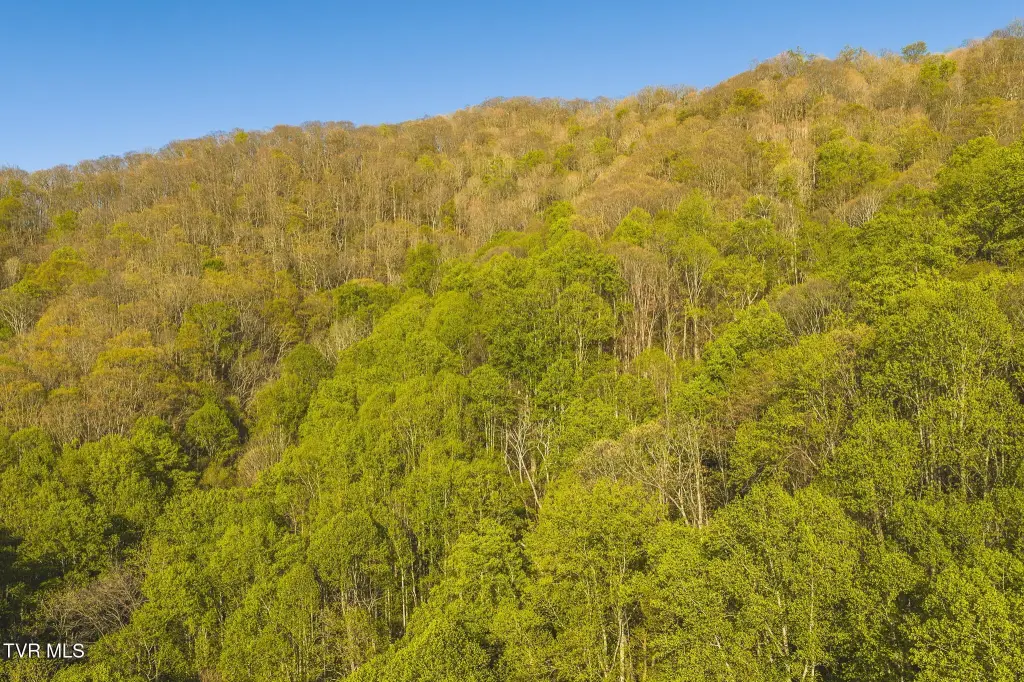
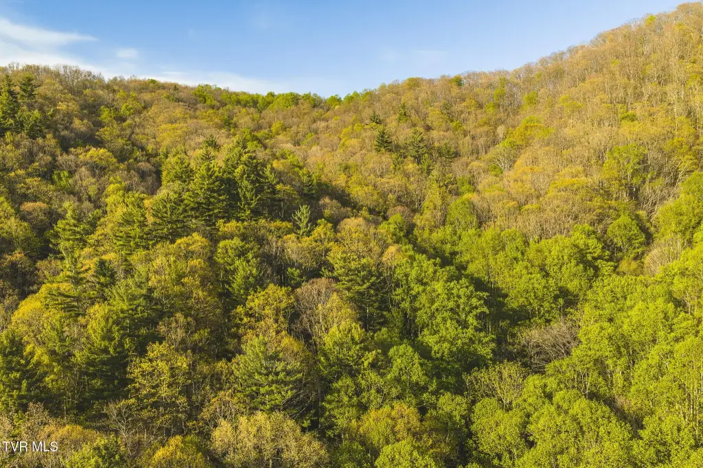
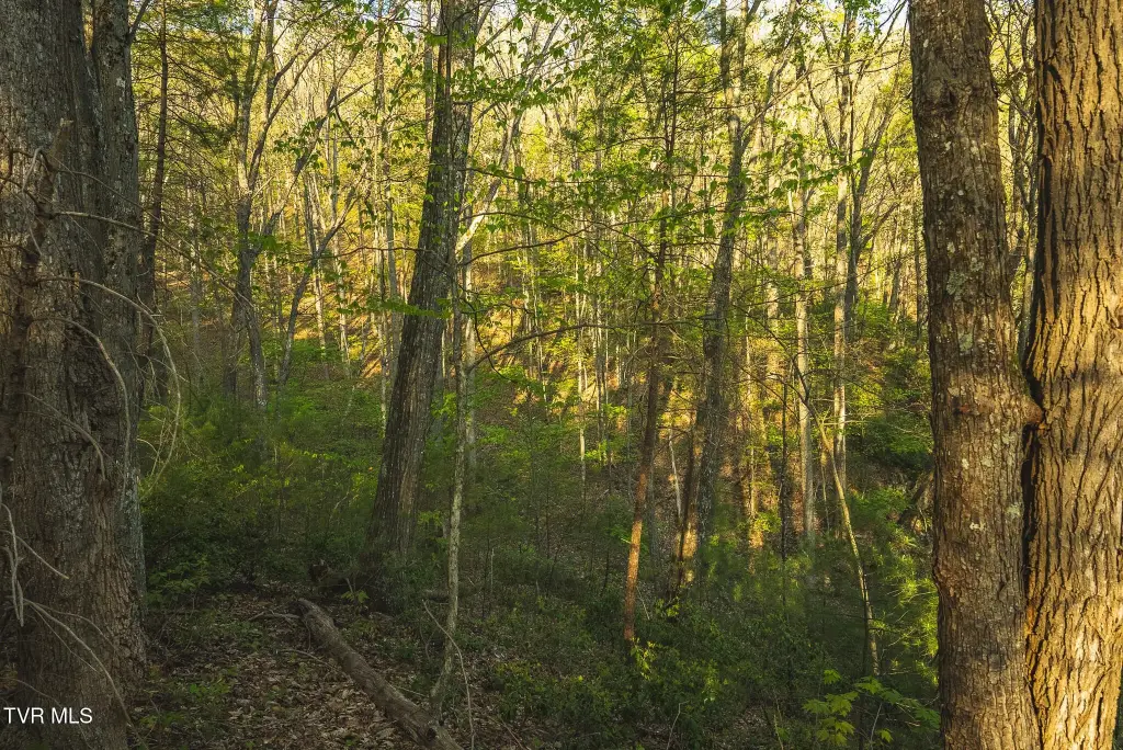
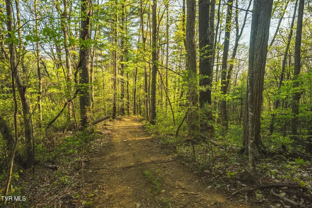
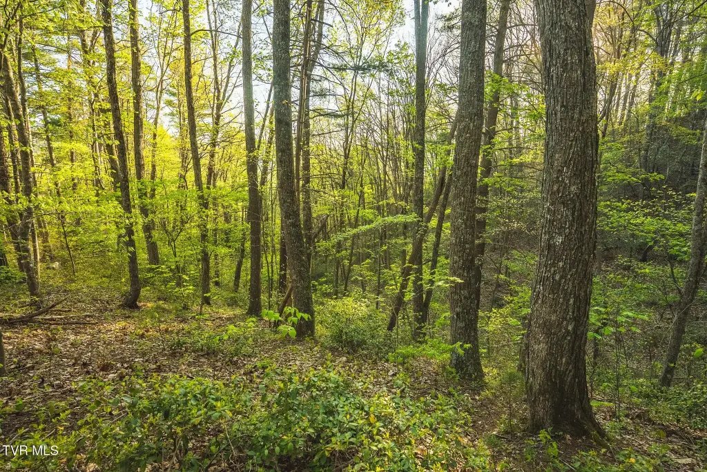
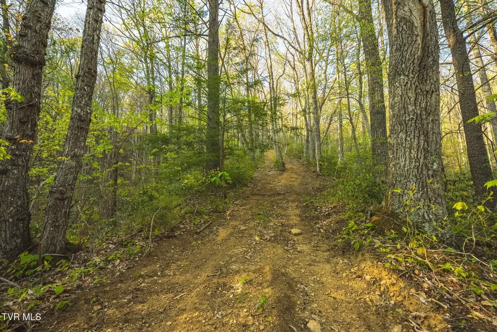
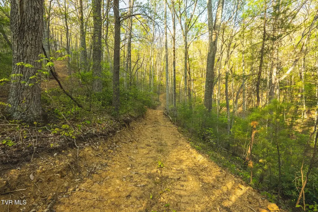
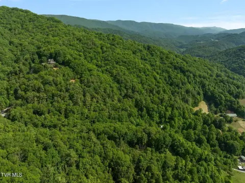
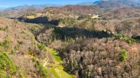
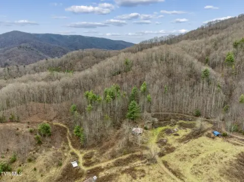
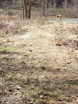
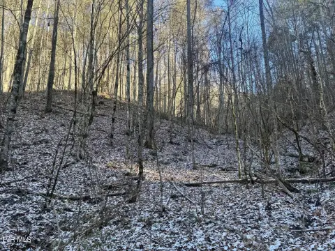
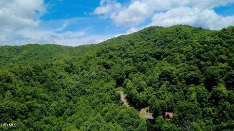
This property is a 147.53-acre tract configured for outdoor recreation, homesteading, or development, with a natural mix of timber and cover. The land includes a well-maintained network of trails and roads, supporting on-property movement for activities such as ATV riding and horseback riding, as well as bringing equipment deeper into the acreage. Several natural flowing springs are present, providing a fresh water source. The terrain and cover also contribute to habitat for deer, turkey, and black bear. Multiple vantage points across the property offer views of the surrounding mountains.
Access is supported by road frontage along Gentry Mountain Road and an additional deeded easement from Cole Road into the back portion of the property. The combination of frontage and easement access helps facilitate practical entry and use across the tract.
For hunters and outdoorsmen, the property’s documented wildlife population and year-round cover create a workable setting for seasonal use. For buyers looking to build a private retreat, the trail and road network offers immediate utility for recreation and day-to-day movement. Water availability from the springs and the presence of multiple natural lookouts further support its fit for off-grid planning and long-term enjoyment, subject to applicable approvals and land-use requirements.
Key Highlights
- 147.53‑acre tract in East Tennessee with mountain views from multiple vantage points
- Road frontage along Gentry Mountain Road plus a deeded easement from Cole Road for access to the back portion
- Natural flowing springs on the property providing a water source
Property Analytics
Current Use
Lease Details
Yes
Paved road access
Location Intelligence
Trade Area within ½ mile
6
Businesses Nearby
Explore this area
Business Placement
Demographics for 37657, TN
879
Population
450
Households
2
Avg Household Size
54
Median Age
27%
College-Educated
90%
High-School Grad
36.7 sq mi
ZIP Area
24
Density / Sq Mi
$71,581
Median Household Income
$32,070
Median Earnings
$214,200
Median Home Value

Questions? Ask Rey
Realmo’s AI knows this listing — price, zoning, demand, history. Ask anything.

Frequently Asked Questions
What type of property is this?
Hunting land - A large East Tennessee tract with road frontage, deeded easement access, trails, springs, and wildlife habitat for outdoor use.
Where is this hunting land located?
The property is located at Gentry Mountain Flag Pond, TN.
What is the asking price?
The asking price for this property is $738,000.
What are key features of this property?
This property features: 147.53‑acre tract in East Tennessee with mountain views from multiple vantage points; Road frontage along Gentry Mountain Road plus a deeded easement from Cole Road for access to the back portion; Natural flowing springs on the property providing a water source


