Lakefront Hunting
For Sale
$1,040,000
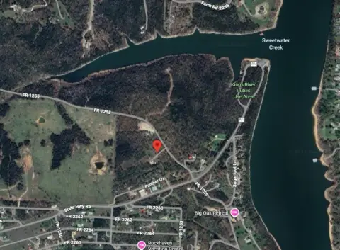
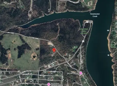
Farm Road 1250, Golden, MO 65658
LAND - Golden, MO
Lot Size86.66 Acres
Days on Market48
Property Features for Farm Road 1250
General Information
Property type
Land
Property subtype
Other
Subdivision
Sunshine Acres
Lot features
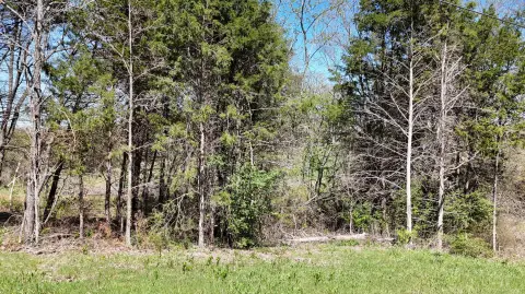
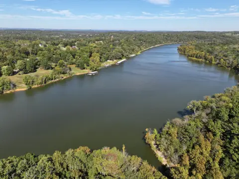
Acreage, Hilly, Secluded, Young Trees, Water View, Waterfront, Valley View, Few Trees, Mature Trees, Lake Front, Lake View, Wooded, Adjoins Government Land
View
Lake
Elementary school
Cassville
Middle school
Cassville
High school
Cassville
Directions
Turn off of Highway 86 between Golden and Car Lane on to Farm Road 1250. Go about 2,400 feet down Farm Road 1250 and the entrance is on the right.
Standard status
Active
APN
30-5.0-22-000-000-0007.000, 30-5.0-22-000-000-0003
Lot size
86.66 Acres
Taxes and HOA fees
Tax Year
2025
Tax Description
SEE SURVEYS
Tax Annual Amount
1836
Legal Description
SEE SURVEYS
Utilities
Utilities
Electricity Available
Water front
1
Listing Agency:
BlueCamo Properties
(417) 242-0000
Listed By:
Jeffrey Burney Flanigan
(417) 430-7915
Added: Jun 15
Changed: Jun 18
Last Checked: Aug 1 at 10:06PM
MLS# 60326562
Copyright © 2026 Southern Missouri Regional MLS, LLC (SOMO). All rights reserved. All information provided by the listing agent/broker is deemed reliable but is not guaranteed and should be independently verified.
Investment Insights
Based on property information with market context.
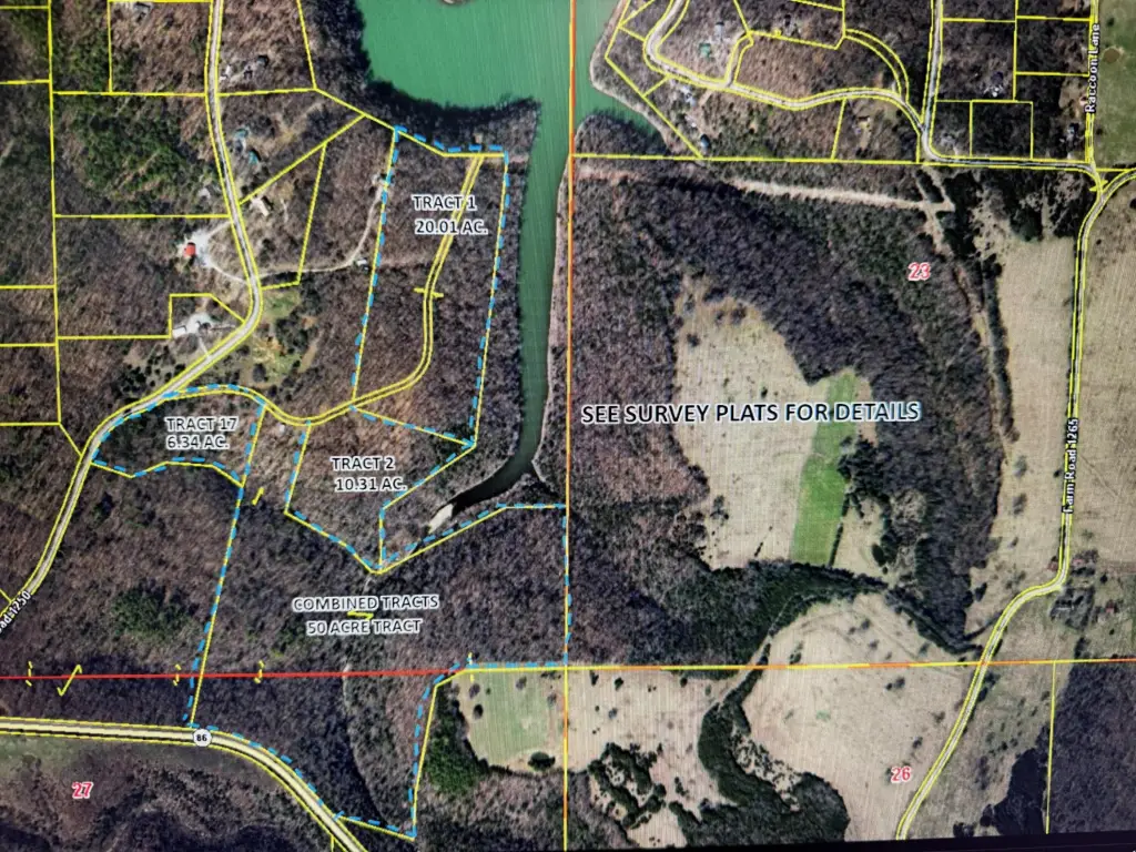
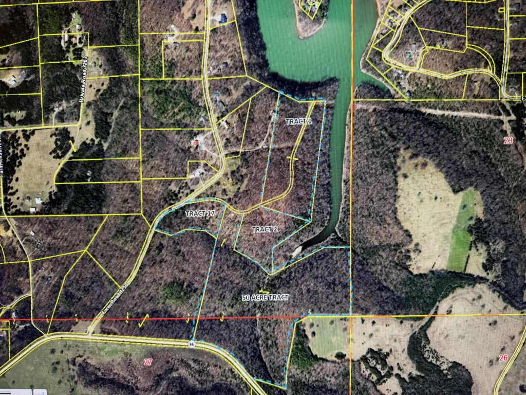
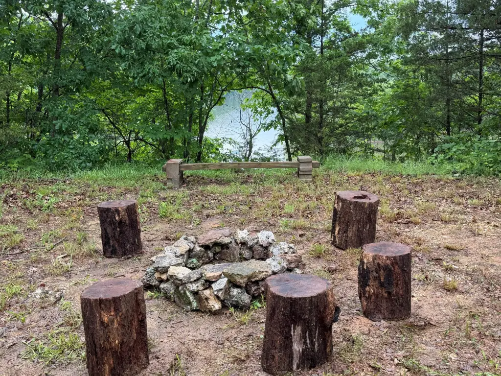
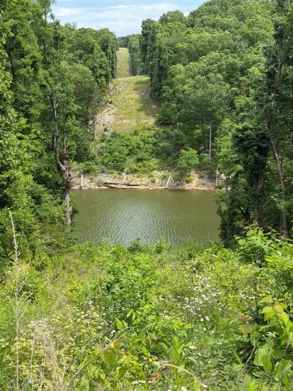
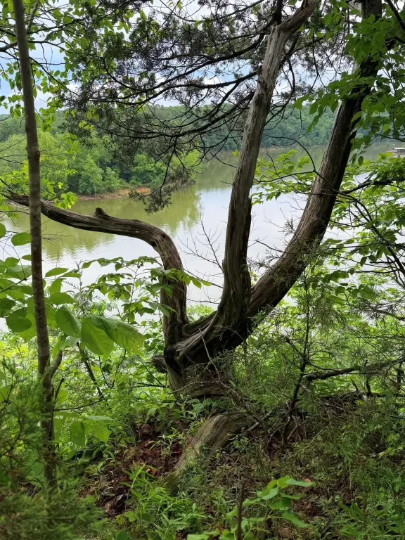
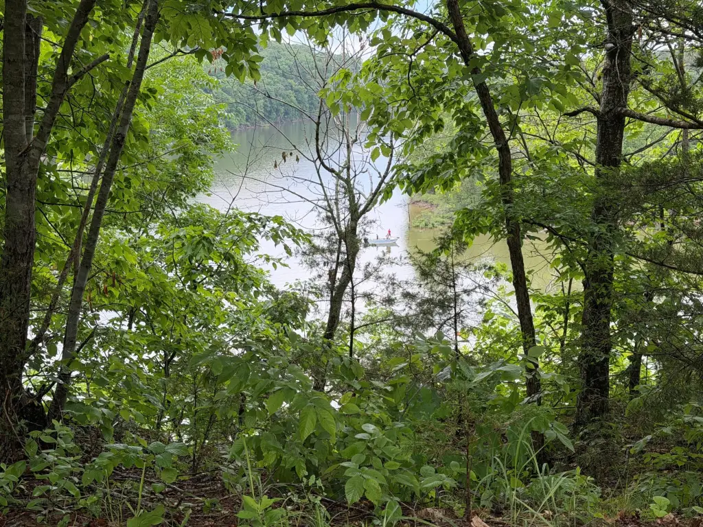
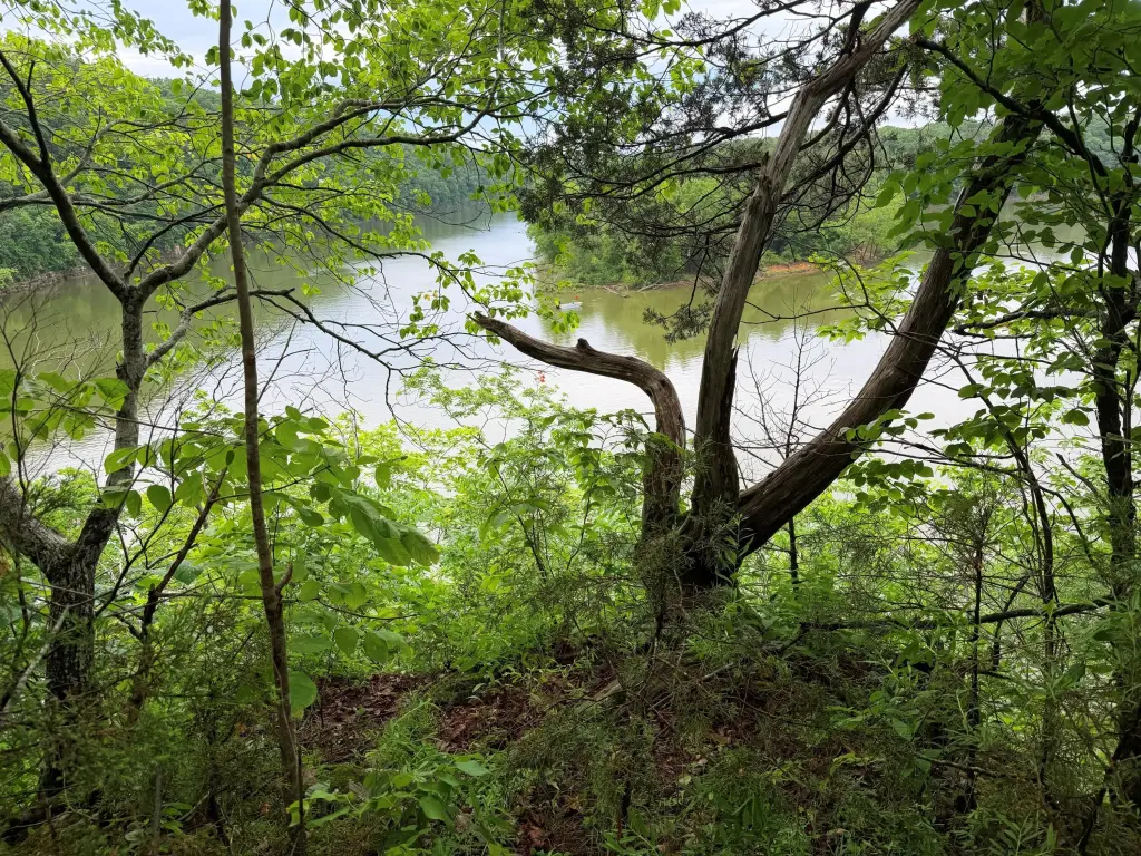
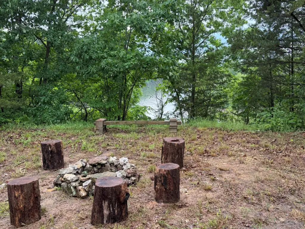
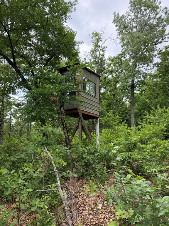
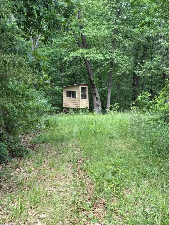
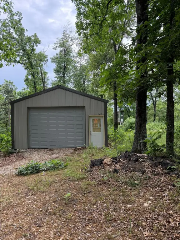
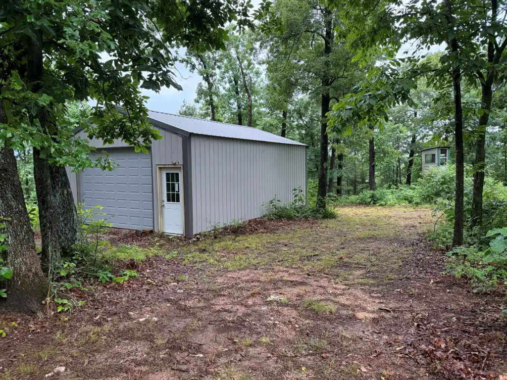
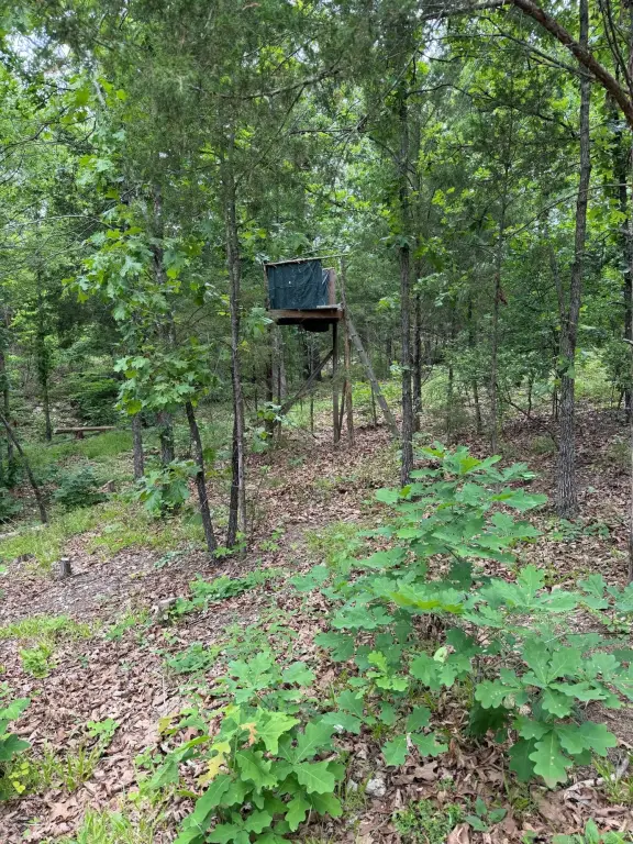
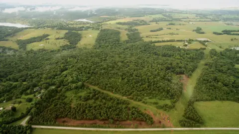
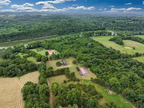
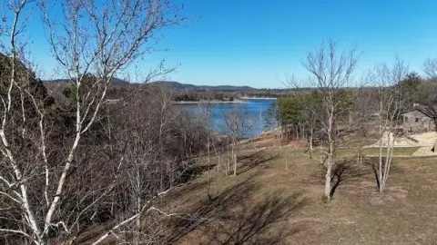
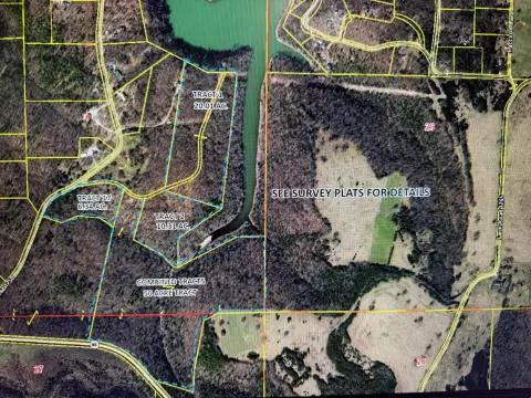
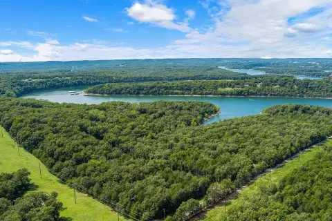
This property consists of multiple surveyed tracts totaling 86.66 acres with frontage on Table Rock Lake. The land includes approximately 4,000 feet adjoining the U.S. Army Corps of Engineers boundary and several established deer stands. Improvements include a well and a newer 20' x 30' metal building for equipment and storage.
As described, portions of the property offer building locations more than 100 feet above the lake. Nearby water access includes Eagle Rock Marina (less than 10 minutes away) and the Kings River Public Use Area boat ramp (about 10 minutes away), and Roaring River State Park is listed as less than 20 minutes away. Table Rock Airport is listed as less than 10 minutes away if flying.
The tracts may be marketed individually or collectively under the parent listing.
Key Highlights
- 86.66‑acre tract with lake frontage on Table Rock Lake across multiple surveyed tracts
- Includes approx. 4,000 ft adjoining the U.S. Army Corps of Engineers boundary on Table Rock Lake
- Multiple building locations, with some sites more than 100 ft above the lake
Property Analytics
Property Profile
Current Use
Location Intelligence
Trade Area within ½ mile
4
Businesses Nearby
Explore this area
Business Placement
Demographics for 65658, MO
1,026
Population
1,042
Households
1
Avg Household Size
62
Median Age
36%
College-Educated
87%
High-School Grad
19.9 sq mi
ZIP Area
52
Density / Sq Mi
$51,579
Median Household Income
$33,750
Median Earnings
$539
Median Rent
$267,900
Median Home Value

Questions? Ask Rey
Realmo’s AI knows this listing — price, zoning, demand, history. Ask anything.


Frequently Asked Questions
What type of property is this?
Waterfront Land - Tracts totaling 86.66 acres with lake frontage on Table Rock Lake and onsite well plus a newer metal storage building.
Where is this waterfront land located?
The property is located at Farm Road 1250 Golden, MO.
What is the asking price?
The asking price for this property is $1,040,000.
What are key features of this property?
This property features: 86.66‑acre tract with lake frontage on Table Rock Lake across multiple surveyed tracts; Includes approx. 4,000 ft adjoining the U.S. Army Corps of Engineers boundary on Table Rock Lake; Multiple building locations, with some sites more than 100 ft above the lake


