Agricultural Land with Mineral
County Road 366 Era, TX 76238
County Road 366, Era, TX, 76238
$2,000,000
For Sale
$2,000,000
LAND - Era, TX
Lot Size115.27 Acres
Days on Market15
Property Features for County Road 366
General Information
- Property type
- Land
- Property subtype
- Other
- Vegetation
- Grassed, Crops
- Fencing
- Fenced
- Standard status
- Active
- APN
- 23224
- Lot size
- 115.27 Acres
Taxes and HOA fees
- Tax Description
- CLARK J 0195 ACRES 115.53
- Tax Annual Amount
- 190
Utilities
- Water front features
- Creek
Listing agency
Mossy Oak Properties- Cross Timbers Land & Home, LLC
(940) 600-1313
Listed by
Jared Groce · License #0584362
(972) 931-1400
Added: Jul 8 Updated: Jul 15 at 12:57AM Checked: Jul 22 at 5:06PM
MLS# 20997764
Copyright © 2026 North Texas Real Estate Information Systems, Inc. All rights reserved. All information provided by the listing agent/broker is deemed reliable but is not guaranteed and should be independently verified.
Investment Insights
Based on property information with market context.
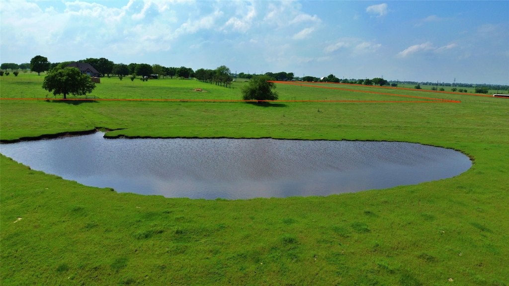
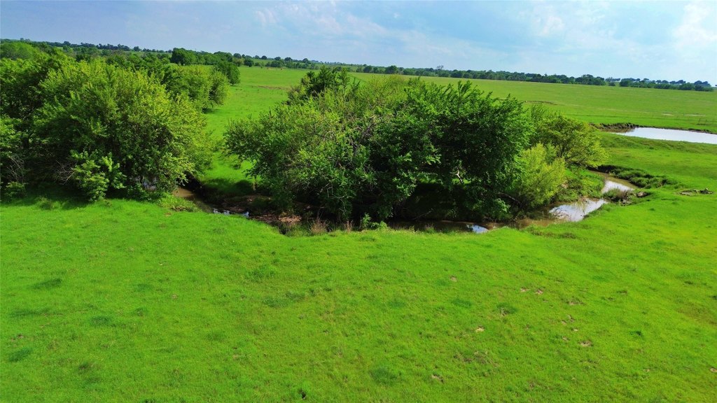
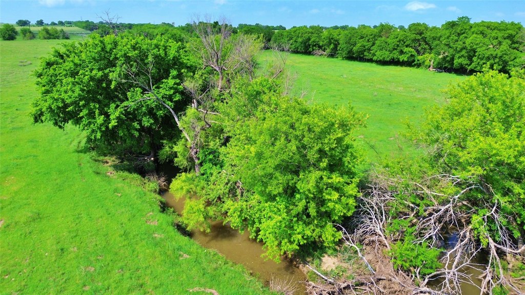
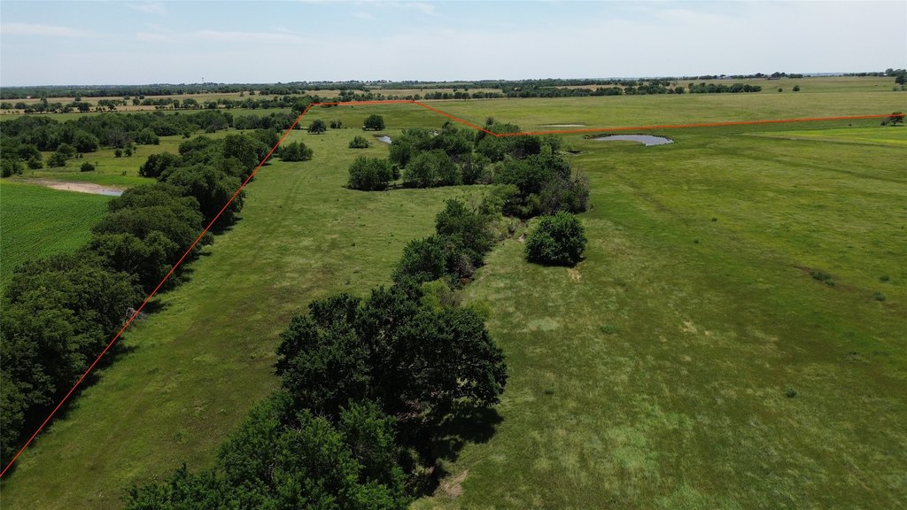
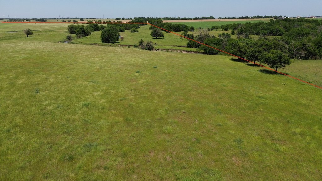
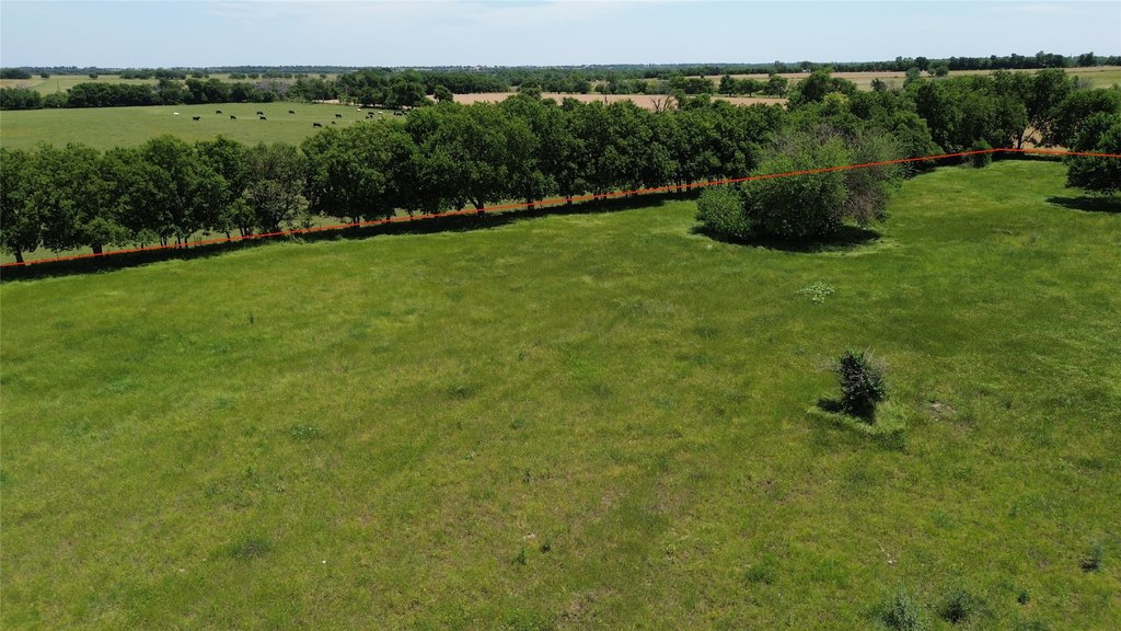
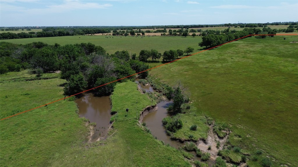
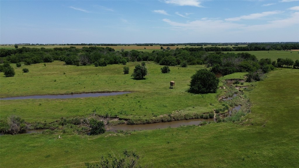
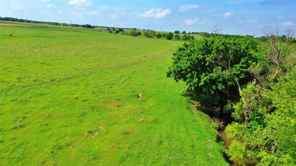
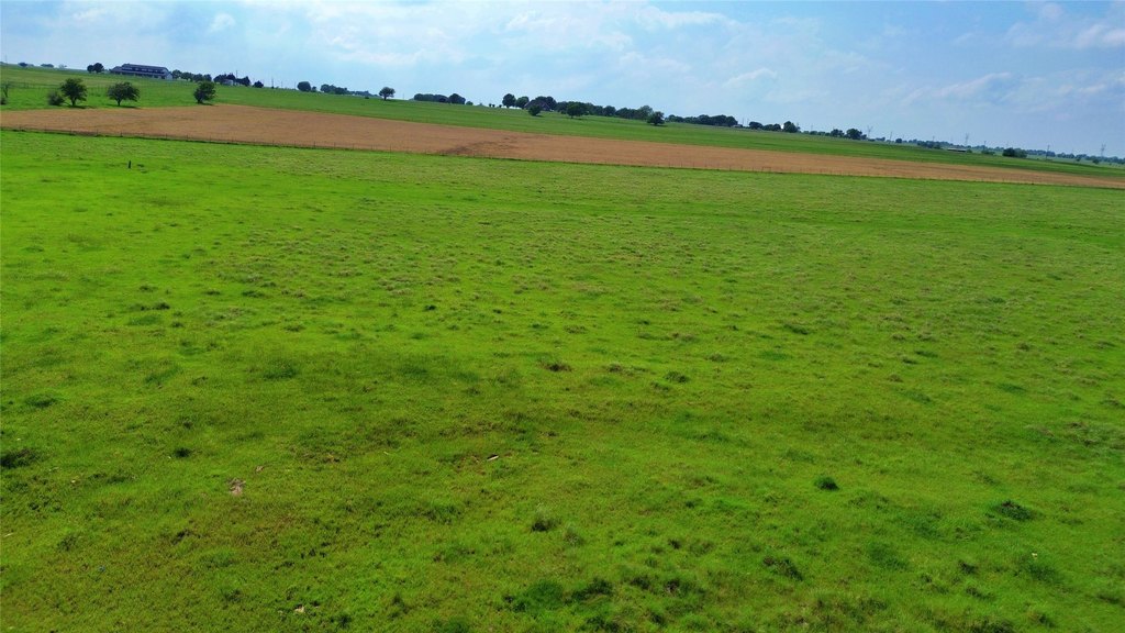
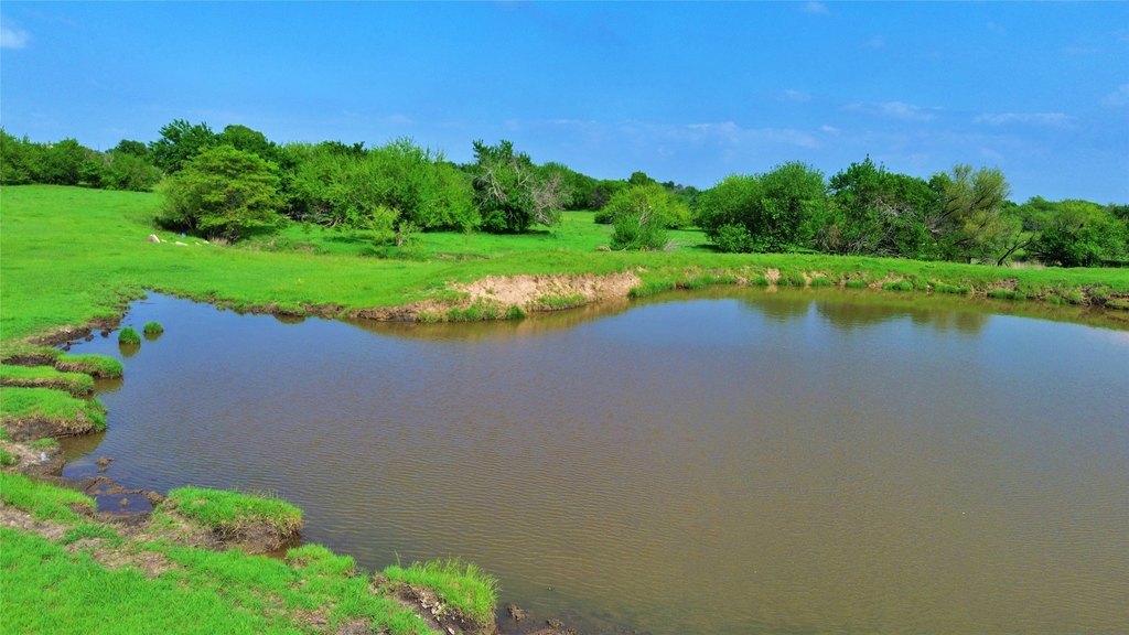
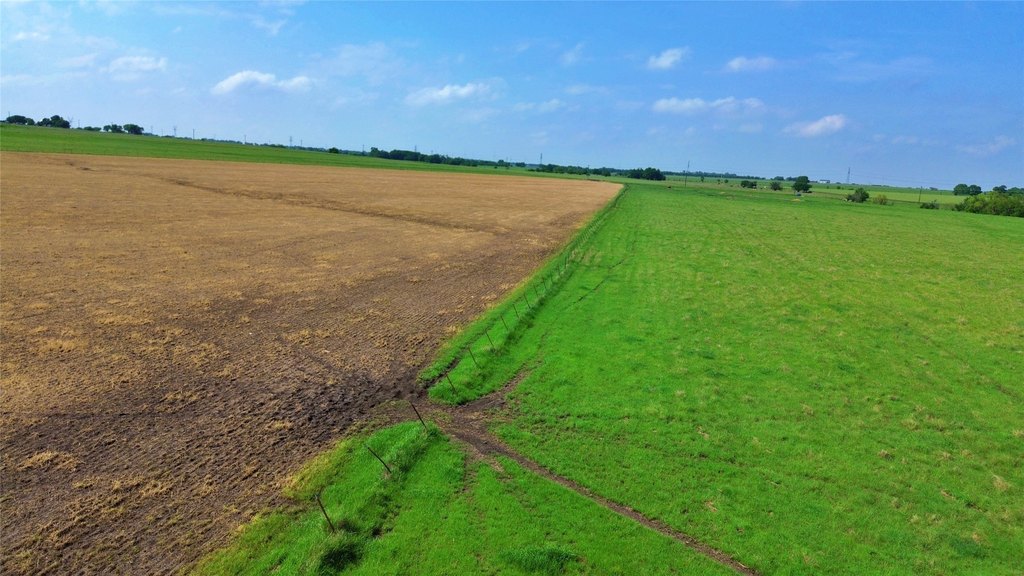
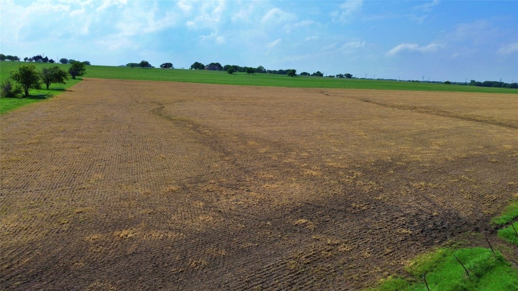
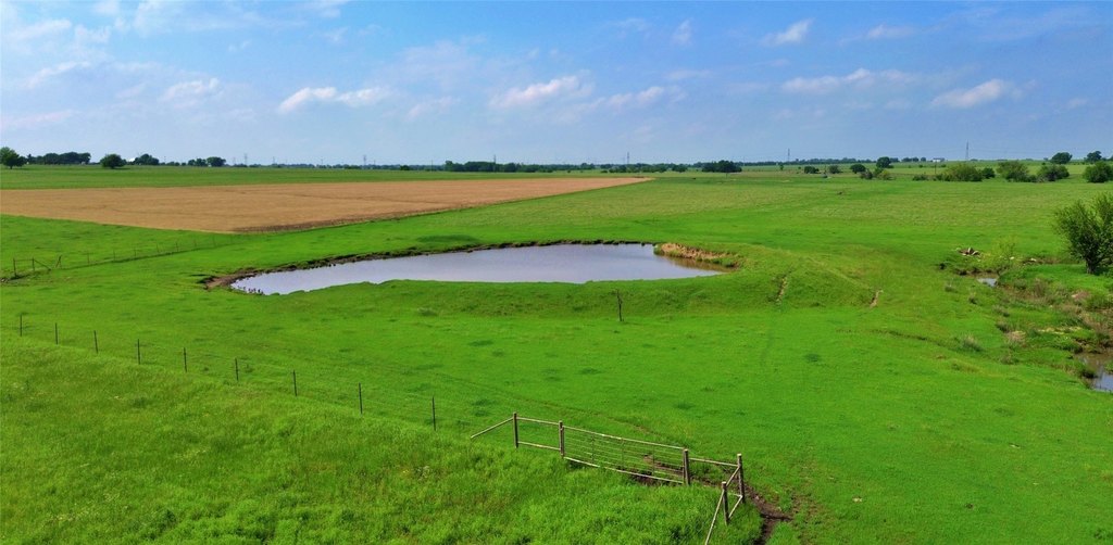
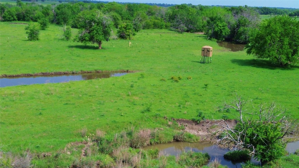
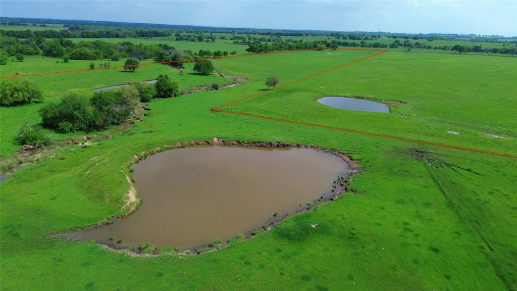
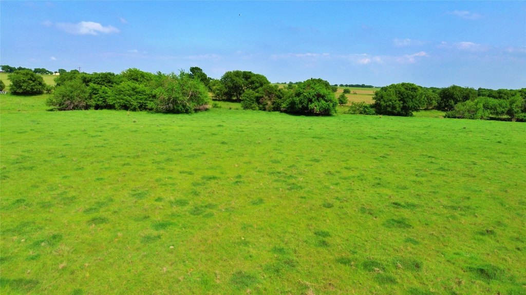
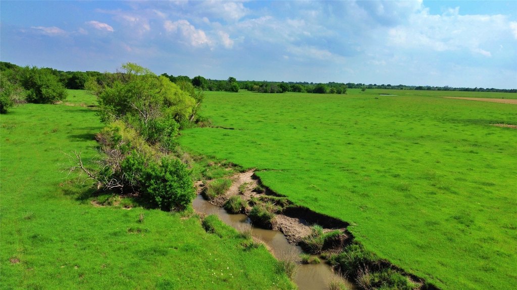
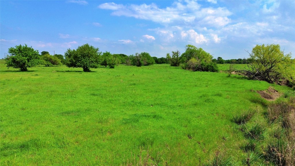
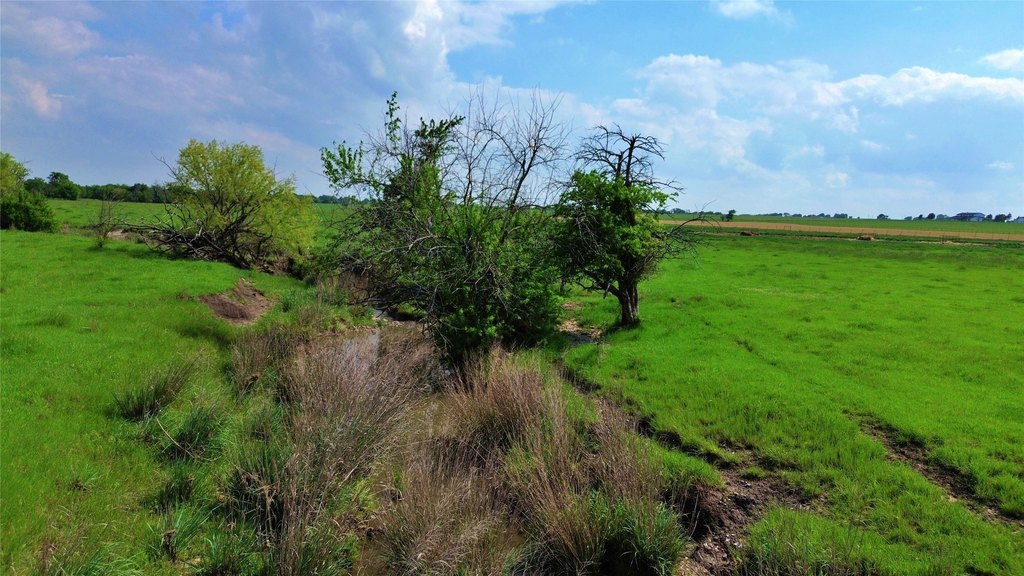
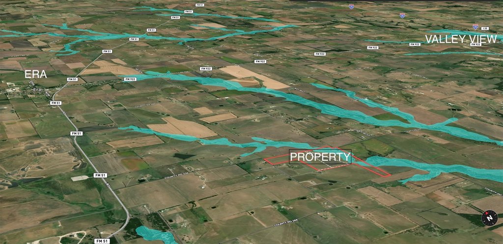
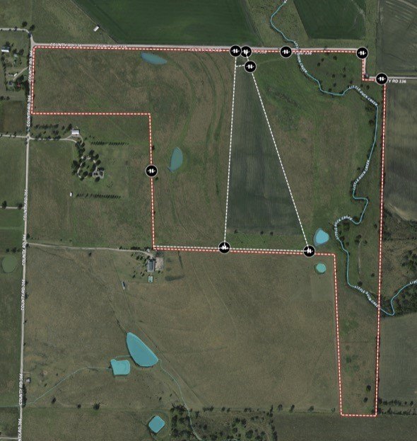
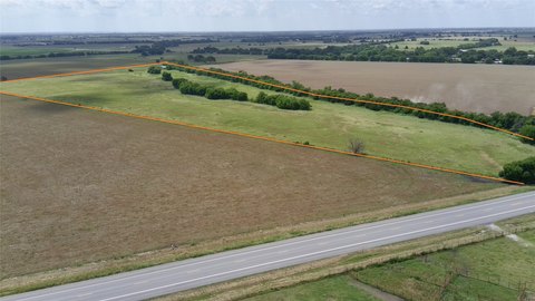
This 115+ acre Cooke County ranch is currently ag exempt and leased for cattle and farming operations. The property features Little Duck Creek frontage along much of the east side, supported by three stock ponds that provide water for livestock. Rolling elevation change runs through the land, along with well-managed grass used for agricultural production. Mineral rights are available at 100% ownership, and electricity, including three-phase service, is available on multiple sides of the property.
The ranch offers extensive road frontage, with more than 4,000 feet along County Roads 366 and 336. Electric lines are located on three sides, and the property has no water lines in the area. For residential water use, a well would be needed; nearby water wells are reportedly in the 220' to 500' depth range to reach the Trinity Aquifer. The terrain varies from roughly 800' to 870' above sea level.
For buyers seeking agricultural land in the Era area, this property provides water sources for cattle and an established grass base while maintaining flexibility for future farming and ranching operations. The farming lease is in place and expires August 1, 2025, which may be a consideration for timing and transition planning.
Key Highlights
- 115+-acre Cooke County ranch with road frontage on multiple roads and 4,000+ ft of county road frontage on CR 366 & CR 336
- Little Duck Creek frontage along the east side plus 3 stock ponds for water on the property
- Ag exempt and currently leased for cattle and farming operations; farming lease expires Aug 1, 2025
Property Analytics
Location Intelligence
Current Use by Public Records
Ranches
Similar For Sale Nearby

FAQs
What type of property is this?
Ranch - Cooke County ranch with cattle and farming lease, creek frontage, stock ponds, and electricity on multiple sides.
Where is this ranch located?
The property is located at County Road 366 Era, TX.
What is the asking price?
The asking price for this property is $2,000,000.
What are key features of this property?
This property features: 115+-acre Cooke County ranch with road frontage on multiple roads and 4,000+ ft of county road frontage on CR 366 & CR 336; Little Duck Creek frontage along the east side plus 3 stock ponds for water on the property; Ag exempt and currently leased for cattle and farming operations; farming lease expires Aug 1, 2025