E Highway 3, Atoka, OK 74525
- Added:
- Jun 26, 2026
- Days on Market:
- 2
- Last Refresh:
- Jun 27 at 3:06 pm
Property Features for E Highway 3
General Information
- Property type
- Land
- Property subtype
- Other
- Zoning
- TM
- Standard status
- Active
- APN
- 0000-35-03S-14E-2-004-00
- Lot size
- 12.88 Acres
Taxes and HOA fees
- Tax Year
- 2025
- Tax Description
- 0000-35-03S-14E-2-004-00 - TR OF LAND IN NW SEC BEG NW/C (S0*01' E DIST 769' FOR POB (S0*01' E A DIST 384'(E DIST 315'(S0* 01'E DIST OF 315'(W DIST 315'(S0*01' E DIST OF 321.59'(S90*02'E775' (N0*01' W 793.63' TO HWY R/W (N73*42' W 807.3' TO POB (LESS 1 AC IN NW/C OF SW NW NW LYING S OF HWY 3 SEC 35-3S-14E
- Tax Annual Amount
- 10

Listing agent Clay Cecil License #0794883 (888) 893-3537
Listing office Epique Realty 8211 E Regal Pl, Tulsa, OK (888) 893-3537
Listing date Jun 26, 2026
Copyright © 2026 MLS Technology, Inc. All rights reserved. All information provided by the listing agent/broker is deemed reliable but is not guaranteed and should be independently verified.
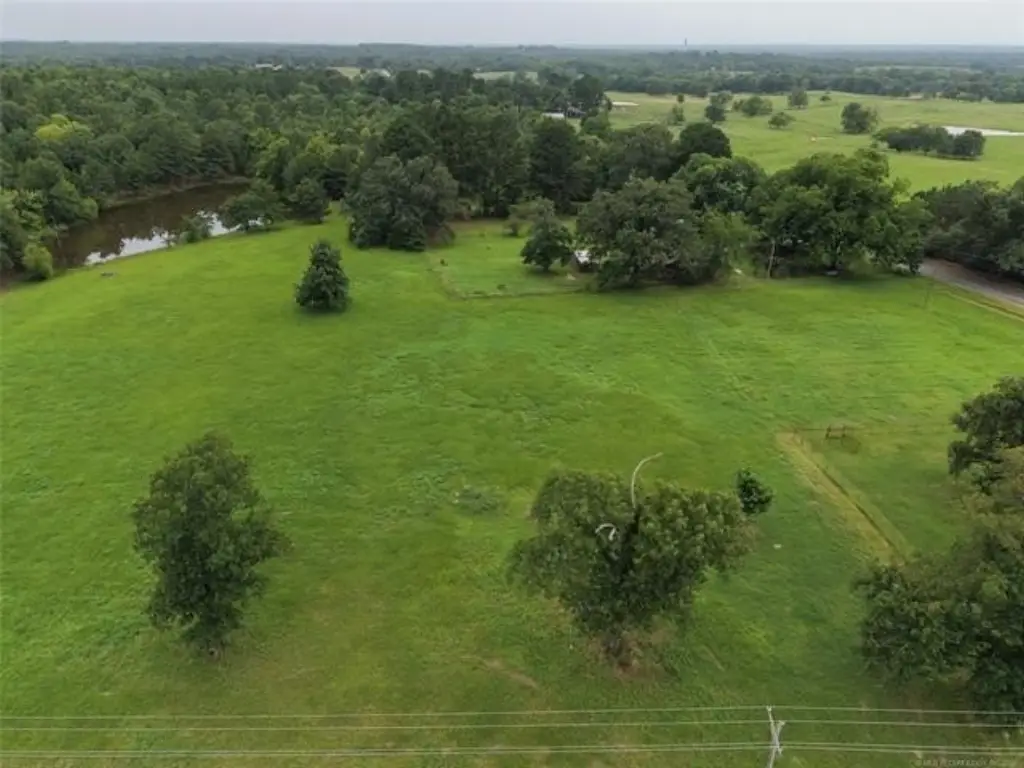
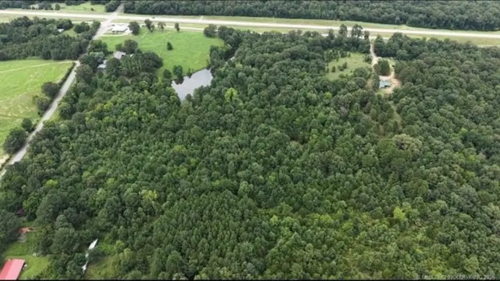
HighLights
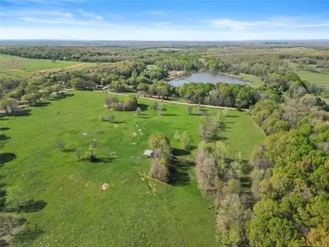
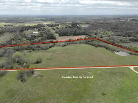
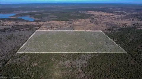
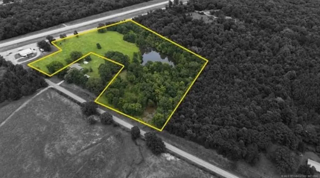
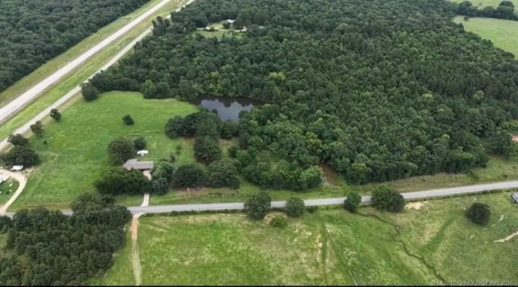
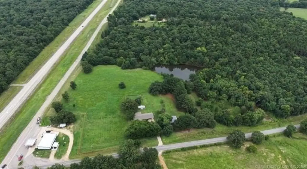
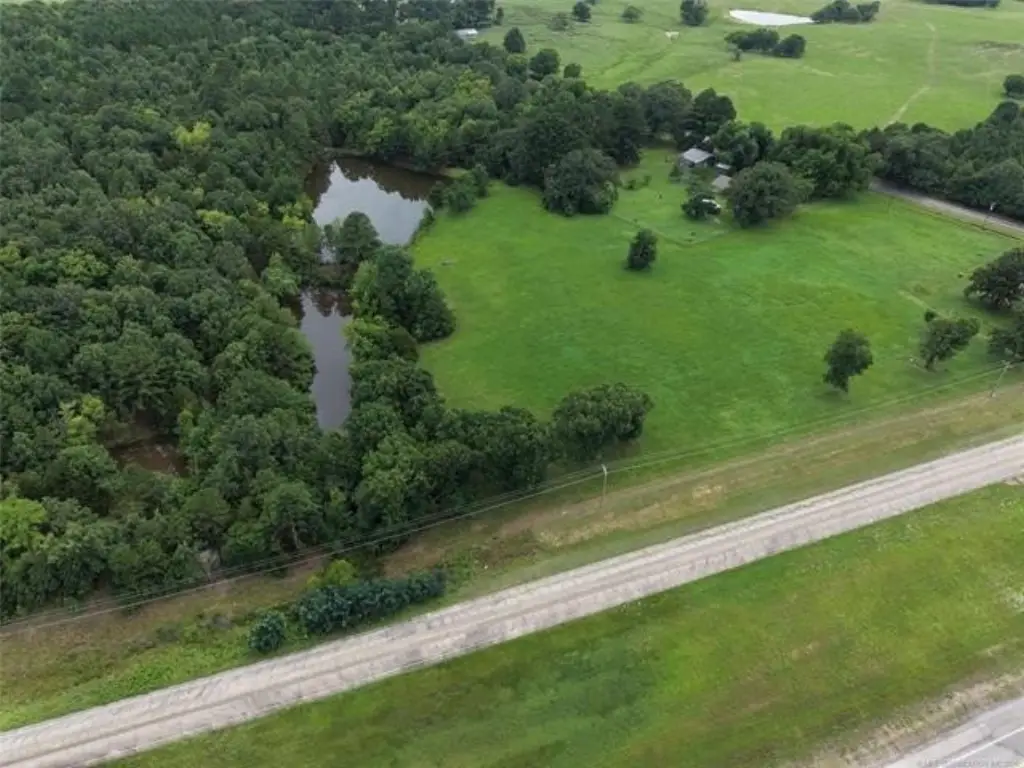
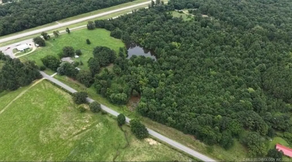
- 12.88 acres MOL with frontage on Highway 3, located between Atoka and Antlers.
- Tract sits atop a hill with visibility from both directions along a major travel corridor.
- Adjacent to an existing convenience store/gas station on Highway 3.
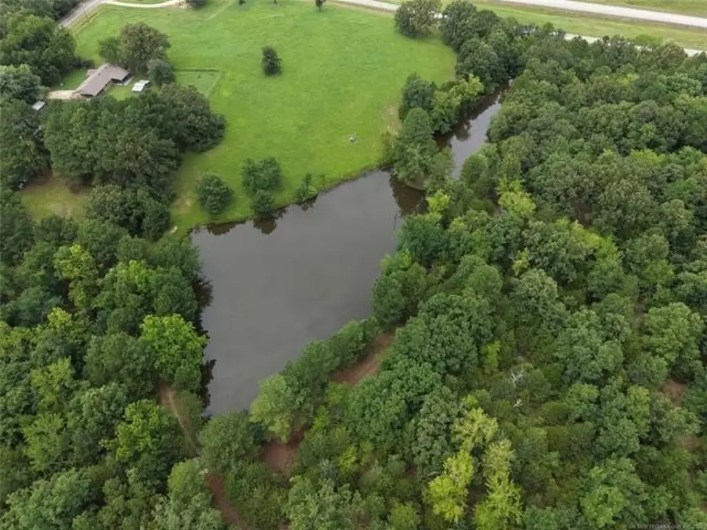
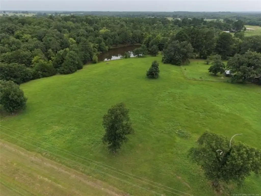
- Includes a large pond with visual appeal and recreational potential.
- Suitable for highway‑oriented uses such as an RV park or campground.
Overview
The tract has frontage on Highway 3 and is positioned between Atoka and Antlers. With access off this major travel corridor and hillside placement, the property is set up for visibility from both directions along Highway 3. The combination of road frontage, elevation, and the pond can help support users that want both exposure and an attractive onsite amenity.
Given the stated suitability for RV park/campground use, as well as truck/RV storage, retail, restaurant, hospitality, or other highway-oriented commercial development, the land may fit investors or operators looking for a flexible site. Zoning is listed as TM, and the buyer should verify zoning, utility availability, and intended use prior to moving forward.
Current Use by Public Records
Map
- City
- Atoka
- County
- Atoka
- State
- Oklahoma
- Longitude
- -96.127612
- Latitude
- 34.385997