Waterfront Recreation
Darling Hill Road Lyndon, VT 05849
Darling Hill Road, Lyndon, VT, 05849
$395,000
For Sale
$395,000
LAND - Lyndon, VT
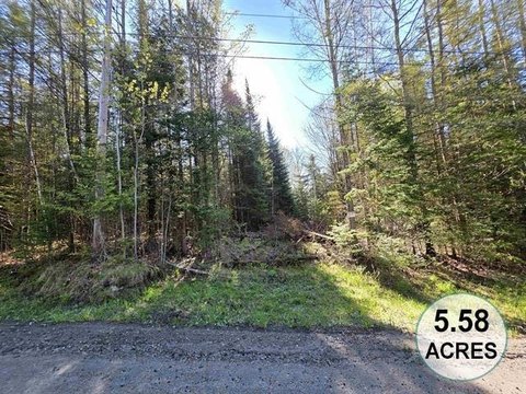
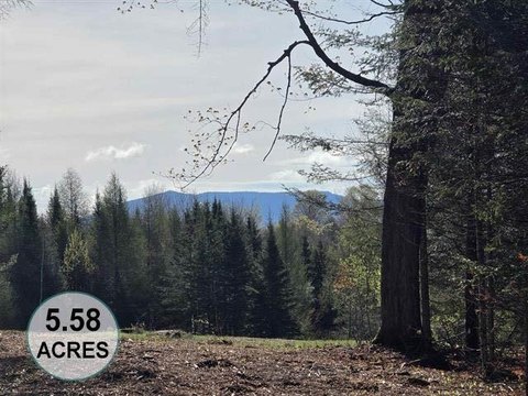
Lot Size20.00 Acres
Days on Market268
Property Features for Darling Hill Road
General Information
- Property type
- Land
- Property subtype
- Other
- Zoning
- Rural Residential
- Standard status
- Active
- Lot size
- 20.00 Acres
Taxes and HOA fees
- Tax Year
- 2025
- Tax Annual Amount
- 754
Utilities
- Sewer type
- Septic Needed
- Water source
- Well Needed
- Water front
- 1
Listing Agency
Century 21 Farm & Forest
(802) 334-1200
34 Up North Dr, Derby, VT
Listed by
Nicholas Maclure
(802) 334-1200
Added: Oct 26, 2025 Checked: Jul 20 at 11:06 am
MLS# 5067325
Listing URL
Copyright © 2026 PrimeMLS. All rights reserved. All information provided by the listing agent/broker is deemed reliable but is not guaranteed and should be independently verified.
Investment Insights
Based on property information with market context.
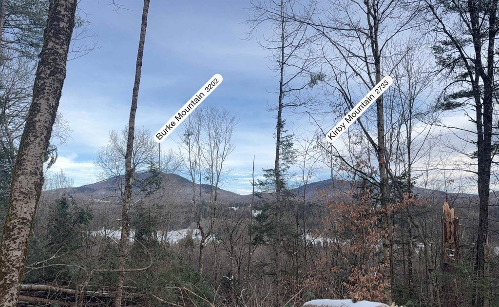
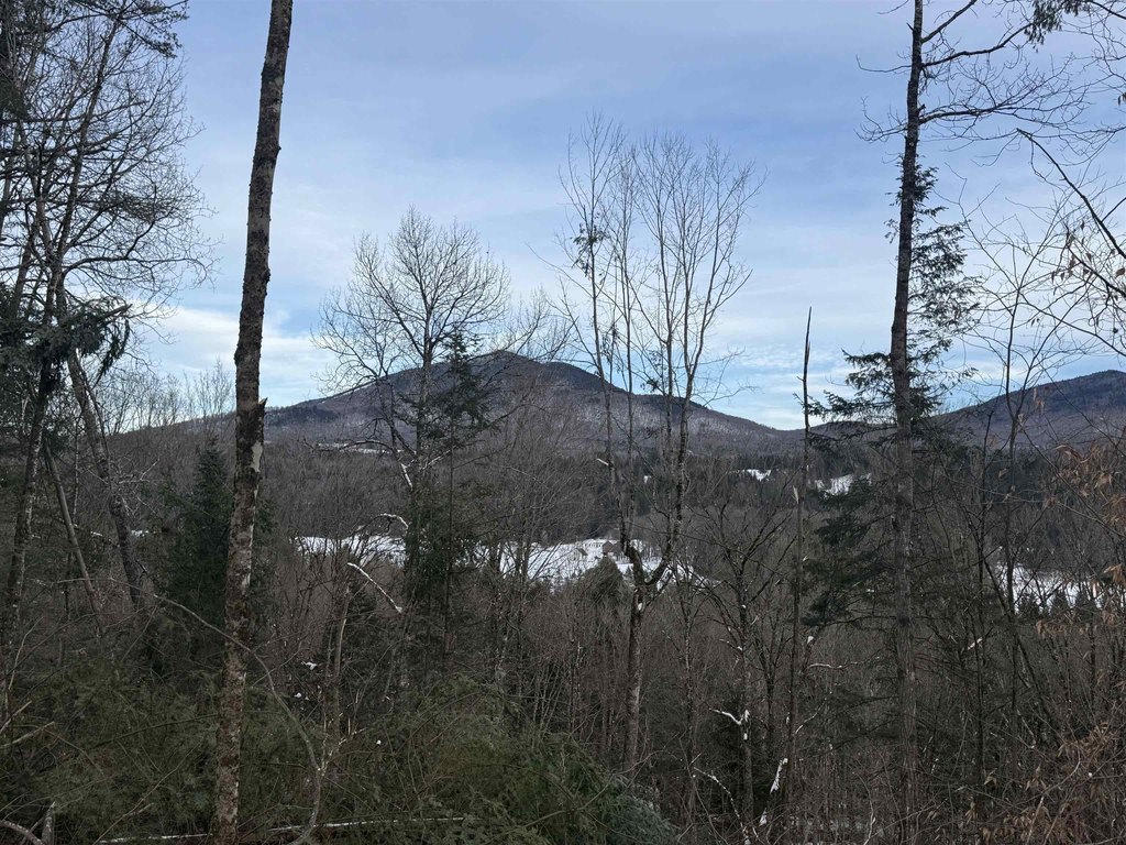
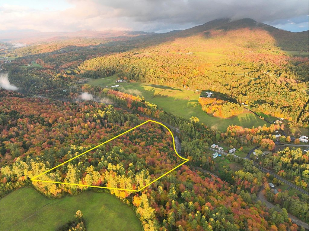
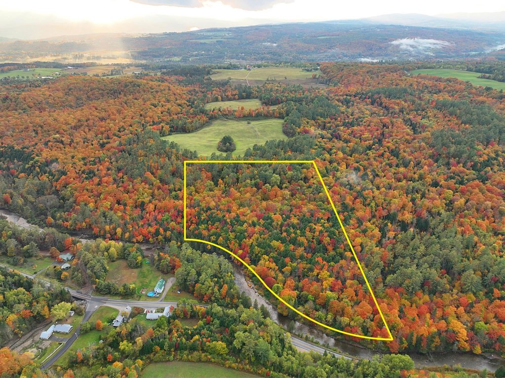
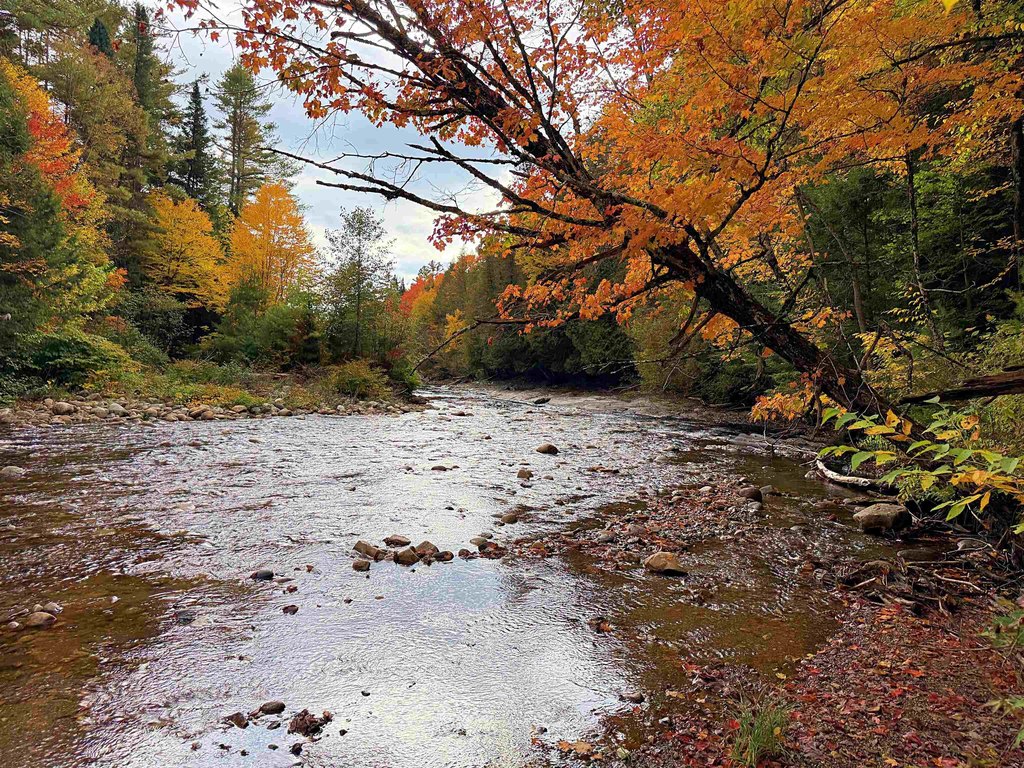
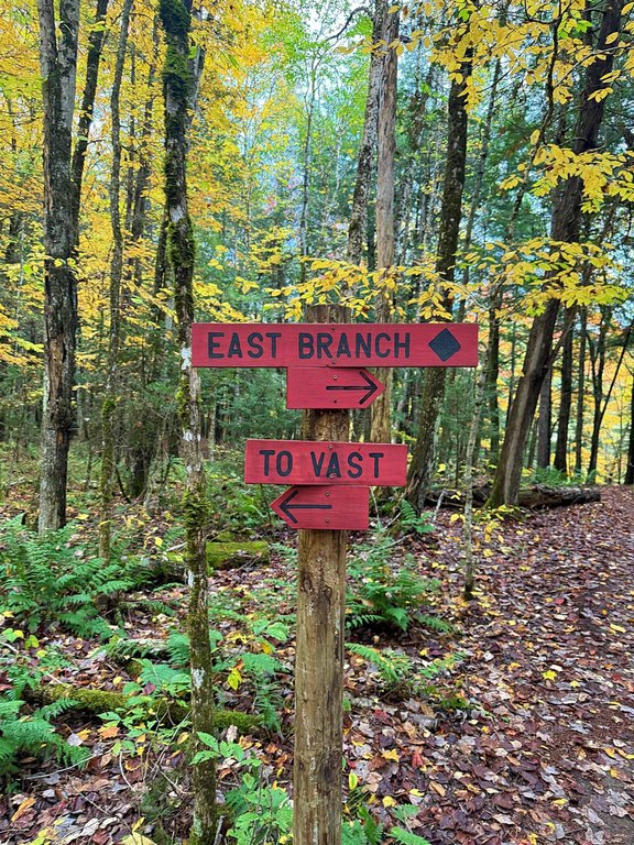
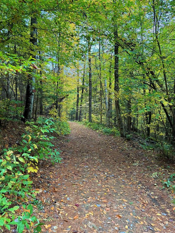
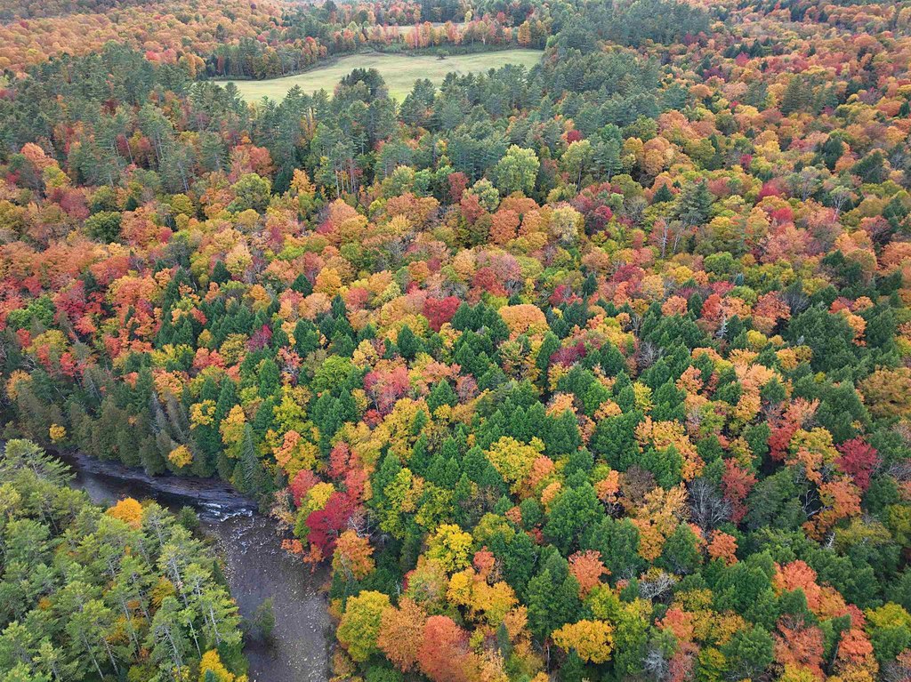
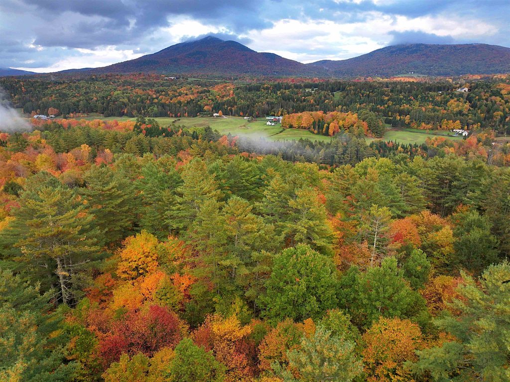
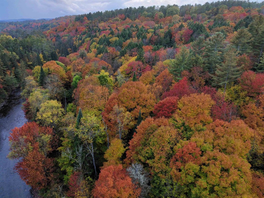
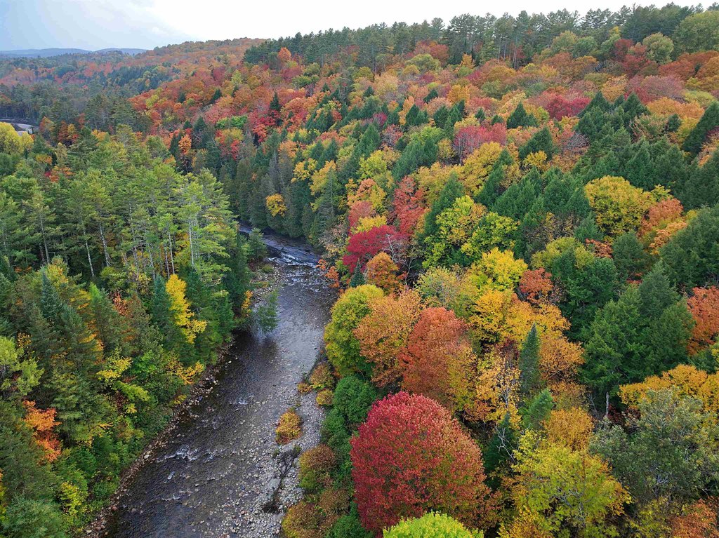
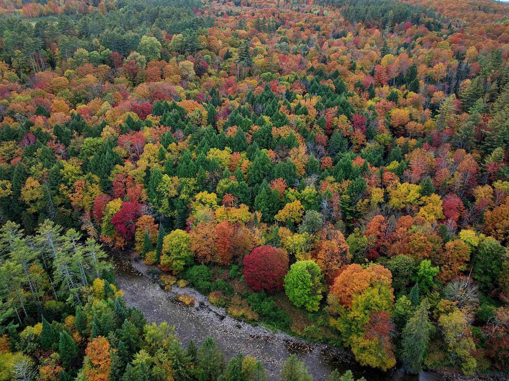
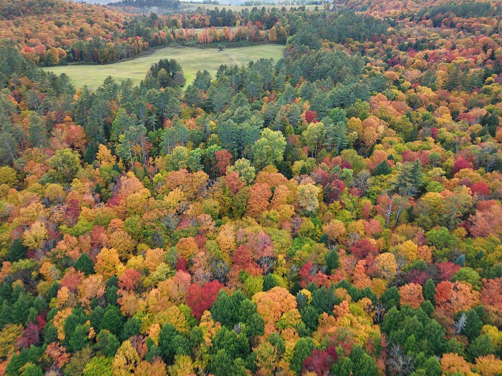
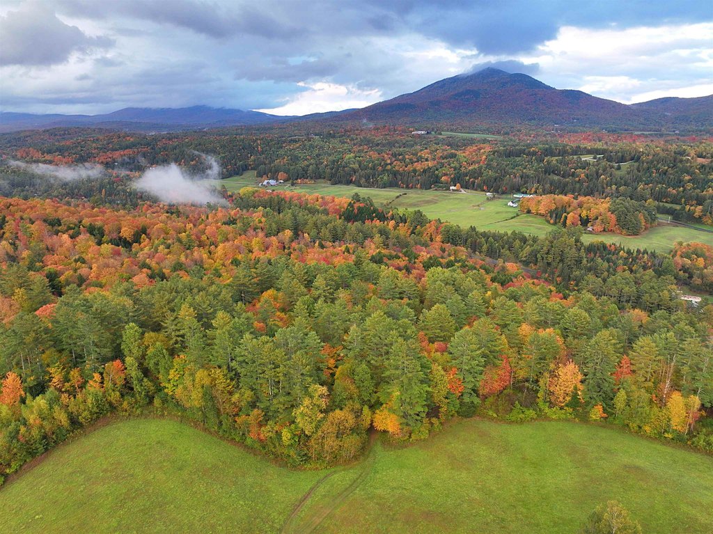
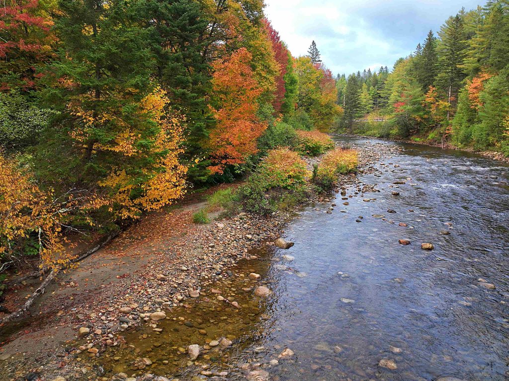
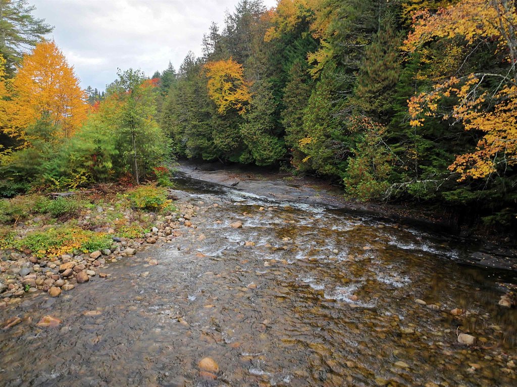
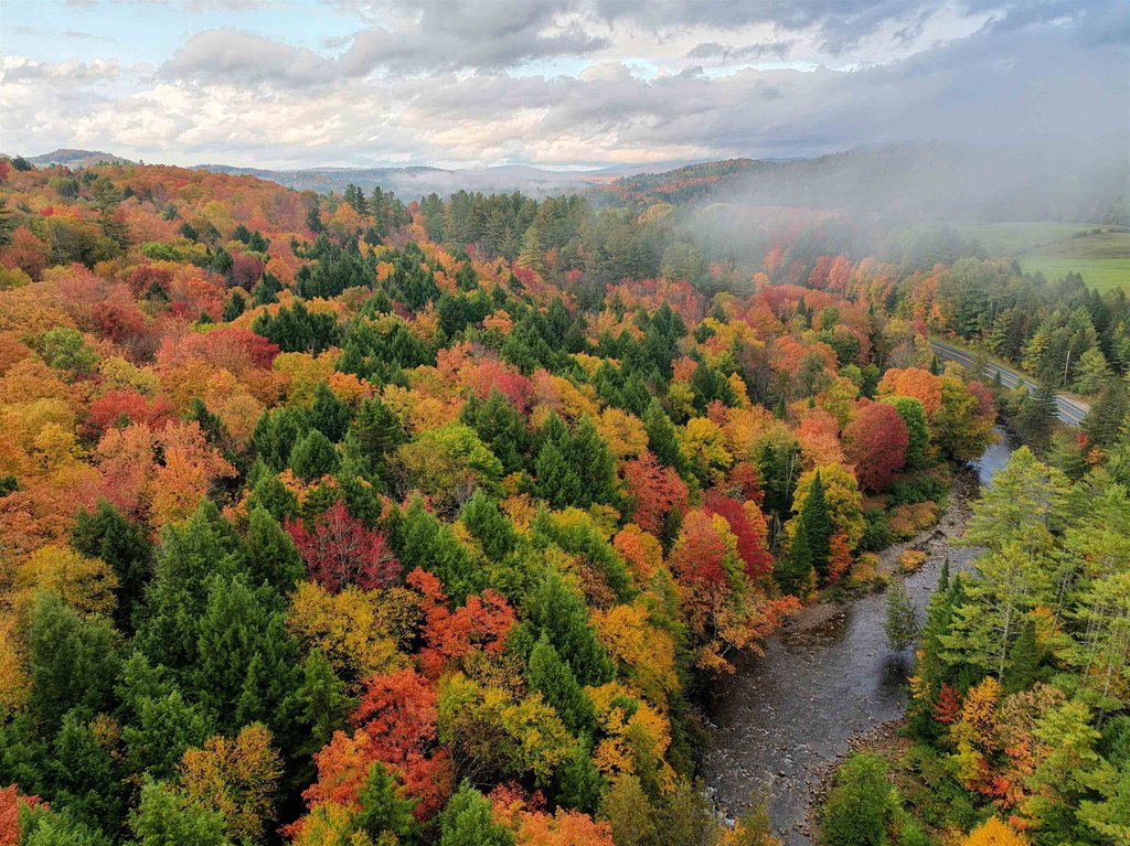
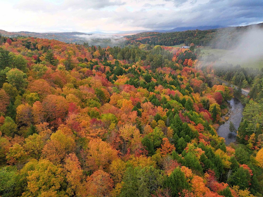
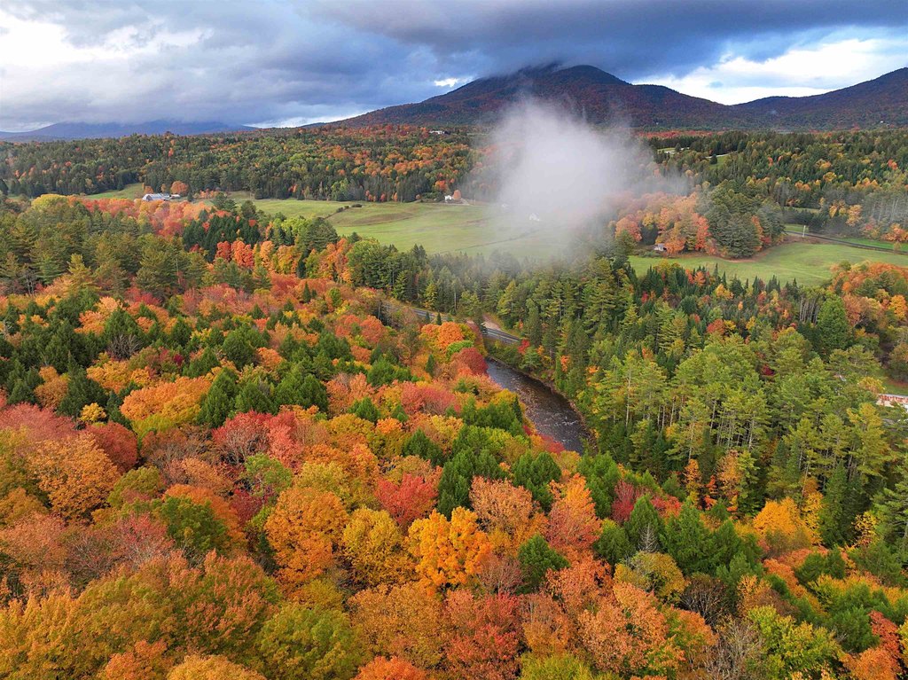
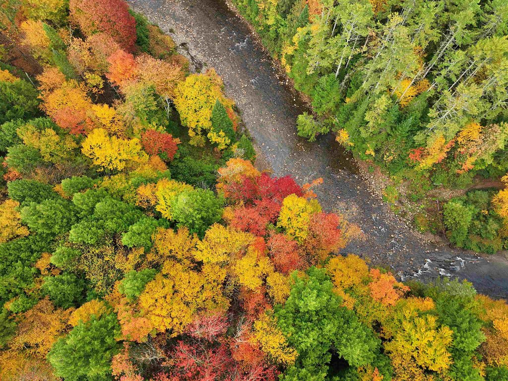
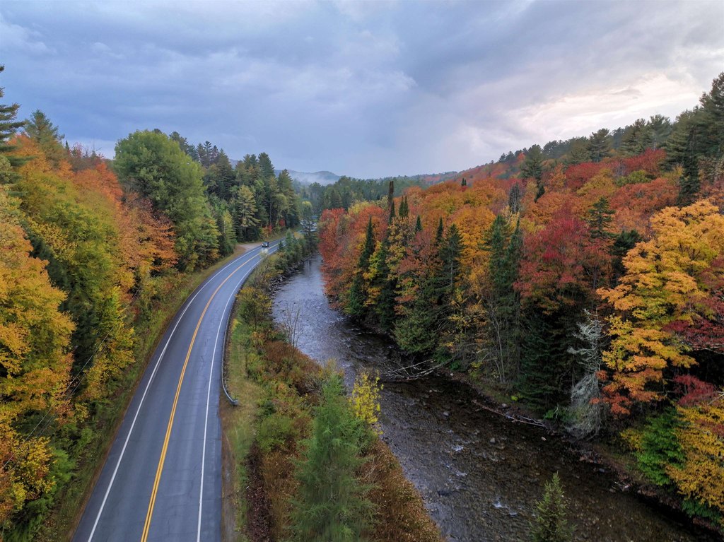
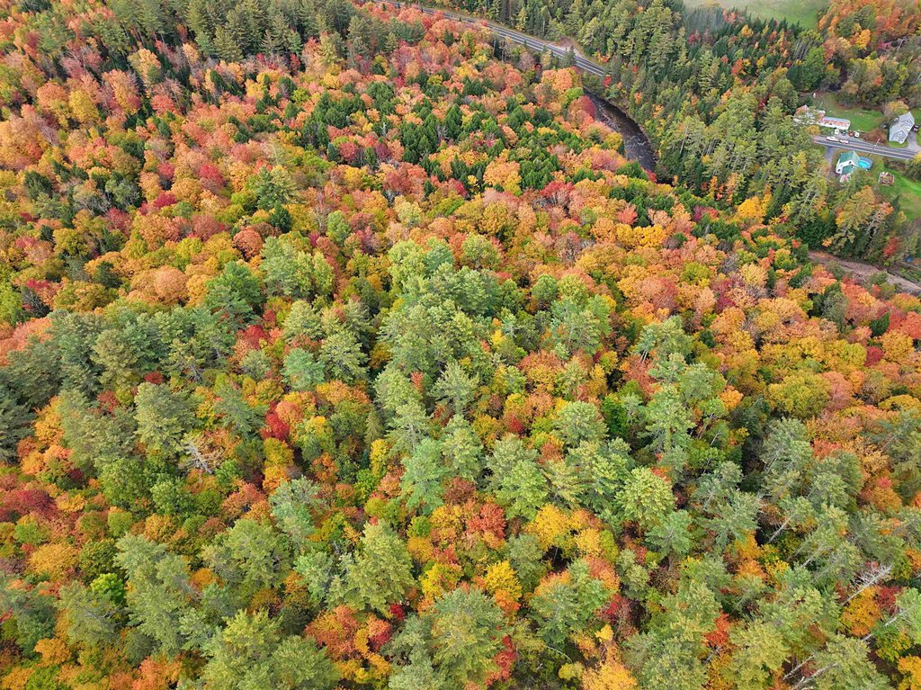
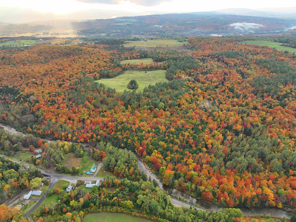
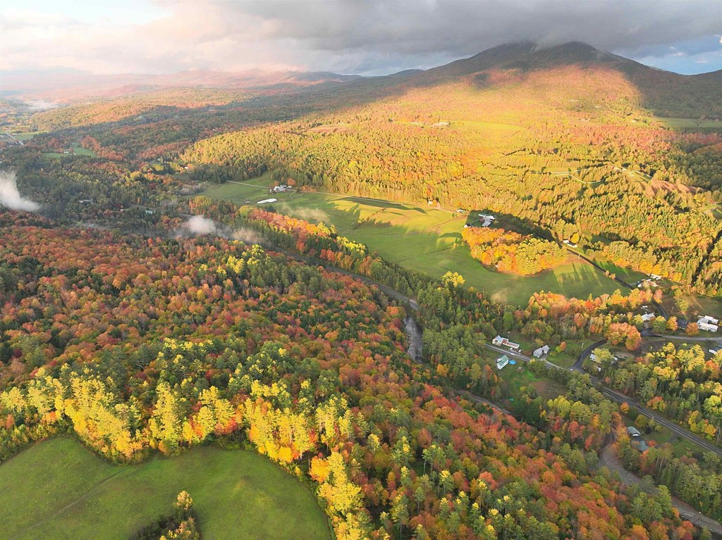
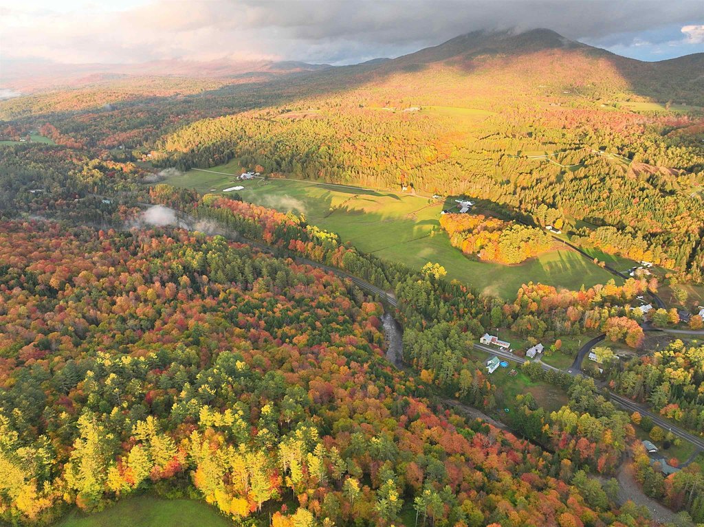
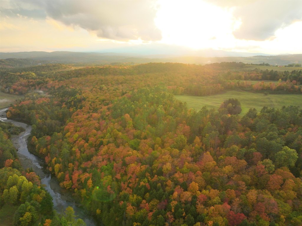
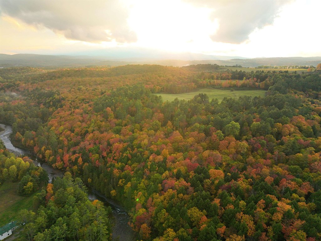
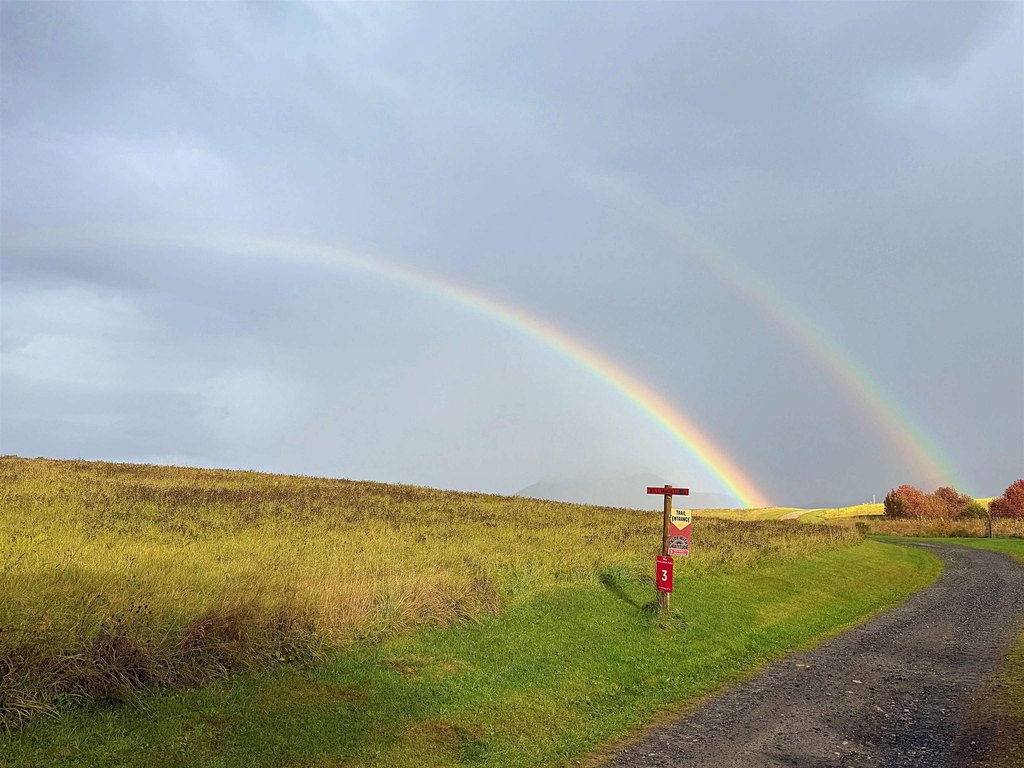
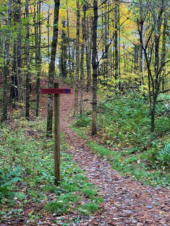
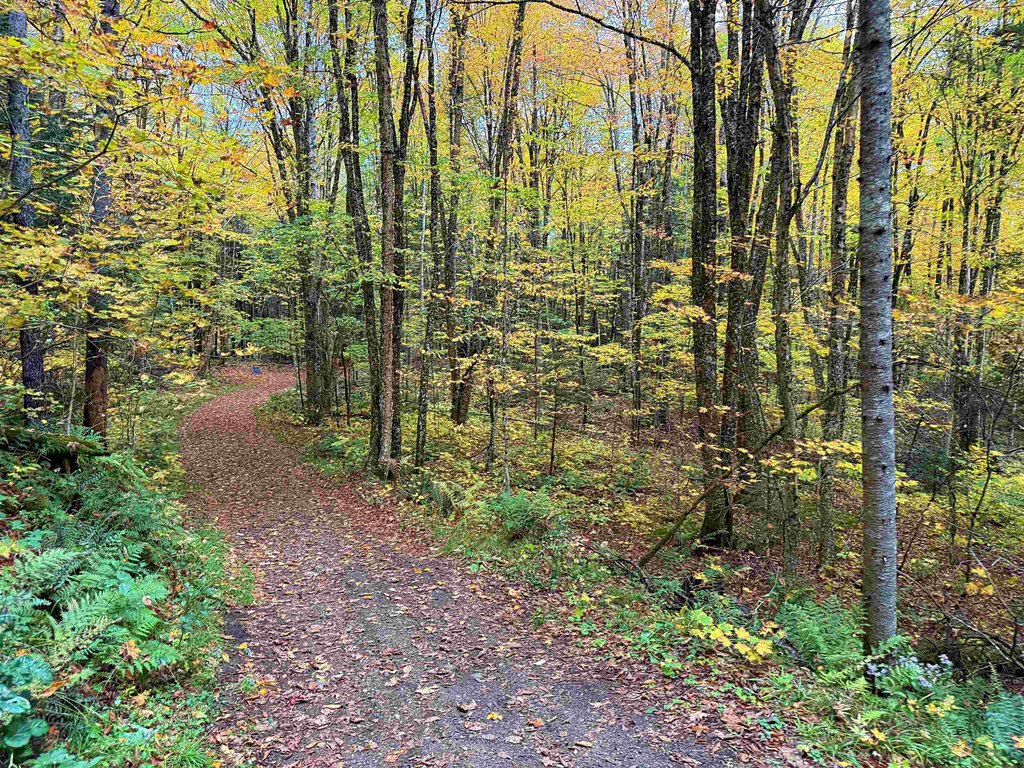
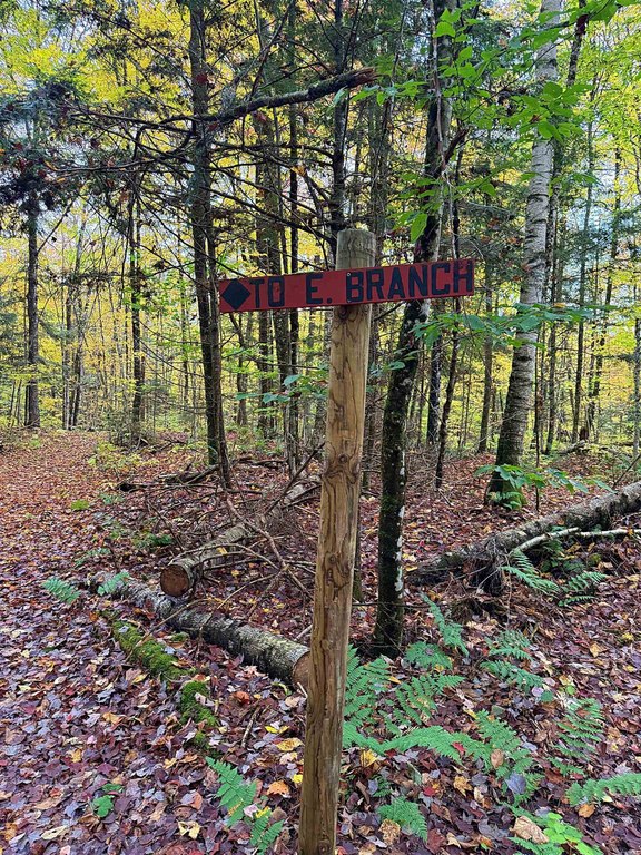
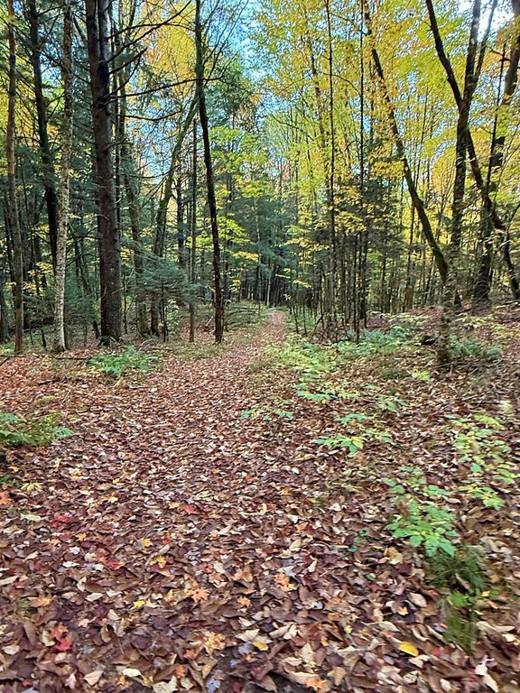
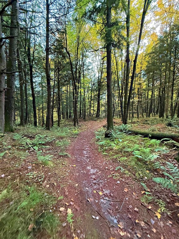
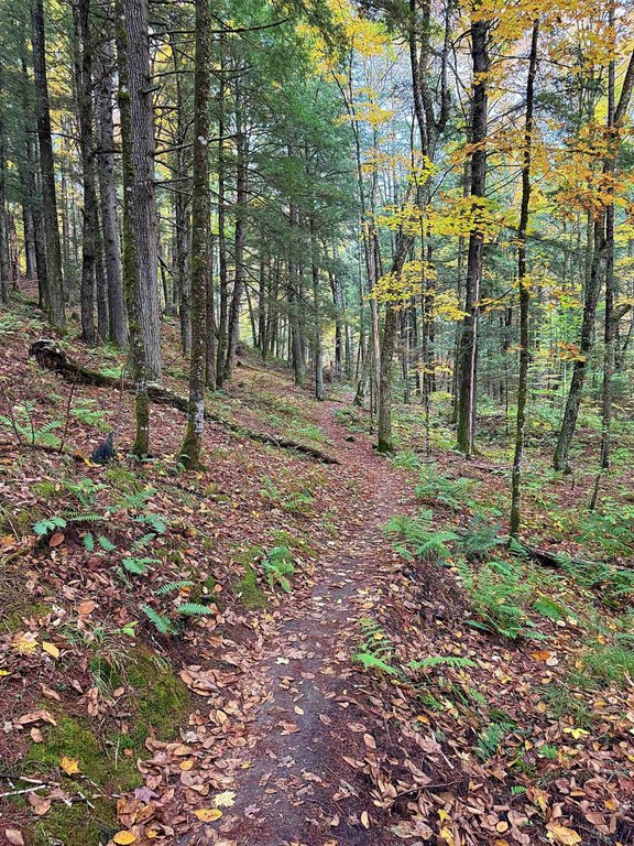
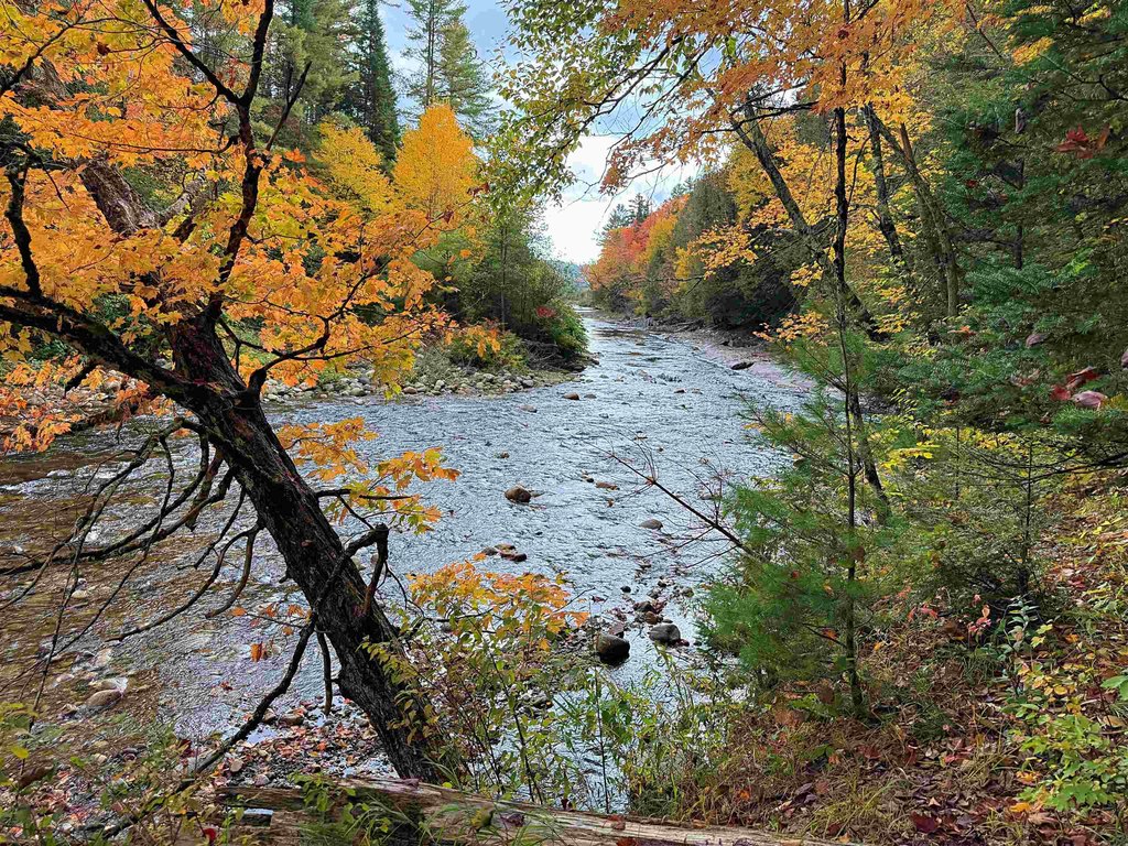
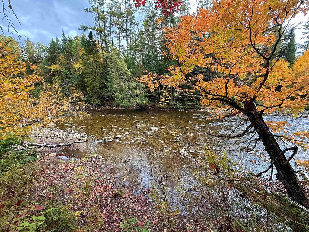
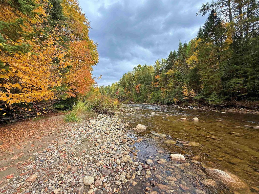
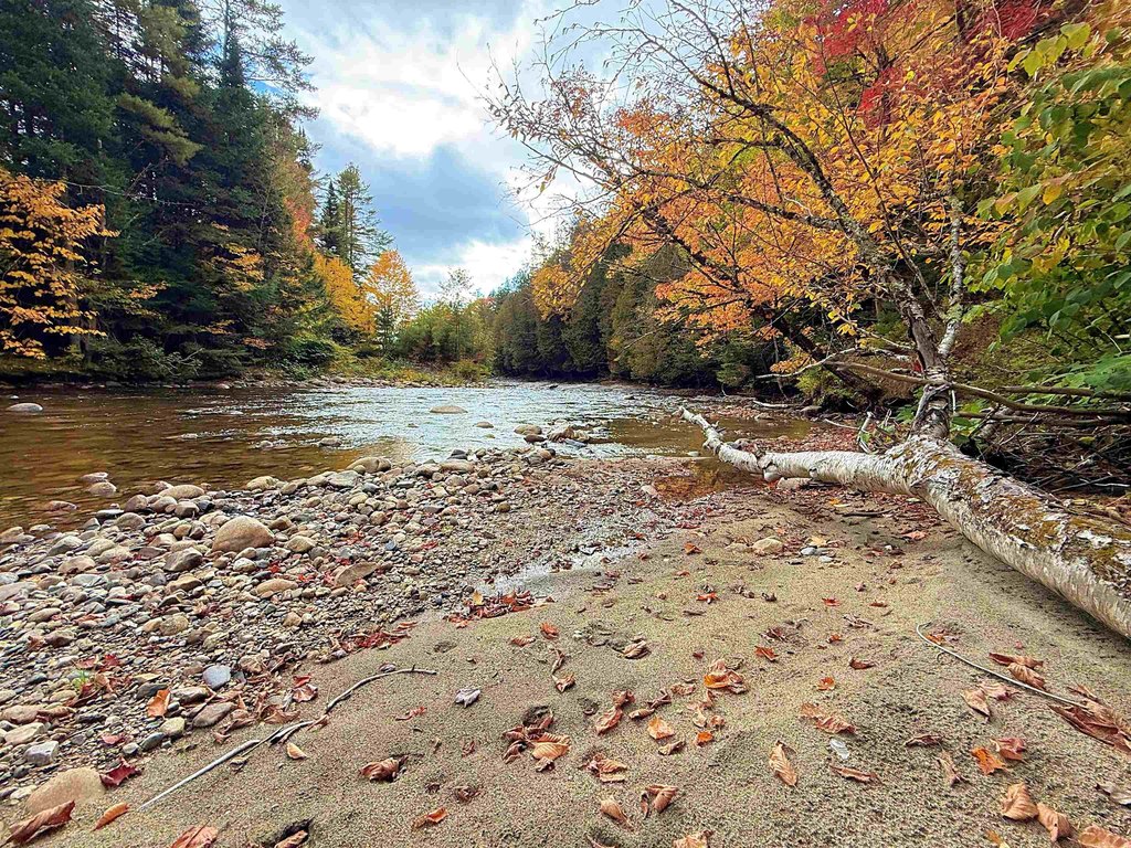
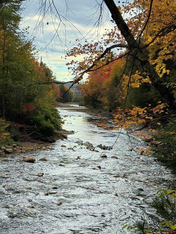
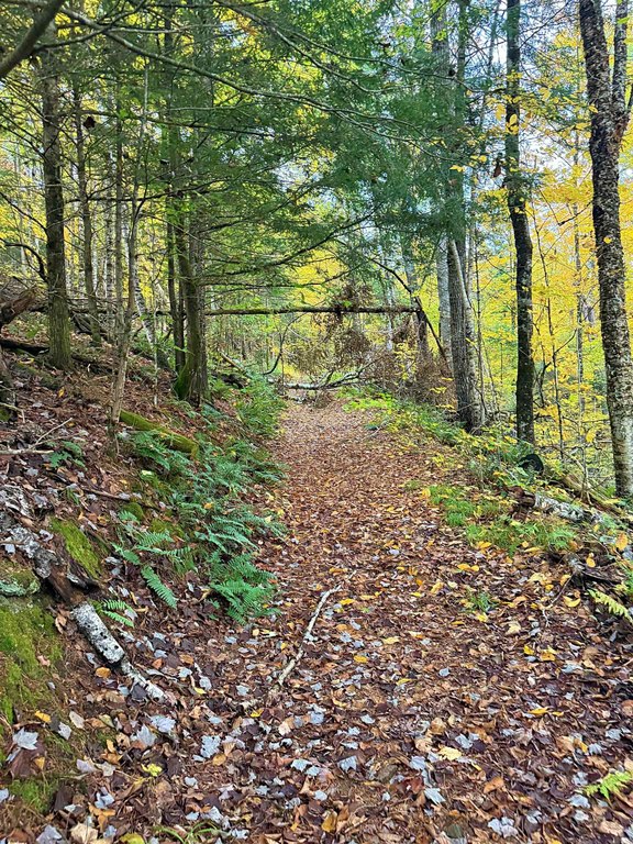
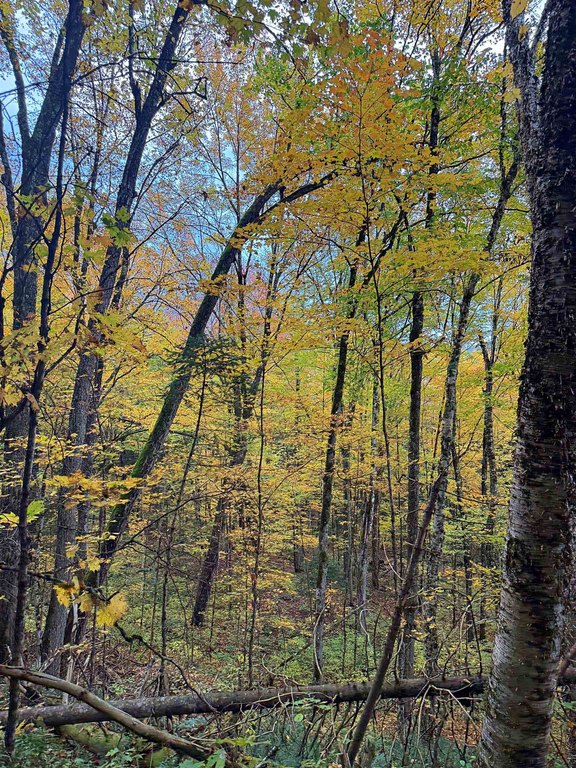
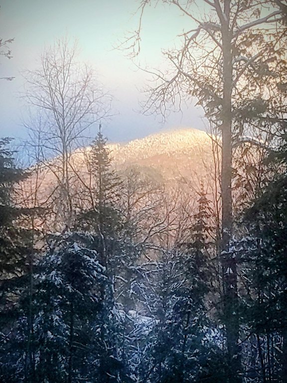
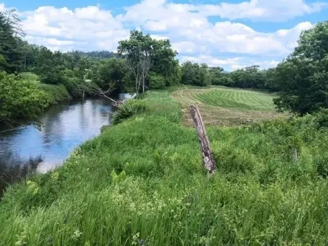
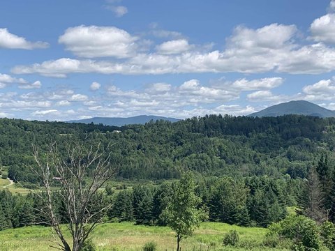
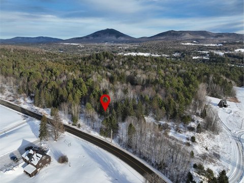
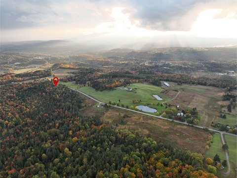
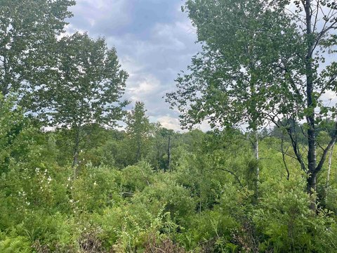
This property is approximately 20 acres of rural residential land with frontage along the East Branch of the Passumpsic River. The tract includes a long, winding right of way through the woods to the site, and the land is crossed by the Kingdom Trails Connector and East Branch Trails, with the VAST snowmobile trail also running through the area. The listing notes that selective cutting may open views of Burke Mountain, and the property includes marketable timber.
The parcel is described as being surrounded by 226 acres of conserved land on Heaven’s Bench, supporting privacy and a natural setting. Trail access is a central feature, with connectivity to the Kingdom Trail network and winter recreation via VAST. An engineer has been engaged to complete soil testing, and a septic design is to be completed and provided at closing.
For buyers planning a private retreat or a year-round recreation property, the combination of river frontage and established trail crossings offers direct outdoor access on-site. Because the septic design and soil testing are in progress with delivery at closing, the property supports next-step planning for residential development while keeping requirements aligned with the available engineering work. The rural residential zoning also aligns with use as a home site, subject to buyer due diligence and approvals.
Key Highlights
- Frontage along the East Branch of the Passumpsic River
- Crossed by the Kingdom Trails Connector and East Branch Trails, plus the VAST snowmobile trail
- Surrounded by 226 acres of conserved land on Heaven's Bench
Property Analytics
Location Intelligence
Current Use by Public Records
Recreation land
Similar For Sale Nearby
FAQs
What type of property is this?
Recreation land - Rural residential land with river frontage and access to trail corridors for year-round outdoor recreation.
Where is this recreation land located?
The property is located at Darling Hill Road Lyndon, VT.
What is the asking price?
The asking price for this property is $395,000.
What are key features of this property?
This property features: Frontage along the East Branch of the Passumpsic River; Crossed by the Kingdom Trails Connector and East Branch Trails, plus the VAST snowmobile trail; Surrounded by 226 acres of conserved land on Heaven's Bench


