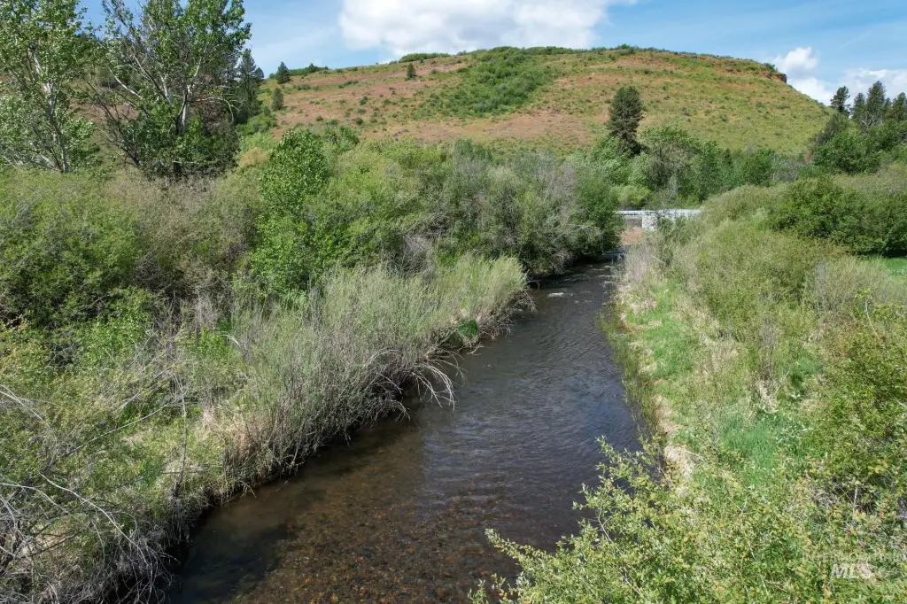
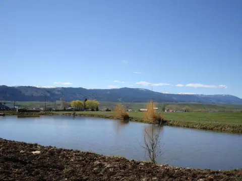
Irrigated Pasture and Creek
Council-Cuprum Road Council, ID 83612
Council-Cuprum Road, Council, ID, 83612
$600,000
For Sale
$600,000
LAND - Council, ID
Lot Size68.59 Acres
Days on Market50
Property Features for Council-Cuprum Road
General Information
- Property type
- Land
- Property subtype
- Other
- Standard status
- Active
- APN
- RP17N01W301500
- Lot size
- 68.59 Acres
Taxes and HOA fees
- Tax Year
- 2025
- Tax Description
- See Docs tab - Exhibit A Legal Description
- Tax Annual Amount
- 155
Utilities
- Utilities
- Electricity Available
- Water front features
- Creek
Listing Agency
Knipe Land Company
(208) 345-3163
860 Beacon, ID
Listed by
Curtis Hitchcock · License #AB33290
(208) 866-2825
Added: Jun 1 Checked: Jul 20 at 4:06 am
MLS# 98988632
Listing URL
Copyright © 2026 Intermountain Multiple Listing Service. All rights reserved. All information provided by the listing agent/broker is deemed reliable but is not guaranteed and should be independently verified.
Investment Insights
Based on property information with market context.
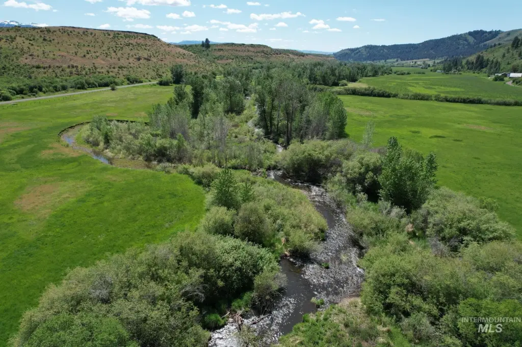
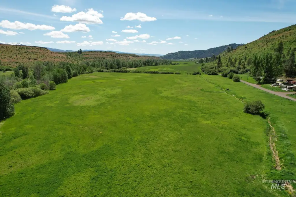
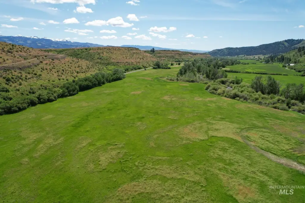
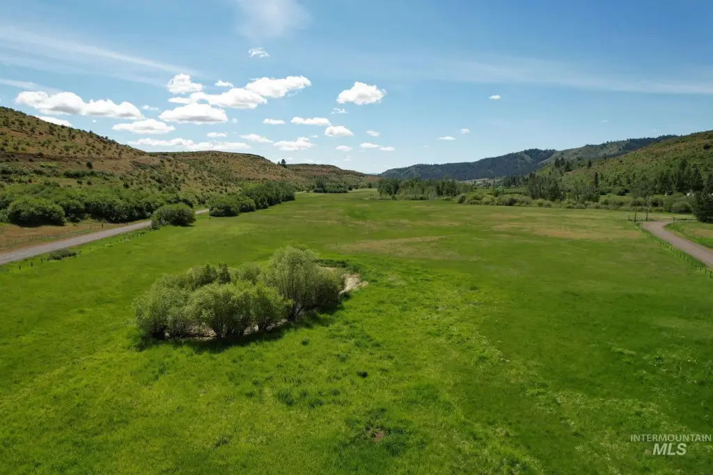
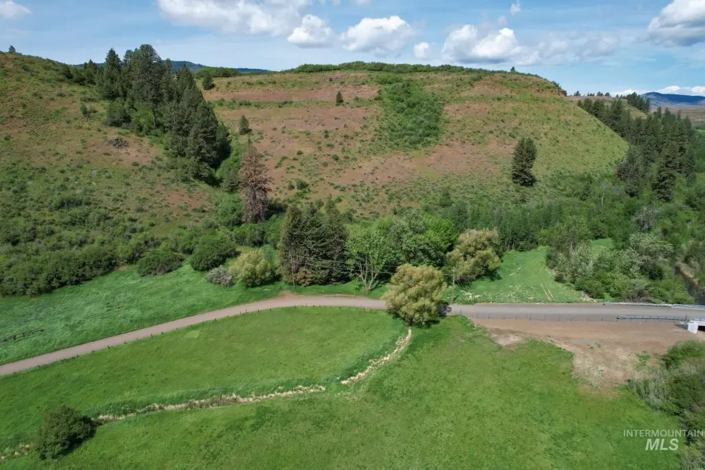
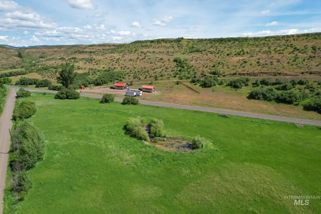
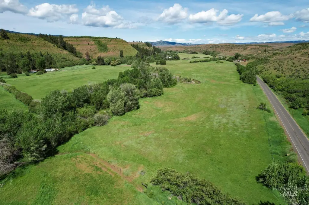
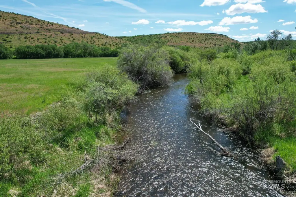
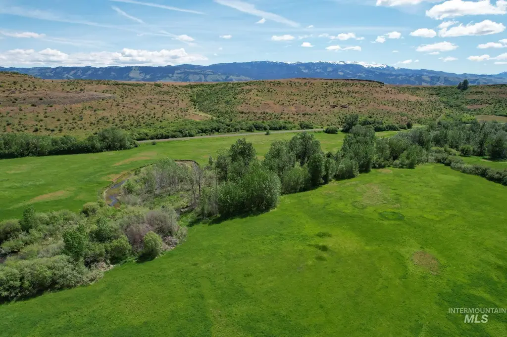
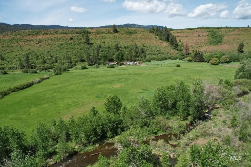
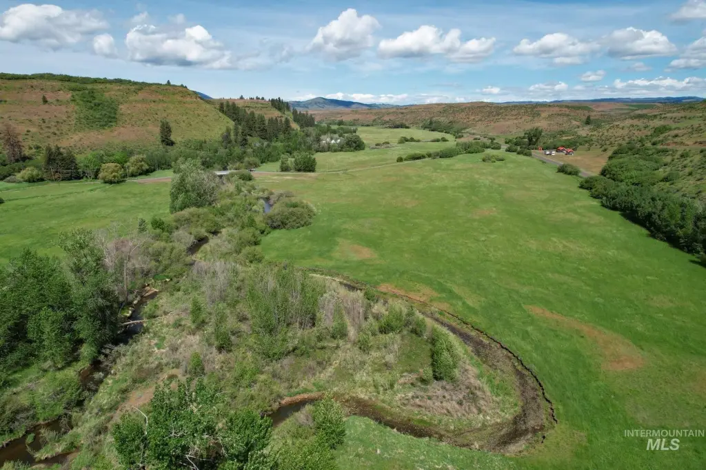
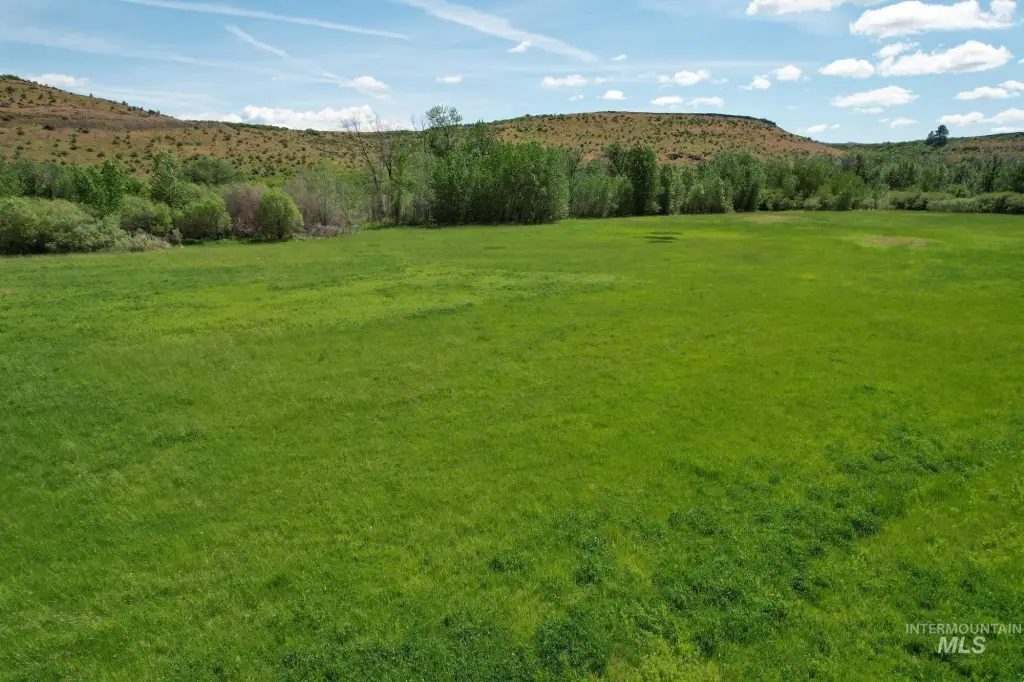
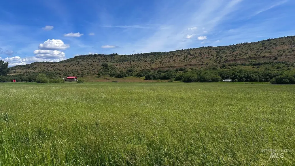
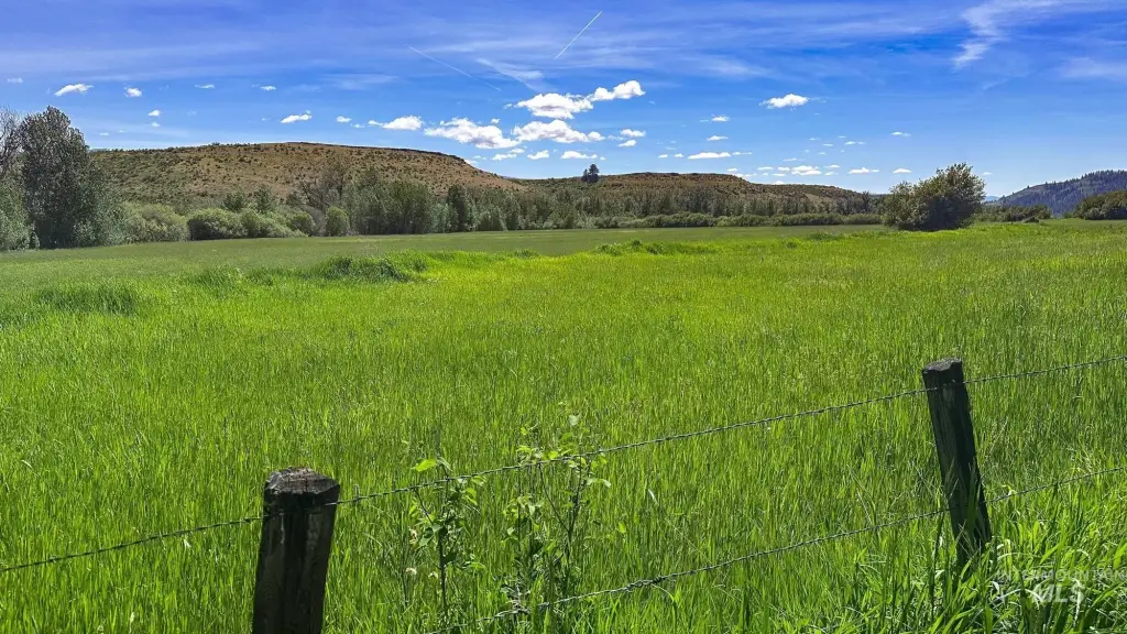
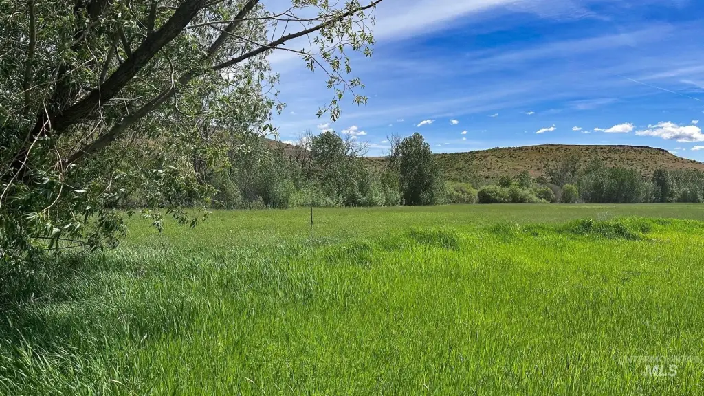
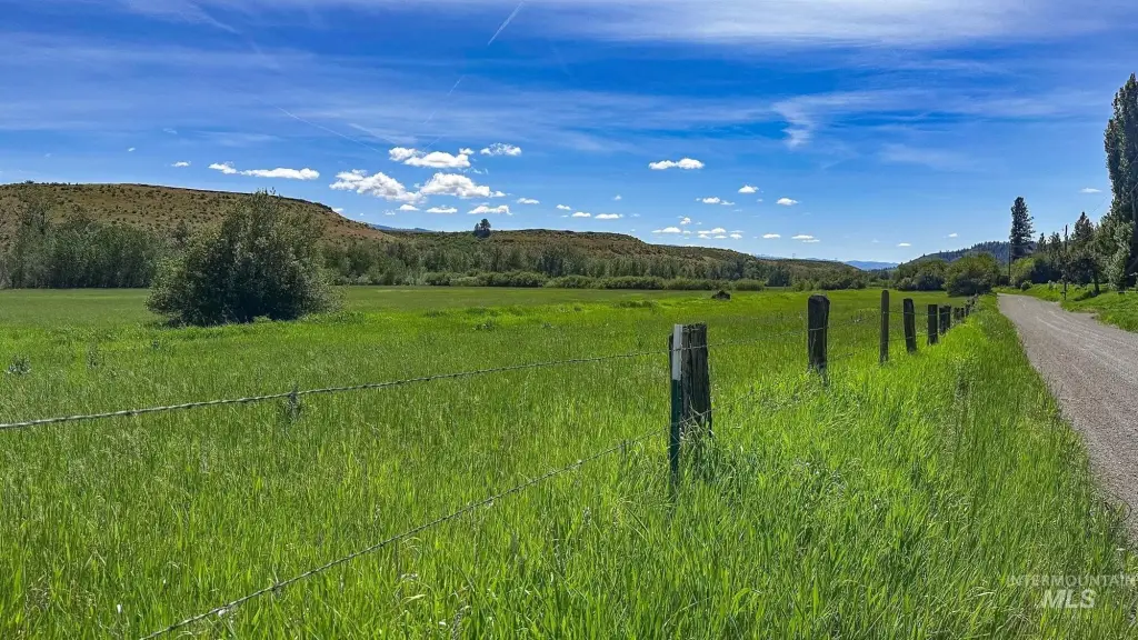
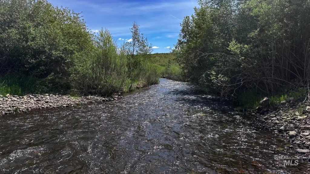
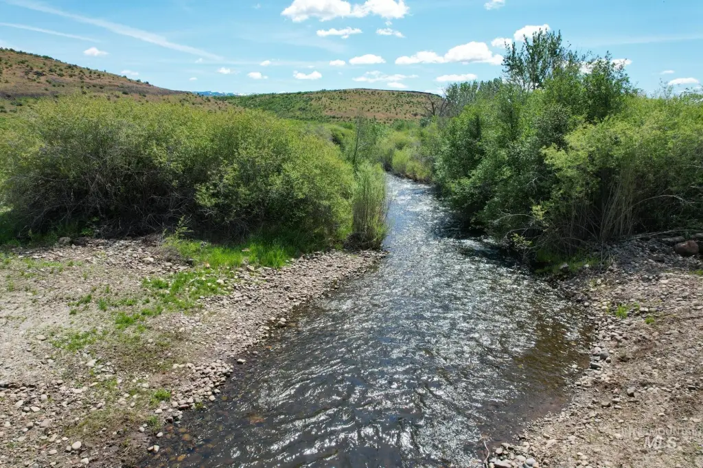
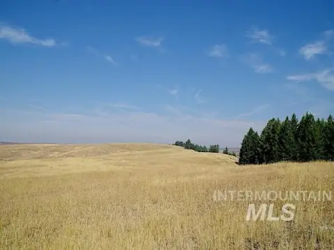
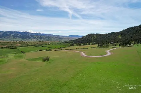
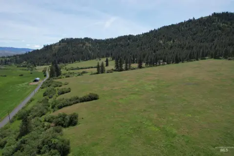
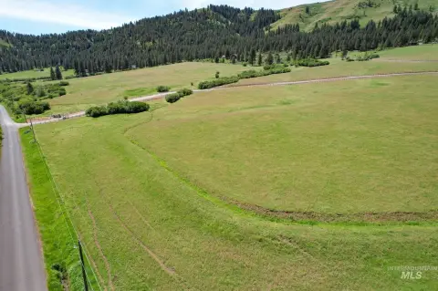
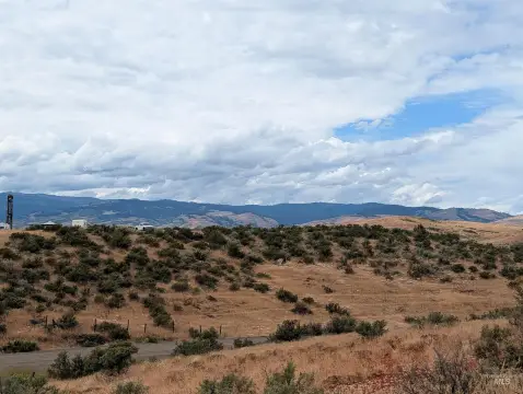
This property consists of irrigated, fully fenced pastures with rolling terrain, mature trees, and live water from Hornet Creek. An area on the east side of the property includes irrigated pastures bordering both sides of the creek as it meanders through the center of the land. The pastures are supported by 33+/- acres of water rights.
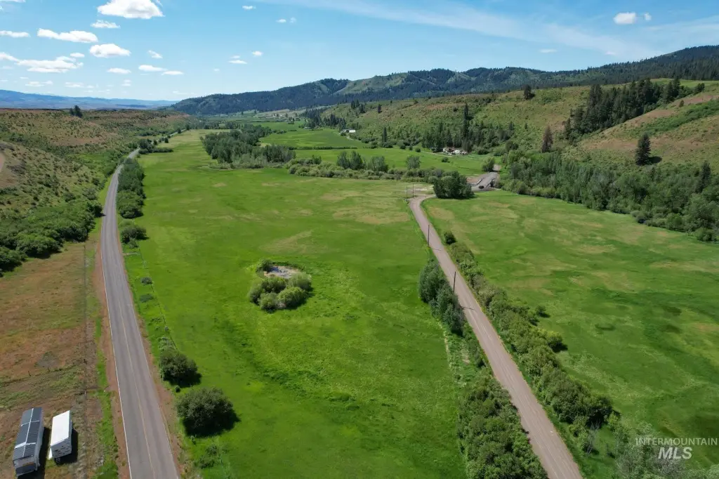
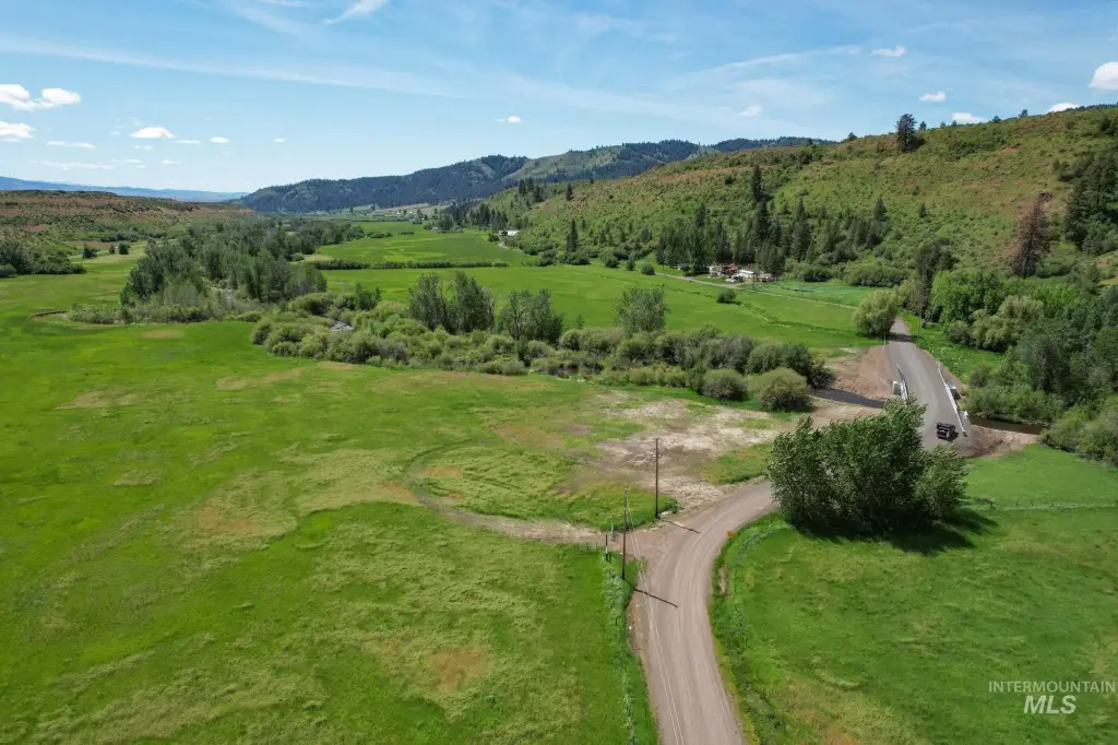
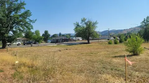
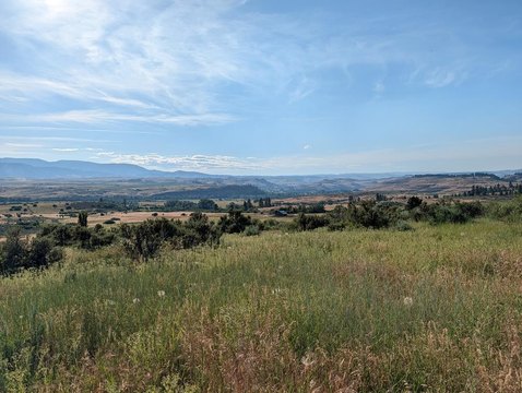
The northern boundary fronts a paved Cuprum-Council Road, and the property is accessed via paved road frontage. The land is surrounded by abundant public lands, providing a rural setting and additional open space beyond the fenced pastures. On the southwest side, a location near Old Hornet Creek Road is described as an easily accessible potential building site.
With its irrigated and fenced configuration, this tract is positioned for livestock use while also supporting recreational plans tied to the creek and surrounding public lands. For buyers looking for a private home site, the combination of pasture infrastructure, creek features, and paved-road frontage offers a practical base for planning around the existing terrain and water access.
Key Highlights
- Pasture acreage with Hornet Creek running through the property
- Irrigated fenced pastures with 33+/- acres of water rights
- Fully fenced property with irrigated pastures on both sides of the creek
Property Analytics
Property Profile
Location Intelligence
Current Use by Public Records
Hunting land
Similar For Sale Nearby
FAQs
What type of property is this?
Agricultural land / Farmland - Fenced, irrigated pastures with water rights and live creek frontage offer flexible options for livestock and recreation.
Where is this agricultural land / farmland located?
The property is located at Council-Cuprum Road Council, ID.
What is the asking price?
The asking price for this property is $600,000.
What are key features of this property?
This property features: Pasture acreage with Hornet Creek running through the property; Irrigated fenced pastures with 33+/- acres of water rights; Fully fenced property with irrigated pastures on both sides of the creek