View-Recreation Land with Secluded
Exeter Rd Council, ID 83612
For Sale
$380,000
LAND - Council, ID
Lot Size47.78 Acres
Days on Market157
Property Features for Exeter Rd
General Information
Property type
Land
Property subtype
Other
Standard status
Active
APN
RP16N01W231605A
Lot size
47.78 Acres
Taxes and HOA fees
Tax Year
2026
Tax Description
T16N R1W SEC 23 IN S2 & SW4NE4 47.78 AC
Tax Annual Amount
13
Utilities
Water source
Well
Listing Agency:
Homes of Idaho
(208) 442-8500
Listed By:
Victor Peterson · License #23487
(208) 880-6498
Added: Feb 23
Changed: Jun 14
Last Checked: Jul 30 at 9:06AM
MLS# 98975760
Copyright © 2026 Intermountain Multiple Listing Service. All rights reserved. All information provided by the listing agent/broker is deemed reliable but is not guaranteed and should be independently verified.
Investment Insights
Based on property information with market context.
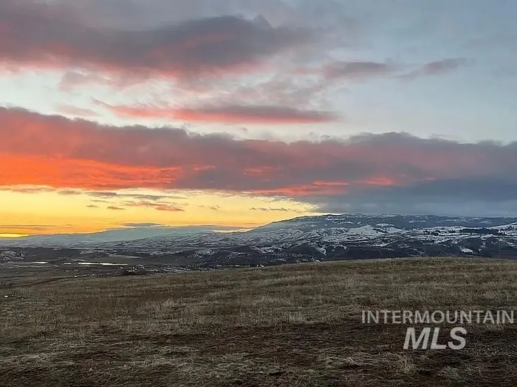
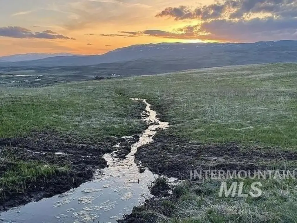
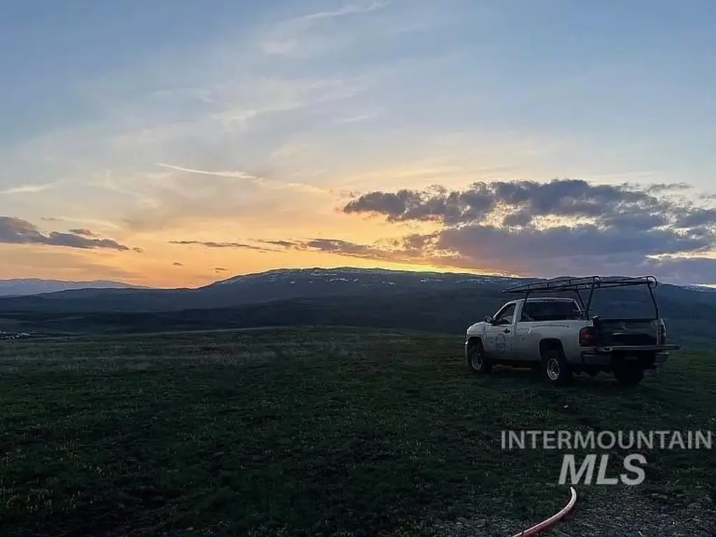
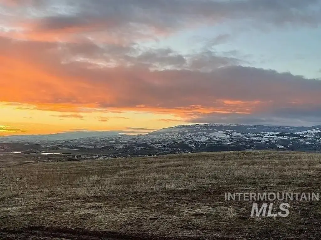
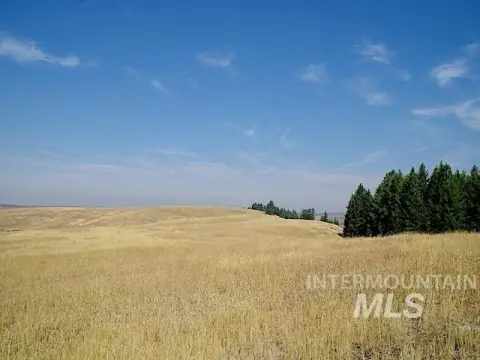
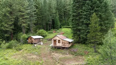
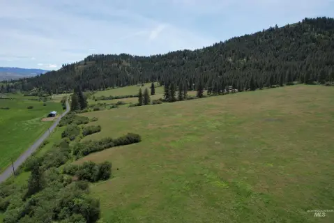
This 47.78-acre property offers an elevated building site reached by a private 3/4-mile driveway. The land includes 30+/- acres that are cleared with natural grass, and the acreage is fully fenced. Wildlife is noted on-site, and the property also includes fruit trees, two seasonal springs, and 22.5 water shares.
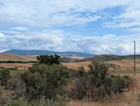
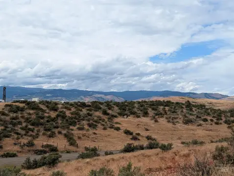
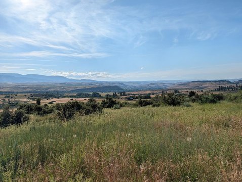
The site is described as having a secluded feel and is listed as approximately two miles from town. The building location is described as being 300' above Exeter and providing views of Council Valley, the 7 Devils, Smith Mountain, Midvale Hill, Cuddy Mountain, Sturgill Peak, and more. The property borders a 2,300-acre ranch with no homes above, supporting the privacy aspect highlighted in the remarks.
For buyers looking for a remote homesite with usable, fenced ground, this tract provides a mix of cleared acreage and view-oriented elevation. Utilities are addressed in the remarks, including fiber optic at the site and underground power service options with an Idaho Power quote for 360' underground service, along with a stated well estimate. With water shares and seasonal springs included, it may suit those planning an off-the-beaten-path build while keeping day-to-day land management in mind.
Key Highlights
- Breathtaking panoramic views of Council Valley, 7 Devils, and surrounding mountains.
- 47.78 acres offering privacy and seclusion, yet only 2 miles from town.
- 30+/- acres cleared and fully fenced, ideal for building and livestock.
Property Analytics
Location Intelligence
Current Use


Frequently Asked Questions
What type of property is this?
Recreation land - Secluded acreage with cleared, fenced grazing land, springs, water shares, and an elevated building site for mountain views.
Where is this recreation land located?
The property is located at Exeter Rd Council, ID.
What is the asking price?
The asking price for this property is $380,000.
What are key features of this property?
This property features: Breathtaking panoramic views of Council Valley, 7 Devils, and surrounding mountains.; 47.78 acres offering privacy and seclusion, yet only 2 miles from town.; 30+/- acres cleared and fully fenced, ideal for building and livestock.


