Undeveloped Residential
Choctaw Road lot 1 Gulf Shores, AL 36542
Choctaw Road lot 1, Gulf Shores, AL, 36542
$44,100
For Sale
$44,100
LAND - Gulf Shores, AL
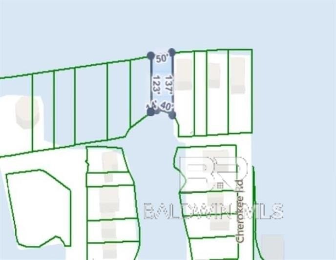
Lot Size0.14 Acres
Days on Market101
Property Features for Choctaw Road lot 1
General Information
- Property type
- Land
- Property subtype
- Other
- Zoning
- Single Family Residence
- Standard status
- Active
- APN
- 37246
- Lot size
- 0.14 Acres
Taxes and HOA fees
- Tax Description
- 55S X 110S Ft Morgan Pines Beg At Sw Cor Of Lot 1 Blk I Fo Rt Morgan Pines W 80 N 50(S) To Pob On N Side Of Lake Wly With Same 55(S) N 110(S) To S Side Of Mobile Bay Ely 50 With Same S 115(S) To Pob Being In Grant 2-9-1
Utilities
- Water front
- 1
Listing agency
Beachball Properties
(251) 968-8896
Listed by
Jonathan Bennett · License #110875
(251) 424-5682
Added: Apr 13 Updated: Jul 17 at 11:38AM Checked: Jul 22 at 4:06AM
MLS# 395044
Copyright © 2026 Baldwin REALTORS®. All rights reserved. All information provided by the listing agent/broker is deemed reliable but is not guaranteed and should be independently verified.
Investment Insights
Based on property information with market context.
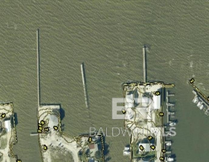
This is an approximately 0.14-acre undeveloped residential lot offered for sale in Gulf Shores, Alabama. The property is described as a vacant parcel with no structures currently in place.
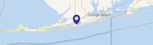
The lot is located on Choctaw Road in the Fort Morgan area. The listing notes convenience to nearby beach access, public boat launches, golf courses, and other local attractions.
Zoning is listed as Single Family Residence. Buyers are advised to conduct due diligence to verify zoning details, permitted uses, utility availability, property dimensions, buildability, and any other information important to their intended use.
Key Highlights
- Approximately 0.14‑acre undeveloped parcel on Choctaw Road in the Fort Morgan area of Gulf Shores, AL
- Nearby access to the beach, public boat launches, golf courses, and other local attractions
- Buyer to verify zoning, permitted uses, utility availability, property dimensions, and buildability during due diligence
Property Analytics
Property Profile
Location Intelligence
Current Use by Public Records
Residential land & home ...
Similar For Sale Nearby


FAQs
What type of property is this?
Residential land & home lot - Approximately 0.14-acre undeveloped parcel zoned for single-family use in the Fort Morgan area.
Where is this residential land & home lot located?
The property is located at Choctaw Road lot 1 Gulf Shores, AL.
What is the asking price?
The asking price for this property is $44,100.
What are key features of this property?
This property features: Approximately 0.14‑acre undeveloped parcel on Choctaw Road in the Fort Morgan area of Gulf Shores, AL; Nearby access to the beach, public boat launches, golf courses, and other local attractions; Buyer to verify zoning, permitted uses, utility availability, property dimensions, and buildability during due diligence