Zoned Agricultural Land

For Sale
$35,000
Cheseboro Road, Palmdale, CA 93550
LAND - Palmdale, CA
Lot Size10.02 Acres
Days on Market55
Property Features for Cheseboro Road
General Information
Property type
Land
Property subtype
Other
Zoning
A-2-2
Directions
Located on 223rd ST E and Fort Tejon Rd in Llano, CA. Use the provided coordinates for directions. Coordinates: 34.470778, -117.730139
Subdivision
10 - Littlerock/Pearblossom
Standard status
Active
APN
3048-016-044
Lot size
10.02 Acres
Utilities
Sewer type
None
Listing Agency:
Home & Land Source
(661) 400-9778
Listed By:
Ruben Del Rio · License #01276100
(661) 998-9460
Added: Jun 8
Last Checked: Aug 1 at 11:06PM
MLS# 26004482
Copyright © 2026 Greater Antelope Valley Association of Realtors. All rights reserved. All information provided by the listing agent/broker is deemed reliable but is not guaranteed and should be independently verified.
Investment Insights
Based on property information with market context.
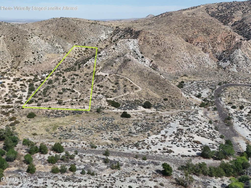
This offering is a roughly 10.02-acre agricultural land parcel listed for sale with zoning designated A-2-2 for agricultural use per county records. The property’s location is identified by APN 3048-016-044, with coordinates 34.500528, -118.027056 provided.
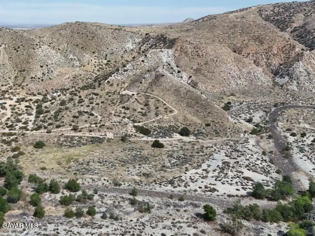
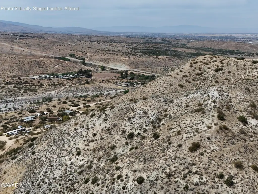
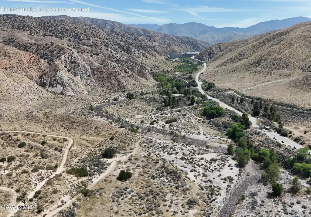
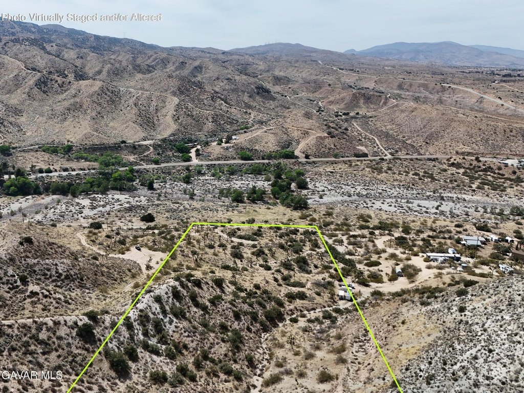
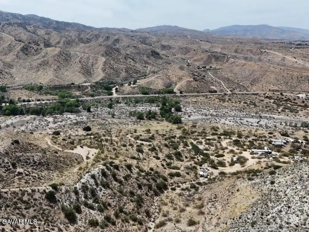
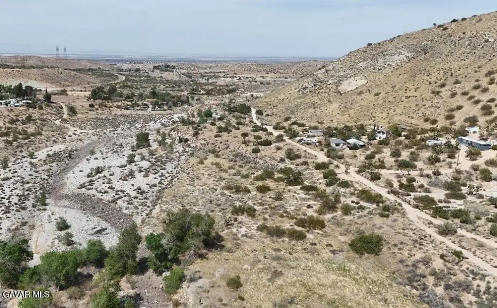
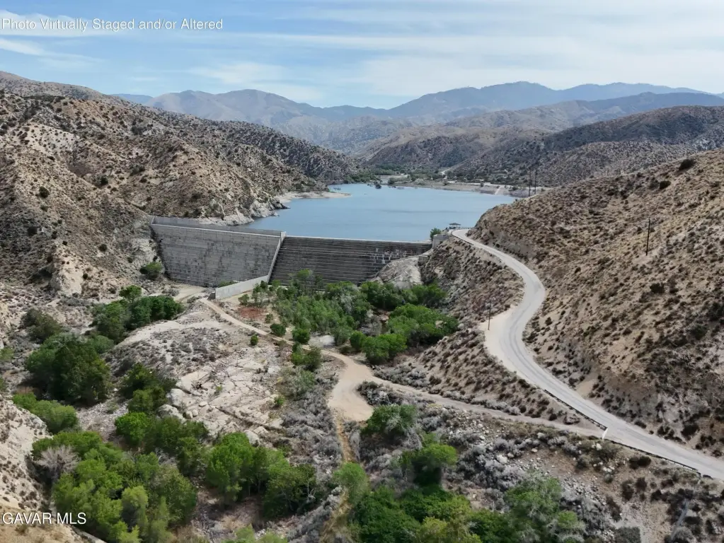
The parcel is situated near the intersection of Cheseboro Road and Mt Emma Rd, not far from Palmdale and Littlerock in Los Angeles County. County records and public remarks also note proximity to the Littlerock Dam and the Four Points Swapmeet. The parcel offers views of the surrounding hills and desert.
For buyers seeking agricultural-zoned land, the A-2-2 designation is the key development consideration reflected in the listing details. This property may also fit use cases where outdoor space and a rural setting are priorities, while buyers should confirm any specific agricultural activities and site requirements with the county based on the A-2-2 zoning and the parcel’s access conditions.
Key Highlights
- Zoned A‑2‑2 for agricultural use (per county records)
- Parcel near the intersection of Cheseboro Road and Mt Emma Rd
- Coordinates: 34.500528, -118.027056 (APN: 3048‑016‑044)
Property Analytics
Property Profile
Current Use
Location Intelligence
Trade Area within ½ mile
53
Businesses Nearby
Explore this area
Business Placement
Demographics for 93550, CA
82,379
Population
23,965
Households
3.4
Avg Household Size
31
Median Age
10%
College-Educated
71%
High-School Grad
259.3 sq mi
ZIP Area
318
Density / Sq Mi
$63,811
Median Household Income
$34,287
Median Earnings
$1,573
Median Rent
$378,700
Median Home Value

Questions? Ask Rey
Realmo’s AI knows this listing — price, zoning, demand, history. Ask anything.


Frequently Asked Questions
What type of property is this?
Agricultural land / Farmland - Approximately 10-acre parcel zoned A-2-2 for agricultural use with open views of surrounding hills and desert.
Where is this agricultural land / farmland located?
The property is located at Cheseboro Road Palmdale, CA.
What is the asking price?
The asking price for this property is $35,000.
What are key features of this property?
This property features: Zoned A‑2‑2 for agricultural use (per county records); Parcel near the intersection of Cheseboro Road and Mt Emma Rd; Coordinates: 34.500528, -118.027056 (APN: 3048‑016‑044)