Wooded RC2 Residential
For Sale
$30,000
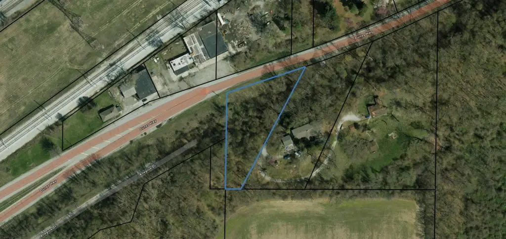
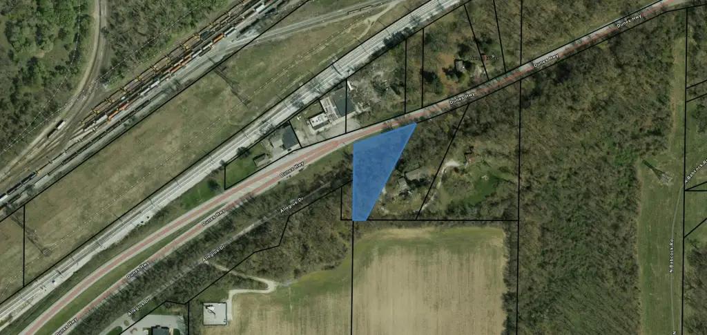
U.s 12, Burns Harbor, IN 46304
LAND - Burns Harbor, IN
Lot Size1.00 Acre
Days on Market56
Property Features for U.s 12
General Information
Property type
Land
Property subtype
Other
Zoning description
Commercial
Lot features
Wooded
Directions
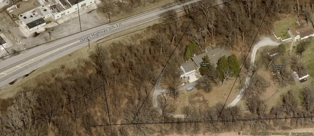
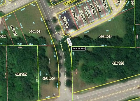
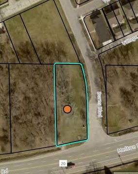
On the south side of US HWY 12, about a mile SE of Cleveland-Cliffs. At the end of Allegius Drive.
Standard status
Active
APN
460328400011000024
Lot size
1.00 Acre
Taxes and HOA fees
Tax Year
2026
Tax Description
Parc In W1/2 E1/2 S Of Rd Se 28-37-6 1A 99-18998
Tax Annual Amount
3172
Legal Description
Parc In W1/2 E1/2 S Of Rd Se 28-37-6 1A 99-18998
Listing Agency:
StreetFront, LLC
(219) 510-3720
Listed By:
Ryan Peters · License #RB14047099
(219) 510-3720
Added: Jun 8
Last Checked: Aug 2 at 10:06PM
MLS# 840304
Copyright © 2026 Greater Northwest Indiana Association of REALTORS. All rights reserved. All information provided by the listing agent/broker is deemed reliable but is not guaranteed and should be independently verified.
Investment Insights
Based on property information with market context.
Approximately 1.06 acres of vacant land zoned RC2. The property is wooded and is described as having no wetlands, with the site located outside of the FEMA floodplain.
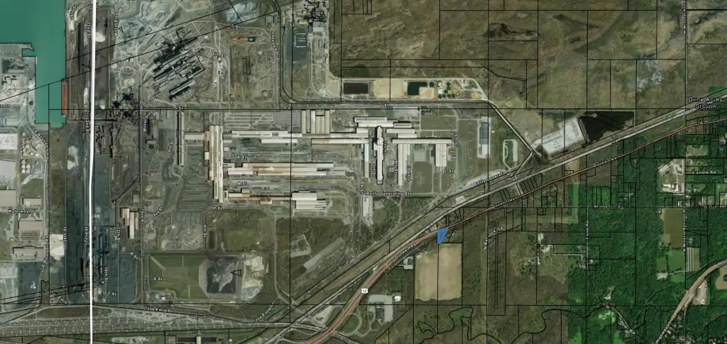
The parcel is positioned along a U.S. highway, with approximately 6,114 vehicles per day for visibility and accessibility. It is also located directly across from Cleveland-Cliffs' Burns Harbor steelmaking operations.
For residential development considerations within RC2, this site offers a wooded, developable footprint with floodplain considerations already addressed in the listing description. Its highway location and proximity to a major industrial employer may also support day-to-day accessibility for future residents or operators, subject to applicable approvals and development requirements.
Key Highlights
- Approximately 1.06 acres of vacant land zoned RC2
- Wooded site with no wetlands reported
- Outside the FEMA floodplain
Property Analytics
Property Profile
Current Use
Lease Details
6,114 VPD
Traffic count
Yes
Highway access
Location Intelligence
Trade Area within ½ mile
819
Businesses Nearby
Explore this area
Business Placement
Demographics for 46304, IN
26,835
Population
11,521
Households
2.3
Avg Household Size
41
Median Age
35%
College-Educated
96%
High-School Grad
57.8 sq mi
ZIP Area
464
Density / Sq Mi
$88,551
Median Household Income
$52,704
Median Earnings
$1,169
Median Rent
$278,300
Median Home Value

Questions? Ask Rey
Realmo’s AI knows this listing — price, zoning, demand, history. Ask anything.


Frequently Asked Questions
What type of property is this?
Residential land & home lot - Vacant, wooded lot zoned RC2, outside the FEMA floodplain and positioned for highway visibility.
Where is this residential land & home lot located?
The property is located at U.s 12 Burns Harbor, IN.
What is the asking price?
The asking price for this property is $30,000.
What are key features of this property?
This property features: Approximately 1.06 acres of vacant land zoned RC2; Wooded site with no wetlands reported; Outside the FEMA floodplain


