Commercial Development Land with Highway
Highway 60 Aurora, MO 65605
For Sale
$700,000
LAND - Aurora, MO
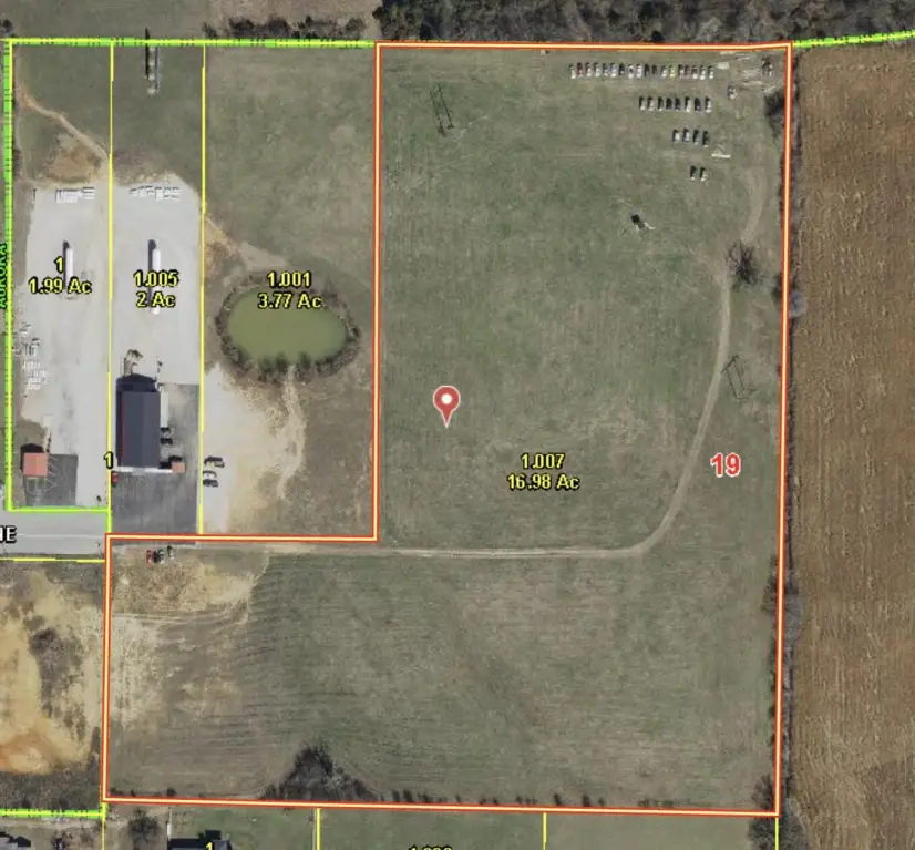
Lot Size16.98 Acres
Days on Market421
Property Features for Highway 60
General Information
Property type
Land
Property subtype
Other
Zoning
Zoned
Standard status
Active
APN
204019003001001007
Lot size
16.98 Acres
Taxes and HOA fees
Tax Year
2024
Tax Description
BEG 370.87'N OF THE SE COR, N1/2 LT 1(SW), THEN N948.03' W519.62' S684.35' W367.44' S335.84' E TO POB
Tax Annual Amount
41
Listing Agency:
Murney Associates - Primrose
(417) 823-2300
Listed By:
Russ Copeland · License #202105092
(417) 872-8658
Added: Jun 5, 2025
Changed: Jun 16
Last Checked: Jul 30 at 8:06AM
MLS# 60296371
Copyright © 2026 Southern Missouri Regional MLS, LLC (SOMO). All rights reserved. All information provided by the listing agent/broker is deemed reliable but is not guaranteed and should be independently verified.
Investment Insights
Based on property information with market context.
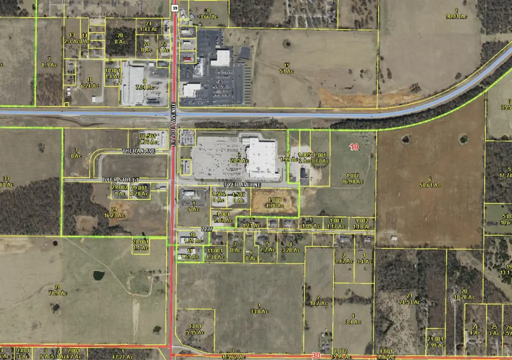
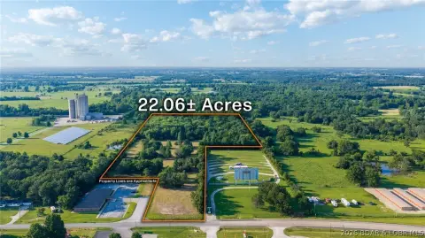
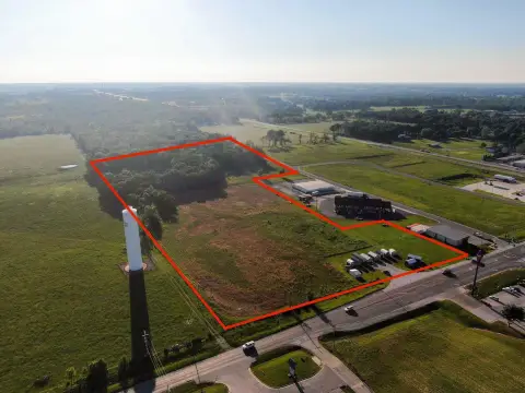
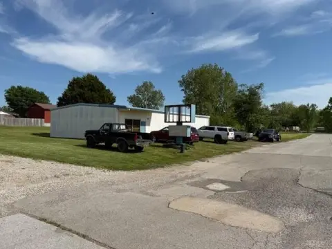
This 16.98-acre commercial development site is located at the end of Dyer Avenue and is zoned Rural/Agricultural. The property features 453 feet of highway frontage and comes with an existing survey for buyer review. City water, sewer, and electric are available at the lot’s entry, and a utility easement helps define space for future site improvements and building placement.
The parcel sits at the Highway 60 and Highway 39 intersection area, with the listing citing approximately 15,000–20,000 vehicles daily per MoDOT. It is described as being steps from the Walmart Supercenter and within about 3.5 miles of Jerry Sumners Sr. Aurora Municipal Airport, supporting access from within the region.
With its size, frontage, and existing utility availability, the site can support a range of commercial concepts consistent with the property’s development intent. The Rural/Agricultural zoning noted in the listing may require any future approvals to align with specific tenant or user requirements, making it well-suited for developers and operators who want to evaluate feasibility early.
Key Highlights
- 16.98‑acre parcel at the end of Dyer Avenue in Aurora, MO.
- 453 ft of Highway 60 frontage at the Hwy 60/Hwy 39 intersection.
- MoDOT reports ~15,000–20,000 vehicles daily on Hwy 60/Hwy 39.
Property Analytics
Property Profile
Location Intelligence
Current Use


Frequently Asked Questions
What type of property is this?
Commercial land - Large commercial-zoned parcel near Walmart, offering substantial Highway 60 frontage and utility availability at the entry.
Where is this commercial land located?
The property is located at Highway 60 Aurora, MO.
What is the asking price?
The asking price for this property is $700,000.
What are key features of this property?
This property features: 16.98‑acre parcel at the end of Dyer Avenue in Aurora, MO.; 453 ft of Highway 60 frontage at the Hwy 60/Hwy 39 intersection.; MoDOT reports ~15,000–20,000 vehicles daily on Hwy 60/Hwy 39.