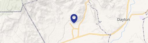
29 Hillside Dr Mound House, NV 89706-7442
- Industrial properties
- 5,700 SF
- 2.40 lot acres
Current Use by Public Records
- Industrial properties
Property Details for 29 Hillside Dr
- Year built
- 1984
- Lot size
- 2.40 lot acres
- Property size
- 5,700 SF
- Zone code
- M1
- Property type
- Industrial properties
- APN
- 019-071-04
- APU
- 1907104
Description
This exceptional industrial property, located at 29 Hillside Drive in Mound House, Nevada, presents a significant opportunity. Situated in Lyon County, zip code 89706, this property offers a substantial land area ideal for various industrial uses. The property is classified as both industrial and land, with a warehouse subtype, making it suitable for a range of development projects. The precise dimensions and specifics of the land parcel are not currently available, however, the location offers excellent access to transportation routes, making it strategically advantageous for logistics and distribution businesses. The asking price for this property is currently listed as $0, indicating a potential opportunity for negotiation. Further details regarding zoning regulations, utility access, and environmental assessments are available upon request. This property is an excellent investment for those seeking a large-scale industrial development site in a rapidly growing area of Nevada. Interested parties are encouraged to conduct their own due diligence to fully assess the potential of this unique opportunity. The property's latitude and longitude coordinates are 39.2125557 and -119.6617205 respectively. This prime location offers significant potential for future growth and development.
Value Estimation
-
AI approach
- CAP return
- Estimation
- Estimation
- $850,000
-
CAP approach
- CAP return
- Estimation
- 6%
- $830,000
- 6.5%
- $790,000
- 7%
- $780,000
-
Comparable approach
- Method
- Estimation
- Relative Method
- $665,000
- Geo Method
- $670,000
-
Alternative Use
- Use
- Estimation
- Distribution
- $765,000
- Retail
- $865,000
- Mixed-Use
- $640,000
- Hospitality
- $860,000
- Educational
- $650,000
- Residential Income
- $885,000
- Energy
- $655,000
- Income-Based Land
- $655,000
- Food Service
- $820,000
Location Insight
- Map
- Local Demand
- City
- Mound House
- County
- Lyon
- State
- Nevada
- Longitude
- -119.662
- Latitude
- 39.2125
- CBSA code
- 22280
- CBSA name
- FERGUS FALLS, MN MICROPOLITAN STATISTICAL AREA