Waterfront Meadow Building
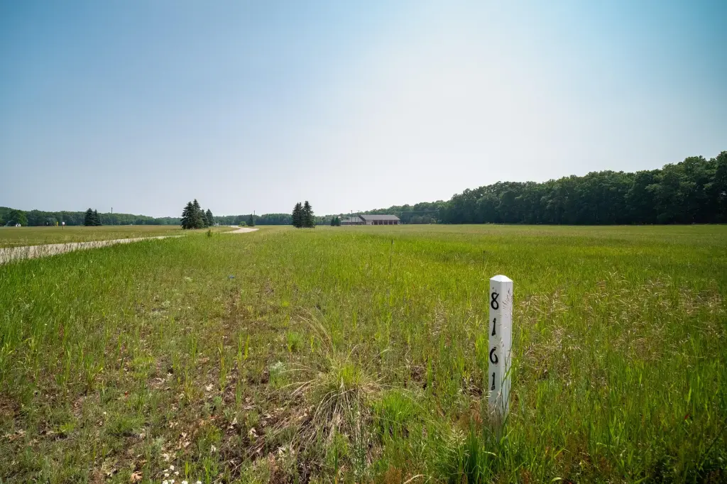
8161 N Hunters Ridge Drive Irons, MI 49644


For Sale
$37,900
LAND - Irons, MI
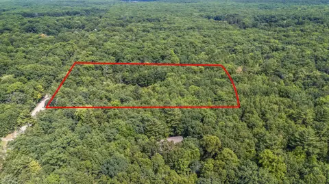
Lot Size1.27 Acres
Days on Market47
Property Features for 8161 N Hunters Ridge Drive
General Information
- Property type
- Land
- Property subtype
- Other
- Standard status
- Active
- APN
- 04-510-011-00
- Lot size
- 1.27 Acres
Taxes and HOA fees
- Tax Year
- 2025
- Tax Description
- UNIT 11 RIVERVIEW SITE CONDOMINIUM
- Tax Annual Amount
- 521
Utilities
- Utilities
- Phone Available
Listing Agency:
RE/MAX Bayshore Manistee
(231) 887-4777
Listed By:
Margie Zaccanelli · License #6501171623
(231) 510-4751
Added: Jun 10
Last Checked: Jul 26 at 12:06PM
MLS# 26028354
Copyright © 2026 Michigan Regional Information Center, LLC. All rights reserved. All information provided by the listing agent/broker is deemed reliable but is not guaranteed and should be independently verified.
Investment Insights
Based on property information with market context.
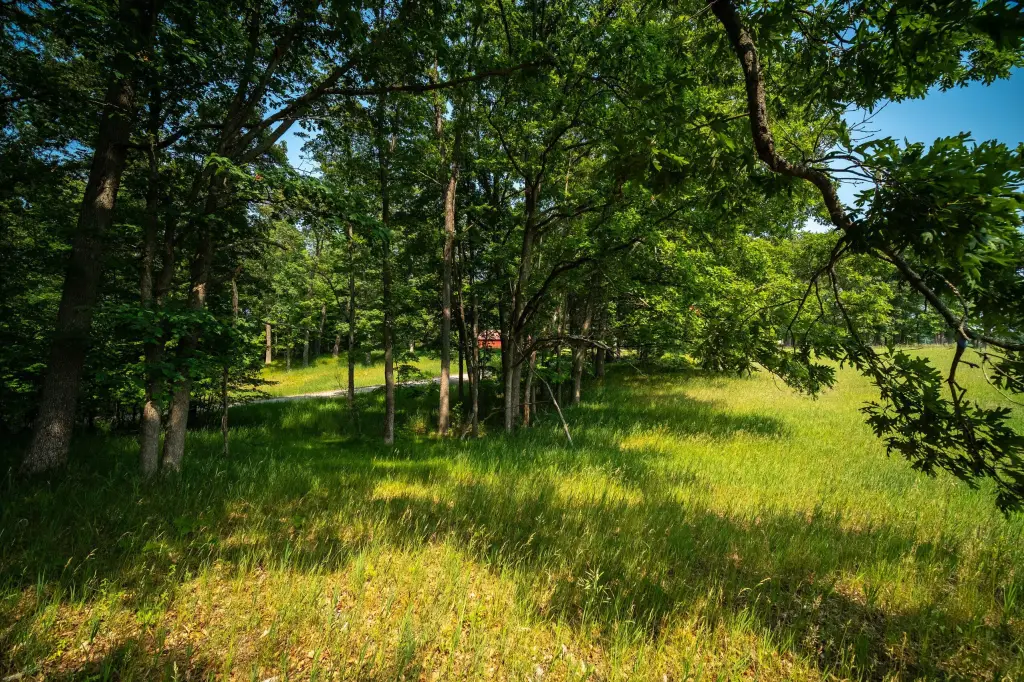
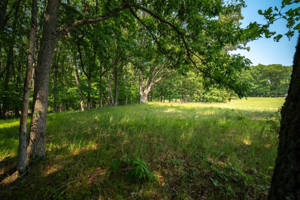
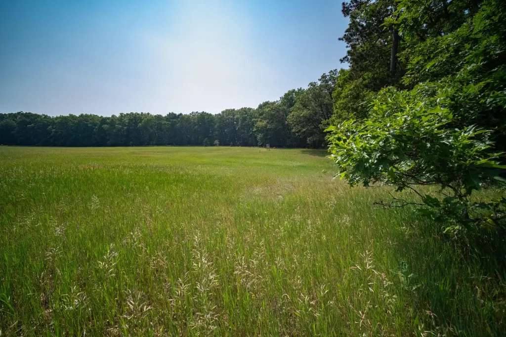
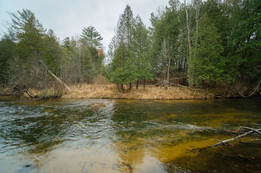
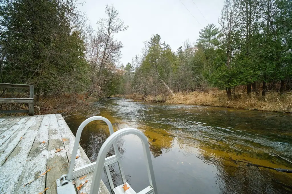
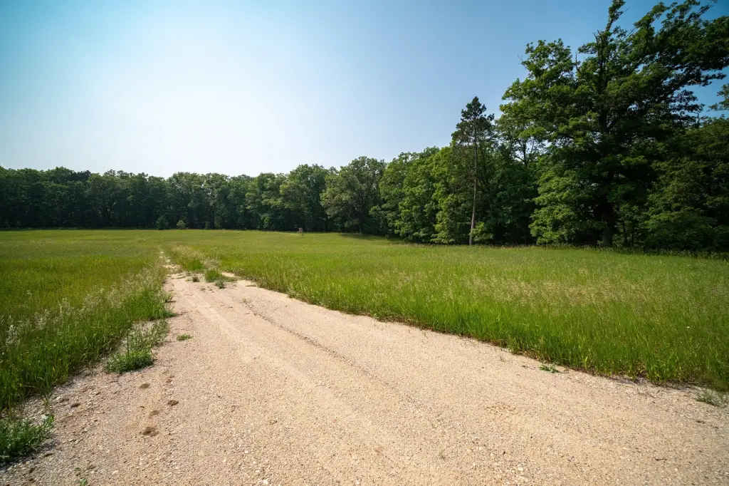
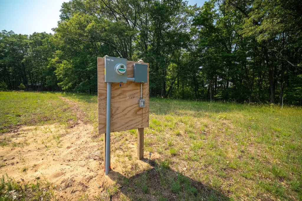
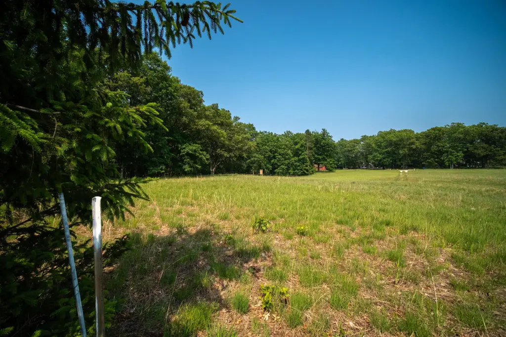
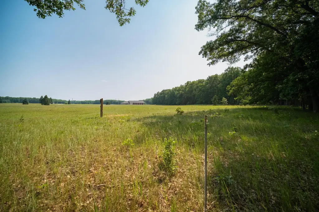
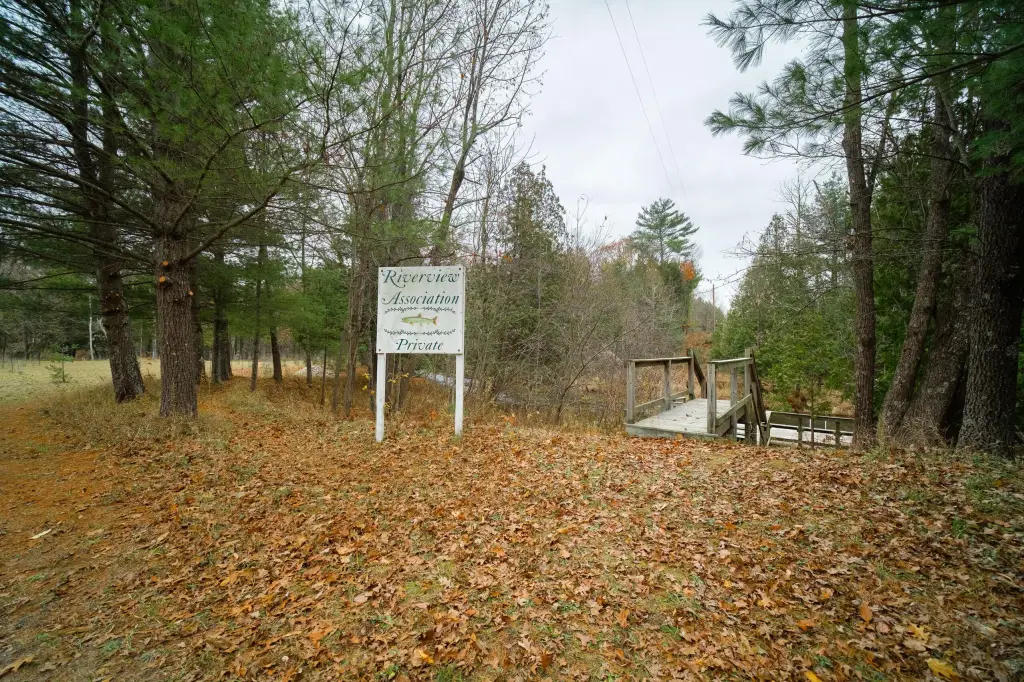
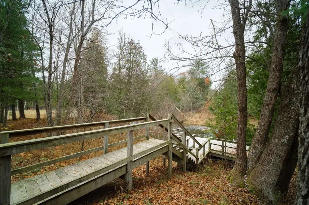
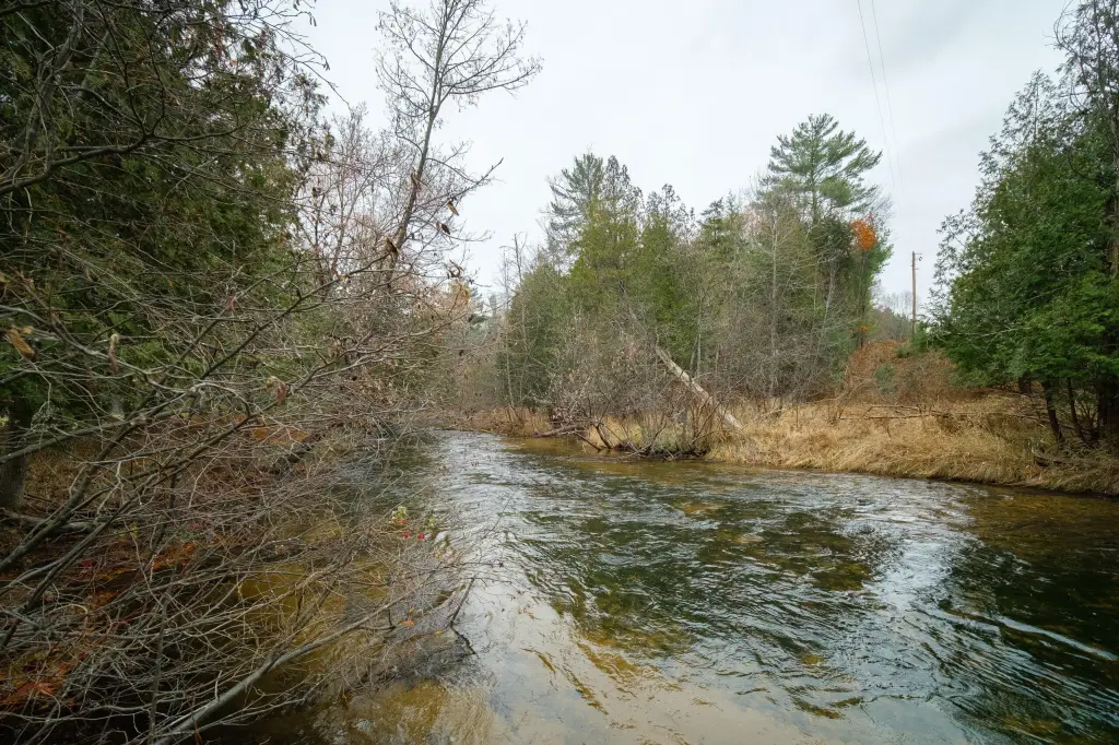
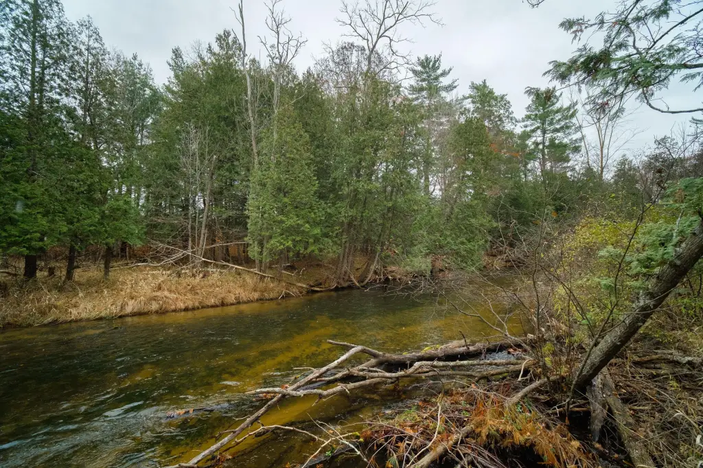
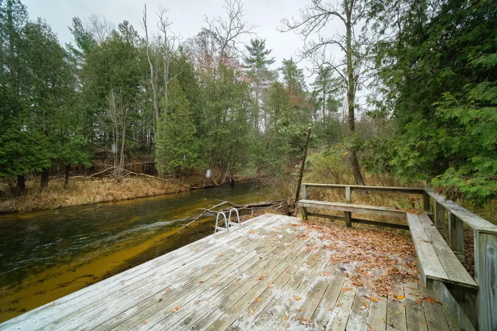
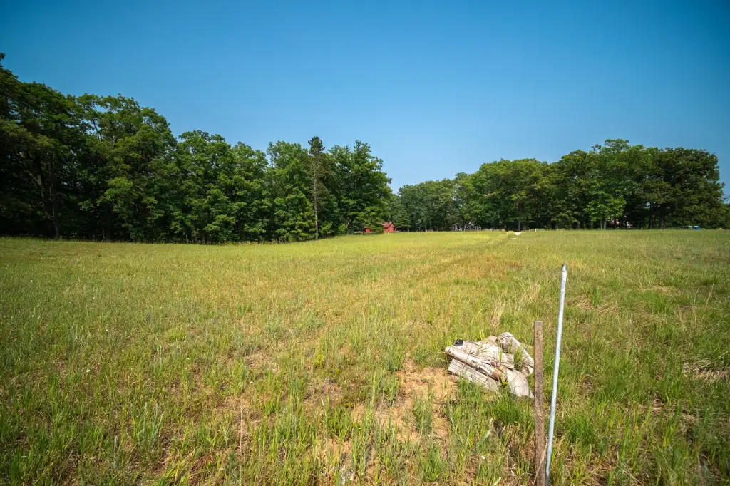
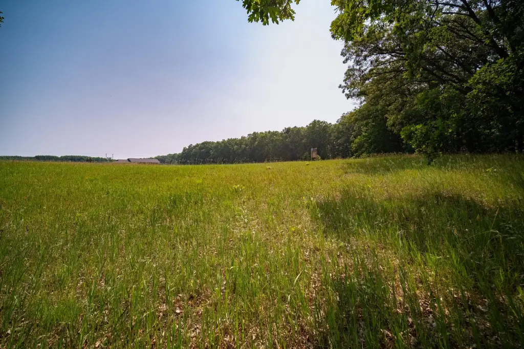
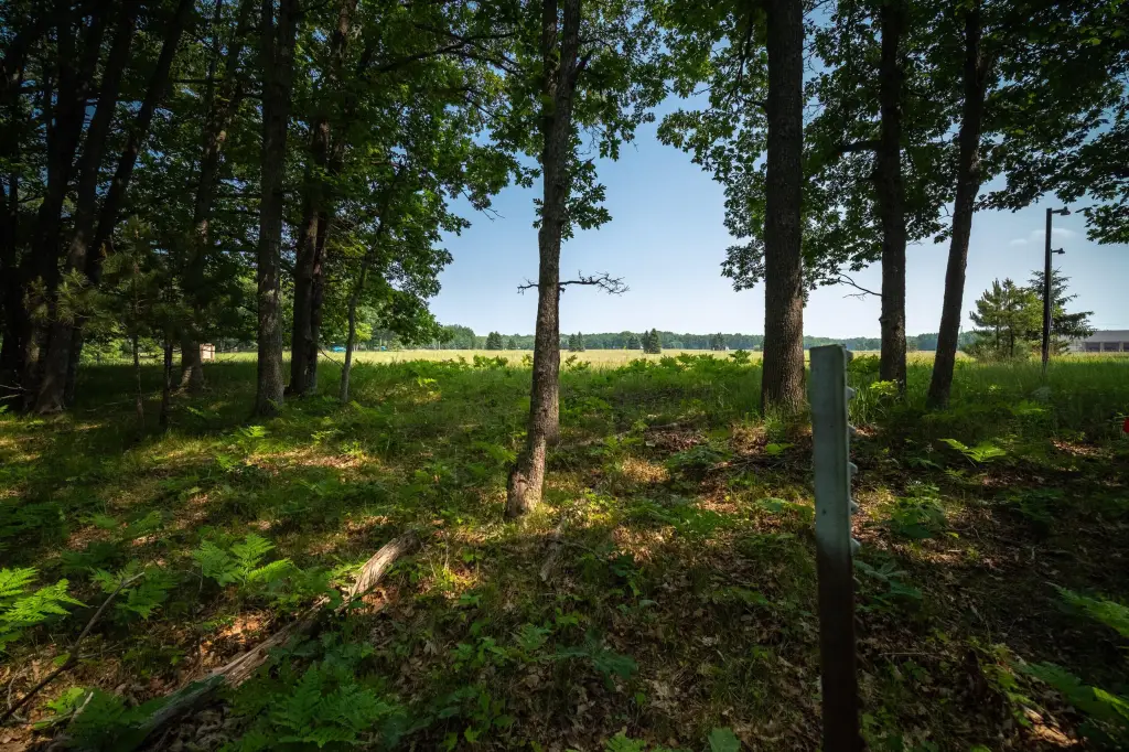
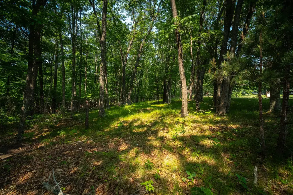
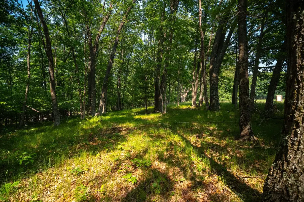
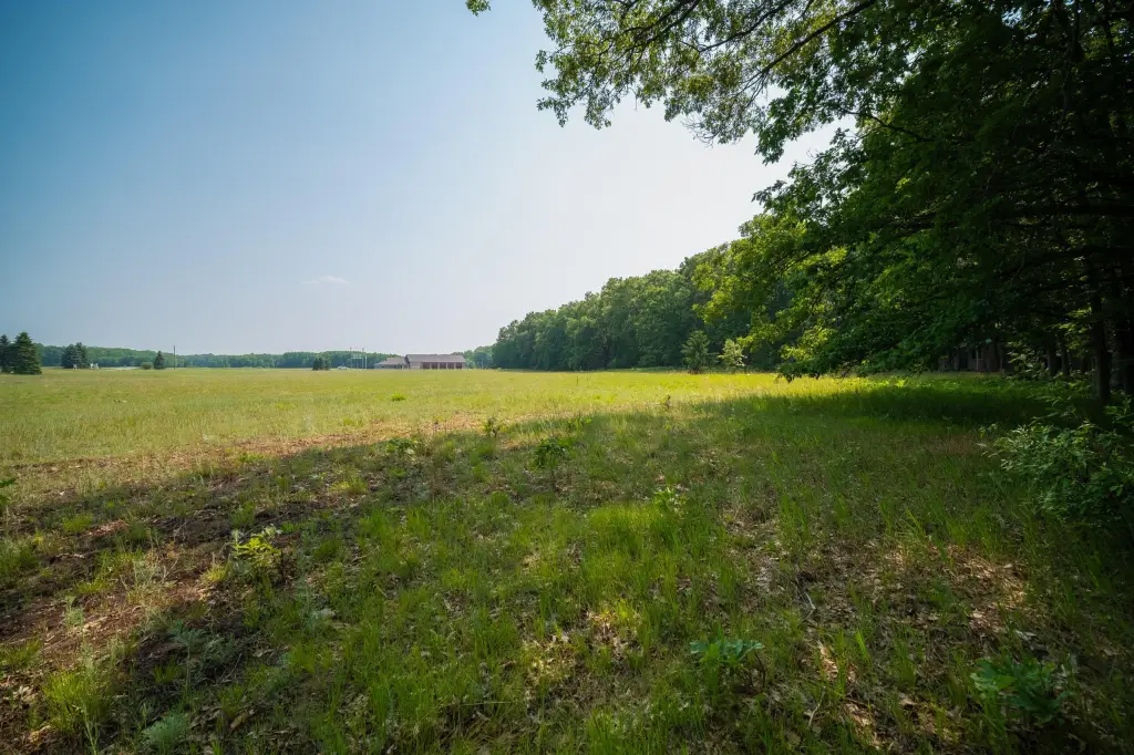
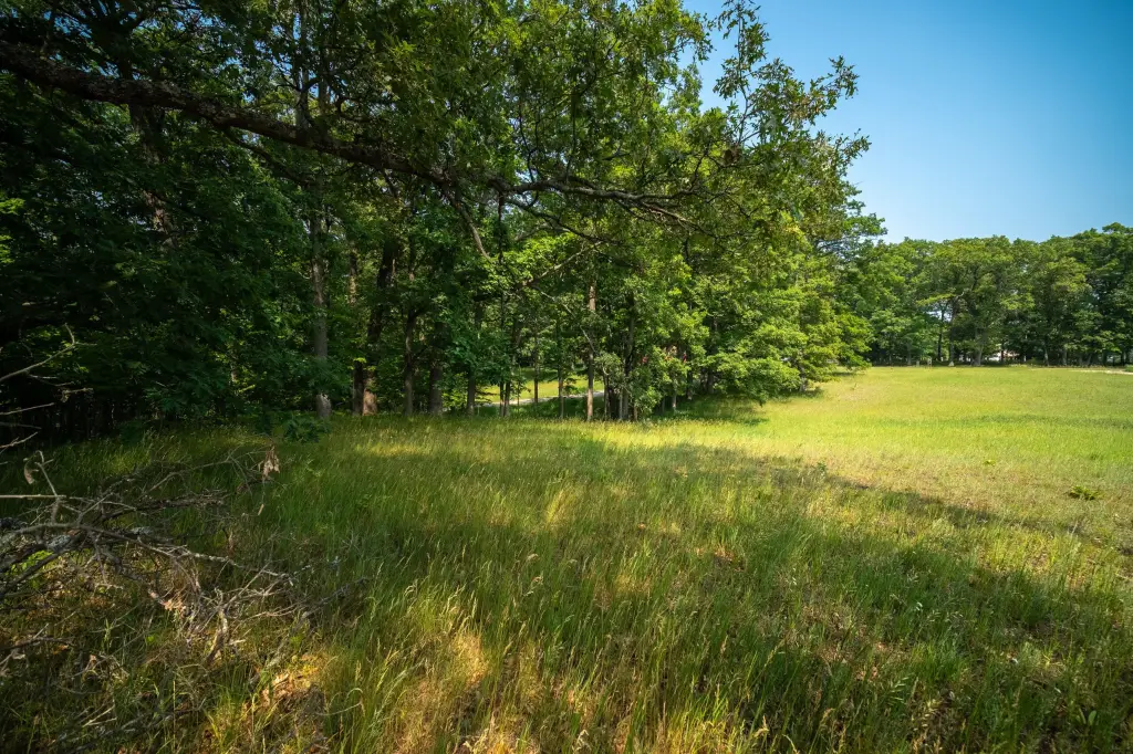
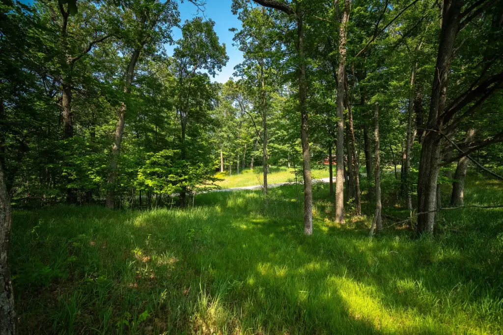
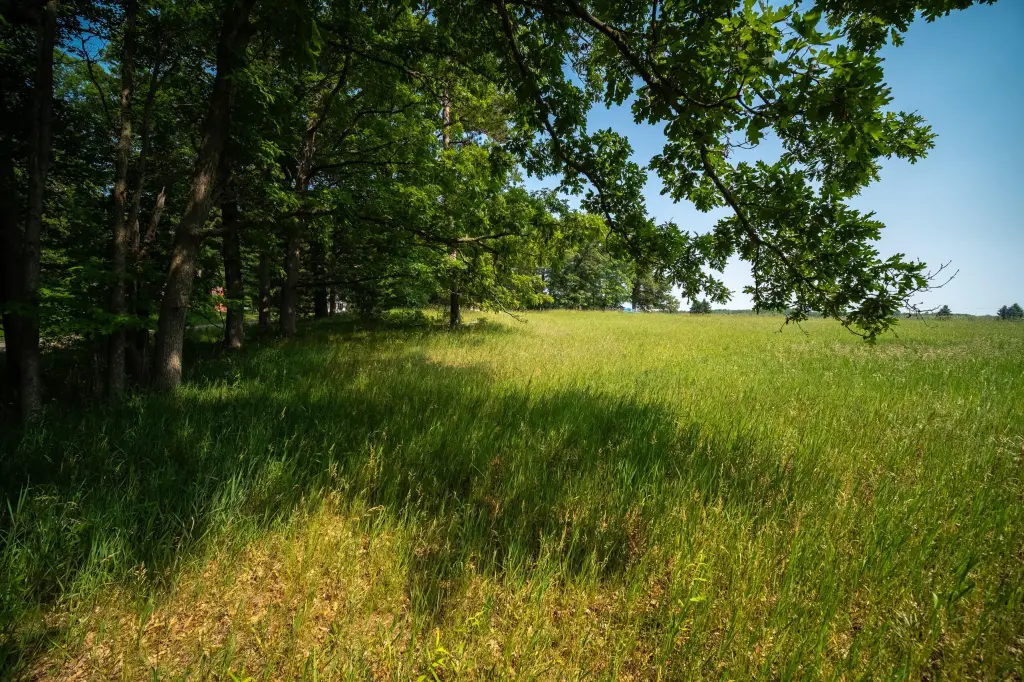
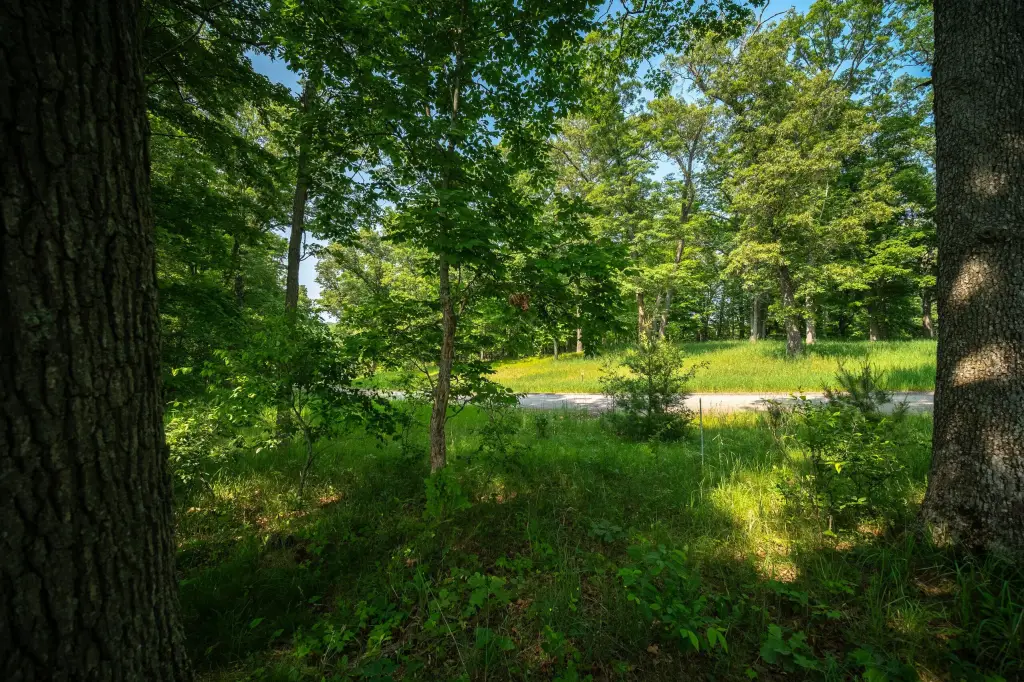
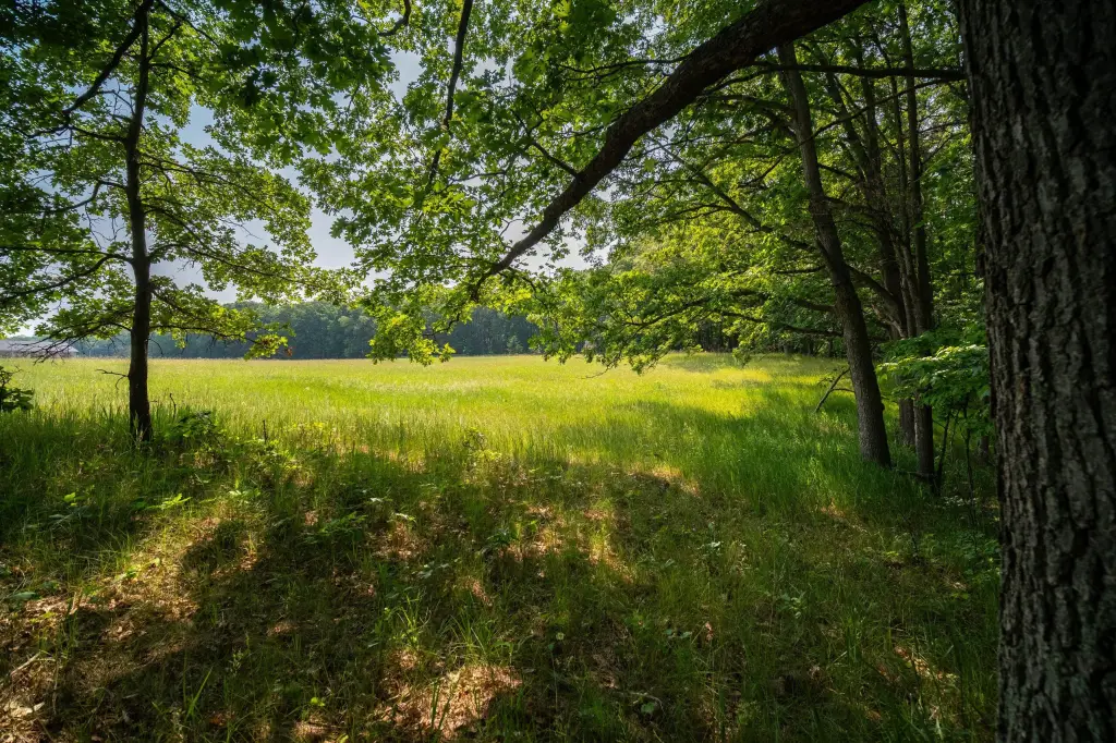
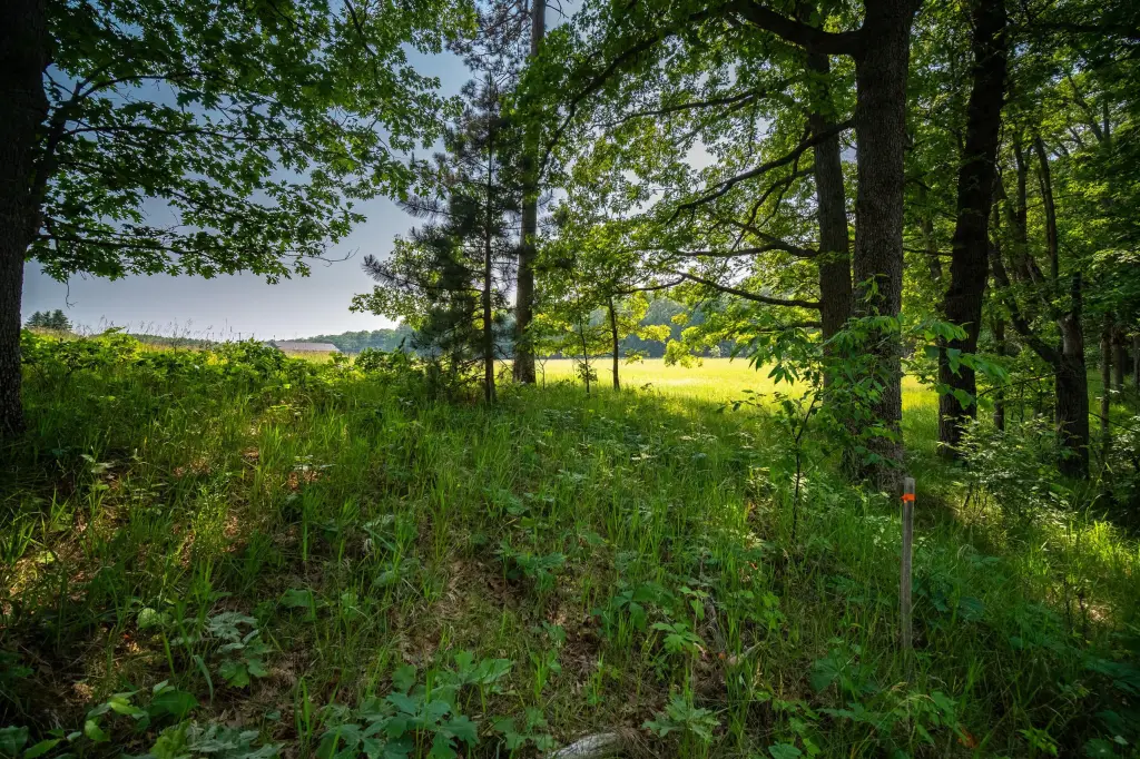
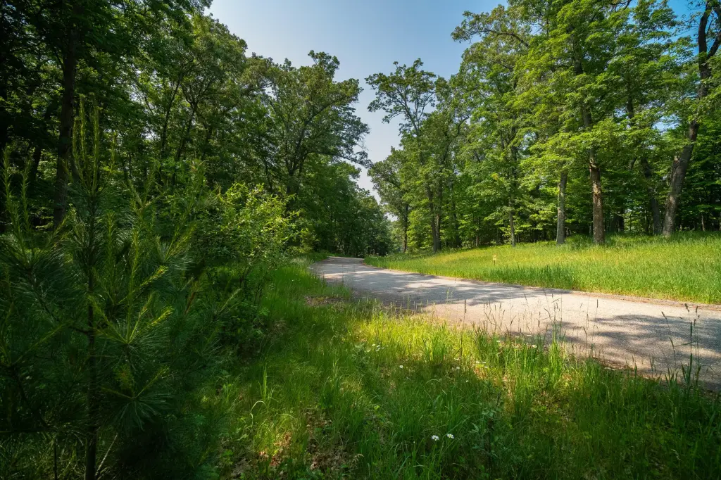
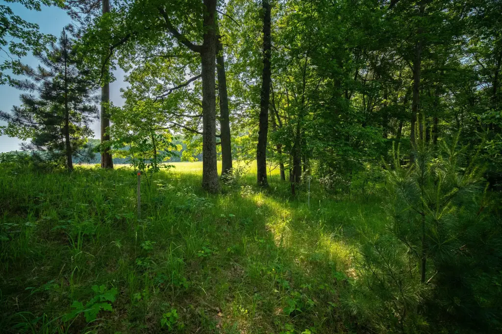
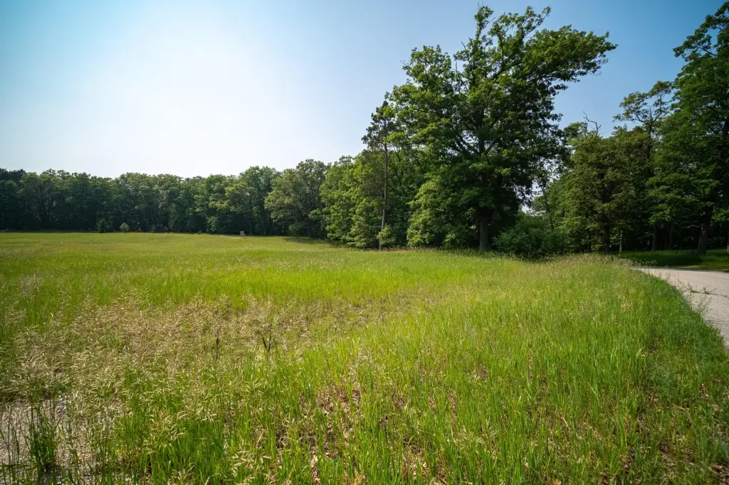
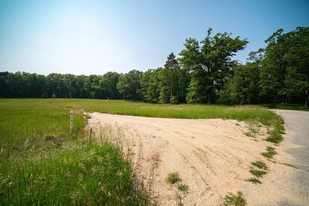
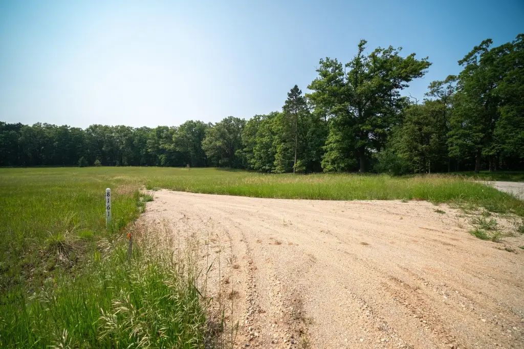
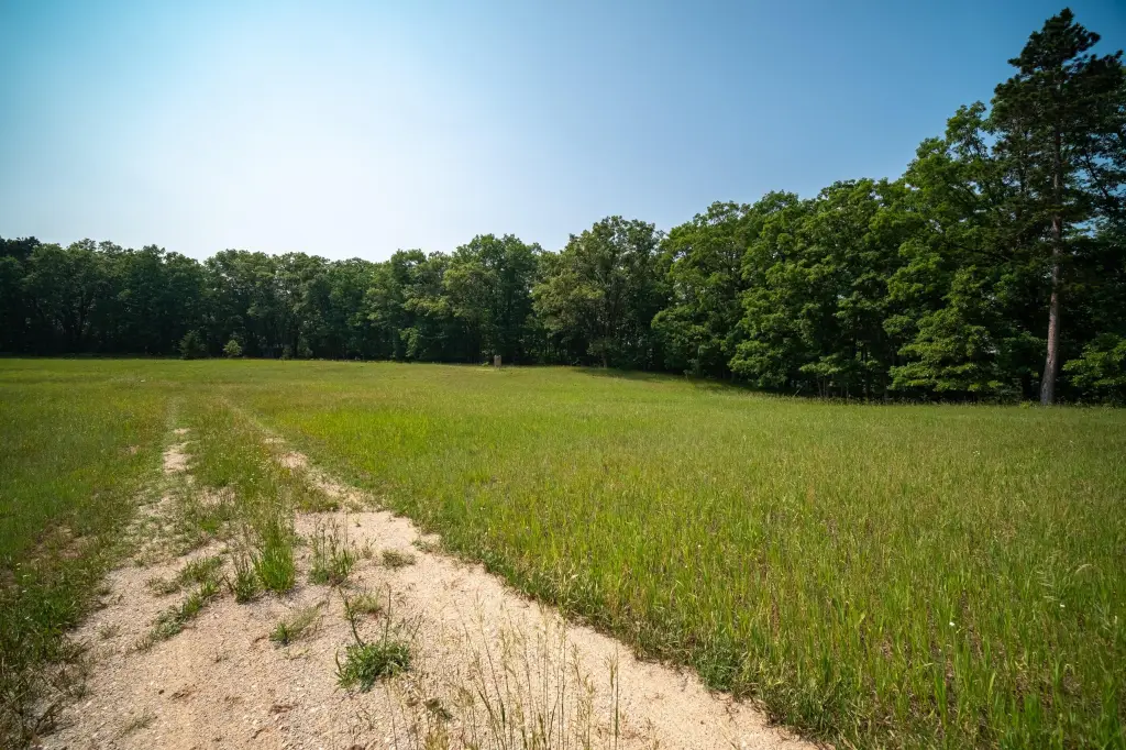
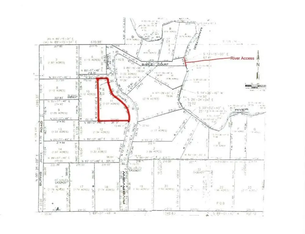
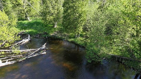
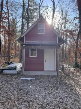
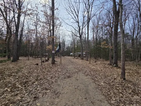
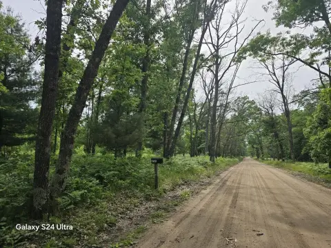
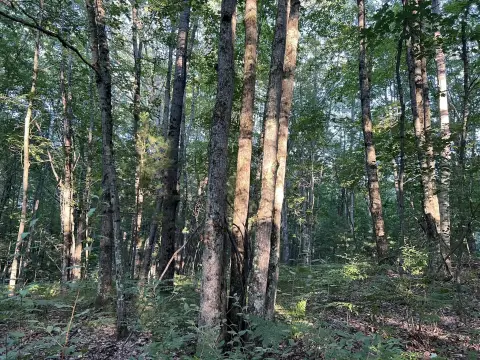
This for-sale waterfront land offering provides a 1.27-acre building site that includes shared and improved access to the Little Manistee River. The property features an open, level meadow intended to support easier site preparation, along with electric service run to the build site. There is also walkout potential from the north ridge, where surrounding woods can offer natural privacy.
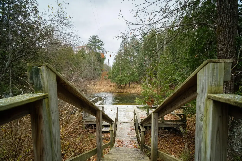
Access is supported by a shared improved drive to the build area, and the listing notes the ability to use a dock for putting in a boat or kayak and fishing for brown, rainbow, steelhead, and salmon. The property is located in Lake County, Michigan, in a quiet country neighborhood just off 8 Mile, with proximity to Crystal Mountain and Caberfae. The area is also described as near snowmobile and ATV trails and about 30 minutes to Lake Michigan beaches. The listing further references nearby federal land and notes a yearly fee of $150 for paved road maintenance and river access care.
Ideal for buyers seeking a cabin or recreational build site with practical utilities already routed to the area and established river access for boating and fishing. The level meadow can simplify initial development, while the north ridge position offers options for a walkout design.
Key Highlights
- 1.25‑acre building site with shared, improved access to the Little Manistee River
- Open, level meadow offers easier site preparation
- Electric meter and drive are run to the building site
Property Analytics
Property Profile
Location Intelligence
Current Use by Public Records
Waterfront Land


FAQs
What type of property is this?
Waterfront Land - Buildable river-access land with level meadow and improved shared access for year-round recreation.
Where is this waterfront land located?
The property is located at 8161 N Hunters Ridge Drive Irons, MI.
What is the asking price?
The asking price for this property is $37,900.
What are key features of this property?
This property features: 1.25‑acre building site with shared, improved access to the Little Manistee River; Open, level meadow offers easier site preparation; Electric meter and drive are run to the building site


