Commercial Land with Loop
806 & 802 Loop 9 Tater Brown Bypass Lancaster, TX 75154
806 & 802 Loop 9 Tater Brown Bypass, Lancaster, TX, 75154
$1,600,000
For Sale
$1,600,000
LAND - Lancaster, TX
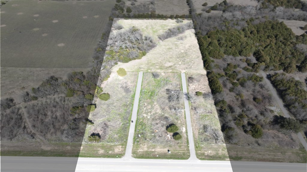
Lot Size4.89 Acres
Days on Market153
Property Features for 806 & 802 Loop 9 Tater Brown Bypass
General Information
- Property type
- Land
- Property subtype
- Other
- Standard status
- Active
- APN
- 60234500010010000
- Lot size
- 4.89 Acres
Taxes and HOA fees
- Tax Description
- WESTERN HILLS BLK 1 LT 1 VOL2004067/19349 DD0
- Tax Annual Amount
- 3543
Utilities
- Water source
- Public
Listing Agency
Tero Real Estate
(972) 777-4141
Waxahachie, TX
Listed by
Jessica Sigler · License #0762064
(972) 777-4141
Added: Feb 15 Checked: Jul 18 at 4:06 pm
MLS# 21177287
Copyright © 2026 North Texas Real Estate Information Systems, Inc. All rights reserved. All information provided by the listing agent/broker is deemed reliable but is not guaranteed and should be independently verified.
Investment Insights
Based on property information with market context.
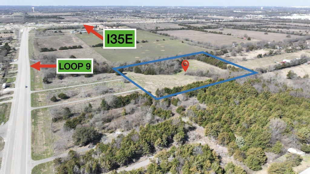
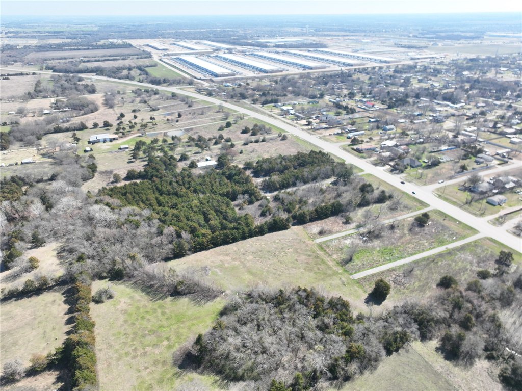
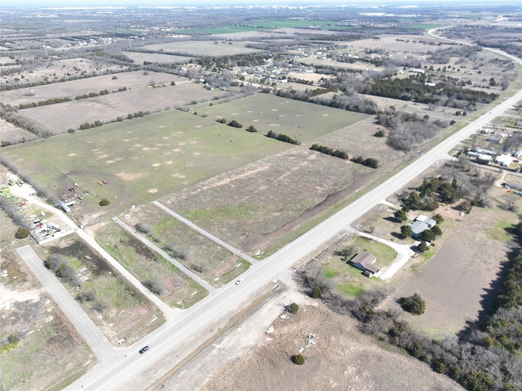
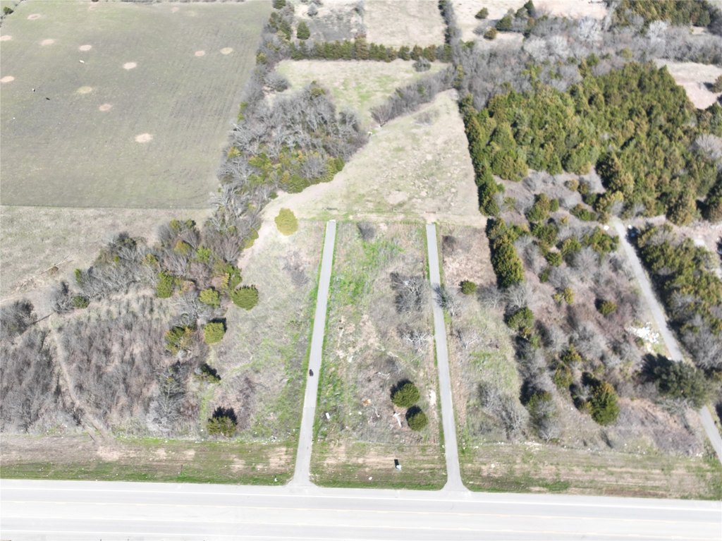
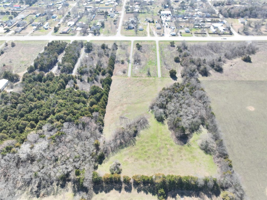
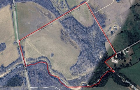
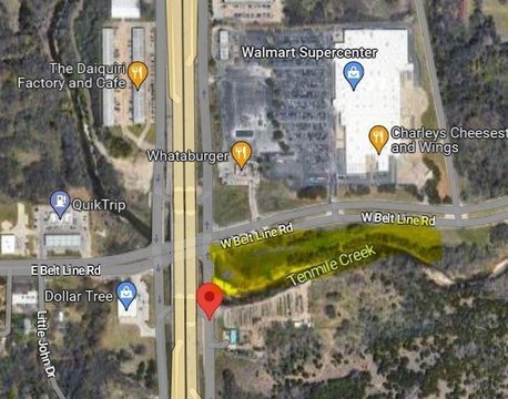
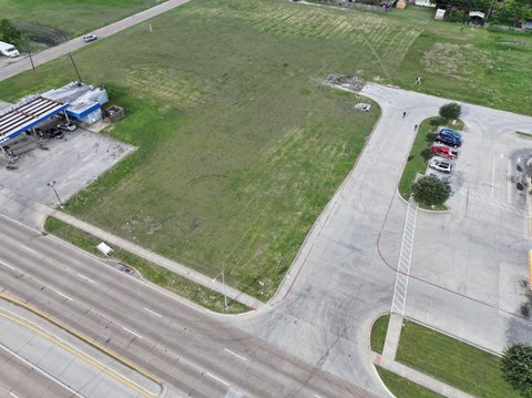
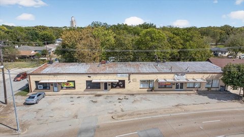
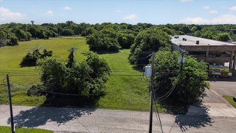
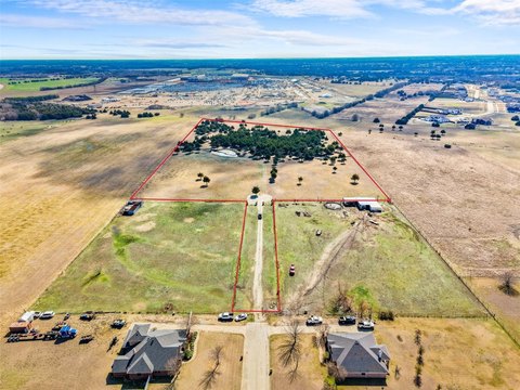
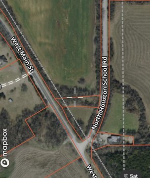
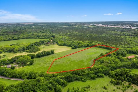
This offering presents a commercial land tract with approximately 4.887 acres available, with a new survey in transition desk. The property is identified as 806 & 802 Loop 9 (Tater Brown) Bypass in Lancaster, Texas, and is being marketed as a high-visibility site with direct frontage along Loop 9.
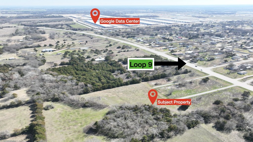
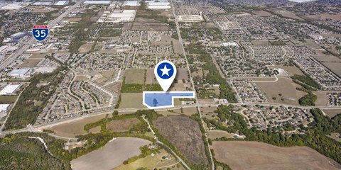
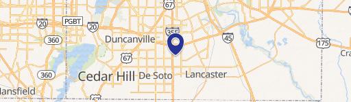
Situated on the Red Oak–Lancaster line, the location is described as providing excellent visibility and accessibility, just off I-35. The property’s direct frontage on Loop 9 places it along a key corridor connecting I-45 to I-20. The remarks also note proximity to a new Google Data Center and a rapidly developing area.
This configuration and setting make the site a practical fit for buyers seeking land for commercial development or investment in a growing submarket. Because the listing indicates “plus or minus” acreage language and asks that buyer and buyer agent verify all information, due diligence around survey details and any intended development requirements will be important before finalizing plans.
Key Highlights
- Approximately ±6 acres of land on Loop 9 (formerly Tater Brown Road) with public water service
- Direct frontage on Loop 9, just off I‑35, with Loop 9 access to I‑45 and I‑20 corridor
- Located on the Red Oak–Lancaster line for commercial or investment use (per listing remarks)
Property Analytics
Property Profile
Location Intelligence
Current Use by Public Records
Commercial land
Similar For Sale Nearby
FAQs
What type of property is this?
Commercial land - Visible, accessible commercial land site just off I-35, suitable for development and long-term investment positioning.
Where is this commercial land located?
The property is located at 806 & 802 Loop 9 Tater Brown Bypass Lancaster, TX.
What is the asking price?
The asking price for this property is $1,600,000.
What are key features of this property?
This property features: Approximately ±6 acres of land on Loop 9 (formerly Tater Brown Road) with public water service; Direct frontage on Loop 9, just off I‑35, with Loop 9 access to I‑45 and I‑20 corridor; Located on the Red Oak–Lancaster line for commercial or investment use (per listing remarks)


