Highway-Frontage Commercial
For Sale
$595,000
7900 State Hwy 133, Blair, NE 68008
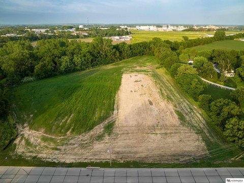
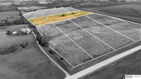
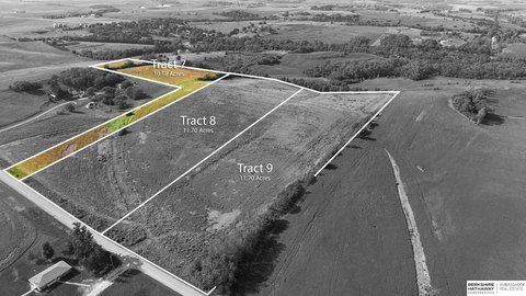
A 12.82-acre site lies within Blair city jurisdiction and is currently zoned for agricultural use.
Property SizeContact for details
Days on Market13
Property Features for 7900 State Hwy 133
General Information
Standard status
Active
Property subtype
Land
Taxes and HOA fees
Annual Taxes
$808
Amenities
10 to 20 Acres
12.82 Acres
12.82
Assessor
Concrete
Highway
Listing Agency:
BHHS Ambassador Real Estate
Listed By:
Staci Mueller · License #NE 20080312
(402) 699-0067
Source:
Ersrealestategroup
Added: Oct 19
Changed: Oct 29
Last Checked: Oct 31 at 4:16AM
Displayed information is deemed reliable but is not guaranteed and should be independently verified. All listing content including descriptions, pricing, images are the copyrighted material of BHHS Ambassador Real Estate

Ask AI about this property
Review the available facts, identify missing information and prepare questions for the agent.
Investment Insights
Based on property information with market context.
This 12.82-acre land parcel is positioned on the east side of State Hwy 133, about two miles south of Blair, Nebraska. Its highway location and acreage provide a substantial tract for consideration as a building site.
The property is within the City of Blair’s jurisdiction and is currently zoned agricultural. Any zoning change or platting proposal is subject to approval. Commercial or residential subdivision is described as a possibility, not an approved use.
The property is within the City of Blair’s jurisdiction and is currently zoned agricultural. Any zoning change or platting proposal is subject to approval. Commercial or residential subdivision is described as a possibility, not an approved use.
Key Highlights
- 12.82 acres
- East side of State Hwy 133, approximately two miles south of Blair
- Current zoning is agricultural; changes and platting proposals require approval
Property Analytics
Location Intelligence
Trade Area within ½ mile
Explore this area
Business Placement
Demographics for 68008, NE
12,597
Population
5,289
Households
2.4
Avg Household Size
42
Median Age
39%
College-Educated
97%
High-School Grad
124.0 sq mi
ZIP Area
102
Density / Sq Mi
$86,905
Median Household Income
$54,588
Median Earnings
$933
Median Rent
$254,900
Median Home Value





Frequently Asked Questions
What type of property is this?
Land - A 12.82-acre site lies within Blair city jurisdiction and is currently zoned for agricultural use.
Where is this land located?
The property is located at 7900 State Hwy 133 Blair, NE.
What is the asking price?
The asking price for this property is $595,000.
What are key features of this property?
This property features: 12.82 acres; East side of State Hwy 133, approximately two miles south of Blair; Current zoning is agricultural; changes and platting proposals require approval