Commercial Land at Signalized
For Sale
$750,000
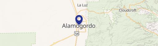
700 West Tenth Street, Alamogordo, NM 88310
M-2-zoned development land with municipal water service and roadway access through a signalized intersection.
Property SizeContact for details
Days on Market386
Property Features for 700 West Tenth Street
General Information
Standard status
Active
Property subtype
Land
Zoning
M-2
Amenities
Power
Water
Natural Gas
Vacant
Listing Agency:
Westsource Corp LLC
(575) 405-0911
Listed By:
Michael Shyne · License #4041C
Source:
Carnm.resimplifi
Added: Aug 11, 2025
Changed: Aug 28
Last Checked: Aug 30 at 1:15PM
Displayed information is deemed reliable but is not guaranteed and should be independently verified. All listing content including descriptions, pricing, images are the copyrighted material of Westsource Corp LLC
Investment Insights
Based on property information with market context.
This 6.125-acre commercial land tract contains 266,800 square feet at the northwest corner of West Tenth Street and the Alamogordo Relief Route. The property lies within Alamogordo city limits and is zoned M-2, providing a substantial development area for uses identified in the listing, including retail, lodging, restaurants, and businesses serving long-haul trucking.
The Relief Route carries US Highway 54, 70 & 82 and is designated as an access-restricted highway by the New Mexico Department of Transportation. Property access is planned from McDonald Road, with westbound travel on Tenth Street through the signalized intersection before turning north. A City water main runs along the east boundary. Electricity and natural gas are located in McDonald Road, while municipal sewer is on the opposite side of the Relief Route and would require a lift station and connector main beneath the highway.
The Relief Route carries US Highway 54, 70 & 82 and is designated as an access-restricted highway by the New Mexico Department of Transportation. Property access is planned from McDonald Road, with westbound travel on Tenth Street through the signalized intersection before turning north. A City water main runs along the east boundary. Electricity and natural gas are located in McDonald Road, while municipal sewer is on the opposite side of the Relief Route and would require a lift station and connector main beneath the highway.
Key Highlights
- 6.125‑acre tract with 266,800 sq ft of developable land
- M‑2 zoning within the Alamogordo city limits
- Northwest corner of West Tenth Street and the Alamogordo Relief Route
Property Analytics
Current Use
Location Intelligence
Trade Area within ½ mile
1,043
Businesses Nearby
Explore this area
Business Placement
Demographics for 88310, NM
35,935
Population
18,112
Households
2
Avg Household Size
40
Median Age
25%
College-Educated
92%
High-School Grad
618.9 sq mi
ZIP Area
58
Density / Sq Mi
$53,833
Median Household Income
$35,616
Median Earnings
$877
Median Rent
$164,300
Median Home Value

Questions? Ask Rey
Realmo’s AI knows this listing — price, zoning, demand, history. Ask anything.




Frequently Asked Questions
What type of property is this?
Commercial land - M-2-zoned development land with municipal water service and roadway access through a signalized intersection.
Where is this commercial land located?
The property is located at 700 West Tenth Street Alamogordo, NM.
What is the asking price?
The asking price for this property is $750,000.
What are key features of this property?
This property features: 6.125‑acre tract with 266,800 sq ft of developable land; M‑2 zoning within the Alamogordo city limits; Northwest corner of West Tenth Street and the Alamogordo Relief Route


