Wooded Recreational
For Sale
Contact for pricing
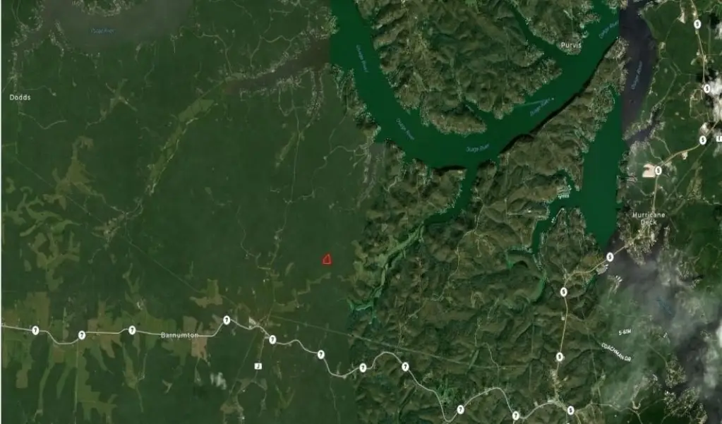
7-9 Lake Road, Camdenton, MO 65020
Land, Camdenton, MO
Property SizeContact for details
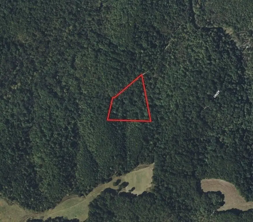
Lot Size5.20 Acres
Days on Market74
Property Features for 7-9 Lake Road
General Information
Property type
Land
Property subtype
Other
Zoning
x
Elementary school district
Camdenton
Middle school district
Camdenton
High school district
Camdenton
Directions
Take Lake rd. 7-9 to Alta Dr to Copper Head Holler, pass the gate and arrive at the property
Subdivision
999 - Other Missouri Area
Standard status
Active
APN
0620900000000065000
Lot size
5.20 Acres
Taxes and HOA fees
Tax Description
A track of land lying in the SE quarter of the NE quarter of section 15,Township 39 N, Range 18 West described by metes and bounds as follows: From an existing stone pile which marks the center of section 15, Township 39 N, Range W run N 88 degrees 42 minutes west along the S line of the SE quarter of the NW quarter of said section 15,152.84 feet to an iron pin for the point of beginning of the tack of lad herein and hereby conveyed, thence continue N 88 degrees 42 minutes W along said S line 579.45 feet to an iron pin,thence leaving said S line N 21 degrees 51 minutes E 336.12 feet to a spike in the centerline of a 40 ft road, thence following said center-line N 50 degrees 58 minutes E 181.51 feet, thence N 48 degrees 54 minutes E 181.65 feet to a spike, thence leaving said centerline S 07 degrees 10 minutes E 661.52 feet, to the point of beginning. 5.2 acres +/-
Tax Annual Amount
48
Legal Description
A track of land lying in the SE quarter of the NE quarter of section 15,Township 39 N, Range 18 West described by metes and bounds as follows: From an existing stone pile which marks the center of section 15, Township 39 N, Range W run N 88 degrees 42 minutes west along the S line of the SE quarter of the NW quarter of said section 15,152.84 feet to an iron pin for the point of beginning of the tack of lad herein and hereby conveyed, thence continue N 88 degrees 42 minutes W along said S line 579.45 feet to an iron pin,thence leaving said S line N 21 degrees 51 minutes E 336.12 feet to a spike in the centerline of a 40 ft road, thence following said center-line N 50 degrees 58 minutes E 181.51 feet, thence N 48 degrees 54 minutes E 181.65 feet to a spike, thence leaving said centerline S 07 degrees 10 minutes E 661.52 feet, to the point of beginning. 5.2 acres +/-
Listing Agency:
Real Broker, LLC-MO
(573) 520-3099
Listed By:
Julia Schoonover
(816) 255-7152
Added: Jul 16
Changed: Sep 16
Last Checked: Sep 27 at 5:06PM
MLS# 2632055
Copyright © 2026 Heartland Multiple Listing Service. All rights reserved. All information provided by the listing agent/broker is deemed reliable but is not guaranteed and should be independently verified.
Investment Insights
Based on property information with market context.
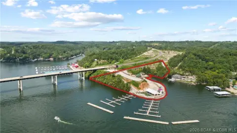
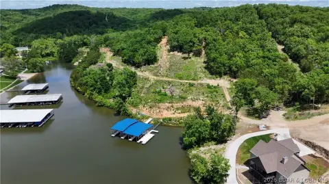
This 5.2-acre wooded land tract at 7-9 Lake Road features mature timber and a private setting suited to recreational use or future development. The property has no known restrictions, and the road easement has been resolved, providing clarity regarding access to the tract.
Located in Camdenton, Missouri, the property is less than 20 minutes from the Lake of the Ozarks. The surrounding area offers access to boating, fishing, dining, shopping, and entertainment while retaining a rural Missouri setting. Potential uses identified for the property include a custom home, barndominium, cabin, camping site, hunting property, or recreational retreat.
Located in Camdenton, Missouri, the property is less than 20 minutes from the Lake of the Ozarks. The surrounding area offers access to boating, fishing, dining, shopping, and entertainment while retaining a rural Missouri setting. Potential uses identified for the property include a custom home, barndominium, cabin, camping site, hunting property, or recreational retreat.
Key Highlights
- 5.2‑acre wooded tract in Camdenton, Missouri
- Mature timber across the property
- No known restrictions
Property Analytics
Unlock full access to Insights
Subscribe to Realmo Intelligence
Open Analytics
Current Use
Location Intelligence
Trade Area within ½ mile
414
Businesses Nearby
Explore this area
Business Placement
Demographics for 65020, MO
14,189
Population
9,962
Households
1.4
Avg Household Size
47
Median Age
18%
College-Educated
91%
High-School Grad
123.7 sq mi
ZIP Area
115
Density / Sq Mi
$57,243
Median Household Income
$28,896
Median Earnings
$836
Median Rent
$243,900
Median Home Value
Check the figures for this property
Cap Rate, Value Estimation, Potential NOI and more
View Realmo Analytics

Questions? Ask Rey
Realmo’s AI knows this listing — price, zoning, demand, history. Ask anything.




Frequently Asked Questions
What type of property is this?
Land - Mature timber, flexible recreational possibilities, and no known restrictions define this wooded Missouri tract.
Where is this land located?
The property is located at 7-9 Lake Road Camdenton, MO.
What are key features of this property?
This property features: 5.2‑acre wooded tract in Camdenton, Missouri; Mature timber across the property; No known restrictions


