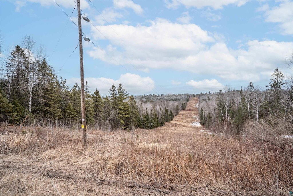
Hunting Land with Creek and River
5xxx S Dedham Rd Superior, WI 54880
For Sale
$350,000
LAND - Superior, WI
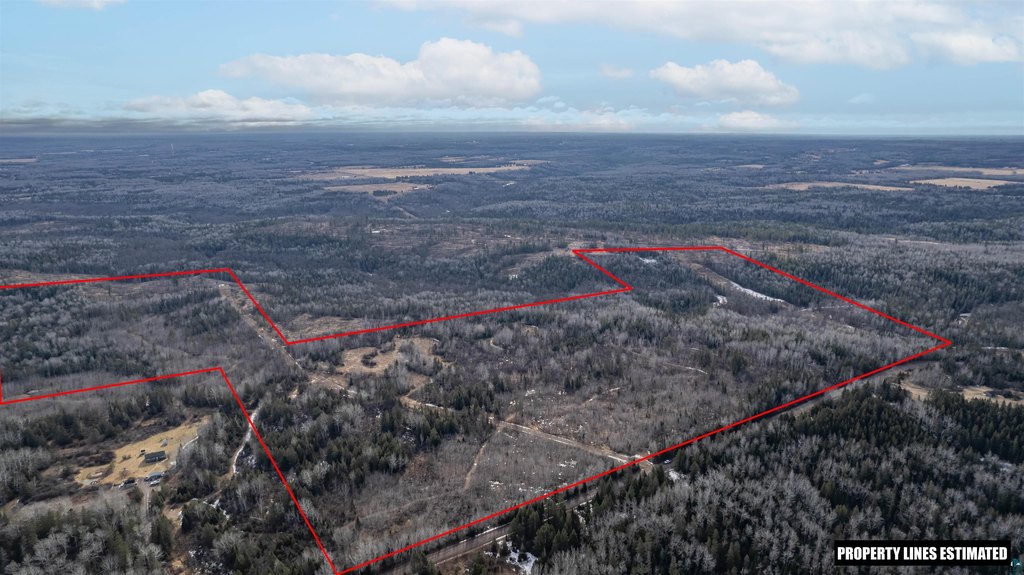
Lot Size180.00 Acres
Days on Market93
Property Features for 5xxx S Dedham Rd
General Information
Property type
Land
Property subtype
Other
Standard status
Active
Lot size
180.00 Acres
Taxes and HOA fees
Tax Year
2024
Tax Annual Amount
2731
Listing Agency:
RE/MAX Results
(952) 829-2900
Listed By:
Steve Braman · License #RA-20553337
(952) 829-2900
Added: Apr 29
Changed: Jun 10
Last Checked: Jul 30 at 4:06AM
MLS# 6124768
Copyright © 2026 Lake Superior Association of REALTORS®. All rights reserved. All information provided by the listing agent/broker is deemed reliable but is not guaranteed and should be independently verified.
Investment Insights
Based on property information with market context.
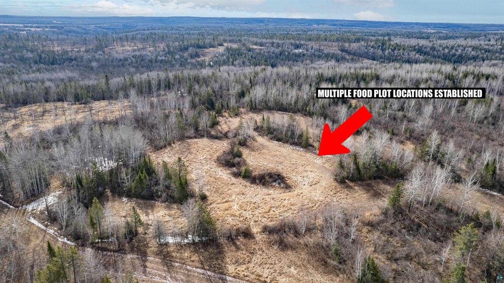
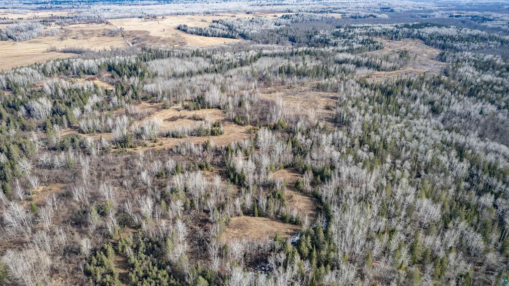
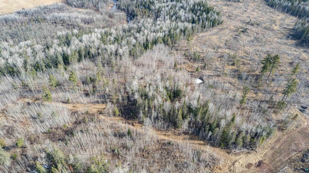
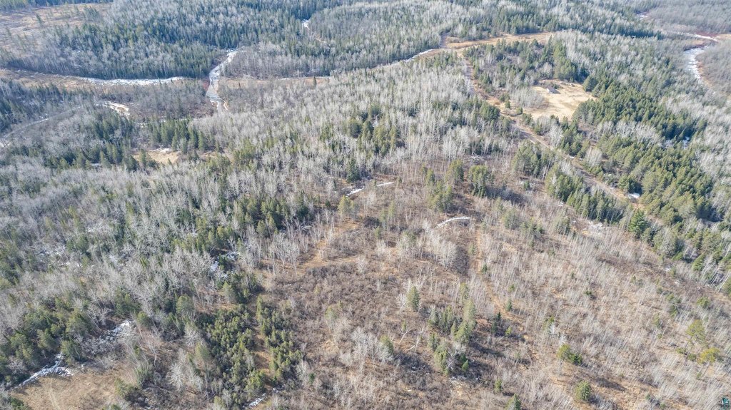
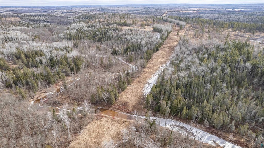
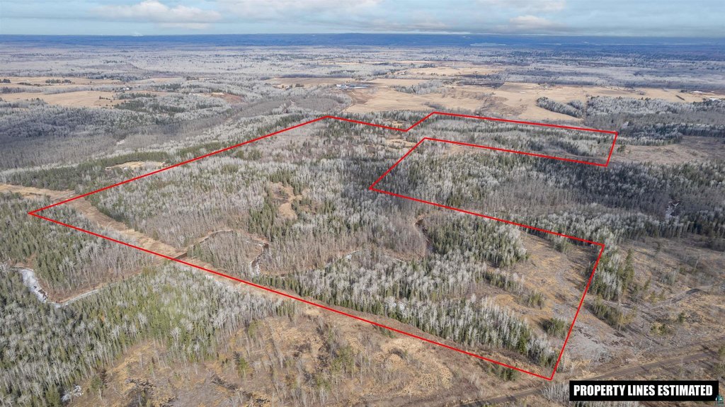
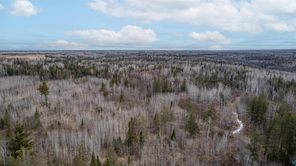
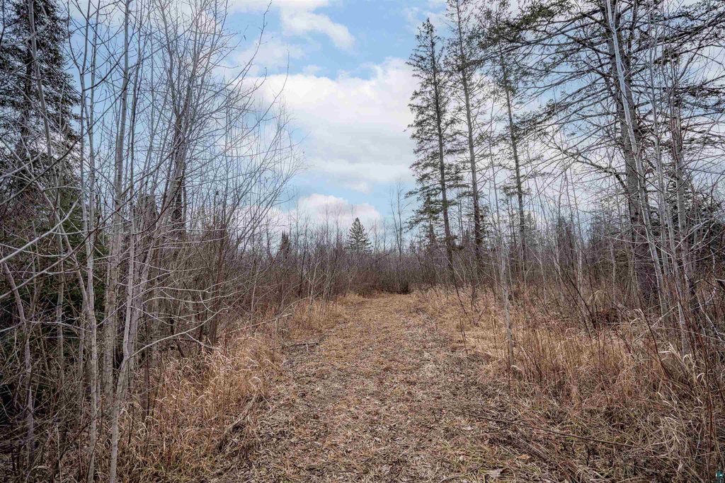
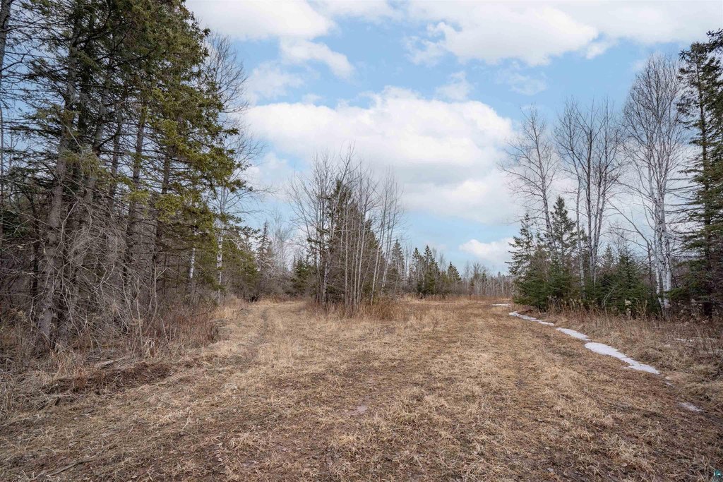
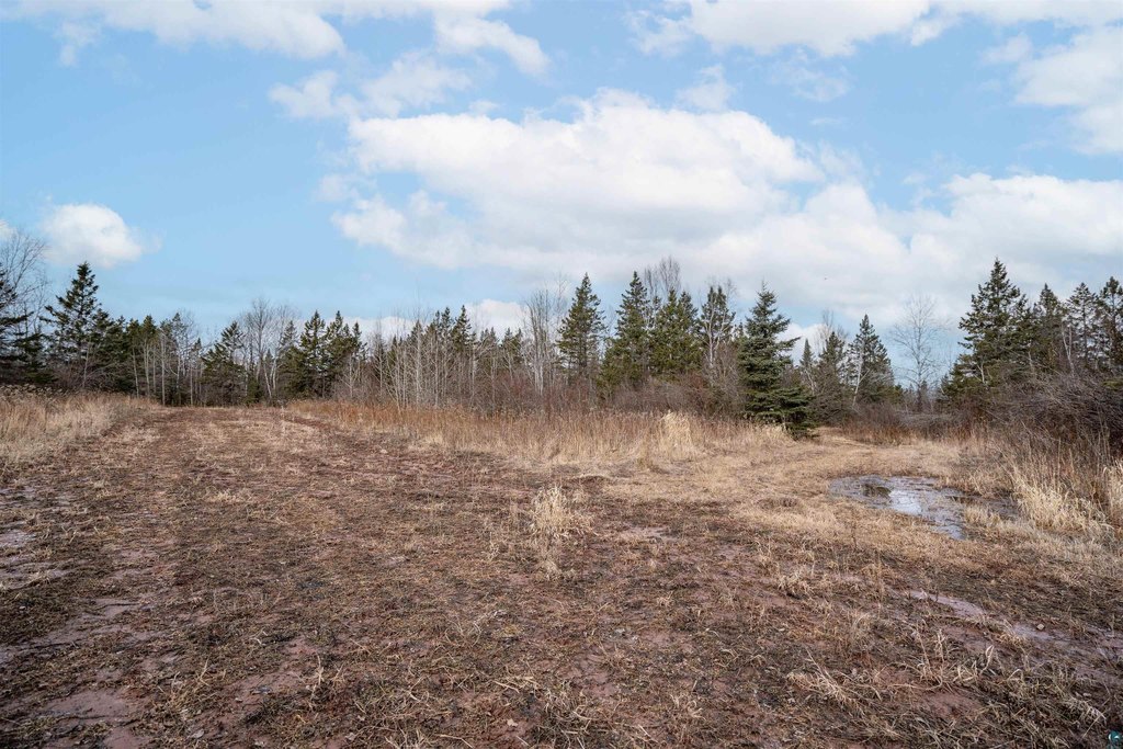
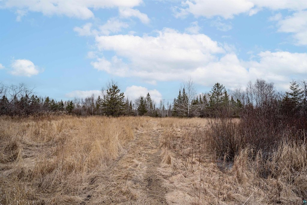
The property is a 180+ acre tract in Northwestern Wisconsin configured for wildlife and hunting. It features established food plots with limed and soil-tested ground, three excavated water holes, and a clover-planted logging road. The land includes a variety of natural food sources such as 50+ apple trees, wild plums, grapes, highbush cranberry, serviceberry, chokeberry, sumac, and mature burr oaks producing an acorn crop. Timber species listed include aspen, birch, maple, alder, balsam fir, black spruce, and white pine, with selective logging reportedly completed about seven years ago to improve habitat.
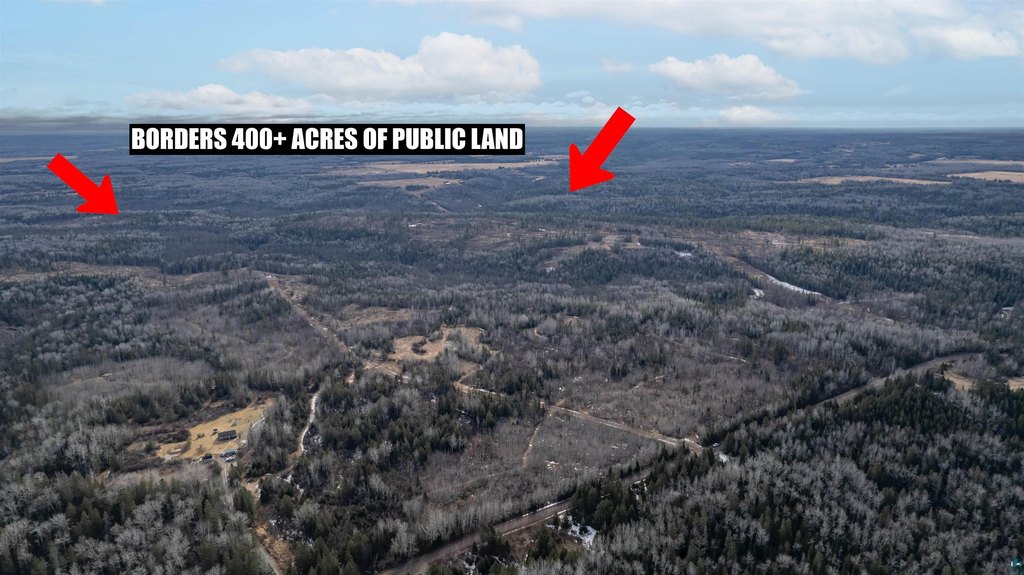
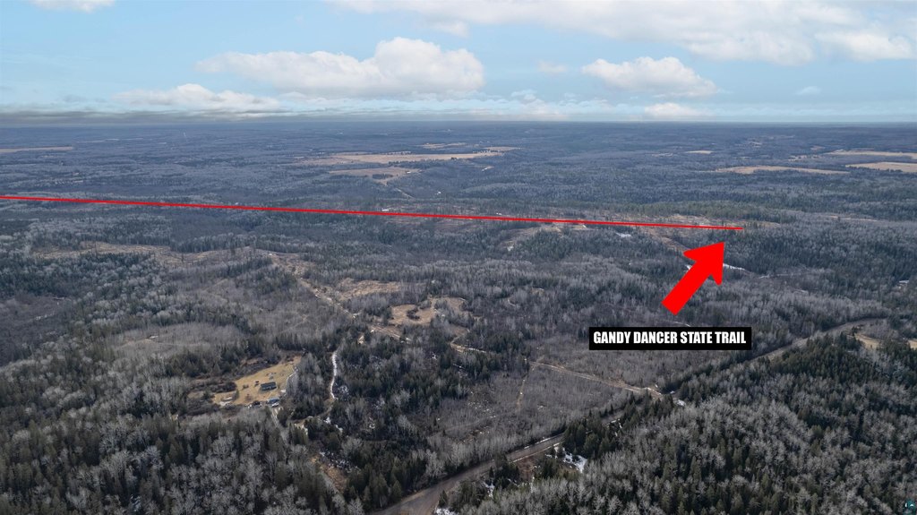
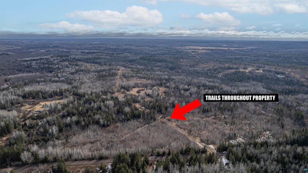
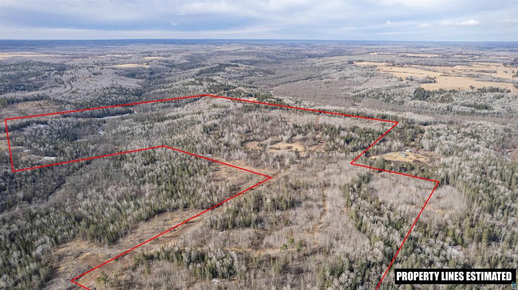
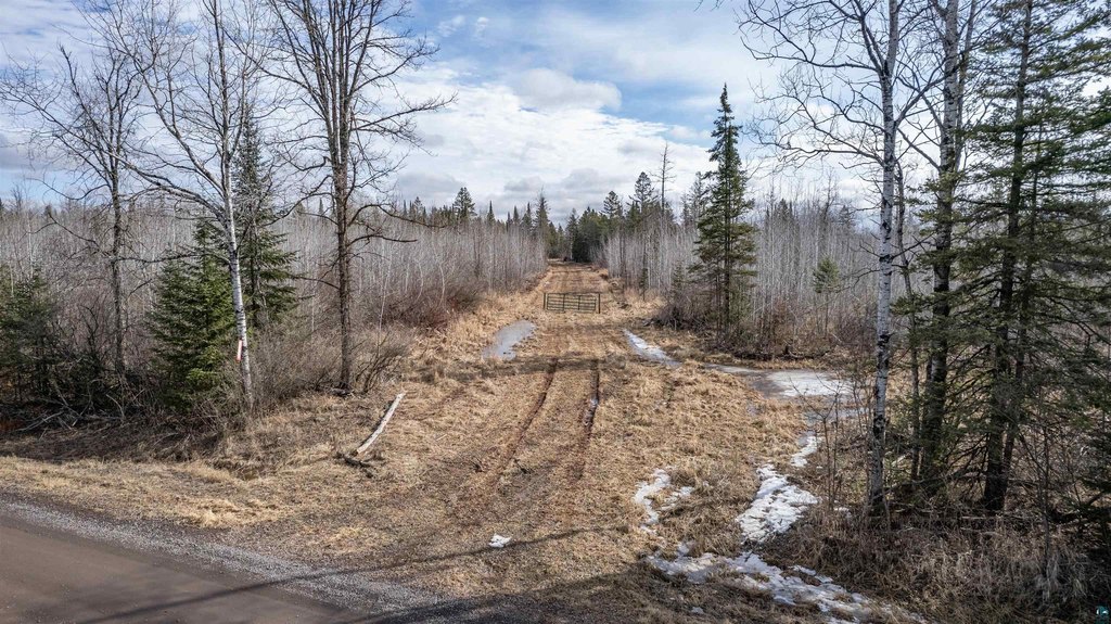
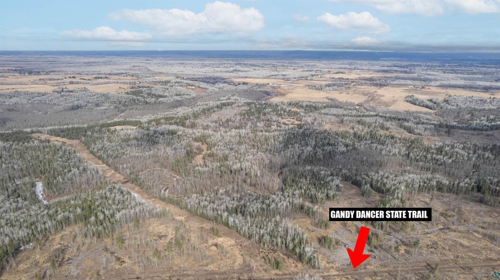
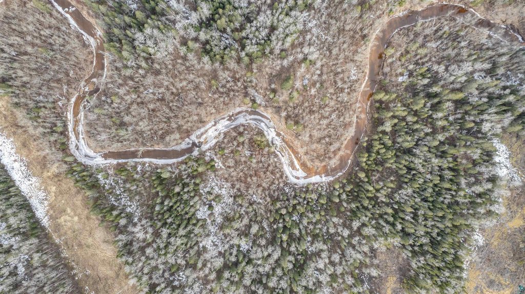
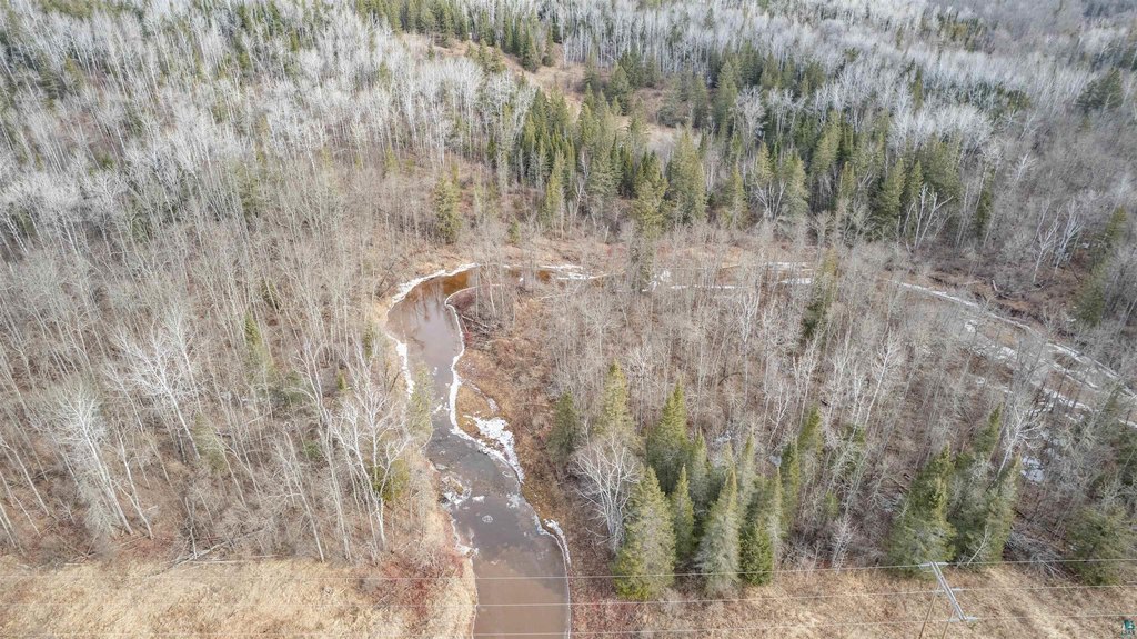
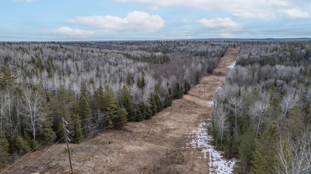
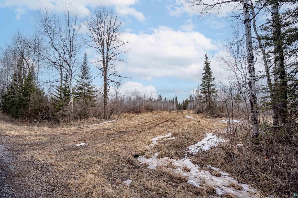
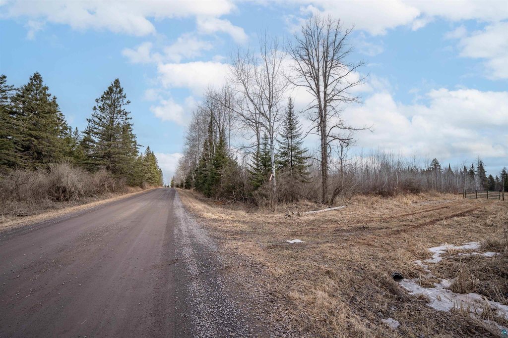
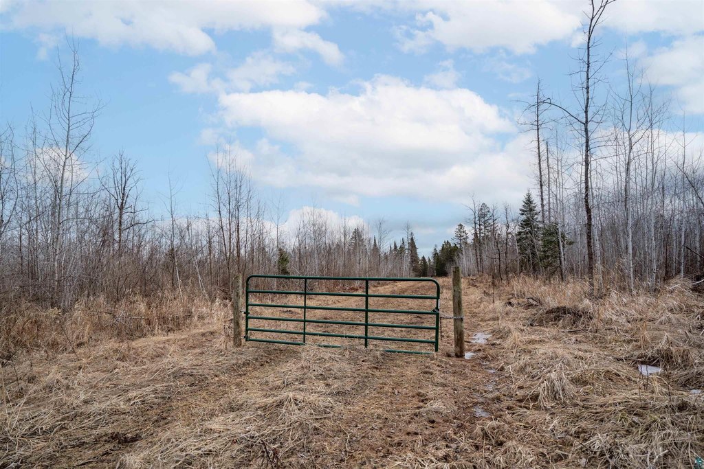
Access is handled through two gated entrances. Balsam Creek and Nemadji River frontage are noted, along with established trails and a power line corridor for hunting access. The property borders Douglas County Special Use public land to the south and east, providing access to several hundred additional acres of landlocked public ground while maintaining privacy.
This parcel is well suited for buyers seeking a private Northwoods property for hunting and outdoor recreation, with on-site water features, food-plot improvements, and durable cover supported by the described timber mix and habitat management. The inclusion of bordering public land can extend potential hunting opportunities beyond the property itself.
Key Highlights
- 180+ acre Northwestern Wisconsin property with established food plots and wildlife habitat improvements
- 50+ apple trees plus wild plums, grapes, highbush cranberry, serviceberry, chokeberry, sumac, and mature burr oaks for natural forage
- Three excavated water holes and clover‑planted logging road, with established trails throughout the property
Property Analytics
Property Profile
Location Intelligence
Current Use


Frequently Asked Questions
What type of property is this?
Hunting land - 180+ acres of managed habitat with food plots, timber, and creek/river frontage for year-round outdoor use.
Where is this hunting land located?
The property is located at 5xxx S Dedham Rd Superior, WI.
What is the asking price?
The asking price for this property is $350,000.
What are key features of this property?
This property features: 180+ acre Northwestern Wisconsin property with established food plots and wildlife habitat improvements; 50+ apple trees plus wild plums, grapes, highbush cranberry, serviceberry, chokeberry, sumac, and mature burr oaks for natural forage; Three excavated water holes and clover‑planted logging road, with established trails throughout the property