Zoned M3 Recreational
5 Elevenmile Well Road Golconda, NV 89414

5 Elevenmile Well Road, Golconda, NV, 89414
Contact for pricing
For Sale
Under Contract
Contact for pricing
LAND - Golconda, NV
Lot Size39.68 Acres
Days on Market113
Property Features for 5 Elevenmile Well Road
General Information
- Property type
- Land
- Property subtype
- Other
- Zoning
- M3
- Standard status
- Active Under Contract
- APN
- 07-0634-05
- Lot size
- 39.68 Acres
Taxes and HOA fees
- Tax Annual Amount
- 59
Utilities
- Utilities
- Water Available
- Water source
- Well
Listing Agency
Congress Realty, INC.
(888) 881-4118
9805 E Bell Rd., Suite 120, Las Vegas, NV
Listed by
Jared English · License #B.1001537
(888) 881-4118
Added: Mar 31 Updated: Jul 9 at 11:44 am Checked: Jul 21 at 12:06 am
MLS# 260003694
Listing URL
Copyright © 2026 Northern Nevada Regional MLS, Inc. All rights reserved. All information provided by the listing agent/broker is deemed reliable but is not guaranteed and should be independently verified.
Investment Insights
Based on property information with market context.
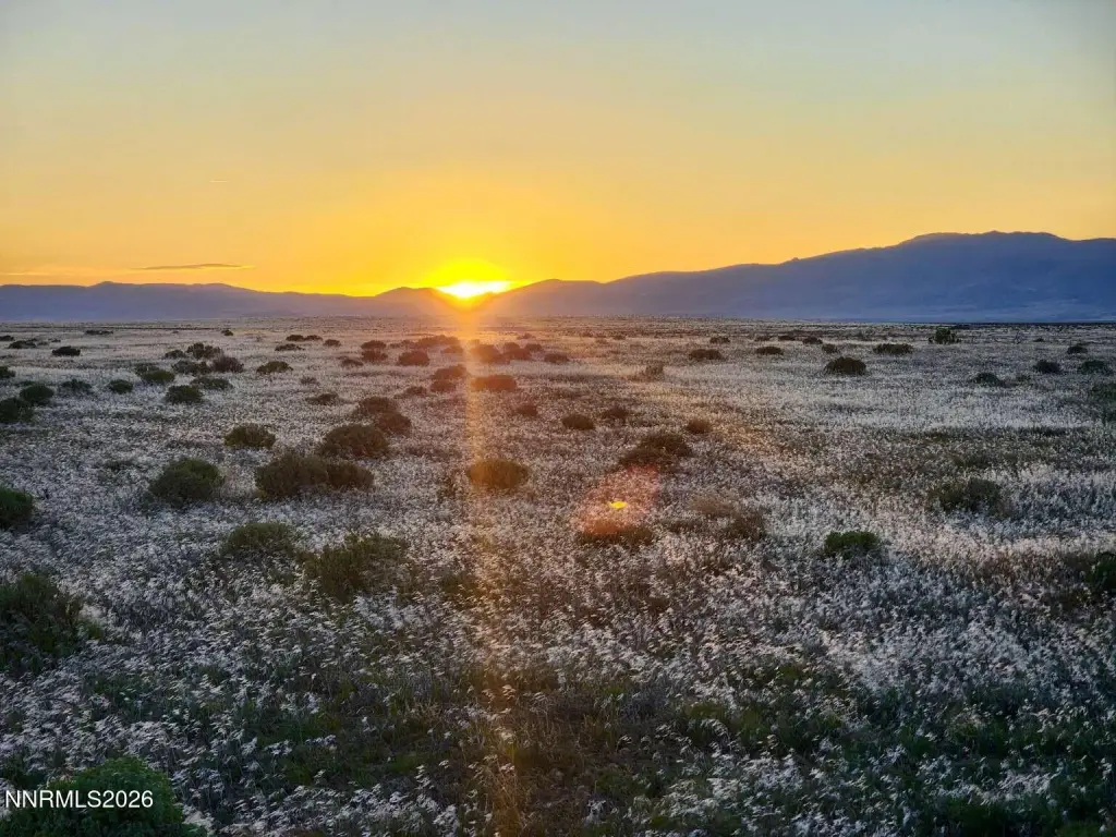
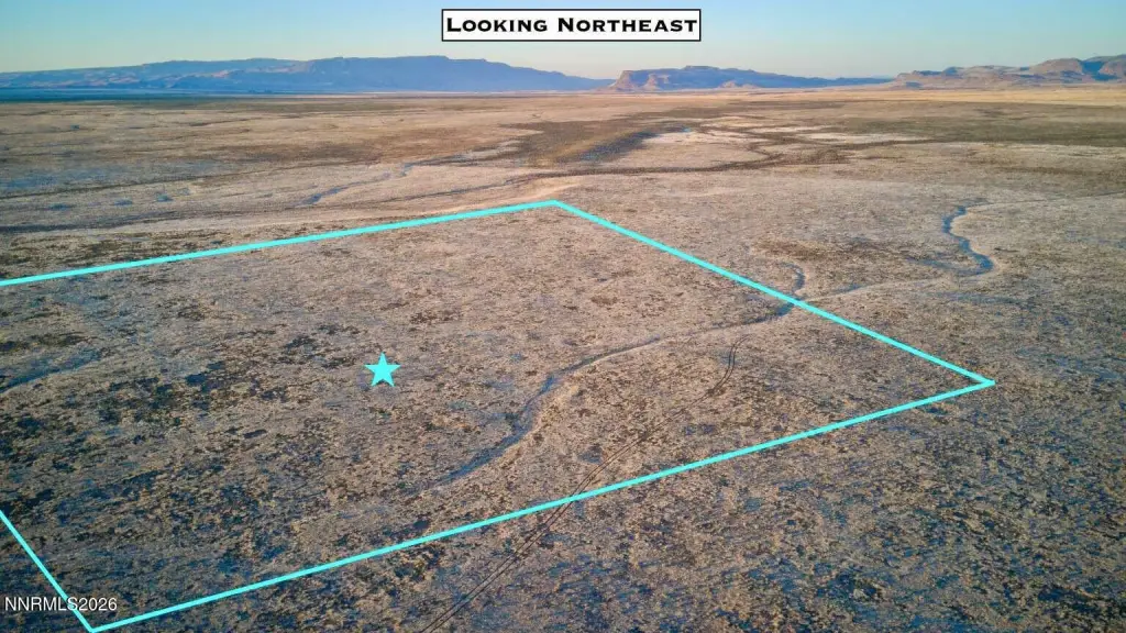
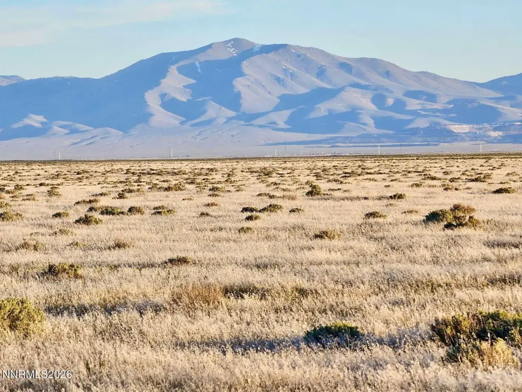
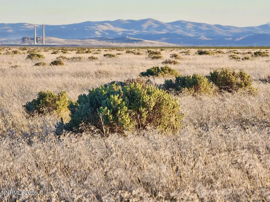
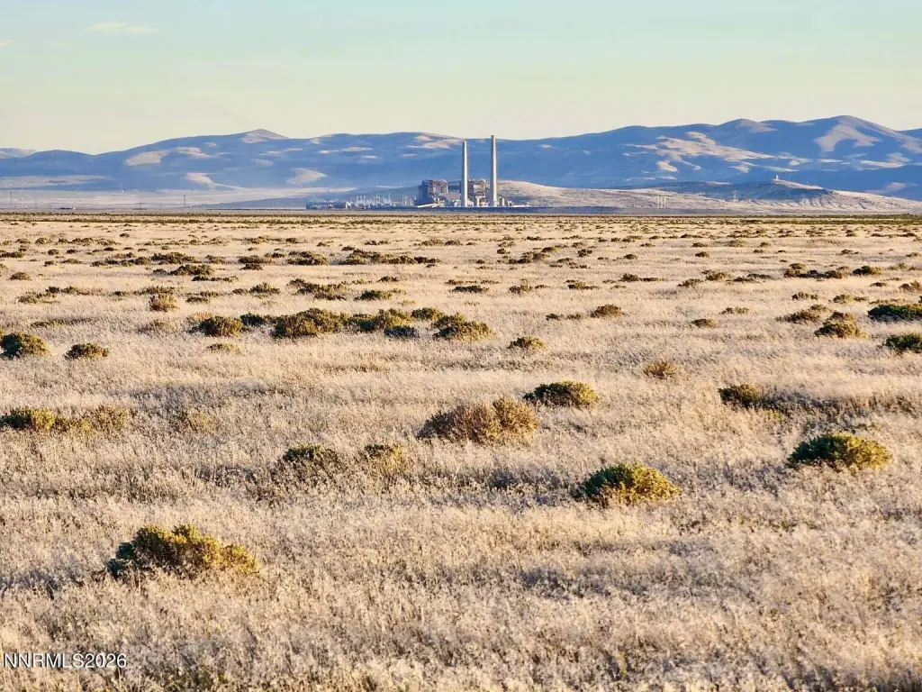
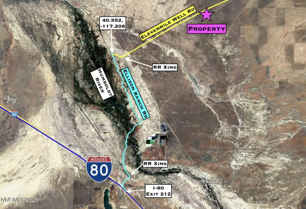
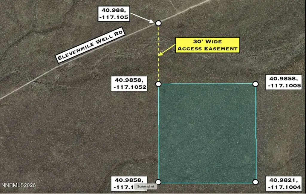
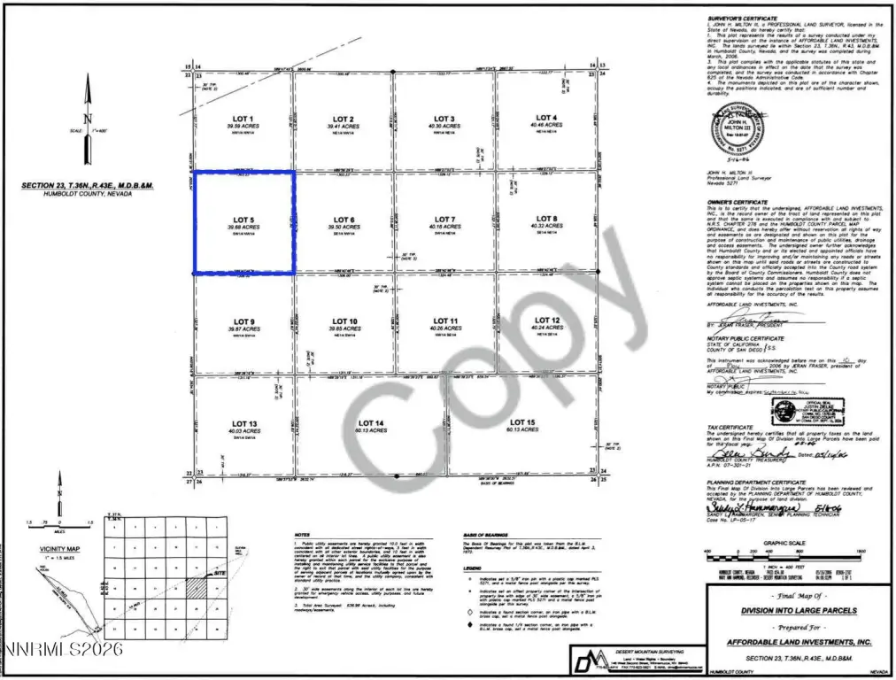
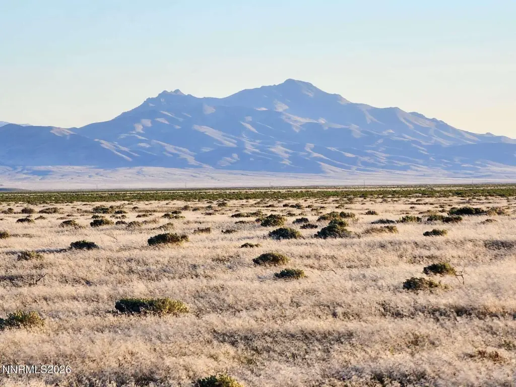
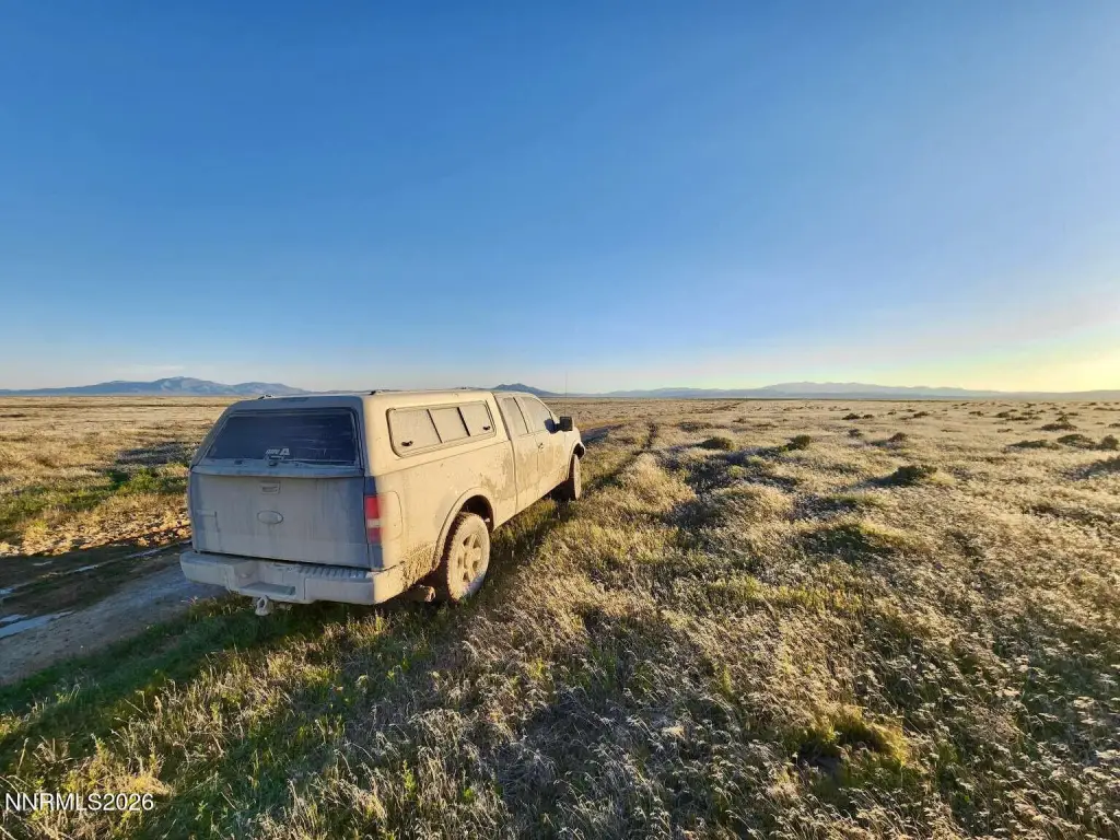
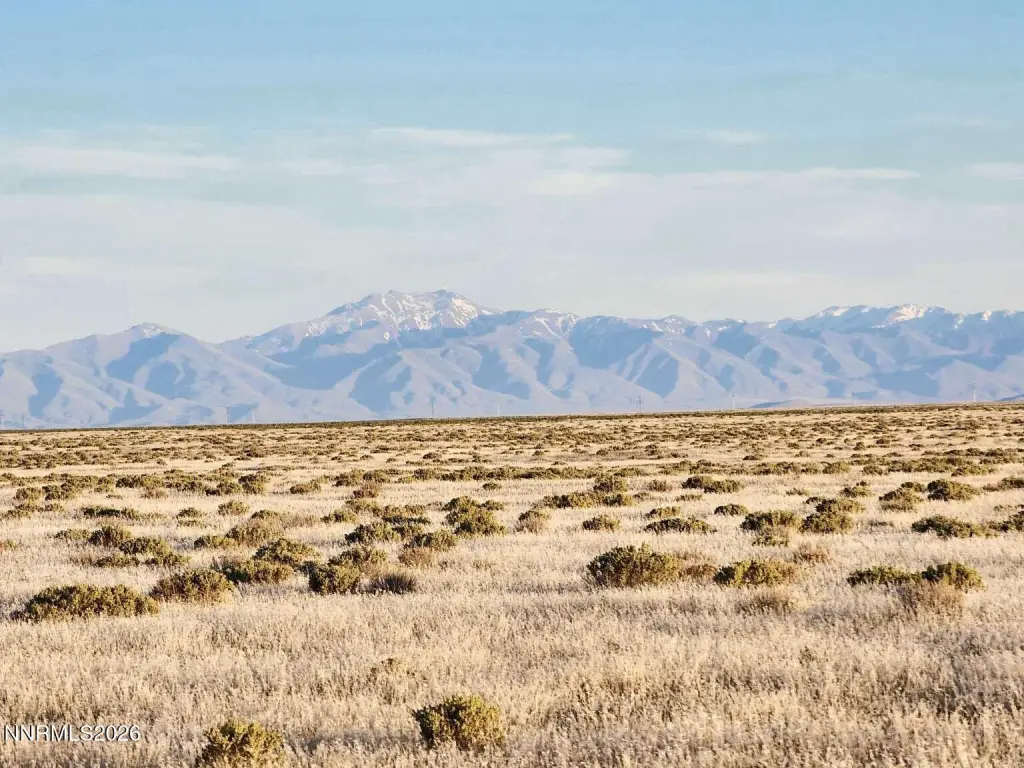
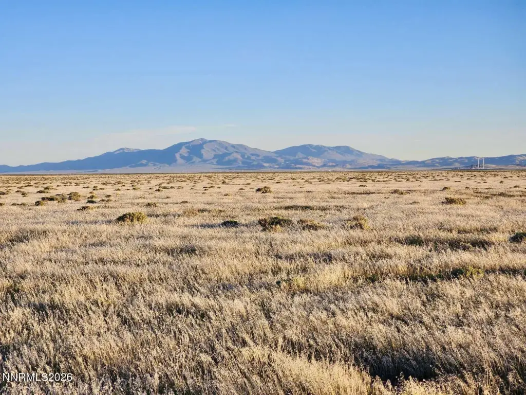
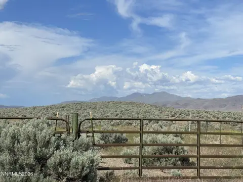
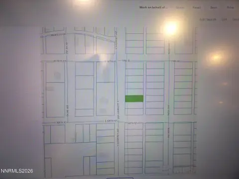
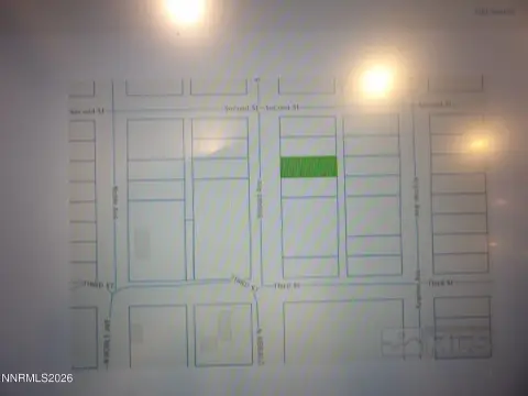
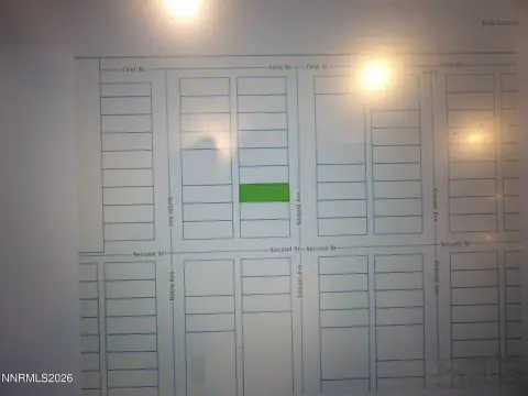
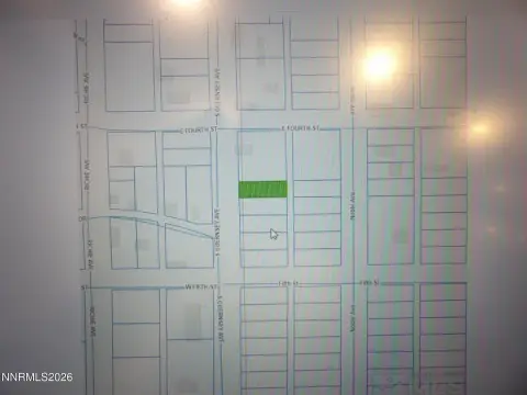
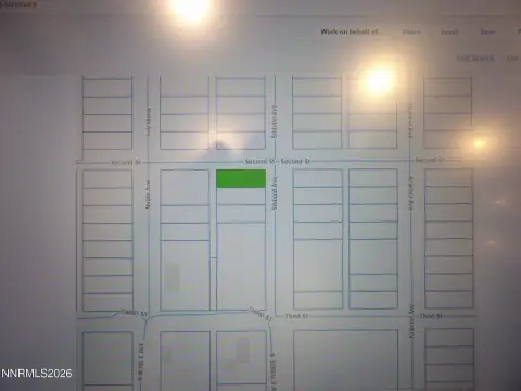
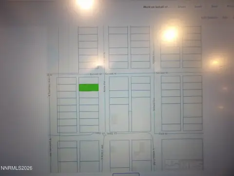
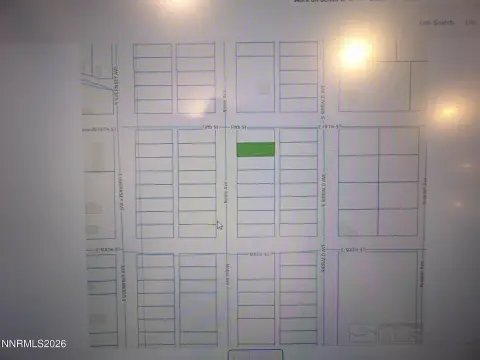
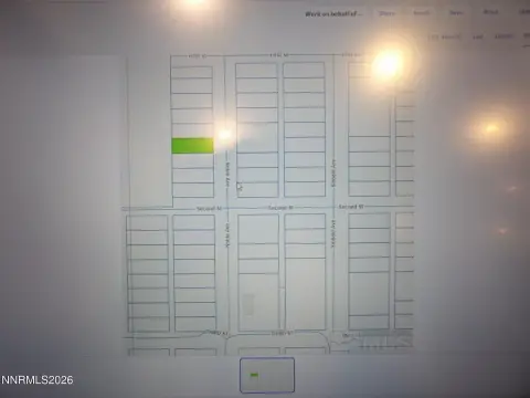
For sale is 39.68 acres of open land in northern Nevada, offered as off-grid recreational or hunting-oriented acreage. The property is described as level and at an elevation of approximately 4,530 to 4,540 feet. There is no electricity on site, and any development would be off grid. Water and waste services are anticipated via well and septic, with nearby well permits indicating water depths ranging from 70 to 120 feet below ground.
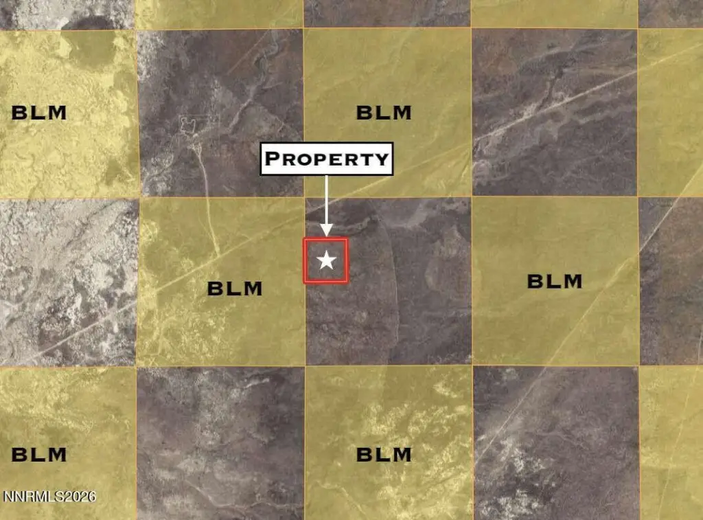
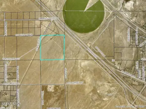
The land is zoned M3 (Open Land Use District) with no HOA. It borders 640 acres of public recreational land maintained by the BLM, providing access to additional public recreational acreage. The property is located in Humboldt County and is listed with the parcel number 07-0634-05 (Lot 5 of DLP, Document 2006-2787).
Utilities are listed as none, and there are no buildings referenced with the offering. The terrain is described as level, and the site is positioned for buyers seeking a remote property for outdoor use within an M-3 zoning framework.
Key Highlights
- 39.68‑acre parcel in northern Nevada (Humboldt County), legally described as Lot 5 Of DLP, Document 2006‑2787 (Parcel 07‑0634‑05).
- Directly borders 640 acres of BLM‑managed public recreational land, with access to thousands more nearby.
- Zoned M‑3 (Open Land Use District) with no HOA; flexible use potential listed for the parcel.
Property Analytics
Property Profile
Location Intelligence
Current Use by Public Records
Hunting land
Similar For Sale Nearby

FAQs
What type of property is this?
Hunting land - 39.68 acres of level land zoned M-3 with no electricity, suited for off-grid recreation or base-camp use.
Where is this hunting land located?
The property is located at 5 Elevenmile Well Road Golconda, NV.
What is the asking price?
The asking price for this property is Off market.
What are key features of this property?
This property features: 39.68‑acre parcel in northern Nevada (Humboldt County), legally described as Lot 5 Of DLP, Document 2006‑2787 (Parcel 07‑0634‑05).; Directly borders 640 acres of BLM‑managed public recreational land, with access to thousands more nearby.; Zoned M‑3 (Open Land Use District) with no HOA; flexible use potential listed for the parcel.


